Rio Dell (Spanish: Río Dell, meaning “Dell River”) is a city in Humboldt County, California, United States. It is located on the west bank of the Eel River 1 mile (2 km) north of Scotia at an elevation of 161 feet (49 m). The population was 3,363 at the 2010 census, up from 3,174 at the 2000 census.
| Name: | Rio Dell city |
|---|---|
| LSAD Code: | 25 |
| LSAD Description: | city (suffix) |
| State: | California |
| County: | Humboldt County |
| Incorporated: | February 23, 1965 |
| Elevation: | 161 ft (49 m) |
| Total Area: | 2.42 sq mi (6.26 km²) |
| Land Area: | 2.28 sq mi (5.91 km²) |
| Water Area: | 0.14 sq mi (0.35 km²) 5.61% |
| Total Population: | 3,379 |
| Population Density: | 1,468.22/sq mi (566.86/km²) |
| ZIP code: | 95562 |
| Area code: | 707 |
| FIPS code: | 0660900 |
| Website: | cityofriodell.ca.gov |
Online Interactive Map
Click on ![]() to view map in "full screen" mode.
to view map in "full screen" mode.
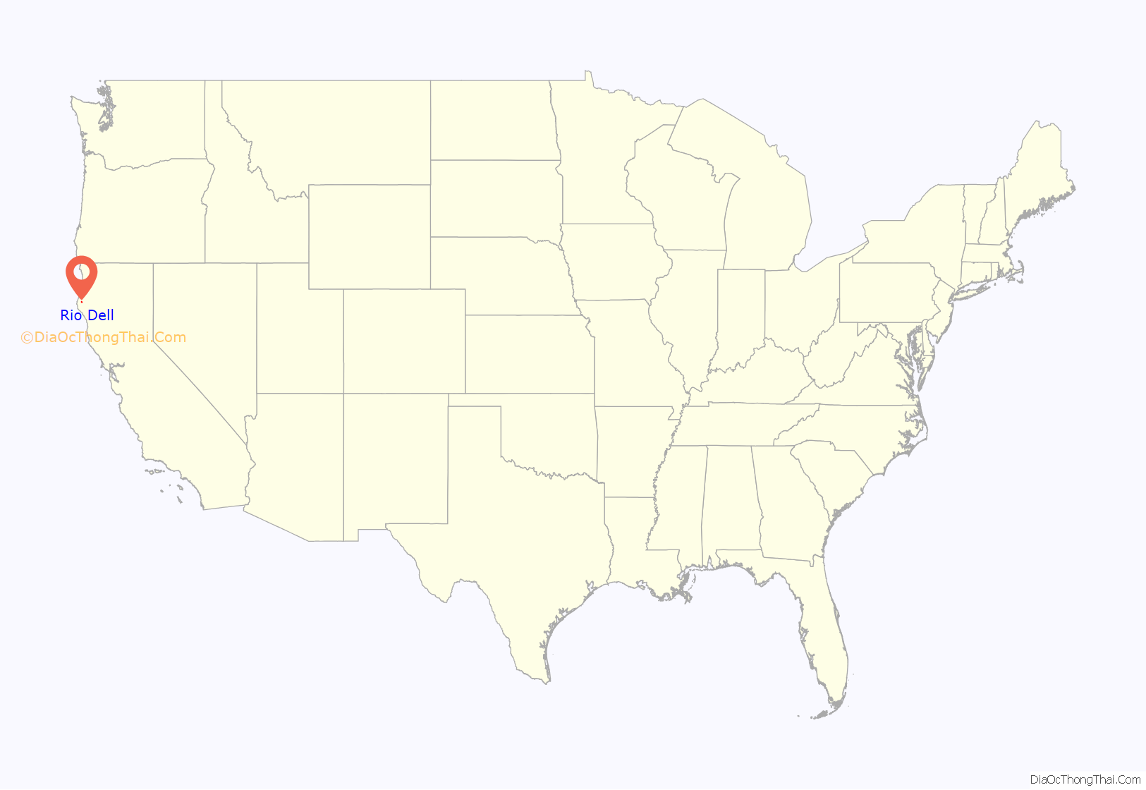
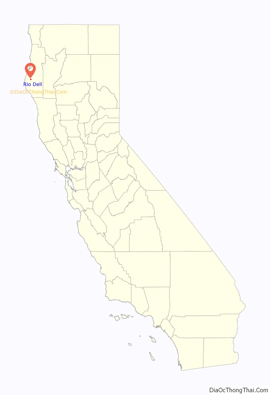
Rio Dell location map. Where is Rio Dell city?
History
Rio Dell derives its name from the historic Rio Dell Hotel. Its owner, businessman Lorenzo Painter, devised the name as a merging of Spanish río (“river”) and English dell (“small wooded valley”).
Originally settled on the territories of the Wiyot, Nongatl, and Mattole tribes, Rio Dell was reportedly first dubbed “Tokemuk” by native inhabitants of the land who were thought to be of multiple regional tribes and who uniquely spoke at least two different regional languages. The native presence was greatly diminished following the 1860 Wiyot massacre on Indian Island that extended south to the Eel river valley where Rio Dell is located. From there, the area became known as Eagle Prairie and finally as Rio Dell.
The first post office at Rio Dell opened in 1876. Rio Dell was connected to Scotia by a ferry provided by the lumber mill in Scotia. After the first bridge was destroyed by a flood in 1905, a ferry carried mill workers from Rio Dell upstream to Scotia, and a second ferry carried mill workers downstream to Metropolitan until a suspension bridge was built to Scotia in 1914. Many Italian immigrants lived in what came to be known as Wildwood, south of Rio Dell proper, and known at the time to outsiders as Little Italy. This part of town became popular with mill workers seeking moonshine, gambling, and prostitution unavailable in the company town of Scotia where they were employed. Men came from as far away as Eureka to enjoy these illegal entertainments, or to engage in recreational fighting, the downtown very soon becoming known as Wildwood. Rio Dell’s main street still carries the name Wildwood Avenue. In 1928 buildings on both sides of this street were engulfed by a fire started by a moonshine still. The fire endangered the bridge to Scotia and prevented the Scotia Fire Department from crossing the bridge to help extinguish the fire.
Rio Dell became home to the workforce for one of the largest lumber mills in the world, the Pacific Lumber Company. It was often the first home of immigrants to the United States and Humboldt County, particularly for the young Italian and Portuguese immigrant workforce of the early 20th century. Rio Dell was incorporated in 1965 as a result of changing demographics, a post-war population expansion and the reluctance of the local Sheriff to provide law enforcement services to what was perceived as a dangerous and remote community. The primary benefit of municipal incorporation being a city’s ability to create its own armed police department under local control. The department totaled 14 sworn officers shortly after obtaining city status. Following the city’s incorporation in 1965 a series of events over the next two decades led to the economic decline of the community, including the opening of a new freeway bypass and the eventual demise of Pacific Lumber Company (Palco) as a significant employer.
Rio Dell was impacted by the 2022 Ferndale earthquake.
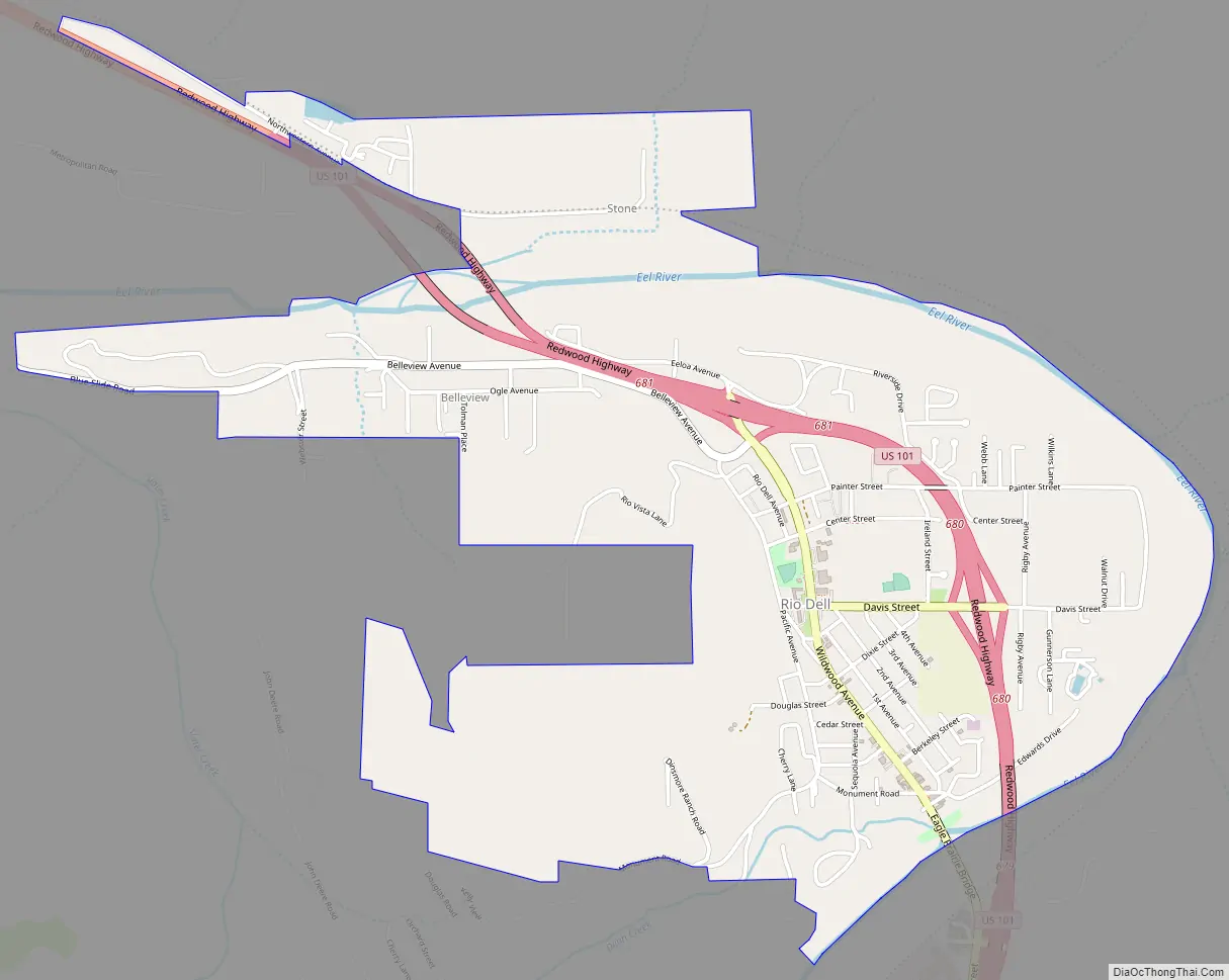
Rio Dell Road Map
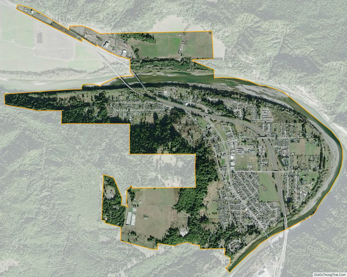
Rio Dell city Satellite Map
Geography
According to the United States Census Bureau, the city has a total area of 2.4 square miles (6.2 km), of which 2.3 square miles (6.0 km) of it is land and 0.1 square miles (0.26 km) of it (5.61%) is water.
Climate
This region experiences warm (but not hot) and dry summers, with no average monthly temperatures above 71.6 °F. According to the Köppen Climate Classification system, Rio Dell has a warm-summer Mediterranean climate, abbreviated “Csb” on climate maps.
See also
Map of California State and its subdivision:- Alameda
- Alpine
- Amador
- Butte
- Calaveras
- Colusa
- Contra Costa
- Del Norte
- El Dorado
- Fresno
- Glenn
- Humboldt
- Imperial
- Inyo
- Kern
- Kings
- Lake
- Lassen
- Los Angeles
- Madera
- Marin
- Mariposa
- Mendocino
- Merced
- Modoc
- Mono
- Monterey
- Napa
- Nevada
- Orange
- Placer
- Plumas
- Riverside
- Sacramento
- San Benito
- San Bernardino
- San Diego
- San Francisco
- San Joaquin
- San Luis Obispo
- San Mateo
- Santa Barbara
- Santa Clara
- Santa Cruz
- Shasta
- Sierra
- Siskiyou
- Solano
- Sonoma
- Stanislaus
- Sutter
- Tehama
- Trinity
- Tulare
- Tuolumne
- Ventura
- Yolo
- Yuba
- Alabama
- Alaska
- Arizona
- Arkansas
- California
- Colorado
- Connecticut
- Delaware
- District of Columbia
- Florida
- Georgia
- Hawaii
- Idaho
- Illinois
- Indiana
- Iowa
- Kansas
- Kentucky
- Louisiana
- Maine
- Maryland
- Massachusetts
- Michigan
- Minnesota
- Mississippi
- Missouri
- Montana
- Nebraska
- Nevada
- New Hampshire
- New Jersey
- New Mexico
- New York
- North Carolina
- North Dakota
- Ohio
- Oklahoma
- Oregon
- Pennsylvania
- Rhode Island
- South Carolina
- South Dakota
- Tennessee
- Texas
- Utah
- Vermont
- Virginia
- Washington
- West Virginia
- Wisconsin
- Wyoming


