Springville is a census-designated place (CDP) in Tulare County, California, United States. The population was 967 at the 2020 census, up from 934 at the 2010 census.
| Name: | Springville CDP |
|---|---|
| LSAD Code: | 57 |
| LSAD Description: | CDP (suffix) |
| State: | California |
| County: | Tulare County |
| Elevation: | 1,024 ft (312 m) |
| Total Area: | 4.200 sq mi (10.878 km²) |
| Land Area: | 4.183 sq mi (10.834 km²) |
| Water Area: | 0.017 sq mi (0.044 km²) 0.41% |
| Total Population: | 967 |
| Population Density: | 230/sq mi (89/km²) |
| ZIP code: | 93208, 93265 |
| Area code: | 559 |
| FIPS code: | 0673710 |
| GNISfeature ID: | 0249828 |
Online Interactive Map
Click on ![]() to view map in "full screen" mode.
to view map in "full screen" mode.
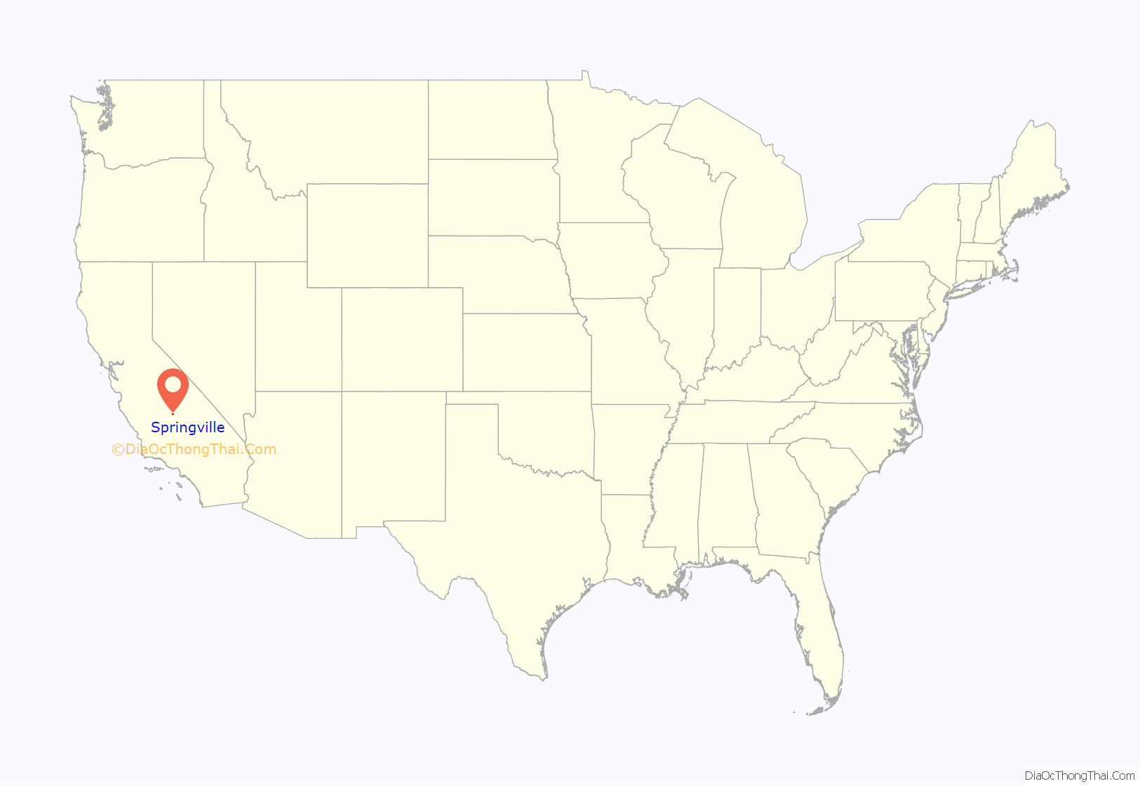
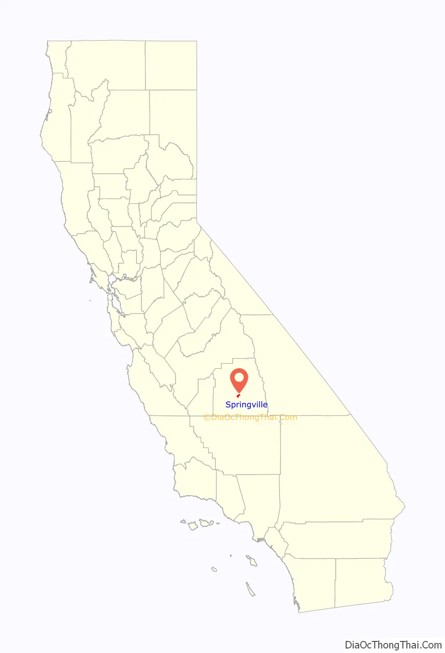
Springville location map. Where is Springville CDP?
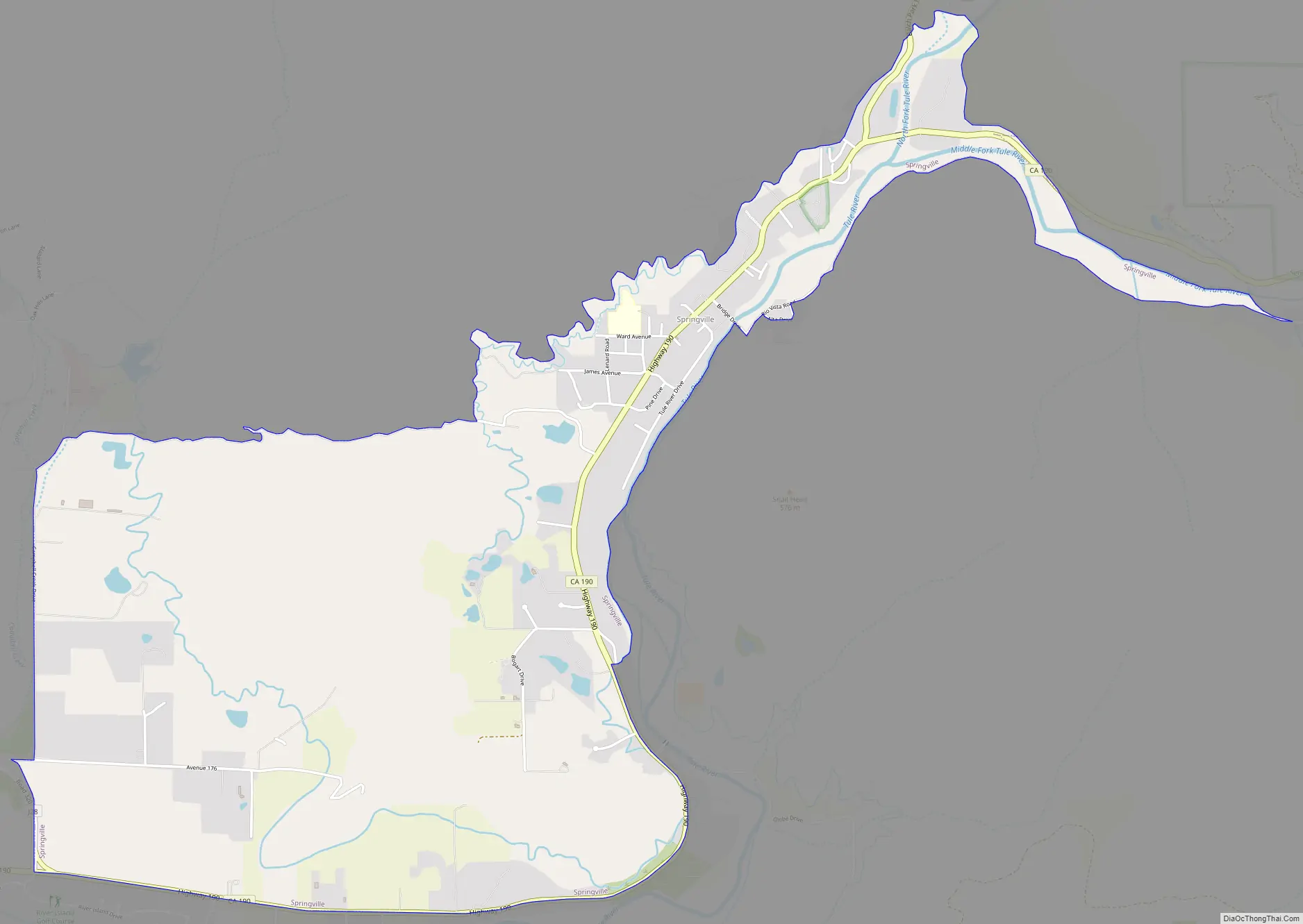
Springville Road Map
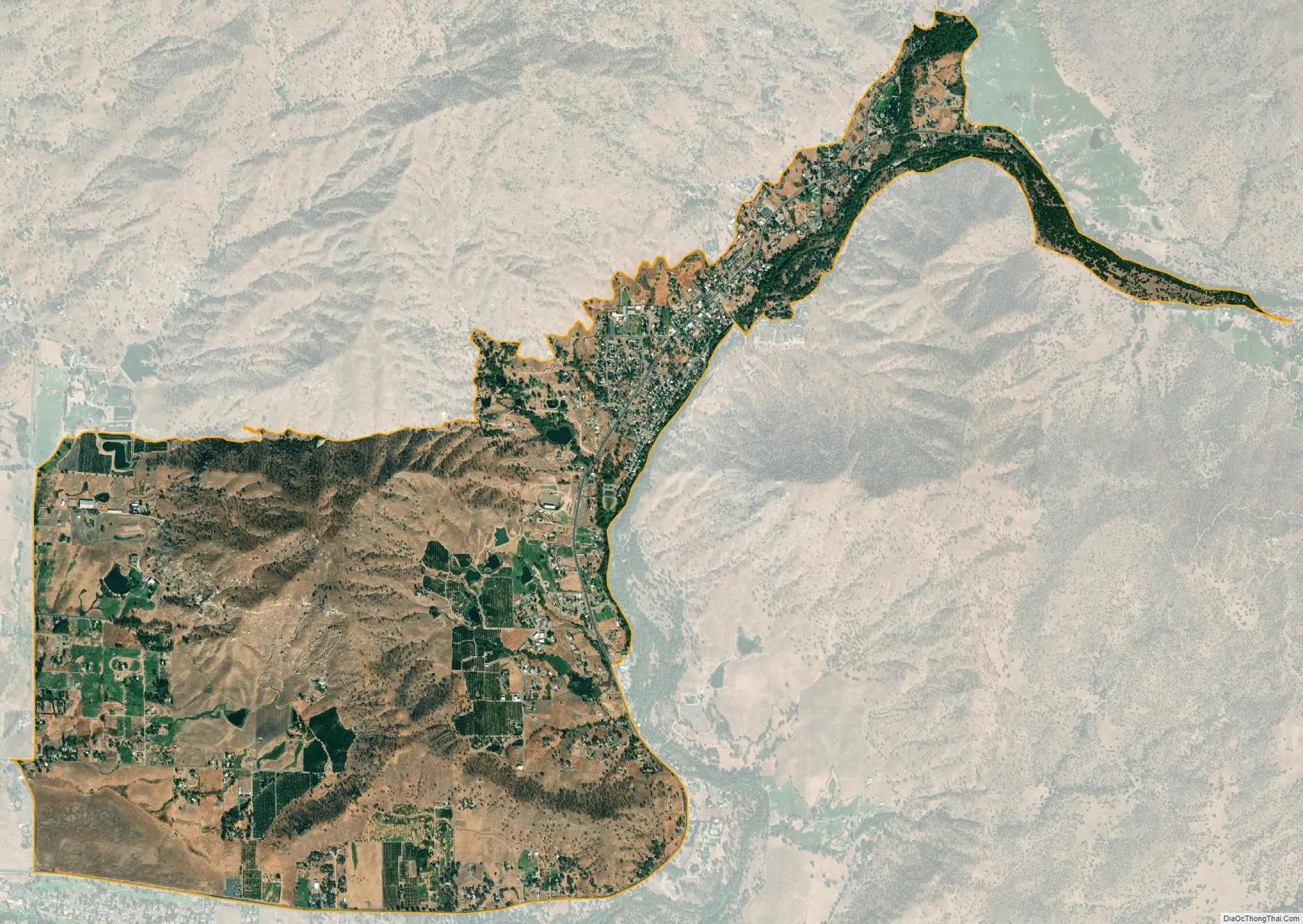
Springville city Satellite Map
Geography
Springville is located at 36°7′42″N 118°49′8″W / 36.12833°N 118.81889°W / 36.12833; -118.81889 (36.128378, -118.819001).
According to the United States Census Bureau, the CDP has a total area of 4.2 square miles (11 km), of which, 4.2 square miles (11 km) of it is land and 0.02 square miles (0.052 km) of it (0.41%) is water.
Climate
This region experiences warm and dry summers, during which the temperature can reach up to 100 F. According to the Köppen Climate Classification system, Springville has a warm-summer Mediterranean climate, abbreviated “Csb” on climate maps. Csb = Warm-summer Mediterranean climate; coldest month averaging above 0 °C (32 °F) (or −3 °C (27 °F)), all months with average temperatures below 22 °C (71.6 °F), and at least four months averaging above 10 °C (50 °F). At least three times as much precipitation in the wettest month of winter as in the driest month of summer, and driest month of summer receives less than 30 mm (1.2 in).
See also
Map of California State and its subdivision:- Alameda
- Alpine
- Amador
- Butte
- Calaveras
- Colusa
- Contra Costa
- Del Norte
- El Dorado
- Fresno
- Glenn
- Humboldt
- Imperial
- Inyo
- Kern
- Kings
- Lake
- Lassen
- Los Angeles
- Madera
- Marin
- Mariposa
- Mendocino
- Merced
- Modoc
- Mono
- Monterey
- Napa
- Nevada
- Orange
- Placer
- Plumas
- Riverside
- Sacramento
- San Benito
- San Bernardino
- San Diego
- San Francisco
- San Joaquin
- San Luis Obispo
- San Mateo
- Santa Barbara
- Santa Clara
- Santa Cruz
- Shasta
- Sierra
- Siskiyou
- Solano
- Sonoma
- Stanislaus
- Sutter
- Tehama
- Trinity
- Tulare
- Tuolumne
- Ventura
- Yolo
- Yuba
- Alabama
- Alaska
- Arizona
- Arkansas
- California
- Colorado
- Connecticut
- Delaware
- District of Columbia
- Florida
- Georgia
- Hawaii
- Idaho
- Illinois
- Indiana
- Iowa
- Kansas
- Kentucky
- Louisiana
- Maine
- Maryland
- Massachusetts
- Michigan
- Minnesota
- Mississippi
- Missouri
- Montana
- Nebraska
- Nevada
- New Hampshire
- New Jersey
- New Mexico
- New York
- North Carolina
- North Dakota
- Ohio
- Oklahoma
- Oregon
- Pennsylvania
- Rhode Island
- South Carolina
- South Dakota
- Tennessee
- Texas
- Utah
- Vermont
- Virginia
- Washington
- West Virginia
- Wisconsin
- Wyoming


