Strathmore is a census-designated place (CDP) in Tulare County, California, United States. The population was 2,819 at the 2010 census, up from 2,584 at the 2000 census.
| Name: | Strathmore CDP |
|---|---|
| LSAD Code: | 57 |
| LSAD Description: | CDP (suffix) |
| State: | California |
| County: | Tulare County |
| Elevation: | 400 ft (122 m) |
| Total Area: | 1.419 sq mi (3.676 km²) |
| Land Area: | 1.406 sq mi (3.642 km²) |
| Water Area: | 0.013 sq mi (0.034 km²) 0.92% |
| Total Population: | 3,033 |
| Population Density: | 2,100/sq mi (830/km²) |
| ZIP code: | 93267 |
| Area code: | 559 |
| FIPS code: | 0675280 |
| GNISfeature ID: | 1652797 |
Online Interactive Map
Click on ![]() to view map in "full screen" mode.
to view map in "full screen" mode.
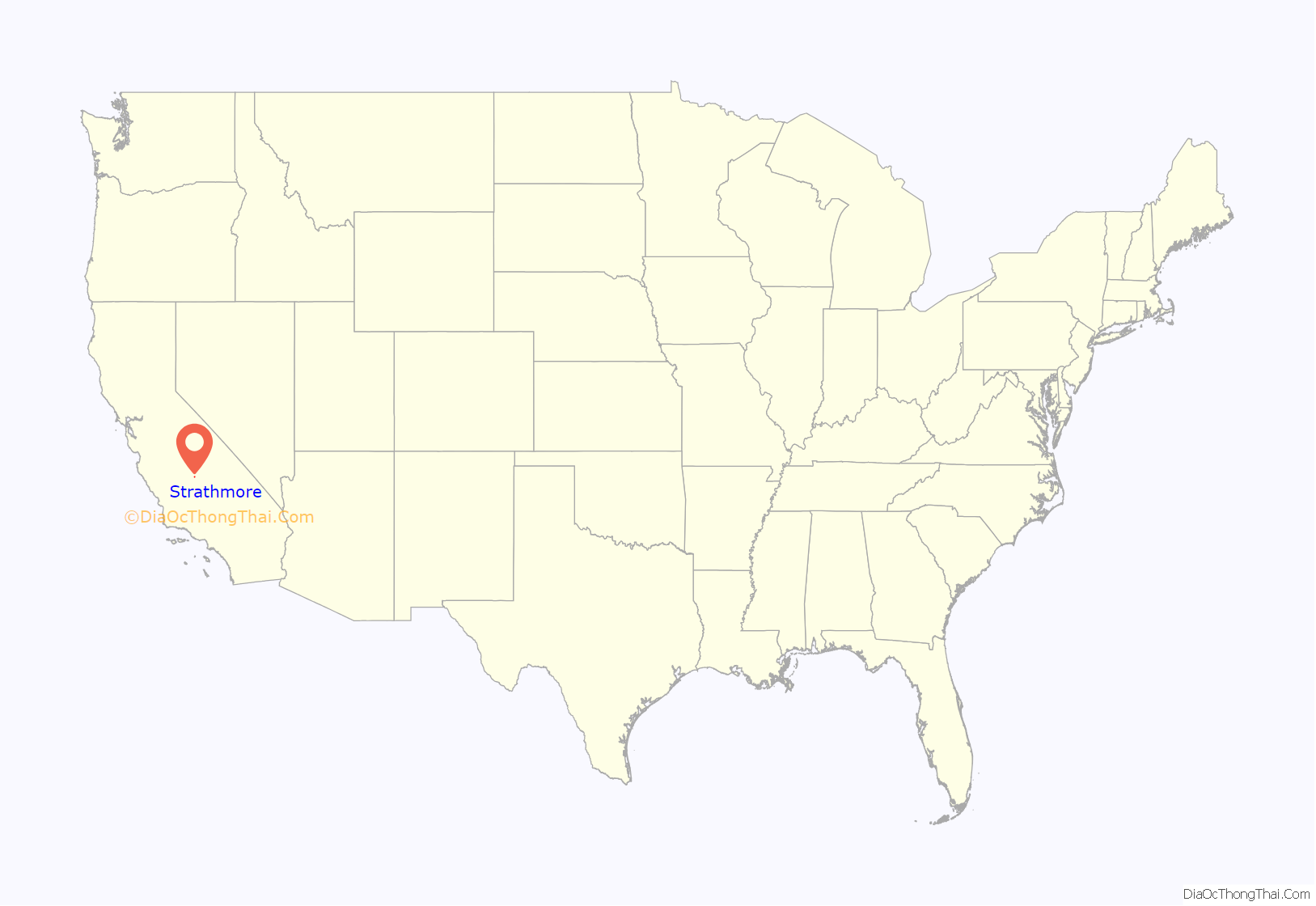
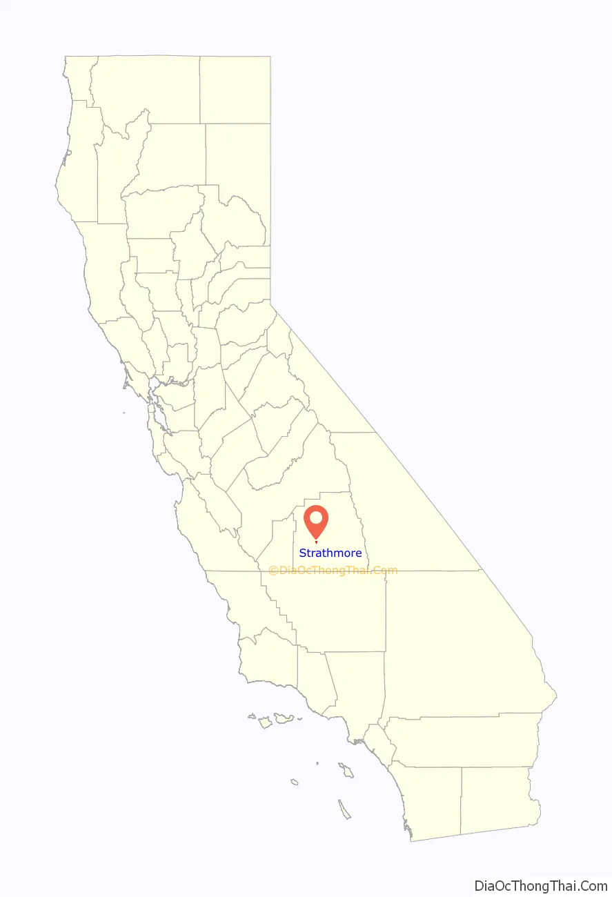
Strathmore location map. Where is Strathmore CDP?
History
Strathmore was given its name by the Scottish corporation Balfour Guthrie Company in 1908. It is a Scottish word which translates to “broad valley.” Previous names for Strathmore have been Roth Spur and Santos, CA.
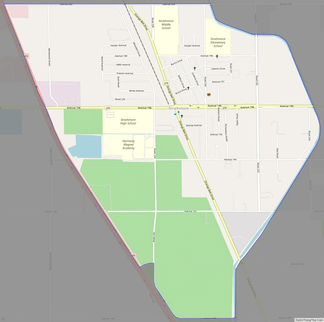
Strathmore Road Map
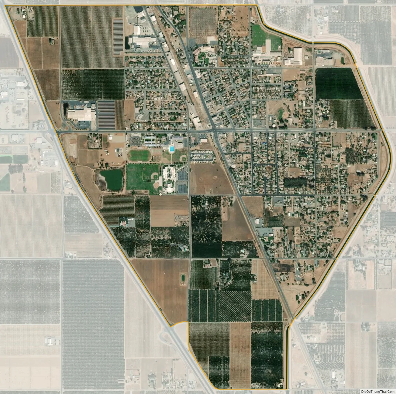
Strathmore city Satellite Map
Geography
Strathmore is located at 36°8′42″N 119°3′34″W / 36.14500°N 119.05944°W / 36.14500; -119.05944 (36.144891, -119.059506).
According to the United States Census Bureau, the CDP has a total area of 1.4 square miles (3.6 km), of which, 1.4 square miles (3.6 km) of it is land and 0.92% is water.
Climate
According to the Köppen Climate Classification system, Strathmore has a semi-arid climate, abbreviated “BSk” on climate maps.
See also
Map of California State and its subdivision:- Alameda
- Alpine
- Amador
- Butte
- Calaveras
- Colusa
- Contra Costa
- Del Norte
- El Dorado
- Fresno
- Glenn
- Humboldt
- Imperial
- Inyo
- Kern
- Kings
- Lake
- Lassen
- Los Angeles
- Madera
- Marin
- Mariposa
- Mendocino
- Merced
- Modoc
- Mono
- Monterey
- Napa
- Nevada
- Orange
- Placer
- Plumas
- Riverside
- Sacramento
- San Benito
- San Bernardino
- San Diego
- San Francisco
- San Joaquin
- San Luis Obispo
- San Mateo
- Santa Barbara
- Santa Clara
- Santa Cruz
- Shasta
- Sierra
- Siskiyou
- Solano
- Sonoma
- Stanislaus
- Sutter
- Tehama
- Trinity
- Tulare
- Tuolumne
- Ventura
- Yolo
- Yuba
- Alabama
- Alaska
- Arizona
- Arkansas
- California
- Colorado
- Connecticut
- Delaware
- District of Columbia
- Florida
- Georgia
- Hawaii
- Idaho
- Illinois
- Indiana
- Iowa
- Kansas
- Kentucky
- Louisiana
- Maine
- Maryland
- Massachusetts
- Michigan
- Minnesota
- Mississippi
- Missouri
- Montana
- Nebraska
- Nevada
- New Hampshire
- New Jersey
- New Mexico
- New York
- North Carolina
- North Dakota
- Ohio
- Oklahoma
- Oregon
- Pennsylvania
- Rhode Island
- South Carolina
- South Dakota
- Tennessee
- Texas
- Utah
- Vermont
- Virginia
- Washington
- West Virginia
- Wisconsin
- Wyoming


