Temescal Valley (Temescal, Spanish for “sweat lodge”) is a census-designated place in Riverside County, California. Temescal Valley sits at an elevation of 1,138 feet (347 m). The 2010 United States census reported Temescal Valley’s population was 22,535.
| Name: | Temescal Valley CDP |
|---|---|
| LSAD Code: | 57 |
| LSAD Description: | CDP (suffix) |
| State: | California |
| County: | Riverside County |
| Elevation: | 1,138 ft (347 m) |
| Total Area: | 19.338 sq mi (50.085 km²) |
| Land Area: | 19.302 sq mi (49.993 km²) |
| Water Area: | 0.036 sq mi (0.092 km²) 0.18% |
| Total Population: | 29,301 |
| Population Density: | 1,500/sq mi (590/km²) |
| FIPS code: | 0678138 |
| GNISfeature ID: | 2629134 |
Online Interactive Map
Click on ![]() to view map in "full screen" mode.
to view map in "full screen" mode.
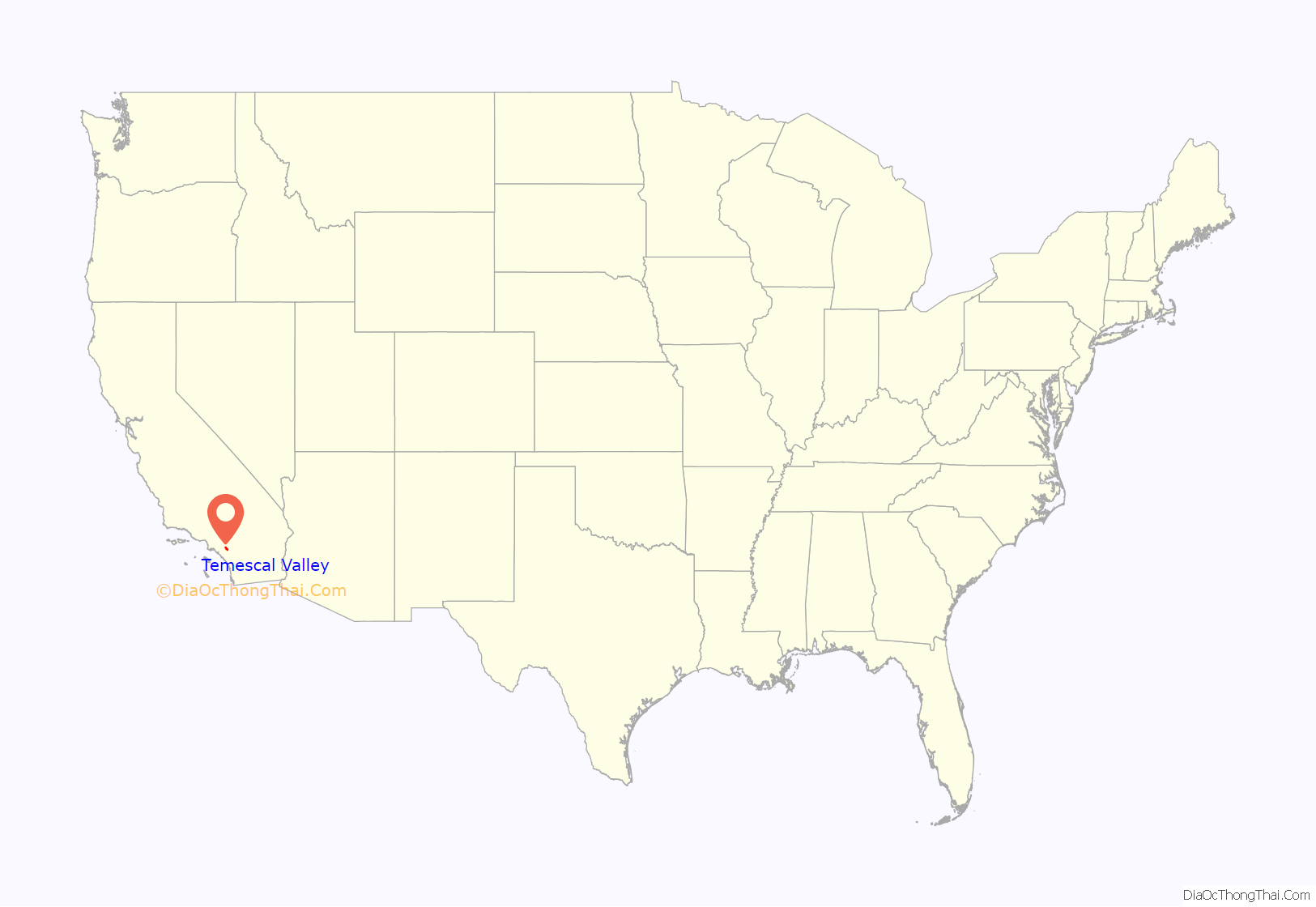
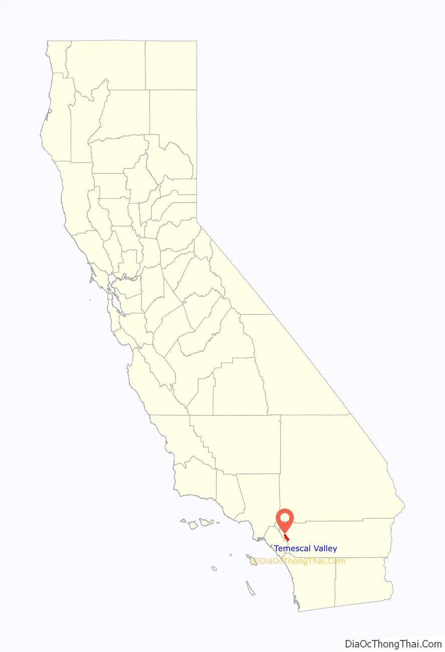
Temescal Valley location map. Where is Temescal Valley CDP?
History
Rancho Temescal
Temescal Valley takes its name from the Rancho Temescal established by Leandro Serrano. Serrano received the written permission of the priest of the Mission San Luis Rey de Francia, or of the military commander of San Diego, to occupy the five square league Rancho Temescal on land belonging to Mission of San Luis Rey. He took possession in about 1818 or 1819 under a grant given by Governor José María de Echeandía to Leandro Serrano. The Serrano Boulder (California Historical Landmark (#185), marks the site of the first house erected by Leandro Serrano about May 1824. The grant extended along the Temescal Valley south of present day Corona and encompassed El Cerrito and Lee Lake. The Serrano family held the land until they lost the court case validating their title to the land in 1866. Meanwhile squatters settled on the land in anticipation of this result in 1855.
Temescal
In 1857, the Temescal Station of the Butterfield Overland Mail stage line was established five miles north of the Temescal Hot Springs, ten miles north of Rancho La Laguna station and twenty miles south of the Chino Rancho station. The Temescal Overland station was “at the foot of the Temescal hills, a splendid place to camp, wood and water plenty, and protected from the winds.” Around this location the settlement of Temescal grew over the next few decades. By 1860, Greenwade’s Place in Temescal Canyon, 3 miles north of the stage station, was a polling place for southwestern San Bernardino County. It was a Post Office from February 12 until November 12, 1861 when the American Civil War shut down the Butterfield stage operations.
In 1866, the Temescal School District was organized, the fifth in San Bernardino County. Its school house was built under a huge sycamore tree and served until 1889, when a new building took its place in the early 1900s. During the 1870s, orchards and bee hives began to replace cattle and sheep ranching. The bees were first brought into the valley in the early seventies and became an important source of income in the valley. From October 29, 1874, Temescal again had its own post office.
In 1856, Abel Stearns was convinced that the rancho’s property contained tin ores and bought an interest in Rancho Temescal from Serrano’s widow for 200 cattle. He was forced by his losses in the drought of 1863-64 to sell off his interest in the Temescal Rancho in 1864, for $100,000. The tin mine, located east of Temescal, was developed after the 1866 ruling and produced tin by 1869. However the land title remained in dispute and no more development to the mines happened until an 1888 Supreme Court ruling settled the title.
After the Supreme Court ruling, experts from England examined the tin district, and made favorable reports which encouraged the California Mining and Smelting Company to be incorporated in London, on July 24, 1890, also another corporation, the San Jacinto Estate, Limited, was formed, by prominent financiers of London, including some of the men interested in the Welsh tin mines. The Rancho San Jacinto Sobrante, on which the mine was now located, was purchased, and the Temescal tin mine was at last opened up operating for the next two years. Temescal grew large with the influx of the miners, enough to have its own post office. Up to July 1892, 136 tons of tin were produced; the first shipment reached New York on March 30, 1892. This was the first and last shipment; the Temescal tin mines were soon closed down in 1892, the valuable equipment and machinery were later sold and no effort has since been made to work the mine.
In May 1886, the South Riverside Land and Water Company was incorporated, its members including ex-Governor of Iowa Samuel Merrill, R. B. Taylor, George L. Joy, A. S. Garretson, and Adolph Rimpau; as a citrus growers’ organization, it purchased the lands of Rancho La Sierra of Bernardo Yorba, and the Rancho Temescal grant and the colony of South Riverside was laid out. They also secured the water rights to Temescal Creek, its tributaries and Lee Lake. Dams and pipelines were built to carry the water to the colony. In 1889, the Temescal Water Company was incorporated, to supply water for the new colony. This company purchased all the water-bearing lands in the valley and began drilling artesian wells. The first wells flowed, at a depth of 300 feet. However, pumping plants soon had to be installed. In time, all the water of both Temescal and Coldwater Creeks was diverted into pipe lines. Cienagas and springs were drained, and, gradually, the valley became dry and desolate. Farms and orchards in the central part of the Temescal Valley were abandoned, and the old adobes along the stage route crumbled and disappeared. By November 30, 1901 the Temescal post office was closed and postal operations moved to the Corona post office.
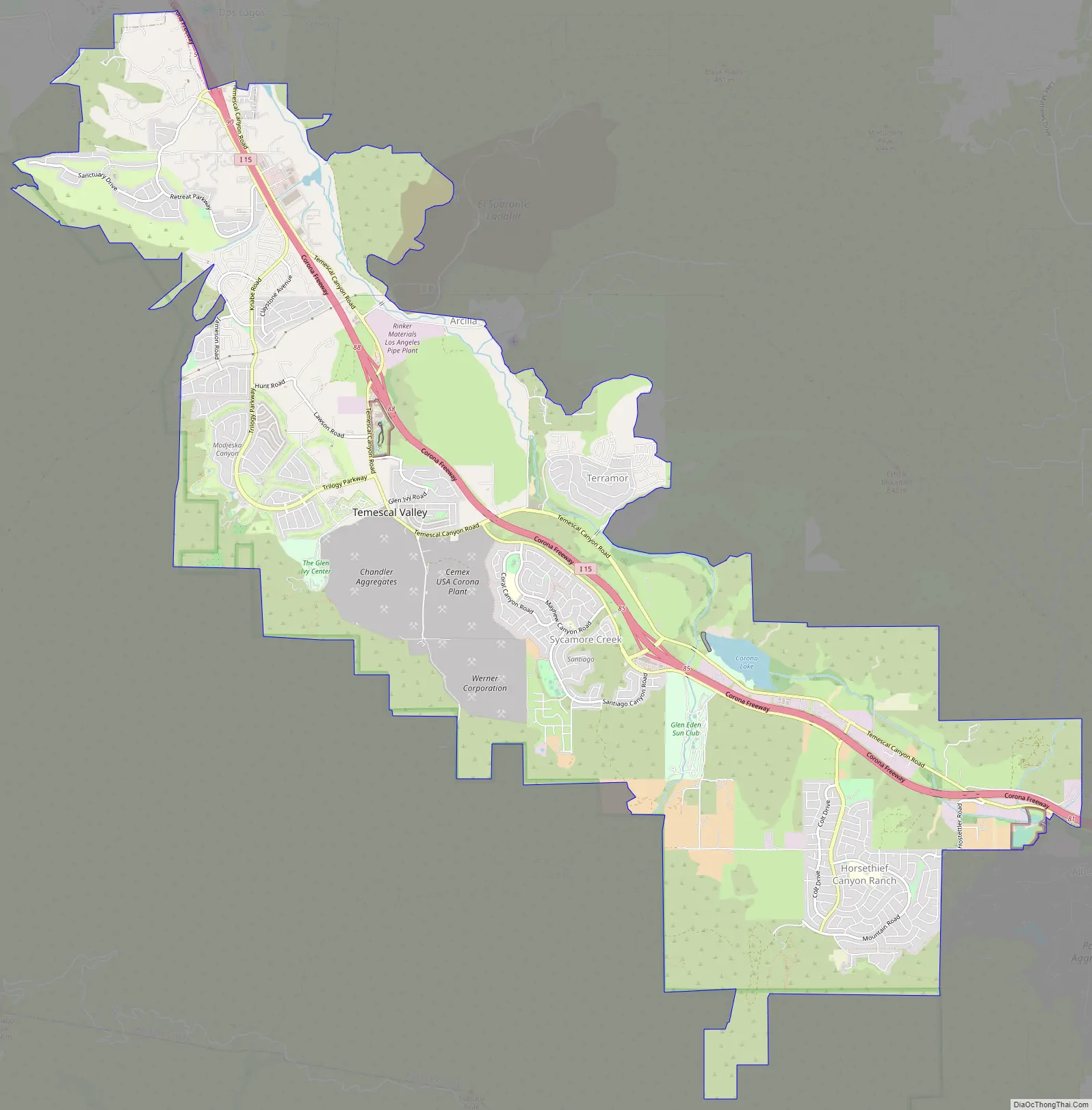
Temescal Valley Road Map
Temescal Valley city Satellite Map
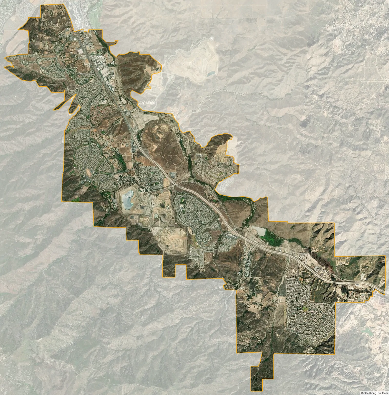
Geography
According to the United States Census Bureau, the CDP covers an area of 19.3 square miles (50.1 km), 99.82% of it land and 0.18% of it water.
See also
Map of California State and its subdivision:- Alameda
- Alpine
- Amador
- Butte
- Calaveras
- Colusa
- Contra Costa
- Del Norte
- El Dorado
- Fresno
- Glenn
- Humboldt
- Imperial
- Inyo
- Kern
- Kings
- Lake
- Lassen
- Los Angeles
- Madera
- Marin
- Mariposa
- Mendocino
- Merced
- Modoc
- Mono
- Monterey
- Napa
- Nevada
- Orange
- Placer
- Plumas
- Riverside
- Sacramento
- San Benito
- San Bernardino
- San Diego
- San Francisco
- San Joaquin
- San Luis Obispo
- San Mateo
- Santa Barbara
- Santa Clara
- Santa Cruz
- Shasta
- Sierra
- Siskiyou
- Solano
- Sonoma
- Stanislaus
- Sutter
- Tehama
- Trinity
- Tulare
- Tuolumne
- Ventura
- Yolo
- Yuba
- Alabama
- Alaska
- Arizona
- Arkansas
- California
- Colorado
- Connecticut
- Delaware
- District of Columbia
- Florida
- Georgia
- Hawaii
- Idaho
- Illinois
- Indiana
- Iowa
- Kansas
- Kentucky
- Louisiana
- Maine
- Maryland
- Massachusetts
- Michigan
- Minnesota
- Mississippi
- Missouri
- Montana
- Nebraska
- Nevada
- New Hampshire
- New Jersey
- New Mexico
- New York
- North Carolina
- North Dakota
- Ohio
- Oklahoma
- Oregon
- Pennsylvania
- Rhode Island
- South Carolina
- South Dakota
- Tennessee
- Texas
- Utah
- Vermont
- Virginia
- Washington
- West Virginia
- Wisconsin
- Wyoming


