Aventura is a planned, suburban city in northeastern Miami-Dade County, Florida, United States, 15 miles (24 km) north of Miami and part of the Miami metropolitan area. The city is especially known for Aventura Mall, the third largest mall in the United States by total square feet of retail space and the largest mall in Florida.
The city name is from the Spanish word for “adventure”, and was named “Aventura” after the developers of the original group of condominiums in the area, Eddie Lewis and Don Soffer, who had remarked “What an adventure this is going to be.”
As of the 2020 census, the city population was 40,242, up from 35,762 in 2010.
| Name: | Aventura city |
|---|---|
| LSAD Code: | 25 |
| LSAD Description: | city (suffix) |
| State: | Florida |
| County: | Miami-Dade County |
| Incorporated: | November 7, 1995 |
| Elevation: | 3 ft (1 m) |
| Total Area: | 3.52 sq mi (9.11 km²) |
| Land Area: | 2.65 sq mi (6.86 km²) |
| Water Area: | 0.87 sq mi (2.25 km²) |
| Total Population: | 40,242 |
| Population Density: | 15,197.13/sq mi (5,867.26/km²) |
| FIPS code: | 1202681 |
| GNISfeature ID: | 1777315 |
| Website: | www.cityofaventura.com |
Online Interactive Map
Click on ![]() to view map in "full screen" mode.
to view map in "full screen" mode.
Aventura location map. Where is Aventura city?
History
Initially referred to as “Turnberry”, Aventura began to be developed during the early 1970s and became an incorporated city in 1995. The Aventura Police Department was formed in 1997.
The city is home to the luxury resort Turnberry Isle, where the yacht Monkey Business was docked during the Gary Hart/Donna Rice incident, which contributed to Hart’s ending his 1988 bid for the presidency.
Aventura is also home to the Aventura Mall, the third-largest shopping mall in the US. Built in 1983, it is a joint venture of Turnberry Associates and Simon Property, and brings a major source of income to the city.
In early 2001, former US President Bill Clinton delivered one of his first speeches after leaving the White House at Aventura-Turnberry Jewish Center.
Aventura Road Map
Aventura city Satellite Map
Geography
Geography
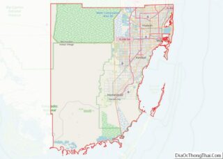
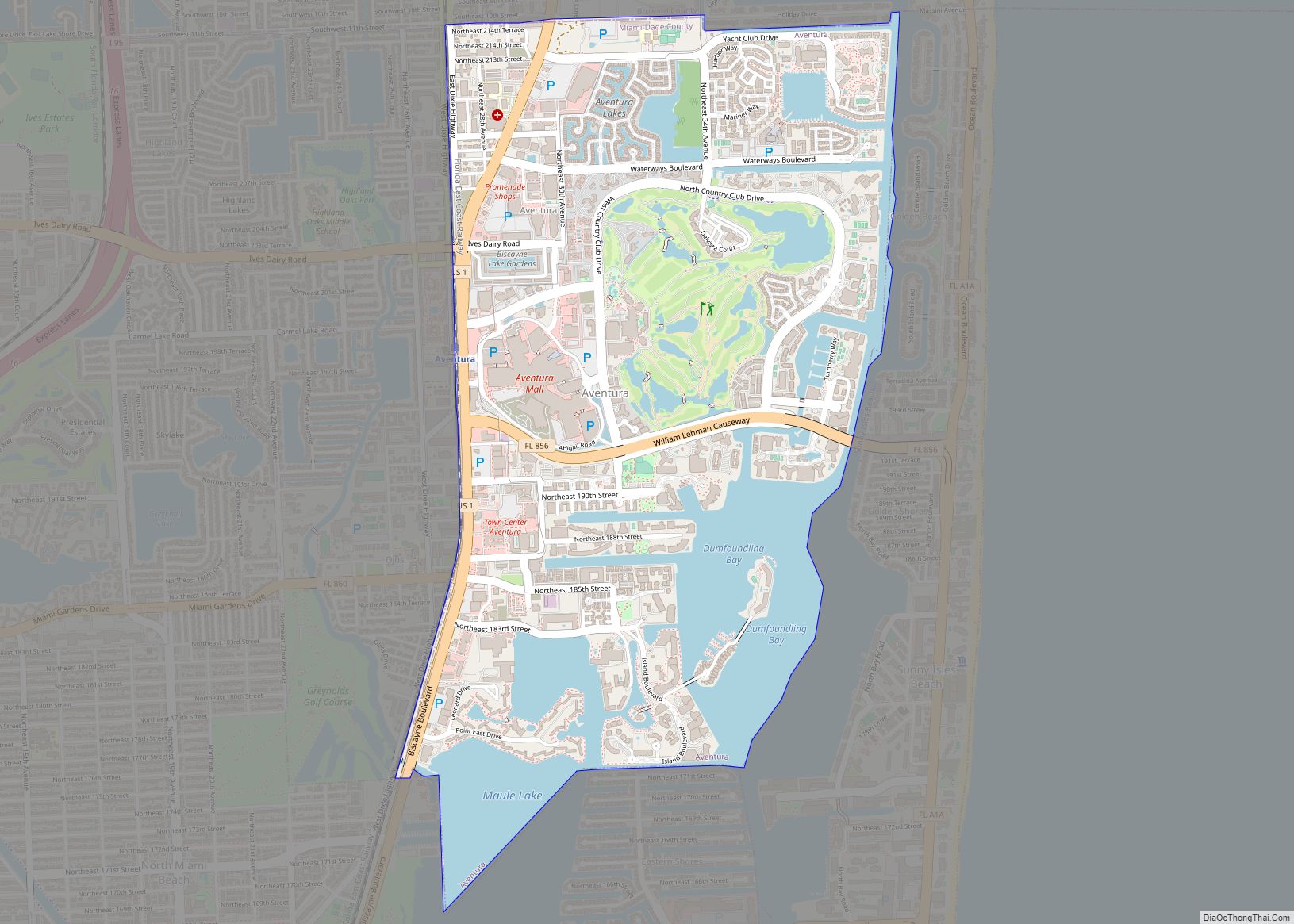
Aventura is located in northeastern Miami–Dade County at 25°57′52″N 80°08′09″W / 25.964345°N 80.135818°W / 25.964345; -80.135818. It is bordered to the east by Golden Beach and Sunny Isles Beach, to the south by North Miami Beach, and to the west by unincorporated Ojus. It is bordered to the north by Hallandale Beach in Broward County. U.S. Route 1 (Biscayne Boulevard) runs along the western edge of the city, leading south 15 miles (24 km) to Downtown Miami and north 12 miles (19 km) to Fort Lauderdale.
According to the United States Census Bureau, the city has an area of 3.5 square miles (9.1 km). Of that, 2.6 sq mi (6.7 km) are land and 0.9 sq mi (2.3 km) (24.73%) are water. The Atlantic Intracoastal Waterway and Dumfoundling Bay form the eastern border of the city, while the southern border is within Maule Lake.
Climate
Aventura has a tropical monsoon climate (Köppen climate classification Am) with hot and humid summers and short, warm winters, with a marked drier season in the winter. The city sees most of its rain in the summer (wet season) and is mainly dry in winter (dry season). The wet season, which is hot and humid, lasts from May to September, when it gives way to the dry season, which features mild temperatures with some invasions of colder air, which is when the little winter rainfall occurs-with the passing of a front. The hurricane season largely coincides with the wet season.
In addition to its sea-level elevation, coastal location and position just north of the Tropic of Cancer, the area owes its warm, humid climate to the Gulf Stream, which moderates climate year-round. A typical summer day does not see temperatures below 75 °F (24 °C). Temperatures in the high 80s to low 90s (30–35 °C) accompanied by high humidity are often relieved by afternoon thunderstorms or a sea breeze that develops off the Atlantic Ocean, which then allow lower temperatures, although conditions still remain very muggy. During winter, humidity is significantly lower, allowing for cooler weather to develop. Average minimum temperatures during that time are around 59 °F (15 °C), rarely dipping below 40 °F (4 °C), and the equivalent maxima usually around 75 °F (24 °C).
Hurricane season begins June 1 and is officially over November 30. Aventura was severely hit by Hurricane Wilma on October 24, 2005 and was still undergoing recovery as of November 2011. The library was destroyed and has been rebuilt. Terraces flew off of high-rises and condos on high floors were flooded with many of their walls exploding into next-door apartments and adjacent hallways. Countless high-rise windows exploded and electricity stopped.
See also
Map of Florida State and its subdivision:- Alachua
- Baker
- Bay
- Bradford
- Brevard
- Broward
- Calhoun
- Charlotte
- Citrus
- Clay
- Collier
- Columbia
- Desoto
- Dixie
- Duval
- Escambia
- Flagler
- Franklin
- Gadsden
- Gilchrist
- Glades
- Gulf
- Hamilton
- Hardee
- Hendry
- Hernando
- Highlands
- Hillsborough
- Holmes
- Indian River
- Jackson
- Jefferson
- Lafayette
- Lake
- Lee
- Leon
- Levy
- Liberty
- Madison
- Manatee
- Marion
- Martin
- Miami-Dade
- Monroe
- Nassau
- Okaloosa
- Okeechobee
- Orange
- Osceola
- Palm Beach
- Pasco
- Pinellas
- Polk
- Putnam
- Saint Johns
- Saint Lucie
- Santa Rosa
- Sarasota
- Seminole
- Sumter
- Suwannee
- Taylor
- Union
- Volusia
- Wakulla
- Walton
- Washington
- Alabama
- Alaska
- Arizona
- Arkansas
- California
- Colorado
- Connecticut
- Delaware
- District of Columbia
- Florida
- Georgia
- Hawaii
- Idaho
- Illinois
- Indiana
- Iowa
- Kansas
- Kentucky
- Louisiana
- Maine
- Maryland
- Massachusetts
- Michigan
- Minnesota
- Mississippi
- Missouri
- Montana
- Nebraska
- Nevada
- New Hampshire
- New Jersey
- New Mexico
- New York
- North Carolina
- North Dakota
- Ohio
- Oklahoma
- Oregon
- Pennsylvania
- Rhode Island
- South Carolina
- South Dakota
- Tennessee
- Texas
- Utah
- Vermont
- Virginia
- Washington
- West Virginia
- Wisconsin
- Wyoming


