Center Hill is a city in Sumter County, Florida, United States. The population was 988 at the 2010 census. According to the U.S Census estimates of 2018, the city had a population of 1,409.
| Name: | Center Hill city |
|---|---|
| LSAD Code: | 25 |
| LSAD Description: | city (suffix) |
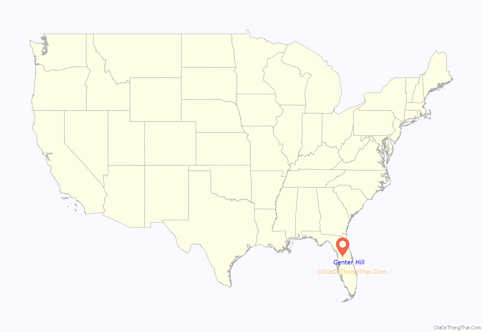
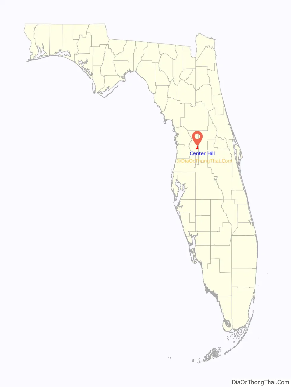
| State: | Florida |
| County: | Sumter County |
| Elevation: | 98 ft (30 m) |
| Total Area: | 6.45 sq mi (16.70 km²) |
| Land Area: | 6.10 sq mi (15.80 km²) |
| Water Area: | 0.35 sq mi (0.90 km²) |
| Total Population: | 846 |
| Population Density: | 138.71/sq mi (53.55/km²) |
| ZIP code: | 33514 |
| Area code: | 352 |
| FIPS code: | 1211325 |
| GNISfeature ID: | 0280236 |
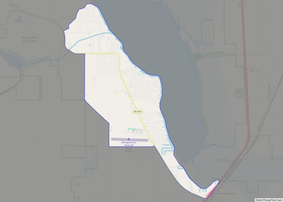
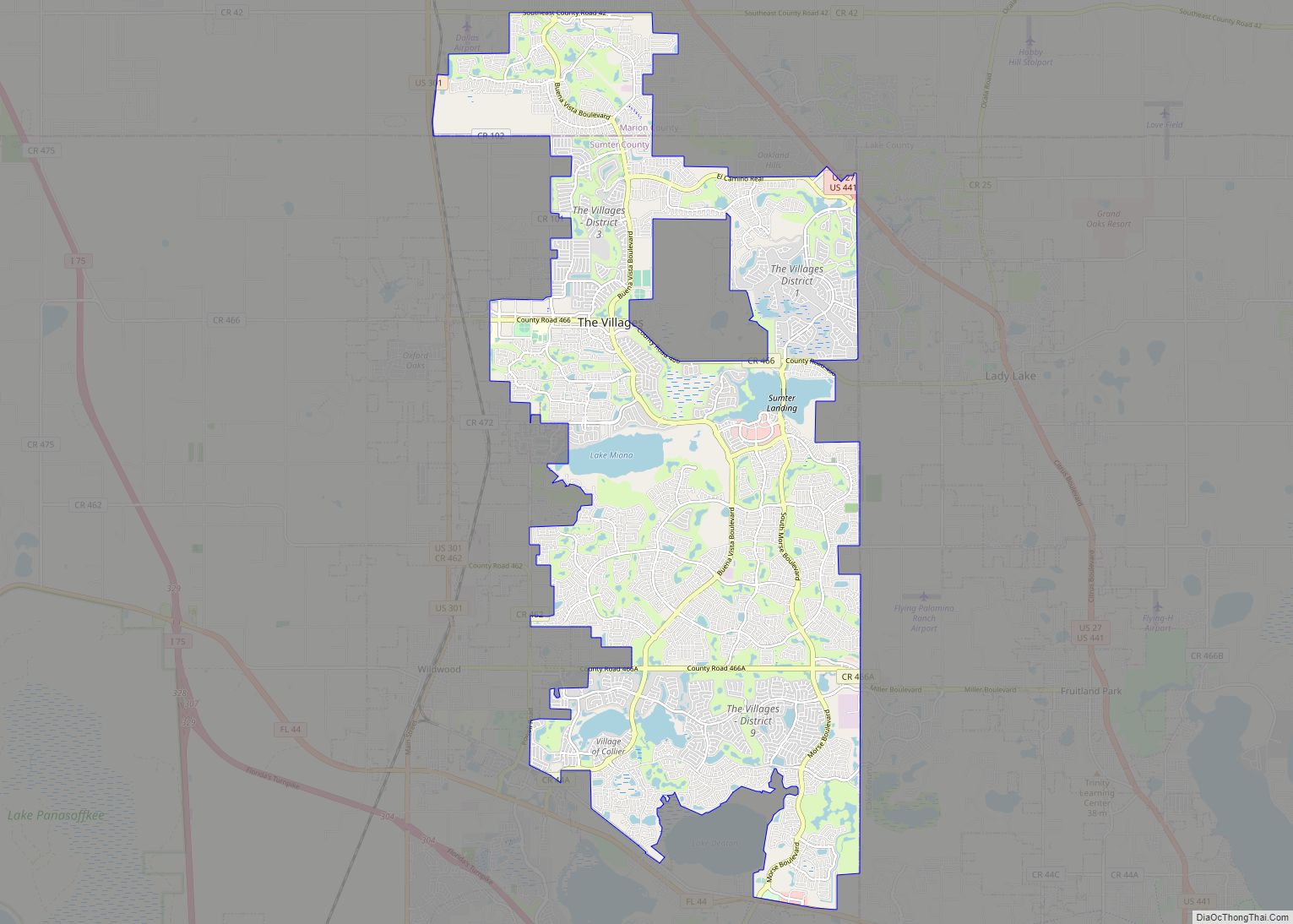
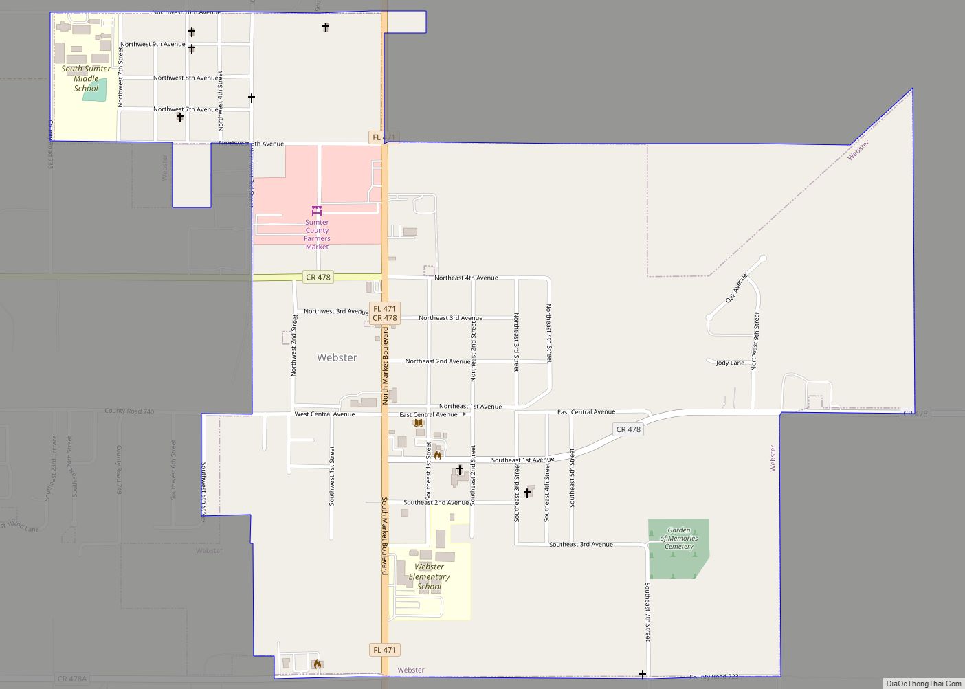
Online Interactive Map
Click on ![]() to view map in "full screen" mode.
to view map in "full screen" mode.
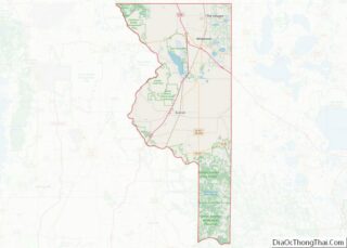
Center Hill location map. Where is Center Hill city?
History
Early inhabitants
By 1800, black Seminoles and “maroons”, or fugitive slaves, had settled in Abraham’s Old Town and the Wahoo Swamp. Maroons who fought for England joined the black Seminoles after the runaway slaves fled to Florida, a free territory under Spanish rule, to avoid remaining in slavery following the American Revolution. Both black Seminoles and maroons lived with the Seminoles in a feudal-like relationship; the black Seminoles paid the Seminoles with a percentage of their crops in exchange for their freedom. The black Seminoles settled in the Center Hill area in 1813 and named it Peliklakaha. Accompanying them was Seminole chief Micanopy, who made Peliklakaha his residence after the death of Payne.
The town had about 100 residents. They came as runaway slaves from Georgia. Others were of African descent, specifically from the Kongo region, and some Seminoles, including one of Micanopy’s wives, lived in Peliklakaha. The town’s layout was influenced by slave quarters, Seminole villages, and African villages. The residents lived in buildings constructed from daub, thatch, and lumber. Peliklakaha participated in regional trade with the Seminoles, black hunters travelling to South Florida, and white travelers as the village was located at the center of several well-travelled Indian trails.
The United States and Florida governments noticed the area’s fertility. In 1823, while informing the Seminoles about the meeting at Moultrie Creek, Horatio S. Dexter, an envoy sent by Florida territorial governor William P. Duval, discovered that the black Seminoles grew rice, peanuts, and corn. In 1826, United States Army General George McCall visited Peliklakaha and noticed that their farms were located on what General McCall called “the finest land”.
Second Seminole War
Whites called the town “Abraham’s Old Town”, after Abraham, a former slave who had been given his freedom by the British and who served as a recruiter and an interpreter for the Seminoles. After hearing that Dade and his men were to cross through the territory, Abraham anticipated an attack on Peliklakaha and convinced Micanopy to move Seminole soldiers to the Fort King Road. Abraham left the village after Dade’s Massacre on December 28, 1835. A short time later in 1836, General Winifred Scott moved General Abraham Eustis’ troops to the Peliklakaha area to destroy the Seminoles. General Eustis and his troops burned Peliklakaha; no Seminoles were killed as Peliklakaha’s population fled to the Wahoo Swamp before Eustis’ forces arrived. General Eustis would later commission a painting depicting the burning of Peliklakaha, which later was hung in the Library of Congress.
On April 19, 1842, Colonel William Worth attacked Halleck Tustenuggee at Peliklakaha. During the battle, Halleck Tustenuggee and his warriors constructed a log barricade. United States Army soldiers attacked the front of the barricade while dragoons attacked from the back. Halleck Tustenuggee and his warriors retreated, and the United States Army burned the camp. The battle left one soldier dead and four wounded on the United States side and one soldier killed and one captured on the Seminole side. A few days later, Halleck Tustenuggee, two of his wives, and two of his children voluntarily surrendered to Worth at Warm Springs. On August 14, 1842, Worth declared the Second Seminole War over.
Settlement by whites
In the late 1830s and early 1840s, the Mobley and Beville families settled in the area. Either the town’s postmaster Thomas W. Spicer or Carrie Lovell named the town “Center Hill”. Spicer thought that the town was the hub of activity. Lovell named the town after its location of being on a hill in the center of the county.
Agricultural heyday
According to Broward Mill, the past president of the Sumter County Historical Society, Center Hill was known for its string bean production in the early part of the 20th century. In 1931, Center Hill shipped green beans, green peas, and lima beans to Baltimore, Boston, New York City, Chicago, and Detroit. Beginning in the mid-1930s, Center Hill’s soil fertility declined. Local bean farmers blamed a decrease in the water table. They believed that the creation of the Jumper Creek Drainage District, which the local circuit court formed in 1922 to reclaim about 24,600 acres by draining water from Jumper Creek into Jumper Lake and the Withlacoochee River, deprived them of water and forced them to irrigate large fields. By 1975, bean production was virtually nonexistent, and the population decreased from a peak of 1,500 people to 37 in 1970. In 1988, area farmers still sent their bell peppers, cucumbers, squash, tomatoes, and watermelons to Center Hill for packing and shipping.
1990s
In the 1990s, Center Hill gained a reputation of being a speed trap. The town received a Clinton administration community policing grant of $167,000 (USD) in order to hire ten full and part-time police officers. From the receipt of the grant to 1997, residents complained about the officers issuing traffic tickets, especially for speeding. In November 1997, four police officers, including Police Chief Kendall Alsobrook, left the police force, and the department’s staff was reduced to one full-time officer.
Peliklakaha’s rediscovery
In 1998, archaeologists from the University of Florida in Gainesville, Florida began the first excavation of a black Seminole village in a pasture about two miles from Center Hill. The researchers hoped to determine the town’s social structure and the former residents’ lifestyle. The investigators found dozens of artifacts, including iron pieces, stoneware, glass beads, nails, and pottery. Historians believe that over 100 black Seminoles lived in Peliklakaha, the largest known black Seminole village. Historians also believe that Peliklakaha was rebuilt after Abraham was among the first Seminoles and black Seminoles to be transferred to a reservation in the west.
2000s
On July 31, 2001, a 500-pound (227-kilogram) Siberian tiger named “Tie” fatally attacked Vincent Lowe, a worker at the Savage Kingdom exotic animal park who was attempting to earn state certification to work with the cats, while Lowe was repairing the cage. The tiger burst through his cage and pounced on Lowe before Lowe could fire his pistol at the tiger. Park owner Robert Baudy shot the cat. The incident was the second one in park history. The first was in March 1997 when another Siberian tiger escaped from its cage and mauled a worker before being killed by members of the Sumter County Sheriff’s Department. In February 1999, state game officials discovered substandard cage wiring; the ranch corrected the issue by May 1999, the last inspection before the incident. On July 6, 2006, the United States Department of Agriculture ordered that Savage Kingdom’s license be revoked permanently.
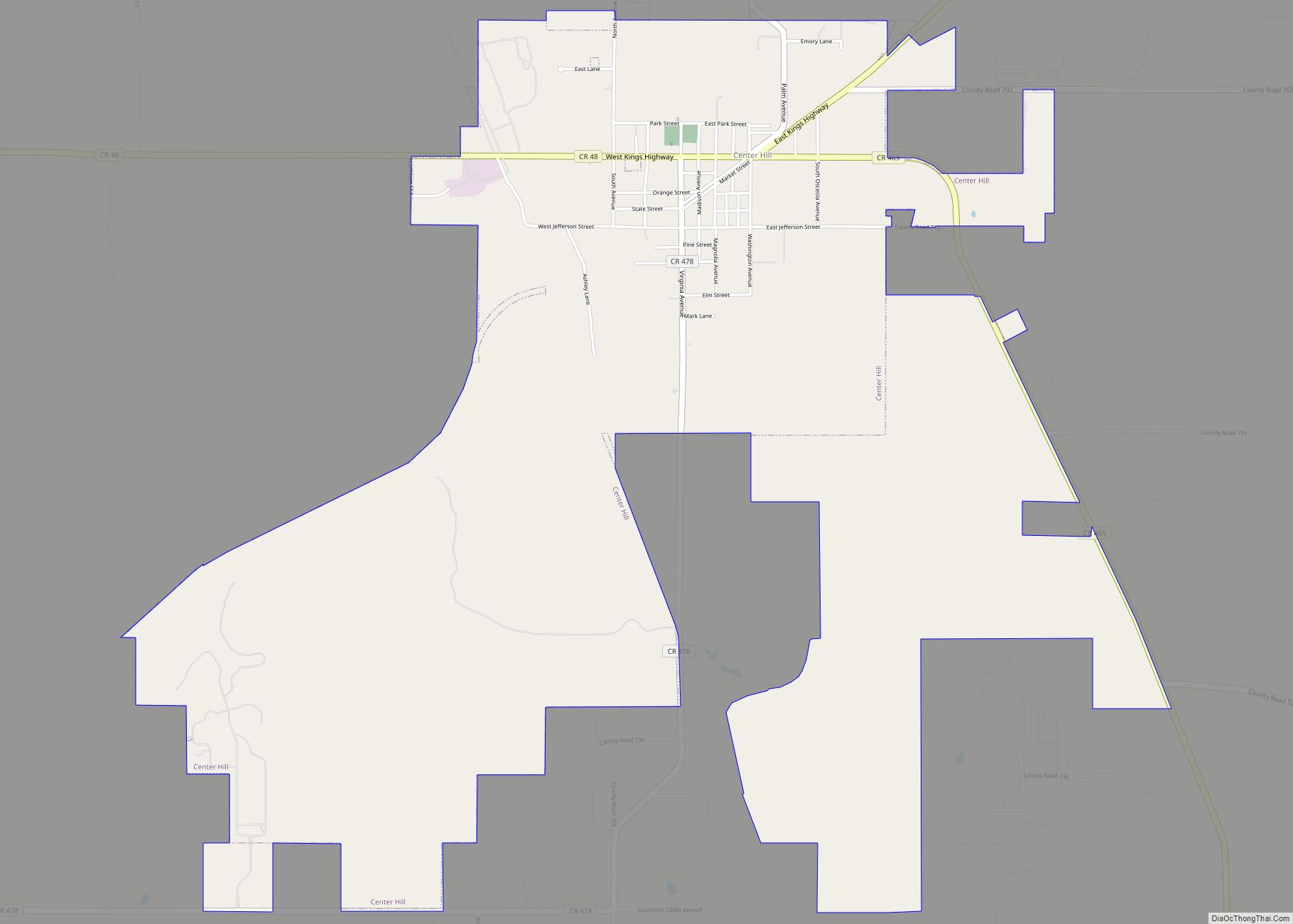
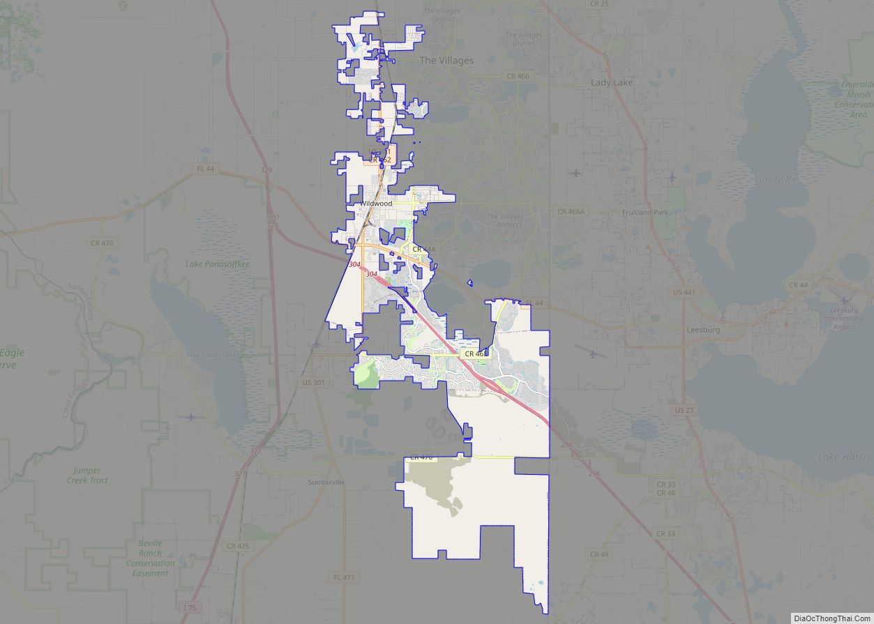
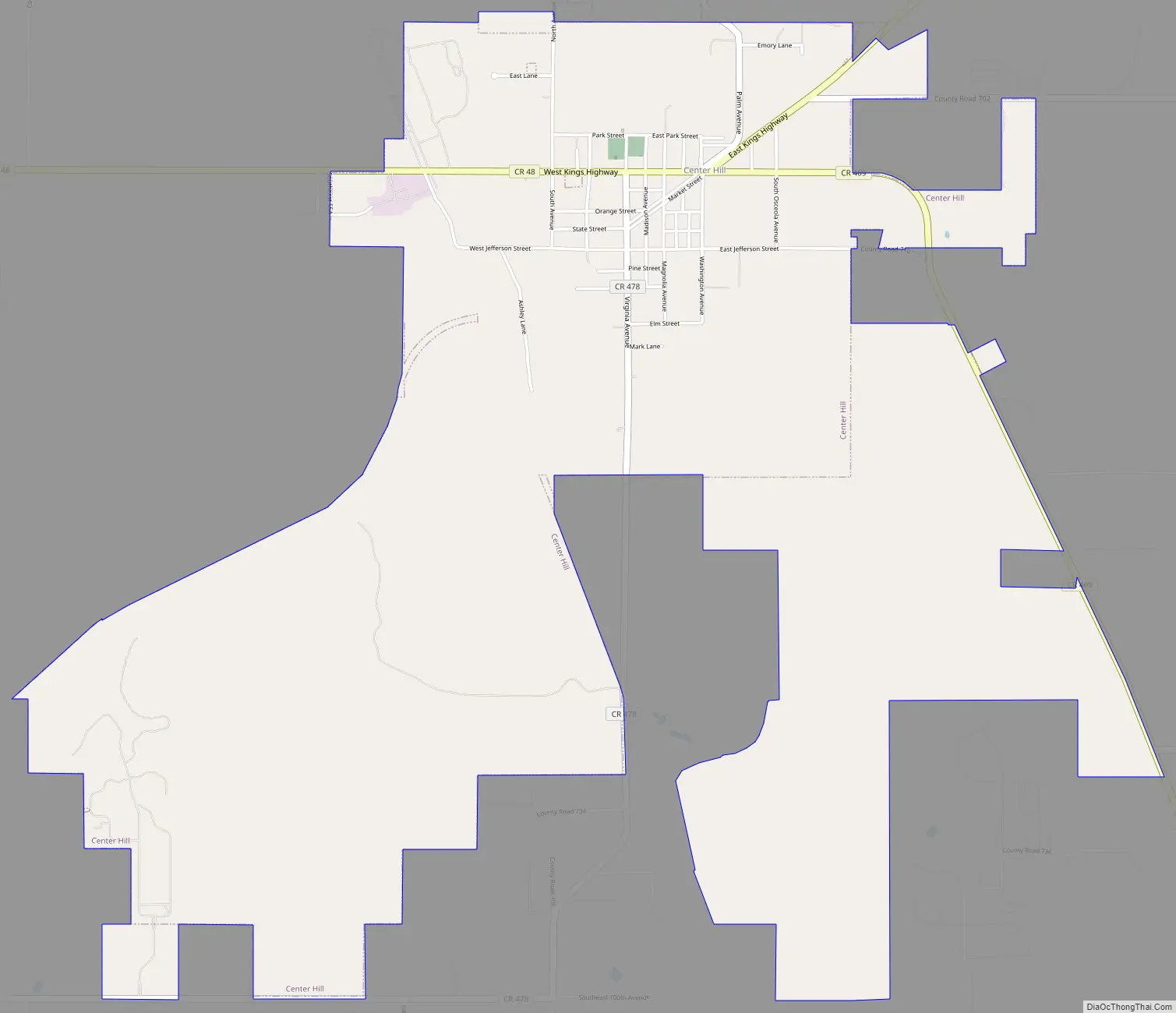
Center Hill Road Map
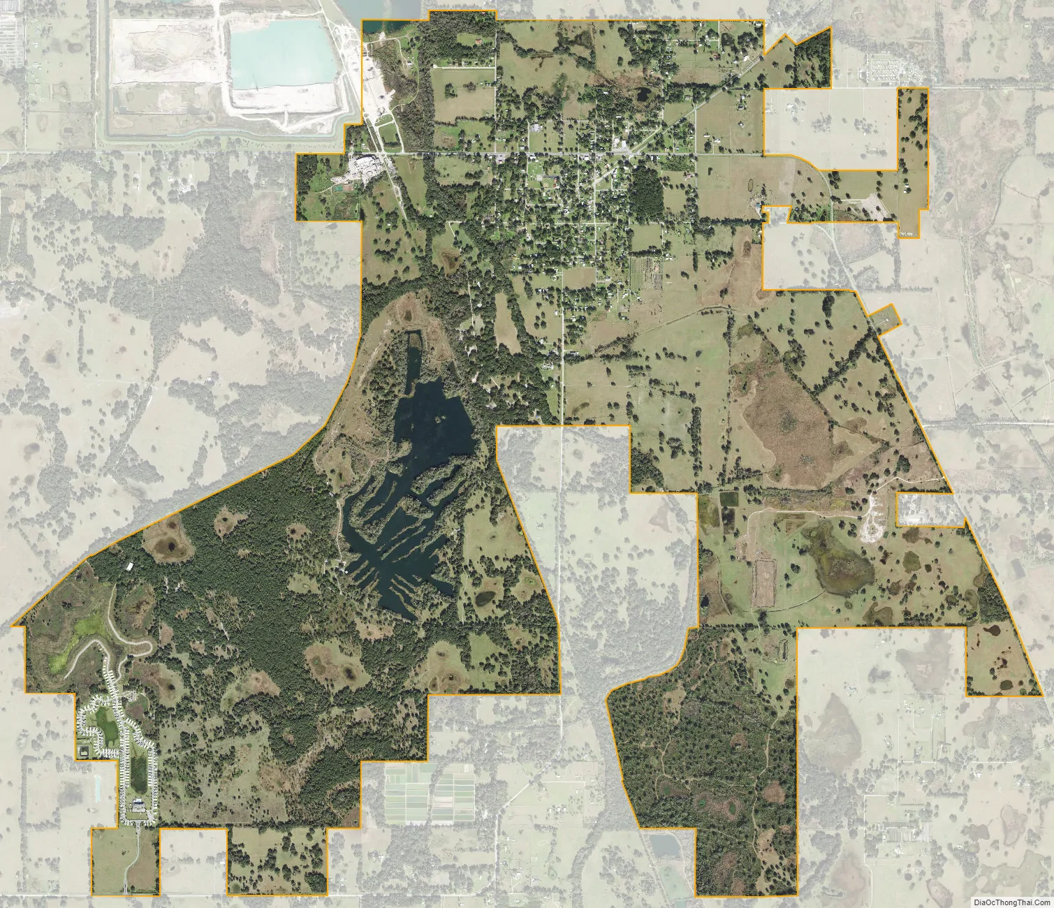
Center Hill city Satellite Map
Geography
Center Hill is located at 28°38′56″N 81°59′43″W / 28.648869°N 81.995396°W / 28.648869; -81.995396.
According to the United States Census Bureau, the city has a total area of 1.8 square miles (4.7 km), of which 1.7 square miles (4.4 km) is land and 0.1 square miles (0.26 km) (3.39%) is water.
See also
Map of Florida State and its subdivision:- Alachua
- Baker
- Bay
- Bradford
- Brevard
- Broward
- Calhoun
- Charlotte
- Citrus
- Clay
- Collier
- Columbia
- Desoto
- Dixie
- Duval
- Escambia
- Flagler
- Franklin
- Gadsden
- Gilchrist
- Glades
- Gulf
- Hamilton
- Hardee
- Hendry
- Hernando
- Highlands
- Hillsborough
- Holmes
- Indian River
- Jackson
- Jefferson
- Lafayette
- Lake
- Lee
- Leon
- Levy
- Liberty
- Madison
- Manatee
- Marion
- Martin
- Miami-Dade
- Monroe
- Nassau
- Okaloosa
- Okeechobee
- Orange
- Osceola
- Palm Beach
- Pasco
- Pinellas
- Polk
- Putnam
- Saint Johns
- Saint Lucie
- Santa Rosa
- Sarasota
- Seminole
- Sumter
- Suwannee
- Taylor
- Union
- Volusia
- Wakulla
- Walton
- Washington
- Alabama
- Alaska
- Arizona
- Arkansas
- California
- Colorado
- Connecticut
- Delaware
- District of Columbia
- Florida
- Georgia
- Hawaii
- Idaho
- Illinois
- Indiana
- Iowa
- Kansas
- Kentucky
- Louisiana
- Maine
- Maryland
- Massachusetts
- Michigan
- Minnesota
- Mississippi
- Missouri
- Montana
- Nebraska
- Nevada
- New Hampshire
- New Jersey
- New Mexico
- New York
- North Carolina
- North Dakota
- Ohio
- Oklahoma
- Oregon
- Pennsylvania
- Rhode Island
- South Carolina
- South Dakota
- Tennessee
- Texas
- Utah
- Vermont
- Virginia
- Washington
- West Virginia
- Wisconsin
- Wyoming