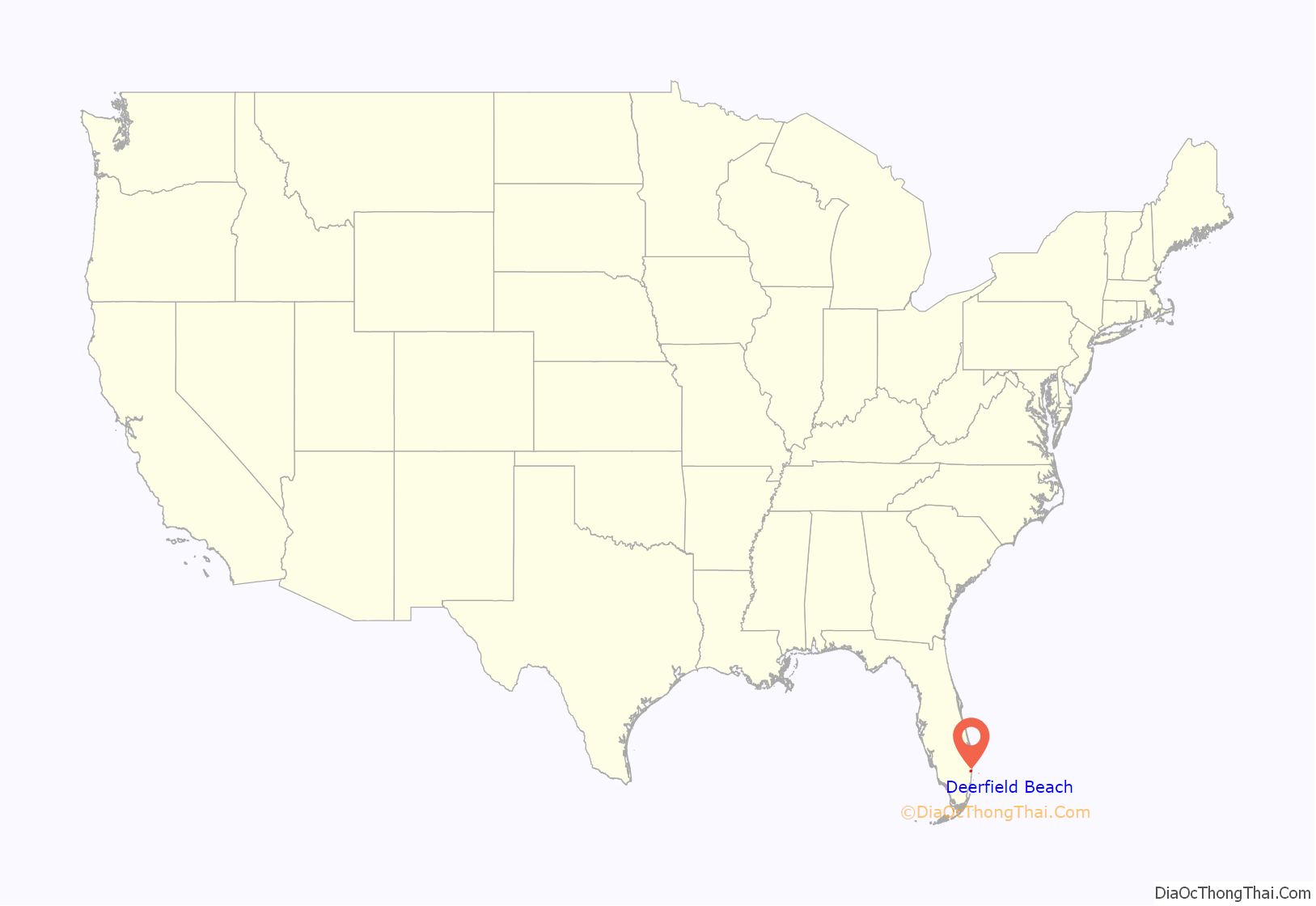
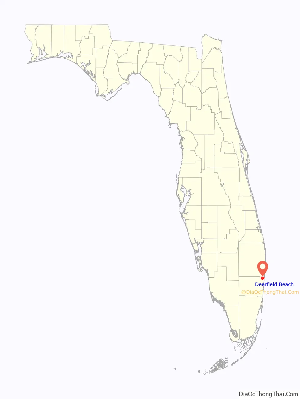
Deerfield Beach is a city in Broward County, Florida, United States, just south of the Palm Beach County line. The city is named for the numerous deer that once roamed the area. As of the 2020 census, the population was 88,859. It is a principal city of the Miami metropolitan area, which is home to 6,166,488 inhabitants as of 2020.
| Name: | Deerfield Beach city |
|---|---|
| LSAD Code: | 25 |
| LSAD Description: | city (suffix) |
| State: | Florida |
| County: | Broward County |
| Elevation: | 13 ft (4 m) |
| Land Area: | 14.95 sq mi (38.71 km²) |
| Water Area: | 1.27 sq mi (3.30 km²) 7.12% |
| Population Density: | 5,811.52/sq mi (2,243.89/km²) |
| Area code: | 754, 954 |
| FIPS code: | 1216725 |
| GNISfeature ID: | 0281460 |
| Website: | www.deerfield-beach.com |
Online Interactive Map
Click on ![]() to view map in "full screen" mode.
to view map in "full screen" mode.
Deerfield Beach location map. Where is Deerfield Beach city?
History
Deerfield Beach’s history dates to 1890, when a small settlement named Hillsborough was developed along the Hillsboro River. As the population grew to 20 by 1898, the settlement was now served by its own post office and the town was named Deerfield for the deer that grazed along the river.
By the early 20th century, as the town’s population continued to grow, the Florida East Coast Railroad constructed tracks en route to Miami bisecting Deerfield. Deerfield’s early settlers were mostly farmers who grew pineapples, tomatoes, green beans, squash and fished along the Intracoastal Waterway. Deerfield remained a largely agricultural community, but in 1939 the town’s name was changed to Deerfield Beach to let tourists know it has a beach. In 1952, the original Deerfield Beach Pier was built of wood.
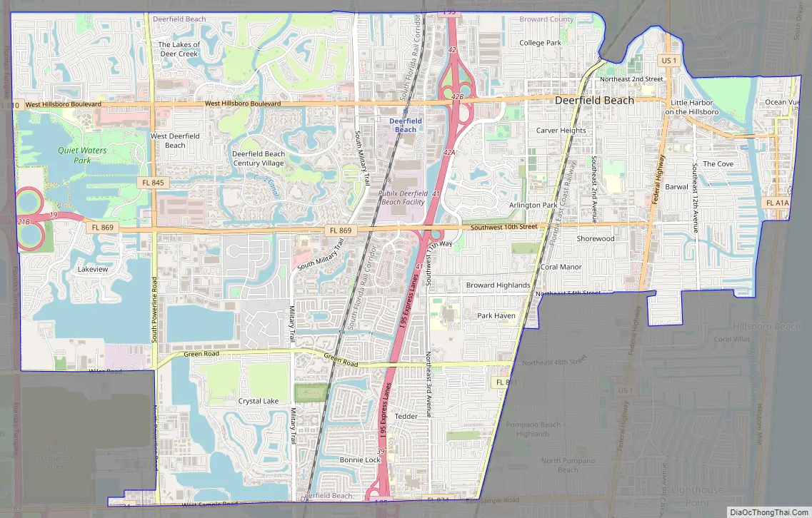
Deerfield Beach Road Map
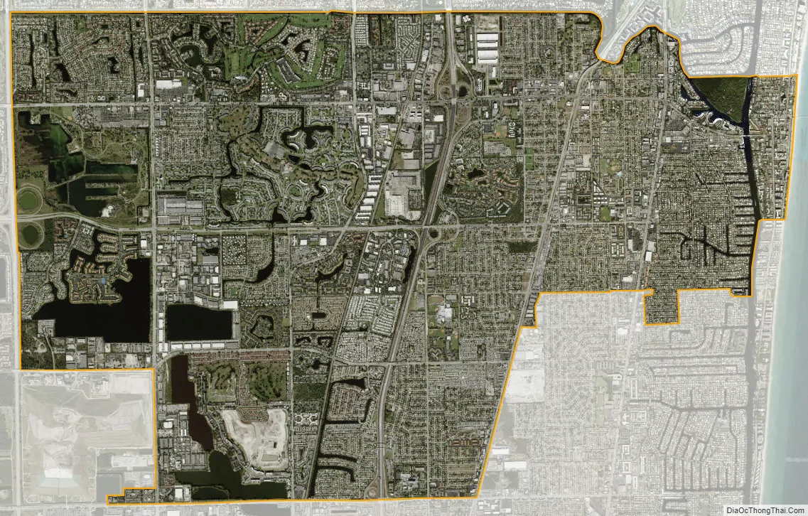
Deerfield Beach city Satellite Map
Geography
Deerfield Beach is located at 26°18′19″N 80°07′11″W / 26.305223°N 80.119817°W / 26.305223; -80.119817. According to the United States Census Bureau, the city has a total area of 16.3 square miles (42.1 km), of which 15.1 square miles (39.1 km) is land and 1.2 square miles (3.0 km) is water (7.12%). Of Deerfield Beach’s land mass 0.3 square miles is located on Deerfield Beach Island (DBI).
Deerfield Beach in March
Northern portion of Deerfield Beach
Deerfield Beach
Deerfield Beach pier from above
Palm trees along Deerfield Beach
Deerfield Beach City Hall
See also
Map of Florida State and its subdivision:- Alachua
- Baker
- Bay
- Bradford
- Brevard
- Broward
- Calhoun
- Charlotte
- Citrus
- Clay
- Collier
- Columbia
- Desoto
- Dixie
- Duval
- Escambia
- Flagler
- Franklin
- Gadsden
- Gilchrist
- Glades
- Gulf
- Hamilton
- Hardee
- Hendry
- Hernando
- Highlands
- Hillsborough
- Holmes
- Indian River
- Jackson
- Jefferson
- Lafayette
- Lake
- Lee
- Leon
- Levy
- Liberty
- Madison
- Manatee
- Marion
- Martin
- Miami-Dade
- Monroe
- Nassau
- Okaloosa
- Okeechobee
- Orange
- Osceola
- Palm Beach
- Pasco
- Pinellas
- Polk
- Putnam
- Saint Johns
- Saint Lucie
- Santa Rosa
- Sarasota
- Seminole
- Sumter
- Suwannee
- Taylor
- Union
- Volusia
- Wakulla
- Walton
- Washington
- Alabama
- Alaska
- Arizona
- Arkansas
- California
- Colorado
- Connecticut
- Delaware
- District of Columbia
- Florida
- Georgia
- Hawaii
- Idaho
- Illinois
- Indiana
- Iowa
- Kansas
- Kentucky
- Louisiana
- Maine
- Maryland
- Massachusetts
- Michigan
- Minnesota
- Mississippi
- Missouri
- Montana
- Nebraska
- Nevada
- New Hampshire
- New Jersey
- New Mexico
- New York
- North Carolina
- North Dakota
- Ohio
- Oklahoma
- Oregon
- Pennsylvania
- Rhode Island
- South Carolina
- South Dakota
- Tennessee
- Texas
- Utah
- Vermont
- Virginia
- Washington
- West Virginia
- Wisconsin
- Wyoming


