Coconut Creek is a city in Broward County, Florida, United States. Situated 37 miles (60 km) north of Miami, it had a population of 57,833 in 2020. It is part of the Miami-Fort Lauderdale-West Palm Beach, FL Metropolitan Statistical Area. The city seceded from Pompano Beach in the 1960s. It is nicknamed “Butterfly Capital of the World” because it is home to Butterfly World, the world’s largest butterfly aviary, with over 80 species and 20,000 individual butterflies.
| Name: | Coconut Creek city |
|---|---|
| LSAD Code: | 25 |
| LSAD Description: | city (suffix) |
| State: | Florida |
| County: | Broward County |
| Incorporated: | February 20, 1967; 56 years ago (1967-02-20) |
| Elevation: | 13 ft (4 m) |
| Land Area: | 11.18 sq mi (28.94 km²) |
| Water Area: | 0.82 sq mi (2.12 km²) |
| Population Density: | 5,174.75/sq mi (1,998.03/km²) |
| ZIP code: | 33063, 33066, 33073, 33093, 33097 |
| Area code: | 754, 954 |
| FIPS code: | 1213275 |
| GNISfeature ID: | 0300334 |
| Website: | www.coconutcreek.net |
Online Interactive Map
Click on ![]() to view map in "full screen" mode.
to view map in "full screen" mode.
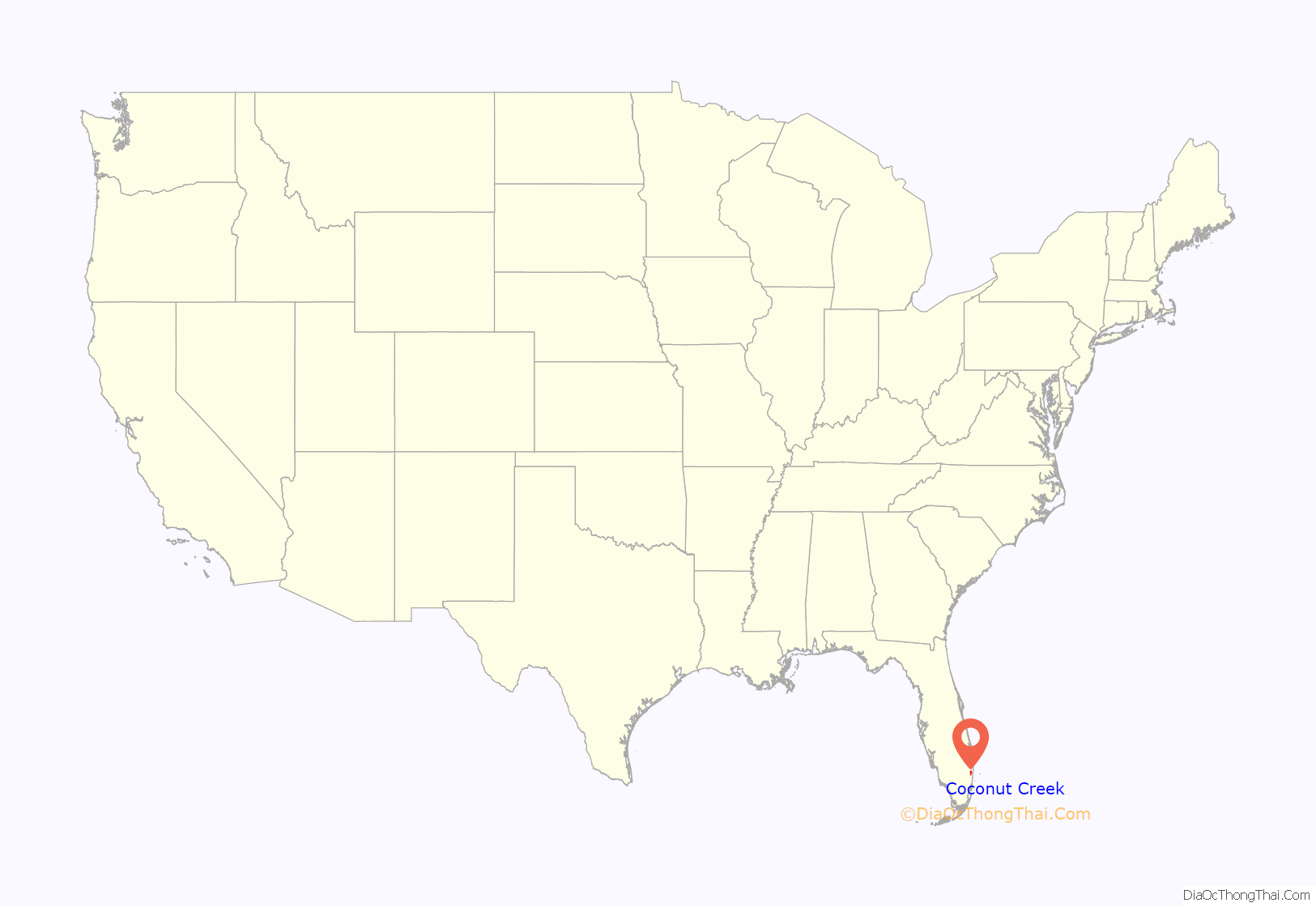
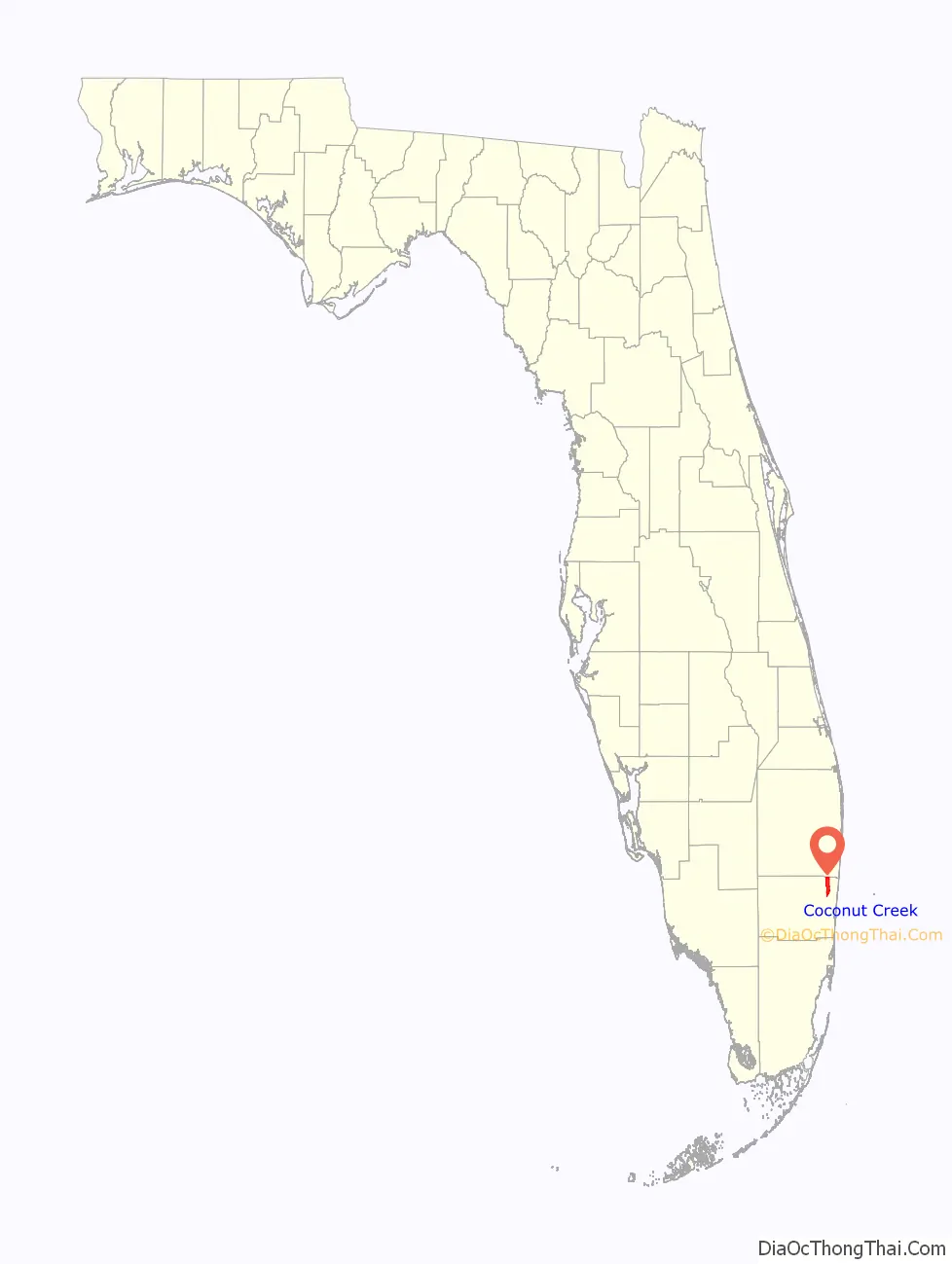
Coconut Creek location map. Where is Coconut Creek city?
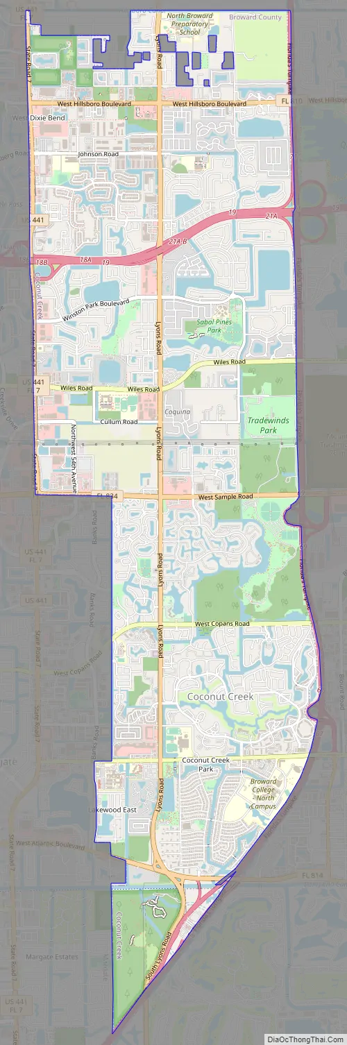
Coconut Creek Road Map
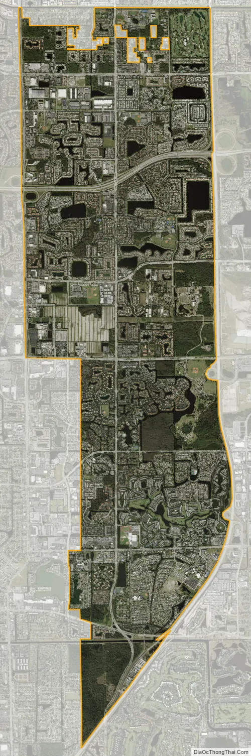
Coconut Creek city Satellite Map
Geography
Coconut Creek is located at 26°16′30″N 80°11′5″W / 26.27500°N 80.18472°W / 26.27500; -80.18472 (26.275010, –80.184719). The city is in northern Broward County. It is bounded by unincorporated Palm Beach County on the north, by the cities of Parkland, Coral Springs and Margate on its west, by Deerfield Beach on its east, and by Pompano Beach on its east and southeast. According to the United States Census Bureau, Coconut Creek has a total area of 12.0 square miles (31.1 km), of which 11.9 square miles (30.7 km) is land and 0.15 square miles (0.4 km) is water (1.21%).
See also
Map of Florida State and its subdivision:- Alachua
- Baker
- Bay
- Bradford
- Brevard
- Broward
- Calhoun
- Charlotte
- Citrus
- Clay
- Collier
- Columbia
- Desoto
- Dixie
- Duval
- Escambia
- Flagler
- Franklin
- Gadsden
- Gilchrist
- Glades
- Gulf
- Hamilton
- Hardee
- Hendry
- Hernando
- Highlands
- Hillsborough
- Holmes
- Indian River
- Jackson
- Jefferson
- Lafayette
- Lake
- Lee
- Leon
- Levy
- Liberty
- Madison
- Manatee
- Marion
- Martin
- Miami-Dade
- Monroe
- Nassau
- Okaloosa
- Okeechobee
- Orange
- Osceola
- Palm Beach
- Pasco
- Pinellas
- Polk
- Putnam
- Saint Johns
- Saint Lucie
- Santa Rosa
- Sarasota
- Seminole
- Sumter
- Suwannee
- Taylor
- Union
- Volusia
- Wakulla
- Walton
- Washington
- Alabama
- Alaska
- Arizona
- Arkansas
- California
- Colorado
- Connecticut
- Delaware
- District of Columbia
- Florida
- Georgia
- Hawaii
- Idaho
- Illinois
- Indiana
- Iowa
- Kansas
- Kentucky
- Louisiana
- Maine
- Maryland
- Massachusetts
- Michigan
- Minnesota
- Mississippi
- Missouri
- Montana
- Nebraska
- Nevada
- New Hampshire
- New Jersey
- New Mexico
- New York
- North Carolina
- North Dakota
- Ohio
- Oklahoma
- Oregon
- Pennsylvania
- Rhode Island
- South Carolina
- South Dakota
- Tennessee
- Texas
- Utah
- Vermont
- Virginia
- Washington
- West Virginia
- Wisconsin
- Wyoming


