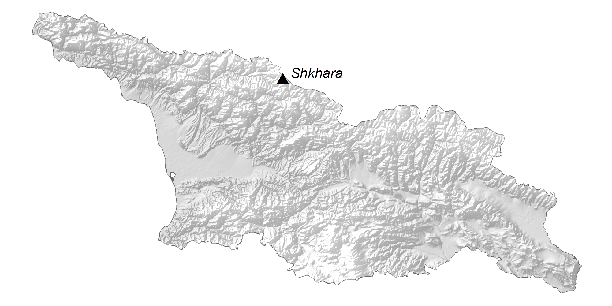
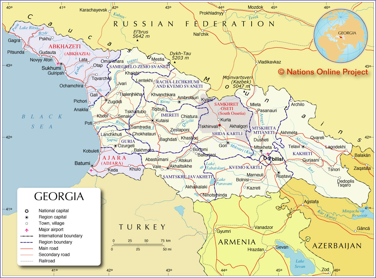
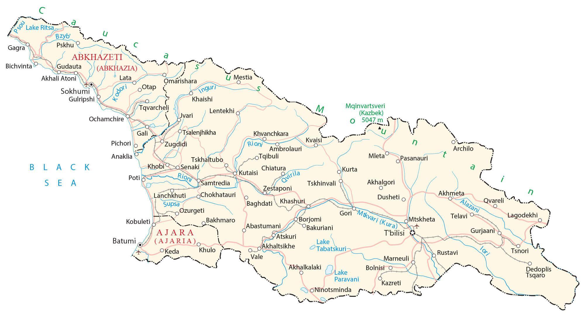
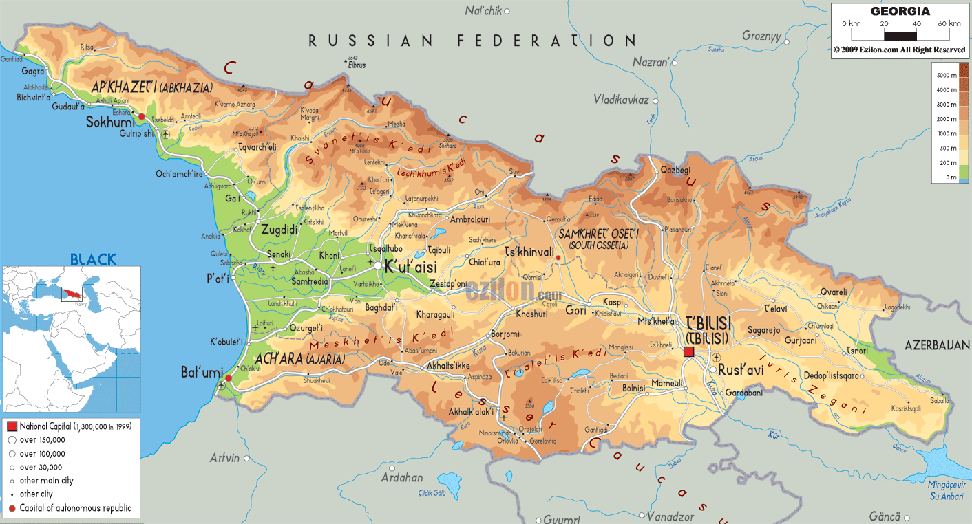
Located in Eurasia’s Caucasus region, Georgia occupies an area of 69,700 sq. km (26,900 sq mi). As observed on the physical map of Georgia above, it is a very mountainous country, with the rugged Caucasus Mountains stretching across the northern third, and the Lesser Caucasus Mountains dominating the central and southern landscape.The country’s highest point, (100% within its borders) is Mt. Kazbek, rising to 16,558 ft. (5,047 m).Mt. Shkhara, is a few meters higher, and its southern slopes front Georgia, but it’s mostly located in Russia, just to the southeast of Mt. Elbrus. It rises to 16,627 ft. (5,068m).Europe’s highest point, (Mt. Elbrus) is located just over Georgia’s northern border, and reaches 18,841 ft. (5,633m).All three peaks have been marked on the map.
The Kolkhida Lowlands front the Black Sea in the west, and numerous small rivers drain the area. Georgia has around 25,000 rivers that either drain into the Black Sea or the Caspian Sea (after cross Azerbaijan). The most significant rivers include the Kura and Rioni.
Georgia has a 310 km long coastline on the Black Sea to the west. The lowest point in Georgia is the Black Sea at 0 m.
| Flag: |  |
|---|---|
| Legal Name: | Georgia |
| Capital Value: | Tbilisi |
| Largest City: |
Tbilisi (1,077,833) |
| Official languages: | Georgian |
| Demonym(s): | Georgian |
| Government: | Unitary parliamentary republic |
| Legislature: | Parliament |
| Total Area: | 69,700 km² |
| Land Area: | 69,700 km² |
| Population: | 3,720,382 |
| Density: | 57.6/km (149.2/sq mi) (137th) |
| GDP: | $17.74 Billion |
| GDP Per Capita: | $4,769.19 |
| Currency Value: | Laris (GEL) |
| Driving side: | right |
| Calling code: | +995 |
| Internet TLD: | .ge, .გე |
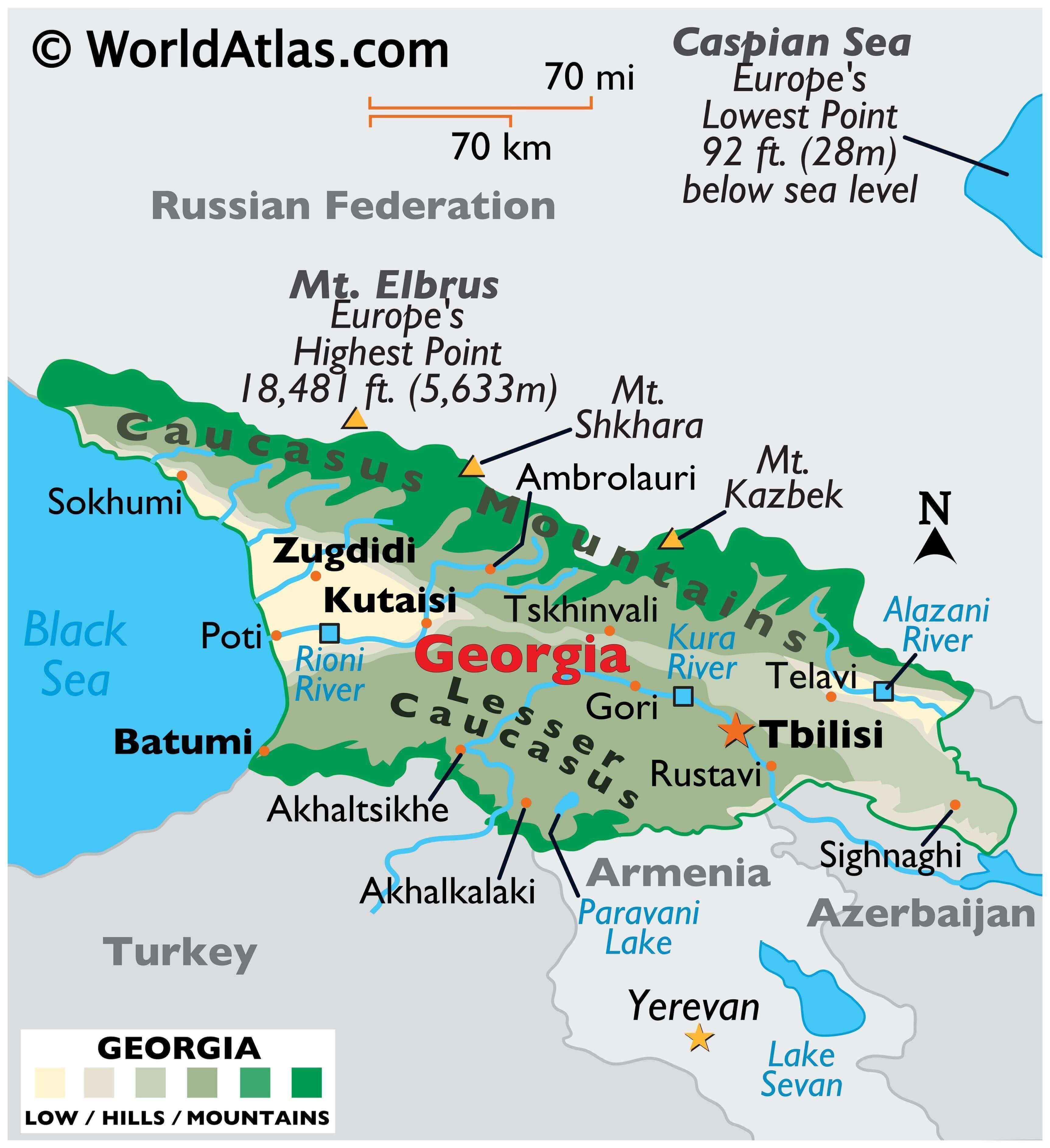
Georgia is a country with a rich history and diverse landscape. Its capital city, Tbilisi, is home to a variety of architecture, from the centuries-old Narikala Fortress to the modern glass-and-steel Bridge of Peace. The country is also known for its two major mountain ranges, the Lesser Caucasus and the Caucasus Mountains. To get a better understanding of Georgia’s geography, take a look at this map of the country.
This map of Georgia displays the country’s major cities, highways, rivers, and airports. The satellite and elevation map highlights its two major mountain ranges, the Lesser Caucasus and the Caucasus Mountains. Georgia’s highest peak, Mount Shkhara, is located in the Caucasus Mountains, at an elevation of 5,068 meters (16,627 feet). Other notable mountains in the Caucasus range include Mount Kazbek, at 5,047 meters (16,558 feet), and Mount Ailama, at 4,863 meters (15,945 feet). The Lesser Caucasus range is home to Mount Didi Abuli, at 2,908 meters (9,541 feet).
Explore Georgia and its unique landscape with this map of the country. Discover its major cities, highways, rivers, and airports, as well as its two major mountain ranges, the Lesser Caucasus and the Caucasus Mountains. From the centuries-old Narikala Fortress to the highest peak, Mount Shkhara, this map of Georgia will help you get a better understanding of the country.
Online Interactive Political Map
Click on ![]() to view map in "full screen" mode.
to view map in "full screen" mode.
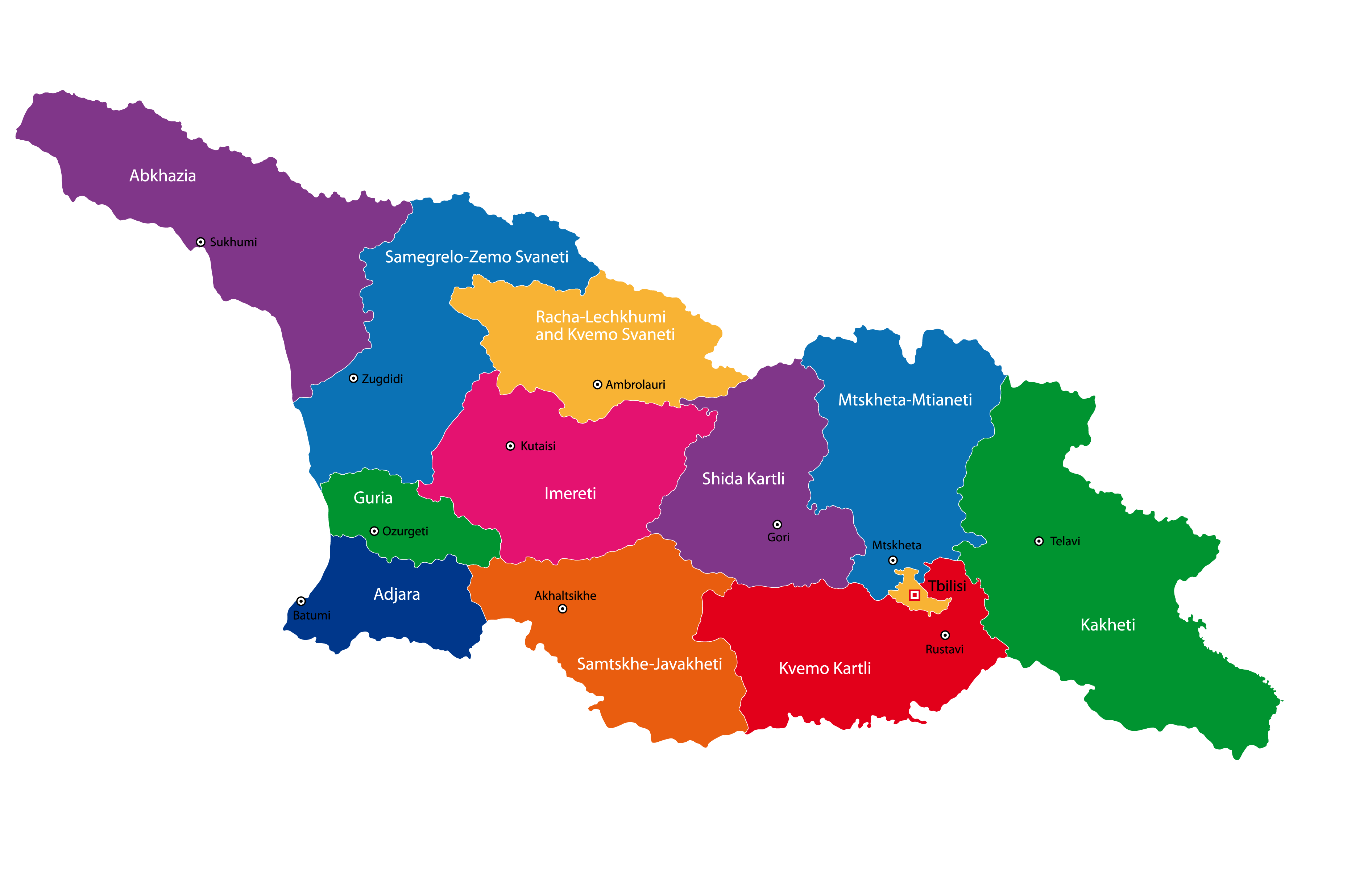
Georgia is divided into 9 regions (mkharebi, singular – mkhare), 1 city (kalaki) and 2 autonomous republics (avtomnoy respubliki, singular – avtom respublika). In alphabetical order, the regions are: Guria, Imereti, Kakheti, Kvemo Kartli, Mtskheta-Mtianeti, Racha-Lechkhumi and Kvemo Svaneti, Samegrelo-Zemo Svaneti, Samtskhe-Javakheti and Shida Kartli. Tbilisi is a city and Abkhazia or Ap’khazet’is Avtonomiuri Respublika (Sokhumi) and Adjara or Acharis Avtonomiuri Respublika (Bat’umi) are the two autonomous republics. Georgia is also subdivided into 76 municipalities – 12 self-governing cities (including the city of Tbilisi) and 64 communities.
Located along the banks of Kura River, Tbilisi is the capital and the largest city of Georgia. It is the chief cultural, educational, industrial and economic center of Georgia.
[note – the breakaway region of South Ossetia consists of the northern part of Shida Kartli, eastern slivers of the Imereti region and Racha-Lechkhumi and Kvemo Svaneti, and part of western Mtskheta-Mtianeti].
Location Maps
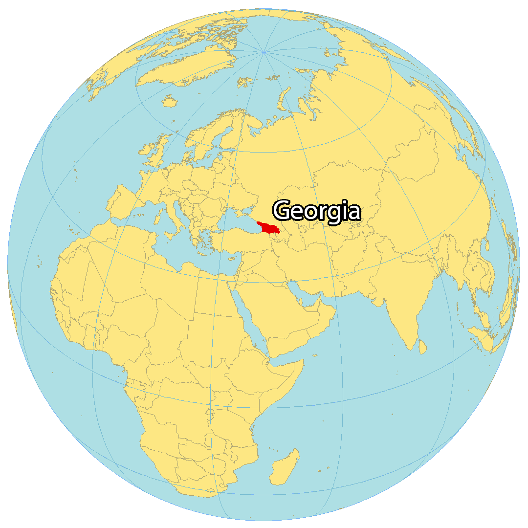
Where is Georgia?
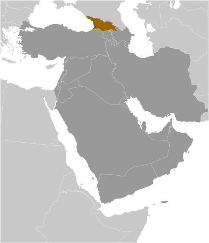
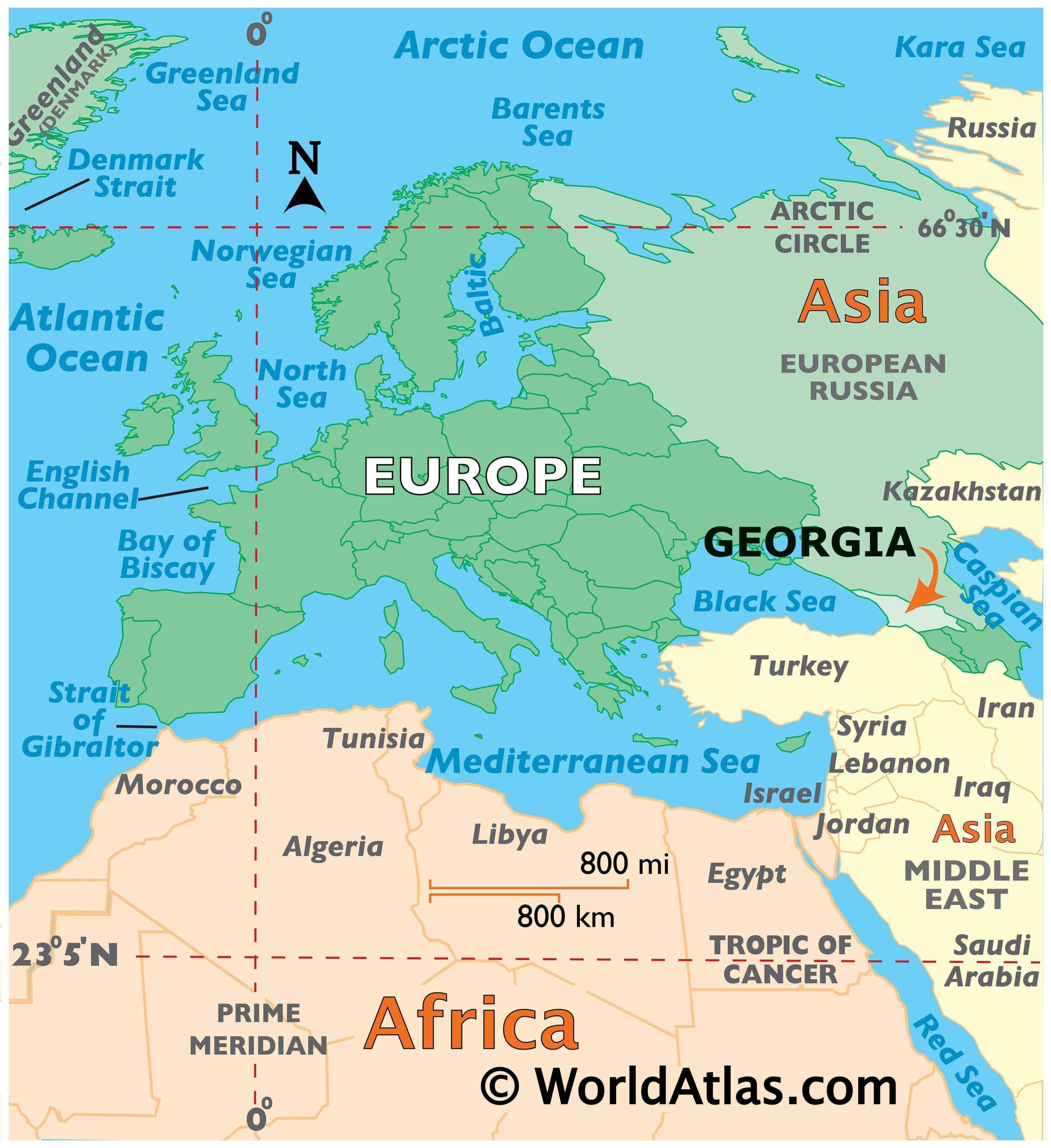
Georgia is located in the easternmost part of Europe at the intersection with Asia. It borders 4 other countries including Russia to the north, as well as Turkey, Armenia, and Azerbaijan to the south. But it has two disputed areas within the Abkhazia and South Ossetia regions with Russia.
The west side is characterized by its 310-kilometer coastline with the Black Sea. The population of Georgia is approximately 4 million with roughly one-quarter living in the capital city of Tbilisi.
High Definition Political Map of Georgia

Physical Map of Georgia
Georgia Satellite Map
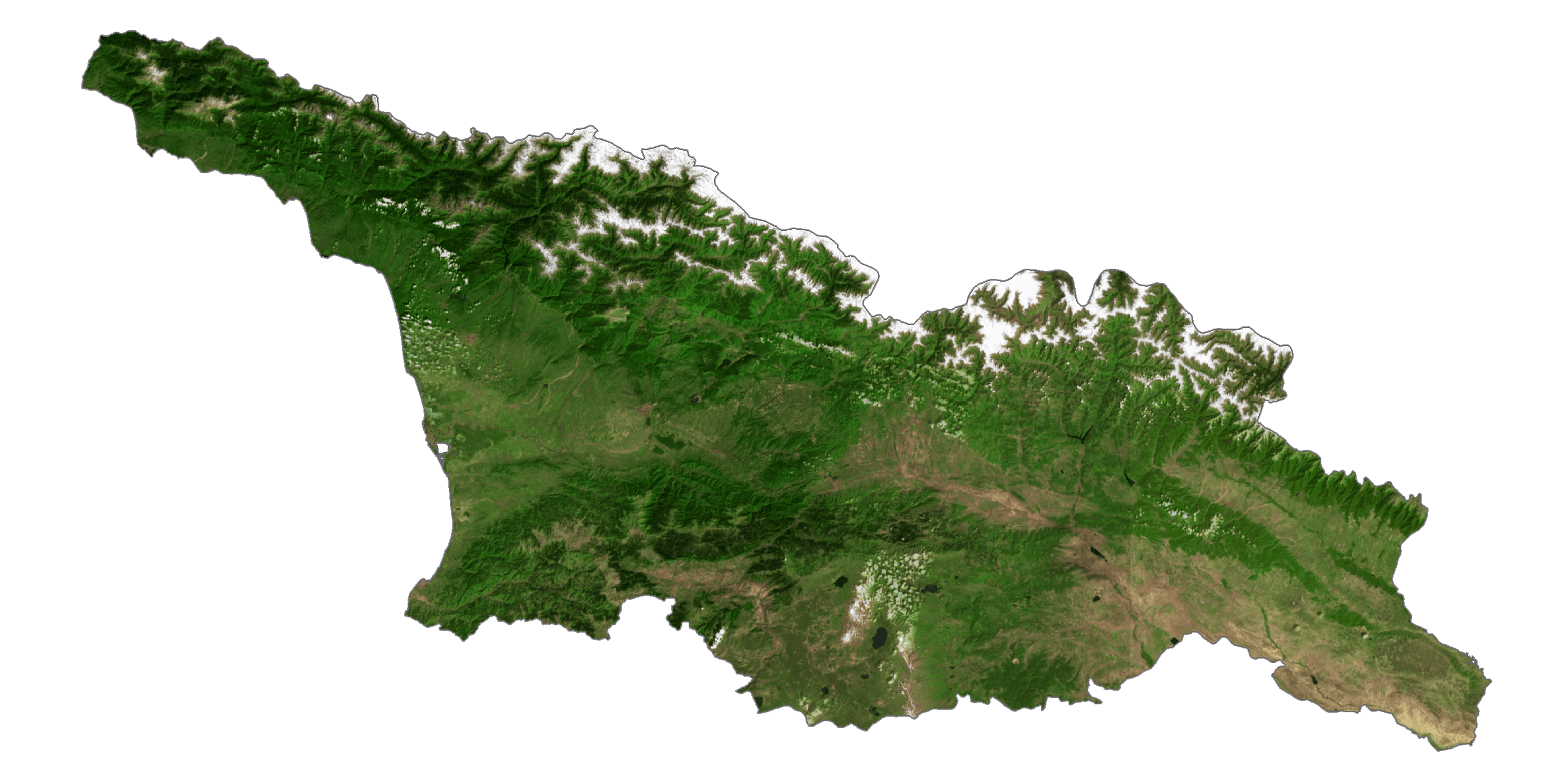
Elevation Map