Havana is a town in Gadsden County, Florida, United States, and a suburb of Tallahassee. The population was 1,754 at the 2010 census. It is part of the Tallahassee Metropolitan Statistical Area. The town was named after Havana, Cuba, located about 530 miles (850 km) to the south.
| Name: | Havana town |
|---|---|
| LSAD Code: | 43 |
| LSAD Description: | town (suffix) |
| State: | Florida |
| County: | Gadsden County |
| Elevation: | 236 ft (72 m) |
| Total Area: | 2.83 sq mi (7.32 km²) |
| Land Area: | 2.79 sq mi (7.22 km²) |
| Water Area: | 0.04 sq mi (0.10 km²) |
| Total Population: | 1,753 |
| Population Density: | 629.22/sq mi (242.92/km²) |
| ZIP code: | 32333 |
| Area code: | 850 |
| FIPS code: | 1229150 |
| GNISfeature ID: | 0283812 |
| Website: | www.townofhavana.com |
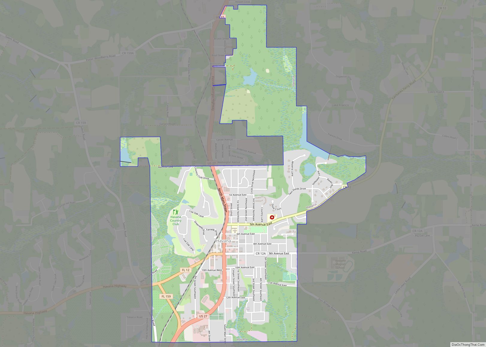
Online Interactive Map
Click on ![]() to view map in "full screen" mode.
to view map in "full screen" mode.
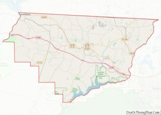
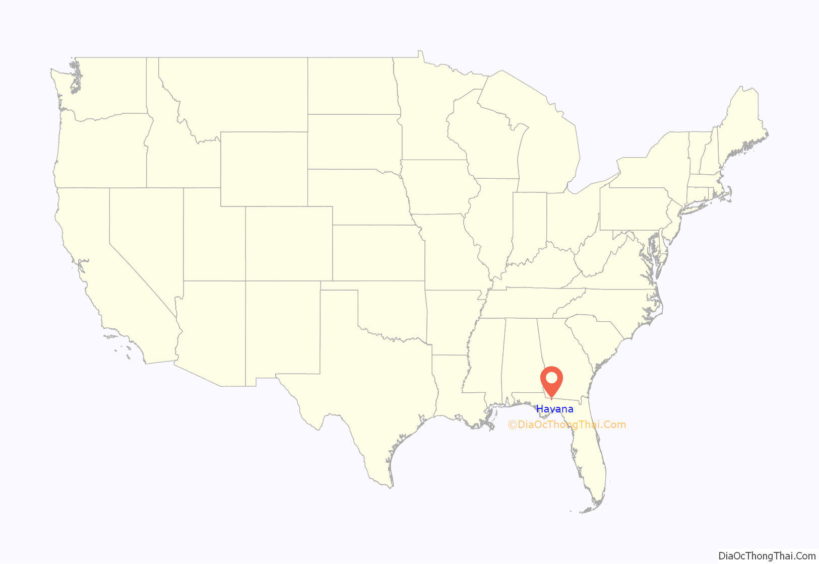
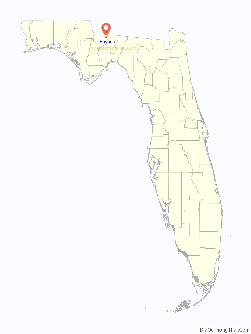
Havana location map. Where is Havana town?
History
Havana is of Indian origin and honours the name of Cuba’s capital.
In 1902, following the completion of the of Georgia, Florida and Alabama Railroad, settlers moved a mile east to the present site of Havana, Florida. The railway town was important to the export of farming and tobacco. On December 5, 1906, Havana was incorporated into a town. The name “Havana” was proposed by James Mathewson, a schoolteacher. Shade tobacco was an important crop at that time.
On March 16, 1916, Havana was destroyed by a fire and 26 business-owned buildings were burned leaving only two remaining stores.
In recent times, much of the tobacco crop industry has declined and is known for its antiques, art galleries and specialty stores.
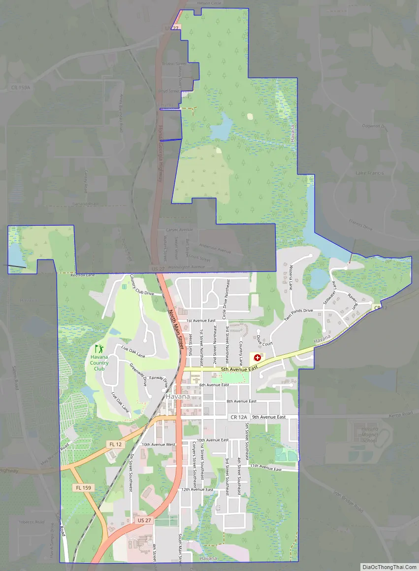
Havana Road Map
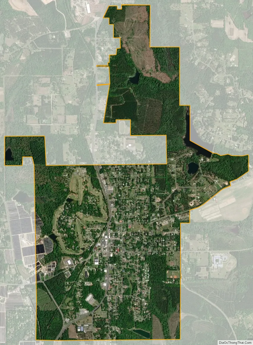
Havana city Satellite Map
Geography
Havana is located in northeastern Gadsden County at 30°37′27″N 84°24′54″W / 30.62417°N 84.41500°W / 30.62417; -84.41500 (30.624245, –84.414955). U.S. Route 27 passes through the center of town, leading southeast 16 miles (26 km) to the center of Tallahassee and north 25 miles (40 km) to Bainbridge, Georgia. Florida State Road 12 intersects US 27 in Havana; it leads west 12 miles (19 km) to Quincy, the Gadsden County seat.
According to the United States Census Bureau, Havana has a total area of 2.8 square miles (7.2 km), of which 0.02 square miles (0.04 km), or 0.57%, is water.
See also
Map of Florida State and its subdivision:- Alachua
- Baker
- Bay
- Bradford
- Brevard
- Broward
- Calhoun
- Charlotte
- Citrus
- Clay
- Collier
- Columbia
- Desoto
- Dixie
- Duval
- Escambia
- Flagler
- Franklin
- Gadsden
- Gilchrist
- Glades
- Gulf
- Hamilton
- Hardee
- Hendry
- Hernando
- Highlands
- Hillsborough
- Holmes
- Indian River
- Jackson
- Jefferson
- Lafayette
- Lake
- Lee
- Leon
- Levy
- Liberty
- Madison
- Manatee
- Marion
- Martin
- Miami-Dade
- Monroe
- Nassau
- Okaloosa
- Okeechobee
- Orange
- Osceola
- Palm Beach
- Pasco
- Pinellas
- Polk
- Putnam
- Saint Johns
- Saint Lucie
- Santa Rosa
- Sarasota
- Seminole
- Sumter
- Suwannee
- Taylor
- Union
- Volusia
- Wakulla
- Walton
- Washington
- Alabama
- Alaska
- Arizona
- Arkansas
- California
- Colorado
- Connecticut
- Delaware
- District of Columbia
- Florida
- Georgia
- Hawaii
- Idaho
- Illinois
- Indiana
- Iowa
- Kansas
- Kentucky
- Louisiana
- Maine
- Maryland
- Massachusetts
- Michigan
- Minnesota
- Mississippi
- Missouri
- Montana
- Nebraska
- Nevada
- New Hampshire
- New Jersey
- New Mexico
- New York
- North Carolina
- North Dakota
- Ohio
- Oklahoma
- Oregon
- Pennsylvania
- Rhode Island
- South Carolina
- South Dakota
- Tennessee
- Texas
- Utah
- Vermont
- Virginia
- Washington
- West Virginia
- Wisconsin
- Wyoming