Bainbridge is a city in Decatur County, Georgia, United States. The city is the county seat of Decatur County. As of the 2020 census, the city had a population of 14,468.
| Name: | Bainbridge city |
|---|---|
| LSAD Code: | 25 |
| LSAD Description: | city (suffix) |
| State: | Georgia |
| County: | Decatur County |
| Elevation: | 121 ft (37 m) |
| Land Area: | 19.78 sq mi (51.22 km²) |
| Water Area: | 1.23 sq mi (3.18 km²) |
| Population Density: | 731.59/sq mi (282.47/km²) |
| ZIP code: | 39817, 39819 |
| Area code: | 229 |
| FIPS code: | 1304896 |
| GNISfeature ID: | 0354431 |
| Website: | bainbridgecity.com |
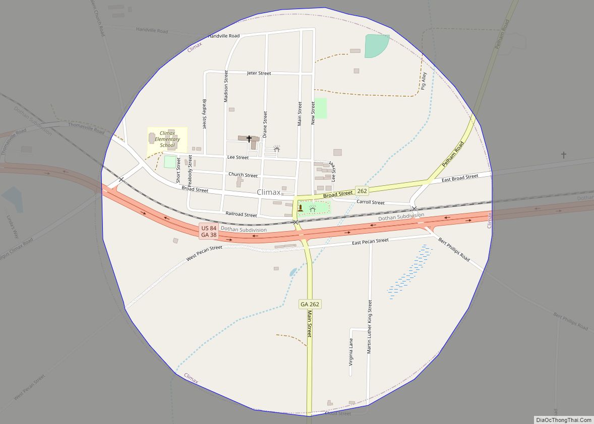
Online Interactive Map
Click on ![]() to view map in "full screen" mode.
to view map in "full screen" mode.
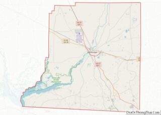
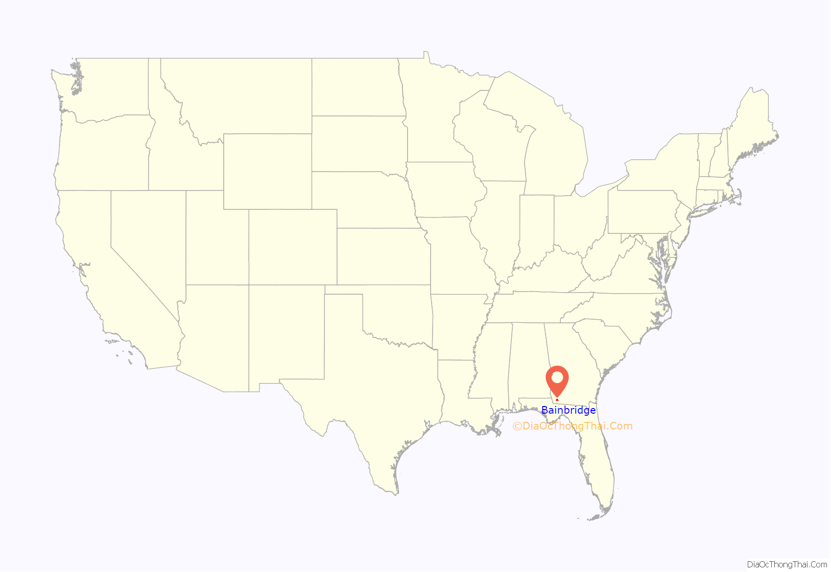
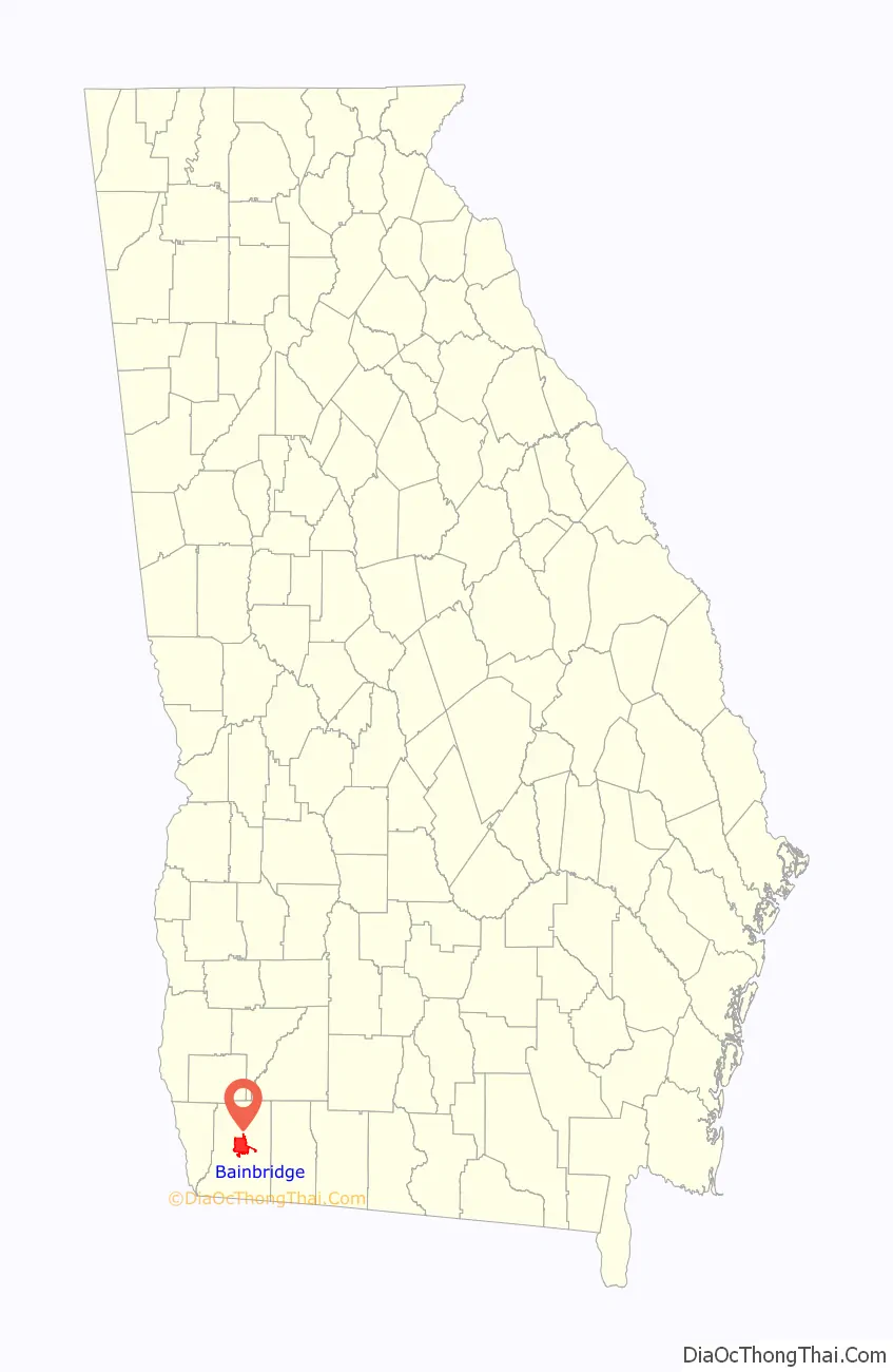
Bainbridge location map. Where is Bainbridge city?
History
The first European settlement in what is today Bainbridge was a trading post set up by James Burges in the late 18th century. From him comes the name Burges’s Bluff. The town was named after U.S. Navy Commodore William Bainbridge, commander of the USS Constitution (“Old Ironsides”), and was incorporated on December 22, 1829.
In 1824, Bainbridge was designated seat of the newly formed Decatur County.
On October 10, 2018, Bainbridge fell victim to Hurricane Michael. The storm left widespread damage through the city limits, including downed trees, power lines, and structural damage. Many residents affected suffered severe damage to their homes.
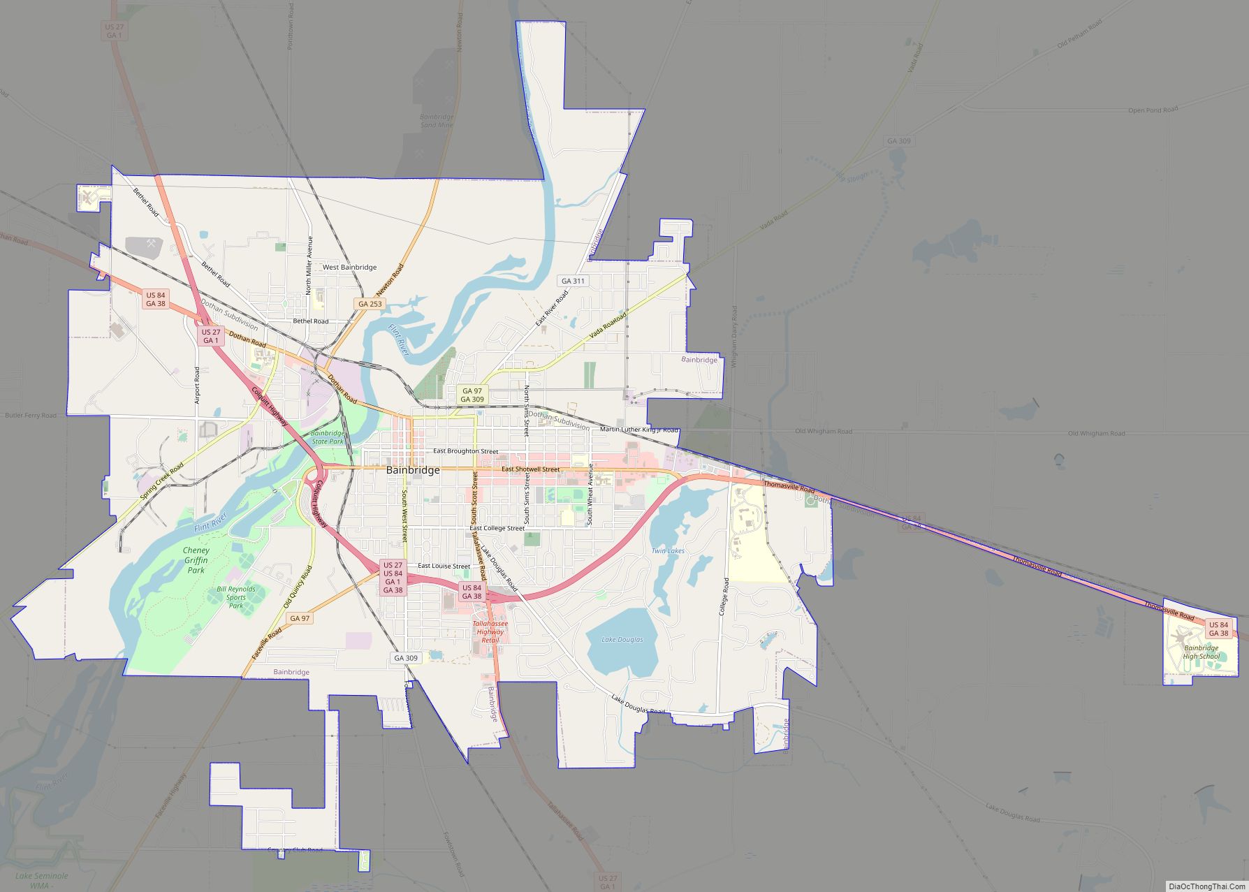
Bainbridge Road Map
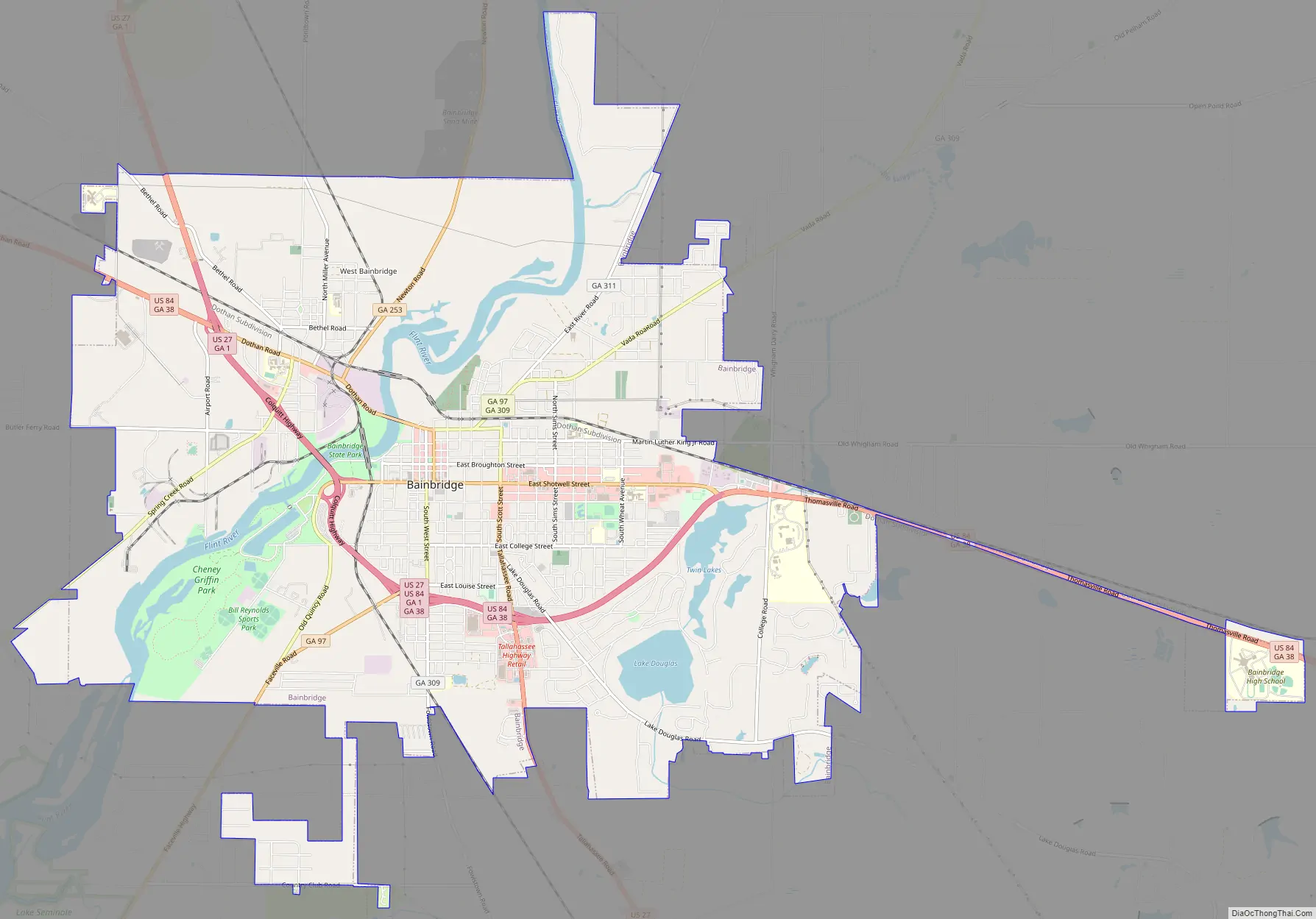
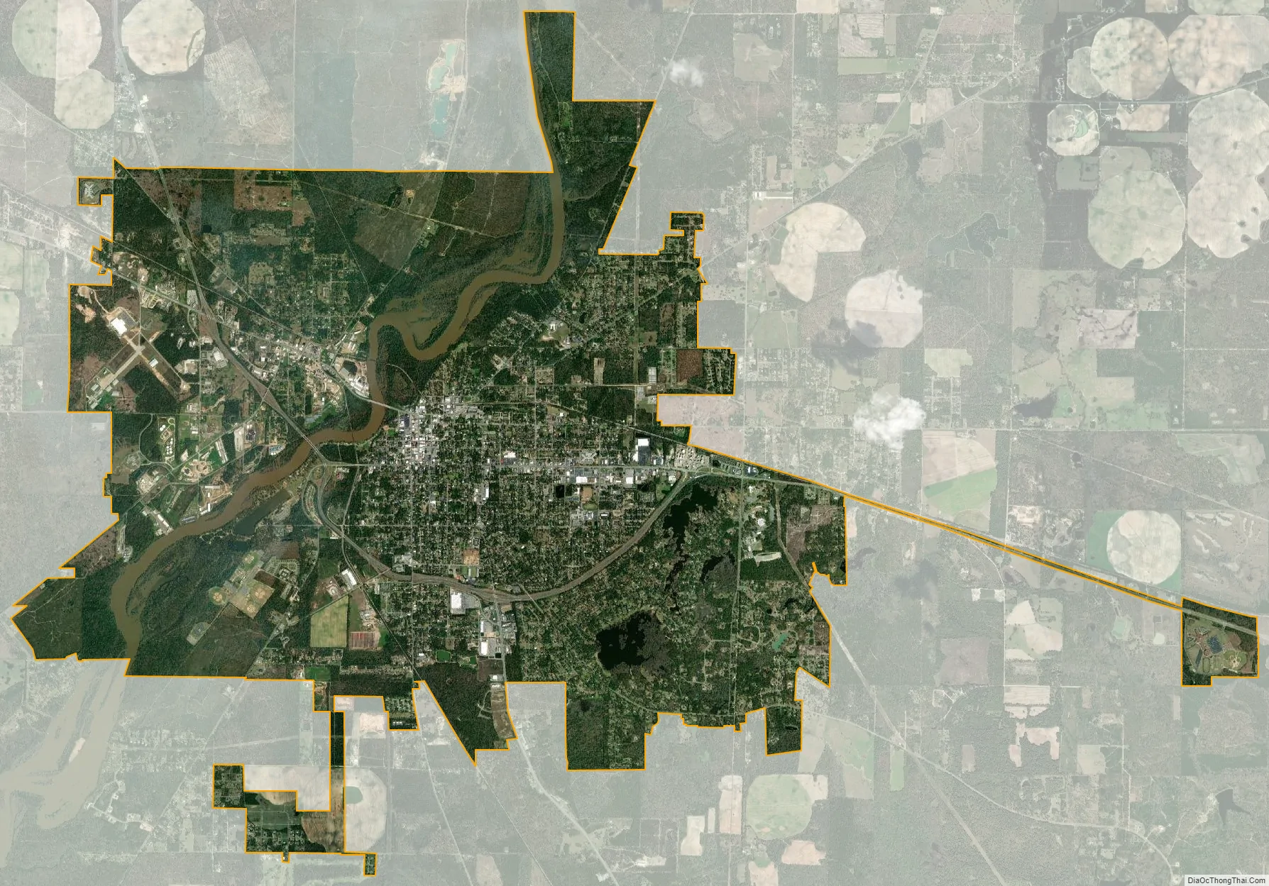
Bainbridge city Satellite Map
Geography
Bainbridge is located in the center of Decatur County. The city is in southwestern Georgia along U.S. Routes 27 and 84, which form a bypass around the southern part of the city. U.S. Route 27 leads southeast 42 miles (68 km) to Tallahassee, Florida, and north 128 miles (206 km) to Columbus. U.S. Route 84 leads east 38 miles (61 km) to Thomasville and northwest 54 miles (87 km) to Dothan, Alabama. Other highways which run through the city include Georgia State Routes 97, 253, 309, and 311.
According to the United States Census Bureau, the city has a total area of 20.1 square miles (52.0 km), of which 18.8 square miles (48.7 km) is land and 1.3 square miles (3.3 km), or 6.40%, is water.
Bainbridge is located on the Flint River, which flows southwest to meet the Chattahoochee. Together they form the Apalachicola River which flows to the Gulf of Mexico. At the junction of the two rivers, the Jim Woodruff Dam forms Lake Seminole. A system of locks at the dam allows barge traffic to travel between the inland port at Bainbridge and the Gulf of Mexico.
See also
Map of Georgia State and its subdivision:- Appling
- Atkinson
- Bacon
- Baker
- Baldwin
- Banks
- Barrow
- Bartow
- Ben Hill
- Berrien
- Bibb
- Bleckley
- Brantley
- Brooks
- Bryan
- Bulloch
- Burke
- Butts
- Calhoun
- Camden
- Candler
- Carroll
- Catoosa
- Charlton
- Chatham
- Chattahoochee
- Chattooga
- Cherokee
- Clarke
- Clay
- Clayton
- Clinch
- Cobb
- Coffee
- Colquitt
- Columbia
- Cook
- Coweta
- Crawford
- Crisp
- Dade
- Dawson
- Decatur
- DeKalb
- Dodge
- Dooly
- Dougherty
- Douglas
- Early
- Echols
- Effingham
- Elbert
- Emanuel
- Evans
- Fannin
- Fayette
- Floyd
- Forsyth
- Franklin
- Fulton
- Gilmer
- Glascock
- Glynn
- Gordon
- Grady
- Greene
- Gwinnett
- Habersham
- Hall
- Hancock
- Haralson
- Harris
- Hart
- Heard
- Henry
- Houston
- Irwin
- Jackson
- Jasper
- Jeff Davis
- Jefferson
- Jenkins
- Johnson
- Jones
- Lamar
- Lanier
- Laurens
- Lee
- Liberty
- Lincoln
- Long
- Lowndes
- Lumpkin
- Macon
- Madison
- Marion
- McDuffie
- McIntosh
- Meriwether
- Miller
- Mitchell
- Monroe
- Montgomery
- Morgan
- Murray
- Muscogee
- Newton
- Oconee
- Oglethorpe
- Paulding
- Peach
- Pickens
- Pierce
- Pike
- Polk
- Pulaski
- Putnam
- Quitman
- Rabun
- Randolph
- Richmond
- Rockdale
- Schley
- Screven
- Seminole
- Spalding
- Stephens
- Stewart
- Sumter
- Talbot
- Taliaferro
- Tattnall
- Taylor
- Telfair
- Terrell
- Thomas
- Tift
- Toombs
- Towns
- Treutlen
- Troup
- Turner
- Twiggs
- Union
- Upson
- Walker
- Walton
- Ware
- Warren
- Washington
- Wayne
- Webster
- Wheeler
- White
- Whitfield
- Wilcox
- Wilkes
- Wilkinson
- Worth
- Alabama
- Alaska
- Arizona
- Arkansas
- California
- Colorado
- Connecticut
- Delaware
- District of Columbia
- Florida
- Georgia
- Hawaii
- Idaho
- Illinois
- Indiana
- Iowa
- Kansas
- Kentucky
- Louisiana
- Maine
- Maryland
- Massachusetts
- Michigan
- Minnesota
- Mississippi
- Missouri
- Montana
- Nebraska
- Nevada
- New Hampshire
- New Jersey
- New Mexico
- New York
- North Carolina
- North Dakota
- Ohio
- Oklahoma
- Oregon
- Pennsylvania
- Rhode Island
- South Carolina
- South Dakota
- Tennessee
- Texas
- Utah
- Vermont
- Virginia
- Washington
- West Virginia
- Wisconsin
- Wyoming