Homeland is an unincorporated community in Polk County, Florida, United States. It has a post office, a general store, and historical park. It is part of the Lakeland–Winter Haven Metropolitan Statistical Area.
| Name: | Homeland CDP |
|---|---|
| LSAD Code: | 57 |
| LSAD Description: | CDP (suffix) |
| State: | Florida |
| County: | Polk County |
| Elevation: | 140 ft (40 m) |
| Total Area: | 0.42 sq mi (1.10 km²) |
| Land Area: | 0.42 sq mi (1.10 km²) |
| Water Area: | 0.00 sq mi (0.00 km²) |
| Total Population: | 305 |
| Population Density: | 717.65/sq mi (277.37/km²) |
| ZIP code: | 33847 |
| Area code: | 863 |
| FIPS code: | 1232250 |
Online Interactive Map
Click on ![]() to view map in "full screen" mode.
to view map in "full screen" mode.
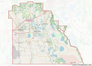
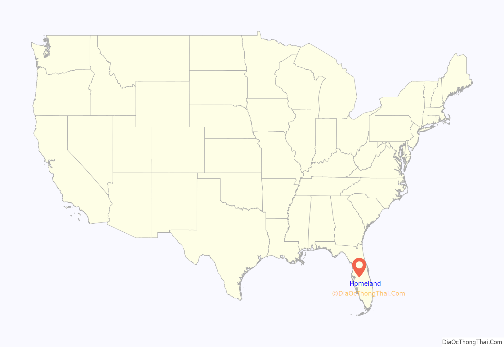
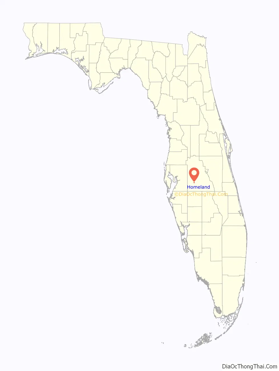
Homeland location map. Where is Homeland CDP?
History
Peace Creek (now Bartow, Florida) and Fort Meade were the two largest cities in Polk County. Homeland was a stop midway between them, and gradually began to attract settlers. The original settlement was called Bethel, but the name was changed to Homeland. A school and several churches were built in the area. The school was closed down in 1956 as Homeland became eclipsed by its neighbor to the north, Bartow. The school building is now part of Homeland Heritage Park, an educational park for elementary Polk County school children.
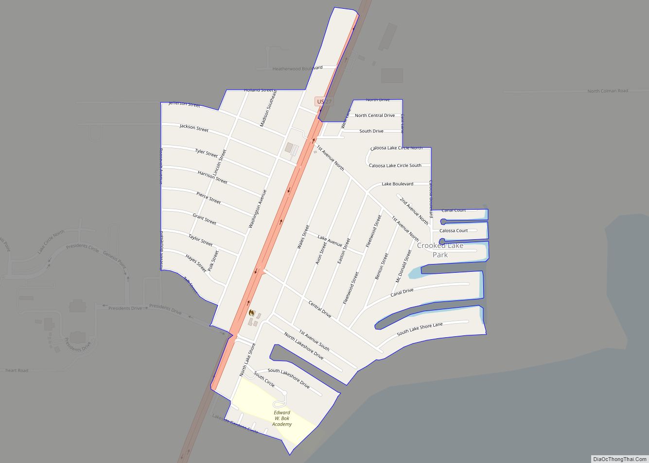
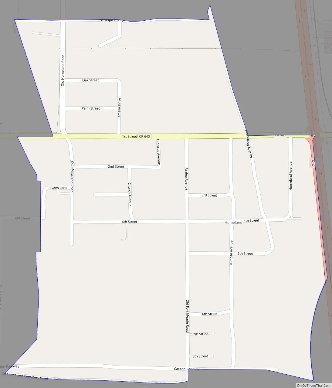
Homeland Road Map
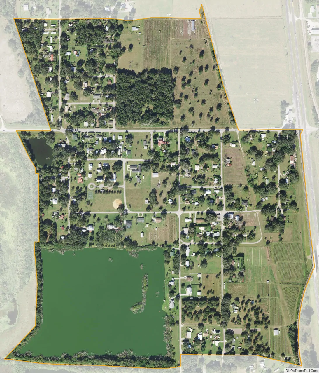
Homeland city Satellite Map
Geography
Homeland is located approximately six miles south of the center of Bartow.
See also
Map of Florida State and its subdivision:- Alachua
- Baker
- Bay
- Bradford
- Brevard
- Broward
- Calhoun
- Charlotte
- Citrus
- Clay
- Collier
- Columbia
- Desoto
- Dixie
- Duval
- Escambia
- Flagler
- Franklin
- Gadsden
- Gilchrist
- Glades
- Gulf
- Hamilton
- Hardee
- Hendry
- Hernando
- Highlands
- Hillsborough
- Holmes
- Indian River
- Jackson
- Jefferson
- Lafayette
- Lake
- Lee
- Leon
- Levy
- Liberty
- Madison
- Manatee
- Marion
- Martin
- Miami-Dade
- Monroe
- Nassau
- Okaloosa
- Okeechobee
- Orange
- Osceola
- Palm Beach
- Pasco
- Pinellas
- Polk
- Putnam
- Saint Johns
- Saint Lucie
- Santa Rosa
- Sarasota
- Seminole
- Sumter
- Suwannee
- Taylor
- Union
- Volusia
- Wakulla
- Walton
- Washington
- Alabama
- Alaska
- Arizona
- Arkansas
- California
- Colorado
- Connecticut
- Delaware
- District of Columbia
- Florida
- Georgia
- Hawaii
- Idaho
- Illinois
- Indiana
- Iowa
- Kansas
- Kentucky
- Louisiana
- Maine
- Maryland
- Massachusetts
- Michigan
- Minnesota
- Mississippi
- Missouri
- Montana
- Nebraska
- Nevada
- New Hampshire
- New Jersey
- New Mexico
- New York
- North Carolina
- North Dakota
- Ohio
- Oklahoma
- Oregon
- Pennsylvania
- Rhode Island
- South Carolina
- South Dakota
- Tennessee
- Texas
- Utah
- Vermont
- Virginia
- Washington
- West Virginia
- Wisconsin
- Wyoming