Fort Meade is a city in Polk County, Florida, United States. As of 2018, the population recorded by the U.S. Census Bureau is 6,203. It is part of the Lakeland–Winter Haven Metropolitan Statistical Area. The city was named for George Meade, at the time an Army lieutenant serving in Florida following the Second Seminole War. Fort Meade is home to Fort Meade Middle-Senior High School, several historic buildings, and Streamsong resort. The area is popular with kayakers and canoers.
| Name: | Fort Meade city |
|---|---|
| LSAD Code: | 25 |
| LSAD Description: | city (suffix) |
| State: | Florida |
| County: | Polk County |
| Elevation: | 144 ft (44 m) |
| Land Area: | 8.18 sq mi (21.20 km²) |
| Water Area: | 0.37 sq mi (0.95 km²) |
| Population Density: | 623.17/sq mi (240.62/km²) |
| ZIP code: | 33841 |
| Area code: | 863 |
| FIPS code: | 1224100 |
| GNISfeature ID: | 2403641 |
| Website: | www.cityoffortmeade.com |
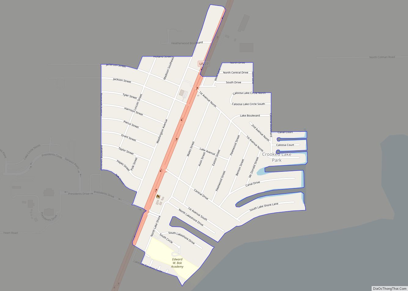
Online Interactive Map
Click on ![]() to view map in "full screen" mode.
to view map in "full screen" mode.
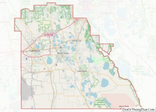
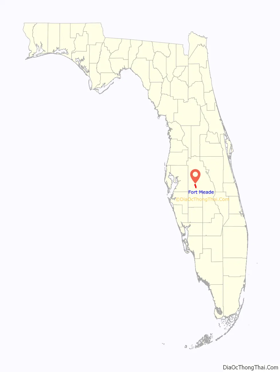
Fort Meade location map. Where is Fort Meade city?

History
Fort Meade is the oldest city in Polk County, dating its origins to 1849 when it was established along a new military road from Tampa (Fort Brooke) to Fort Pierce following the Second Seminole War. The town and road were originally sited by then-lieutenant George Meade of the Corps of Topographical Engineers, whose commander named it for him. Around the start of the American Civil War a mounted volunteer company nicknamed the “Hickory Boys” was formed at the fort. The 1880s business district was located on old Wire Street (now Broadway), which was a casualty of four devastating fires. Today, there are over 150 buildings which are designated as landmarks. In the 1890s the Fort Meade Street Railway operated a horse-drawn service in the town.
The earliest known burial is John I. Hooker (1821–1862) located in the town’s Evergreen Cemetery. Fort Meade’s Christ Church (Episcopal) located at 526 North Oak, was built in 1889. It is a frame vernacular with Gothic Revival elements and was designed by architect J. H. Weddell. Located within the historic district, the church was used for the HBO motion picture Judgment, featuring Blythe Danner, Keith Carradine and Jack Warden (1990).
Future Confederate General Stonewall Jackson was stationed at the fort in 1851. The town was burned by Union forces in 1864 and all of the original structures were destroyed, except the second fort which was dismantled in the 1890s. Fort Meade has over 300 homes on the National Register of Historic Places and a handful that date to the late 1800s.
Historic homes and buildings
- Old Fort Meade School House Museum, c. 1885
- Rev. Wm James Reid House, c. 1900
- W.O. Williams/R.C. McClellan House, c. 1898
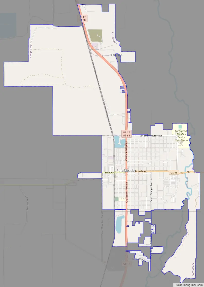
Fort Meade Road Map
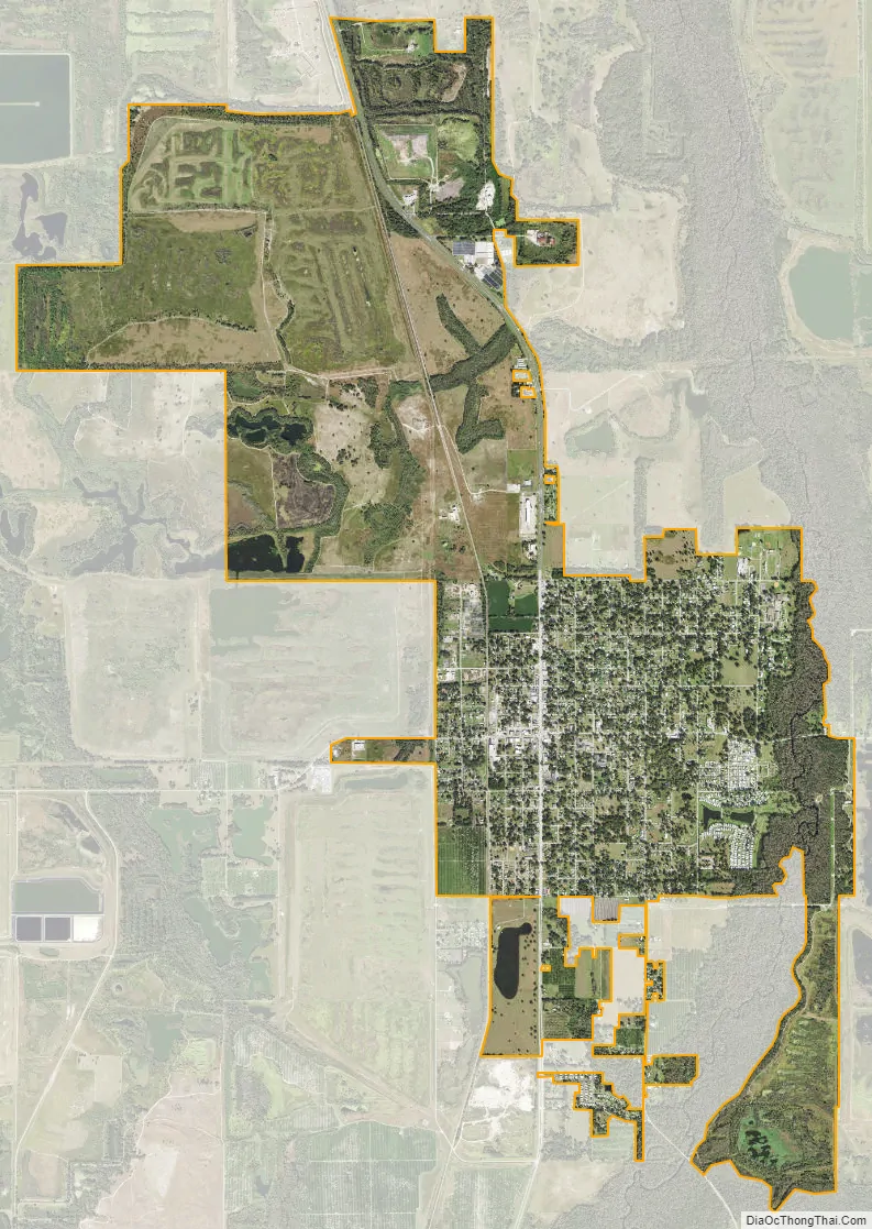
Fort Meade city Satellite Map
Geography
Fort Meade is located 20 miles southwest of Legoland in Winter Haven. Fort Meade is located within the Central Florida Highlands area of the Atlantic coastal plain, with a terrain consisting of flatland interspersed with gently rolling hills.
According to the United States Census Bureau, the city has a total area of 13.0 km (5.0 mi), of which 12.9 km (5.0 mi) is land and 0.1 km (0.1 mi) (1.00%) is water.
Fort Meade is located in the humid subtropical zone, as designated by (Köppen climate classification: Cfa).
See also
Map of Florida State and its subdivision:- Alachua
- Baker
- Bay
- Bradford
- Brevard
- Broward
- Calhoun
- Charlotte
- Citrus
- Clay
- Collier
- Columbia
- Desoto
- Dixie
- Duval
- Escambia
- Flagler
- Franklin
- Gadsden
- Gilchrist
- Glades
- Gulf
- Hamilton
- Hardee
- Hendry
- Hernando
- Highlands
- Hillsborough
- Holmes
- Indian River
- Jackson
- Jefferson
- Lafayette
- Lake
- Lee
- Leon
- Levy
- Liberty
- Madison
- Manatee
- Marion
- Martin
- Miami-Dade
- Monroe
- Nassau
- Okaloosa
- Okeechobee
- Orange
- Osceola
- Palm Beach
- Pasco
- Pinellas
- Polk
- Putnam
- Saint Johns
- Saint Lucie
- Santa Rosa
- Sarasota
- Seminole
- Sumter
- Suwannee
- Taylor
- Union
- Volusia
- Wakulla
- Walton
- Washington
- Alabama
- Alaska
- Arizona
- Arkansas
- California
- Colorado
- Connecticut
- Delaware
- District of Columbia
- Florida
- Georgia
- Hawaii
- Idaho
- Illinois
- Indiana
- Iowa
- Kansas
- Kentucky
- Louisiana
- Maine
- Maryland
- Massachusetts
- Michigan
- Minnesota
- Mississippi
- Missouri
- Montana
- Nebraska
- Nevada
- New Hampshire
- New Jersey
- New Mexico
- New York
- North Carolina
- North Dakota
- Ohio
- Oklahoma
- Oregon
- Pennsylvania
- Rhode Island
- South Carolina
- South Dakota
- Tennessee
- Texas
- Utah
- Vermont
- Virginia
- Washington
- West Virginia
- Wisconsin
- Wyoming