Lehigh Acres is an unincorporated area and Municipal District in Lee County, Florida, United States. As of the 2020 Census the population was 135,272. Lehigh Acres is part of the Cape Coral-Fort Myers, Florida Metropolitan Statistical Area. Lehigh Acres is also one of the fastest growing communities in the State of Florida as well as the United States.
A large portion of the community is served by the Lehigh Acres Municipal Services Improvement District, a special-purpose district created by the Florida Legislature which covers areas in Lee and neighboring Hendry County.
| Name: | Lehigh Acres CDP |
|---|---|
| LSAD Code: | 57 |
| LSAD Description: | CDP (suffix) |
| State: | Florida |
| County: | Lee County |
| Elevation: | 20 ft (6 m) |
| Total Area: | 94.21 sq mi (244.00 km²) |
| Land Area: | 92.69 sq mi (240.08 km²) |
| Water Area: | 1.51 sq mi (3.92 km²) 1.14% |
| Total Population: | 135,272 |
| Population Density: | 1,232.95/sq mi (476.04/km²) |
| ZIP code: | 33900-33999 |
| Area code: | 239 |
| FIPS code: | 1239925 |
| GNISfeature ID: | 0285447 |
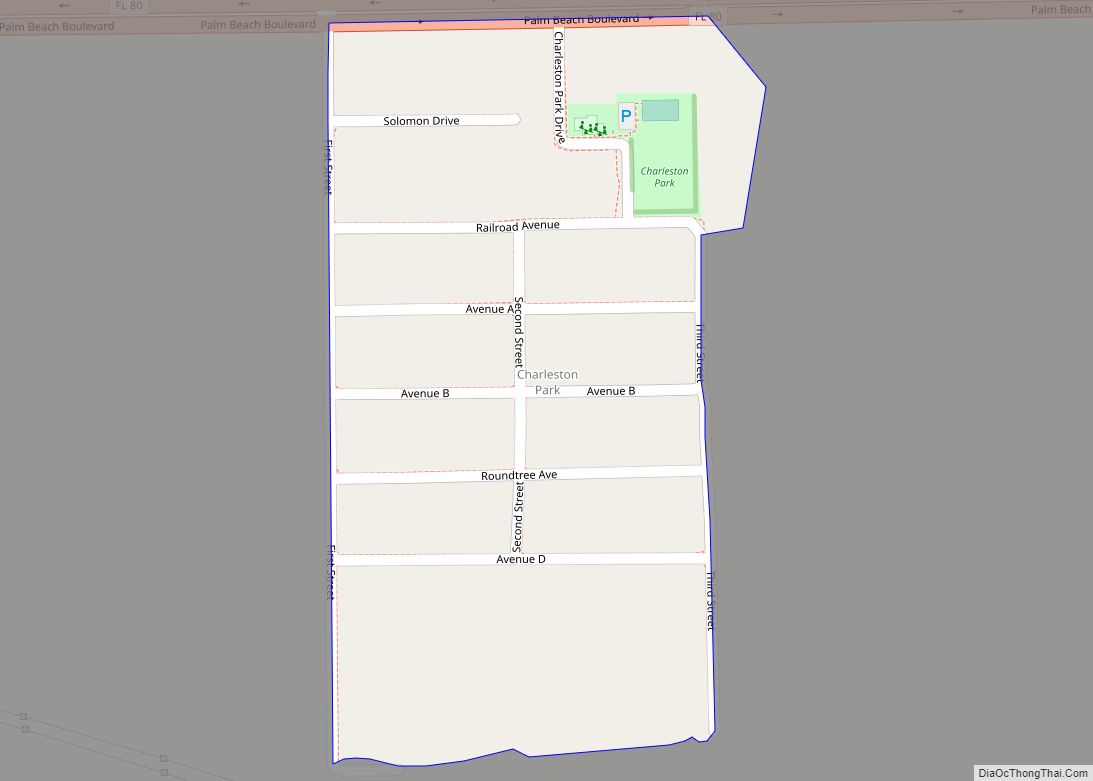
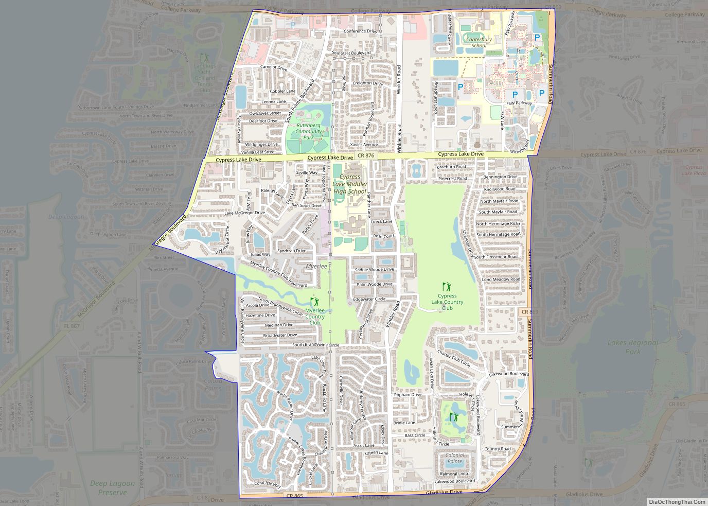
Online Interactive Map
Click on ![]() to view map in "full screen" mode.
to view map in "full screen" mode.
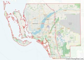
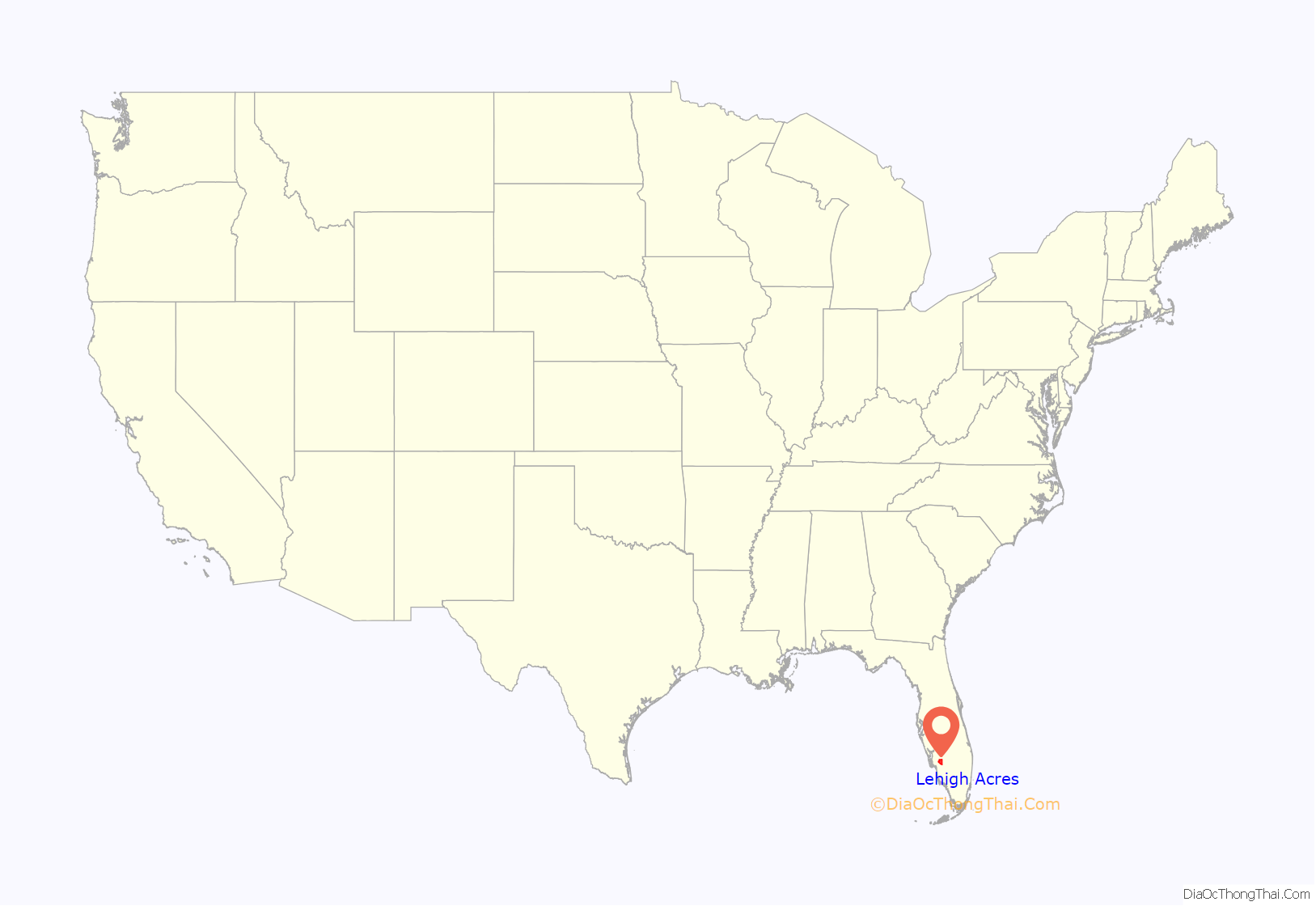
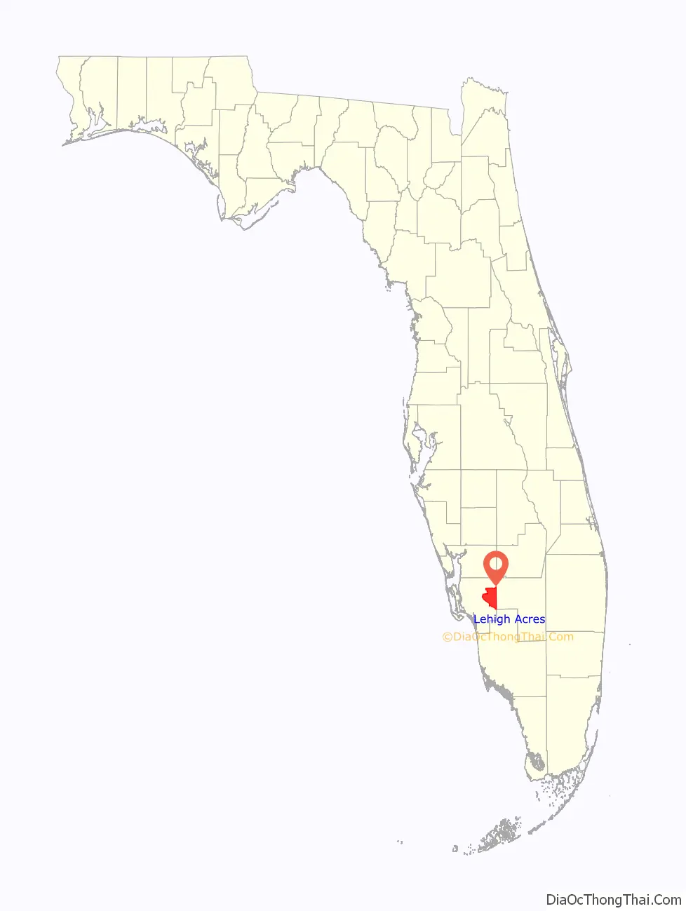
Lehigh Acres location map. Where is Lehigh Acres CDP?
History
Lehigh Acres was developed in the mid-1950s by Chicago businessman Lee Ratner. Seeking a tax shelter, Ratner had sold his pest control business and faced the possibility of losing most of his earnings to the high capital gains tax of that era. Ratner heard that cattle was a good investment for people in his predicament, and he bought 18,000 acres (73 km) of land in eastern Lee County and named it the Lucky Lee Ranch. After ranching for a while, and despite having no prior development experience, Ratner joined with Gerald H. Gould, a Florida advertising executive, Manuel Riskin, a Chicago CPA, and Edward Shapiro, a former Chicagoan who was in the real estate business in California, and began land sales at Lehigh Acres.
Gerald Gould was the president of the corporation that developed Lehigh Acres, which began in 1954. He remained as president until the company was sold in 1972.
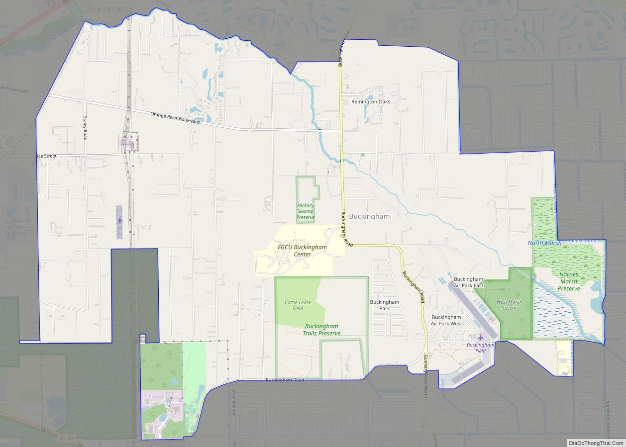
Since the days of the Lucky Lee Ranch, the boundaries of Lehigh Acres have stretched to cover 61,000 acres (250 km), including the runways of the former Buckingham Army Airfield, a major Army Air Forces training base that was closed at the end of World War II. The pasture land where Ratner’s cattle roamed and the since broken up runways where military flight crews trained has been divided into some 152,000 0.25-acre (1,000 m) and 0.5-acre (2,000 m) lots for housing, along over 1,400 miles (2,300 km) of roads. Strips of land along major thoroughfares, such as Homestead Road and Lee Boulevard, were set aside for commerce. In 1997, nearly 90% of Lehigh Acres’ lots remained vacant.
In 1992, Lee County, with the cooperation of a new developer, declared Lehigh Acres to be blighted, and authorized its Community Redevelopment Agency to take steps towards improving infrastructure and planning elements neglected by the original developer. It is estimated that nearly $11 million would be needed to repave the development’s roads.
A surge in housing prices led to a boom in Lehigh Acres new-housing construction from 2003 to 2007, peaking at more than 7,500 new homes constructed in 2006. The number of homes built during this period exceeded the total number of homes constructed during the preceding 50 years.
But as in much of the United States, the real-estate boom of the 2000s went bust. The median house price in the Fort Myers area peaked in late 2005 at $322,300. Three years later, it had plummeted to $106,900. A reliance on construction jobs no longer available pushed the unemployment rate in the area of Lehigh Acres and Fort Myers to 14% by the summer of 2009. Property values reached a low in 2008 of $106,900. By late 2014, property values averaged $169,200.
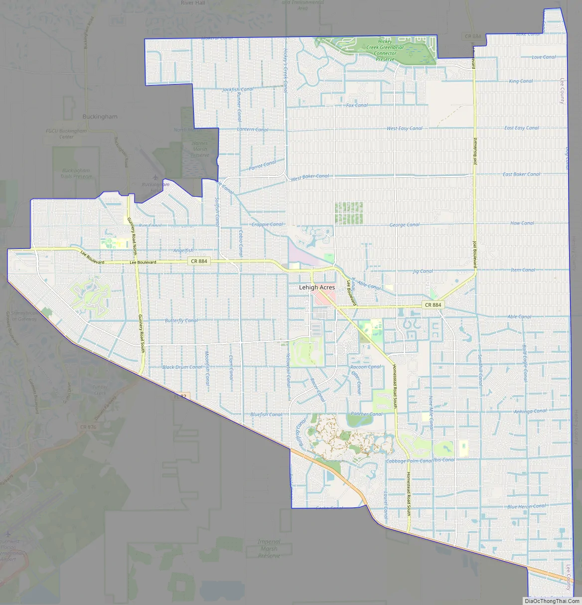
Lehigh Acres Road Map
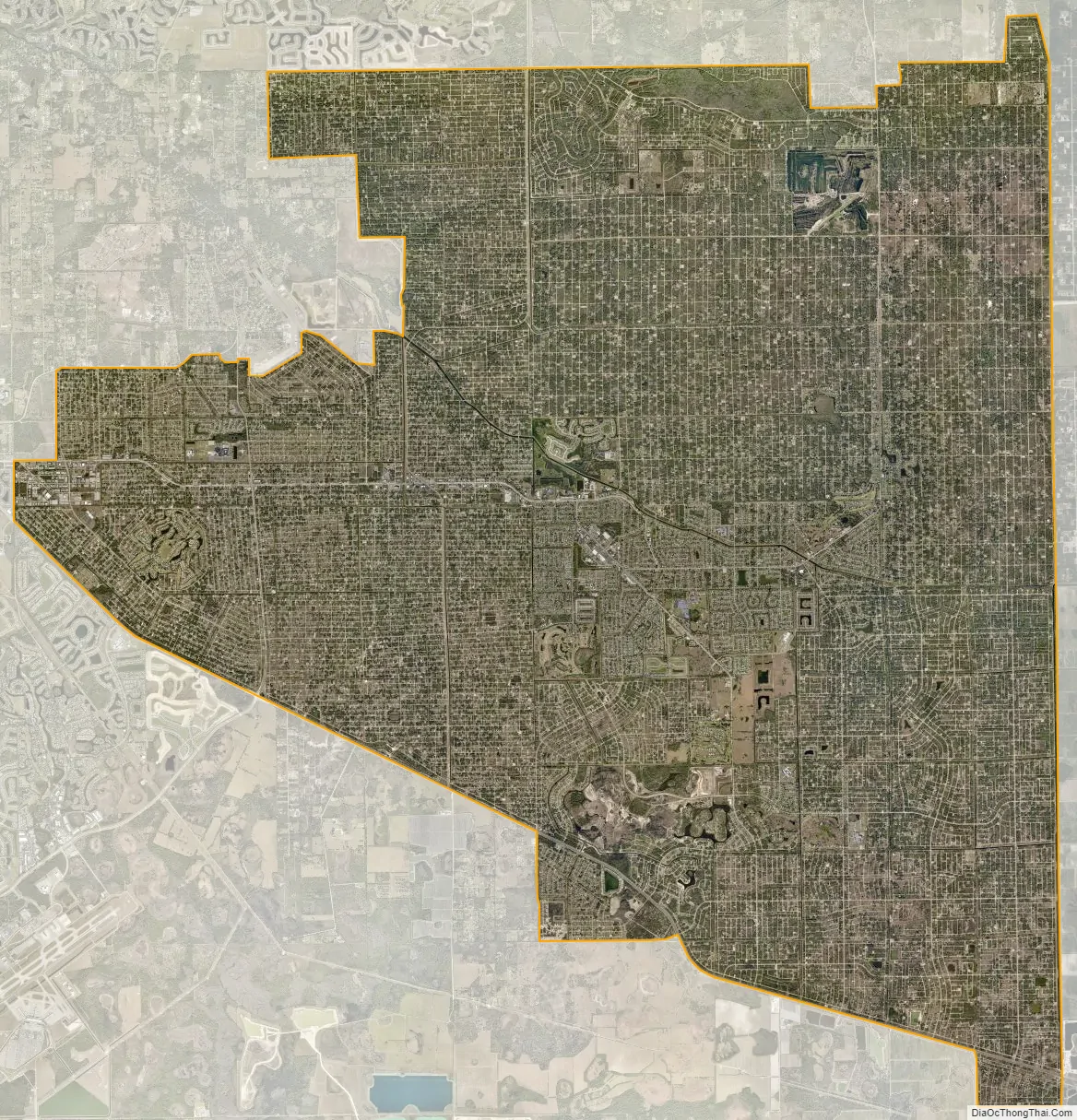
Lehigh Acres city Satellite Map
Geography
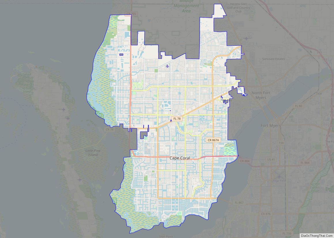
Lehigh Acres is located in eastern Lee County at 26°36′30″N 81°38′21″W / 26.60833°N 81.63917°W / 26.60833; -81.63917 (26.608333, -81.639167). It is bordered to the north by Alva, to the northwest by Buckingham, and to the southwest by Gateway, all unincorporated. It is bordered on the west by the city of Fort Myers, the Lee county seat, and extends east to the Hendry County line.
Florida State Road 82 forms the southern border of the community; the highway leads west 15 miles (24 km) to the center of Fort Myers and southeast 20 miles (32 km) to Immokalee.
According to the United States Census Bureau, the Lehigh Acres CDP has a total area of 94.2 square miles (243.9 km), of which 92.7 square miles (240.0 km) are land and 1.5 square miles (3.9 km), or 1.61%, are water.
See also
Map of Florida State and its subdivision:- Alachua
- Baker
- Bay
- Bradford
- Brevard
- Broward
- Calhoun
- Charlotte
- Citrus
- Clay
- Collier
- Columbia
- Desoto
- Dixie
- Duval
- Escambia
- Flagler
- Franklin
- Gadsden
- Gilchrist
- Glades
- Gulf
- Hamilton
- Hardee
- Hendry
- Hernando
- Highlands
- Hillsborough
- Holmes
- Indian River
- Jackson
- Jefferson
- Lafayette
- Lake
- Lee
- Leon
- Levy
- Liberty
- Madison
- Manatee
- Marion
- Martin
- Miami-Dade
- Monroe
- Nassau
- Okaloosa
- Okeechobee
- Orange
- Osceola
- Palm Beach
- Pasco
- Pinellas
- Polk
- Putnam
- Saint Johns
- Saint Lucie
- Santa Rosa
- Sarasota
- Seminole
- Sumter
- Suwannee
- Taylor
- Union
- Volusia
- Wakulla
- Walton
- Washington
- Alabama
- Alaska
- Arizona
- Arkansas
- California
- Colorado
- Connecticut
- Delaware
- District of Columbia
- Florida
- Georgia
- Hawaii
- Idaho
- Illinois
- Indiana
- Iowa
- Kansas
- Kentucky
- Louisiana
- Maine
- Maryland
- Massachusetts
- Michigan
- Minnesota
- Mississippi
- Missouri
- Montana
- Nebraska
- Nevada
- New Hampshire
- New Jersey
- New Mexico
- New York
- North Carolina
- North Dakota
- Ohio
- Oklahoma
- Oregon
- Pennsylvania
- Rhode Island
- South Carolina
- South Dakota
- Tennessee
- Texas
- Utah
- Vermont
- Virginia
- Washington
- West Virginia
- Wisconsin
- Wyoming