Miami Lakes is an incorporated town in Miami-Dade County, Florida, United States. As of the 2020 census, the population was 30,467.
| Name: | Miami Lakes town |
|---|---|
| LSAD Code: | 43 |
| LSAD Description: | town (suffix) |
| State: | Florida |
| County: | Miami-Dade County |
| Incorporated: | December 5, 2000 |
| Elevation: | 3 ft (1 m) |
| Total Area: | 6.51 sq mi (16.85 km²) |
| Land Area: | 5.66 sq mi (14.65 km²) |
| Water Area: | 0.85 sq mi (2.20 km²) 6.73% |
| Total Population: | 30,467 |
| Population Density: | 5,385.72/sq mi (2,079.43/km²) |
| Area code: | 305, 786 |
| FIPS code: | 1245100 |
| GNISfeature ID: | 0305161 |
| Website: | miamilakes-fl.gov |
Online Interactive Map
Click on ![]() to view map in "full screen" mode.
to view map in "full screen" mode.
Miami Lakes location map. Where is Miami Lakes town?


History
The development was constructed by Sengra (now the Graham Companies) beginning in 1962 on land formerly owned by Florida state senator Ernest “Cap” Graham. The Grahams stated for many years that it would be a 30-year development, but they are still developing to this day.
The original Miami Lakes development, east of the Palmetto Expressway, was master-planned by Lester Collins with curving tree-shaded roadways and numerous curving lakes, which are unusual compared to most surrounding areas with their treeless streets on a square grid and rectangular lakes. This original development, which is on the east side of the more recently designated Town of Miami Lakes, has neighborhood shopping centers, tot-lot parks, and a town center named Main Street. A significant portion of Miami Lakes is still owned by the Grahams, mostly apartment buildings, shopping centers, office buildings, and undeveloped land. The town is an early model of the New Urbanism movement, with shopping and services located within walking distance of residences as well as narrow, walkable streets and plenty of neighborhood parks.
When it was incorporated in December 2000, the Town of Miami Lakes became the 31st municipality in Miami-Dade County. Miami Lakes is home to approximately 30,000 residents and more than 1,100 businesses.
The Master Plan began over 50 years ago when the Graham family began the development of what was their dairy farm. Unlike many cities and towns created during the early 1960s, the Grahams decided to create a master plan for the city that would allow decades of growth, construction, and changing market conditions. Lester Collins, former dean of the Harvard School of Design, was enlisted to create a master plan for the area that would become the center of Miami Lakes. Collins laid the foundation for an integrated community, including residential, commercial, industrial, and mixed uses.
Former U.S. Senator Bob Graham, the younger half-brother of family patriarch William “Bill” Graham, is one of the owners, and Katharine Graham, the late publisher of the Washington Post, had a share by marriage. On December 5, 2000, Miami Lakes voted to become an incorporated town.
Miami Lakes Road Map

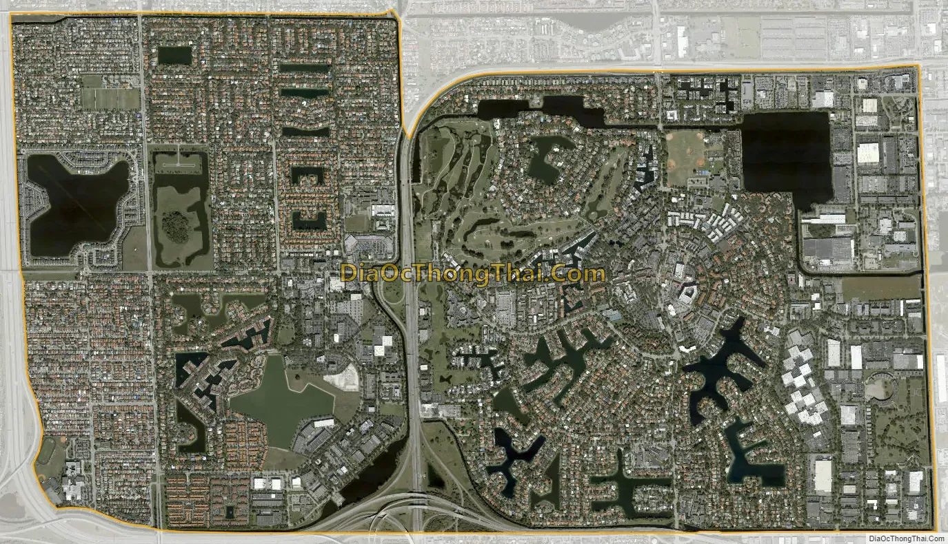
Miami Lakes city Satellite Map
Geography
Miami Lakes is located 15 miles (24 km) northwest of downtown Miami at 25°54′42″N 80°19′30″W / 25.911672°N 80.325067°W / 25.911672; -80.325067. It is bordered to the south and west by the city of Hialeah, to the east by the city of Miami Gardens, and to the north by the unincorporated community of Country Club.
According to the United States Census Bureau, the town of Miami Lakes has a total area of 6.5 square miles (17 km). 5.7 square miles (15 km) of it are land and 0.8 square miles (2.1 km) of it (13.05%) are water.
See also
Map of Florida State and its subdivision:- Alachua
- Baker
- Bay
- Bradford
- Brevard
- Broward
- Calhoun
- Charlotte
- Citrus
- Clay
- Collier
- Columbia
- Desoto
- Dixie
- Duval
- Escambia
- Flagler
- Franklin
- Gadsden
- Gilchrist
- Glades
- Gulf
- Hamilton
- Hardee
- Hendry
- Hernando
- Highlands
- Hillsborough
- Holmes
- Indian River
- Jackson
- Jefferson
- Lafayette
- Lake
- Lee
- Leon
- Levy
- Liberty
- Madison
- Manatee
- Marion
- Martin
- Miami-Dade
- Monroe
- Nassau
- Okaloosa
- Okeechobee
- Orange
- Osceola
- Palm Beach
- Pasco
- Pinellas
- Polk
- Putnam
- Saint Johns
- Saint Lucie
- Santa Rosa
- Sarasota
- Seminole
- Sumter
- Suwannee
- Taylor
- Union
- Volusia
- Wakulla
- Walton
- Washington
- Alabama
- Alaska
- Arizona
- Arkansas
- California
- Colorado
- Connecticut
- Delaware
- District of Columbia
- Florida
- Georgia
- Hawaii
- Idaho
- Illinois
- Indiana
- Iowa
- Kansas
- Kentucky
- Louisiana
- Maine
- Maryland
- Massachusetts
- Michigan
- Minnesota
- Mississippi
- Missouri
- Montana
- Nebraska
- Nevada
- New Hampshire
- New Jersey
- New Mexico
- New York
- North Carolina
- North Dakota
- Ohio
- Oklahoma
- Oregon
- Pennsylvania
- Rhode Island
- South Carolina
- South Dakota
- Tennessee
- Texas
- Utah
- Vermont
- Virginia
- Washington
- West Virginia
- Wisconsin
- Wyoming


