Miami Shores or Miami Shores Village is a village in Miami-Dade County, Florida. As of the 2020 census, the population was 11,567, up from 10,493 in 2010.
| Name: | Miami Shores village |
|---|---|
| LSAD Code: | 47 |
| LSAD Description: | village (suffix) |
| State: | Florida |
| County: | Miami-Dade County |
| Incorporated: | January 2, 1932 |
| Elevation: | 7 ft (2 m) |
| Total Area: | 3.78 sq mi (9.79 km²) |
| Land Area: | 2.49 sq mi (6.44 km²) |
| Water Area: | 1.29 sq mi (3.35 km²) |
| Total Population: | 11,567 |
| Population Density: | 4,650.99/sq mi (1,795.97/km²) |
| Area code: | 305, 786 |
| FIPS code: | 1245175 |
| GNISfeature ID: | 0286760 |
| Website: | www.msvfl.gov |
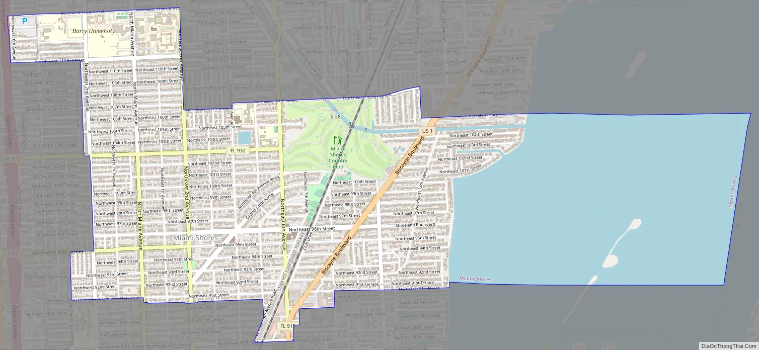
Online Interactive Map
Click on ![]() to view map in "full screen" mode.
to view map in "full screen" mode.
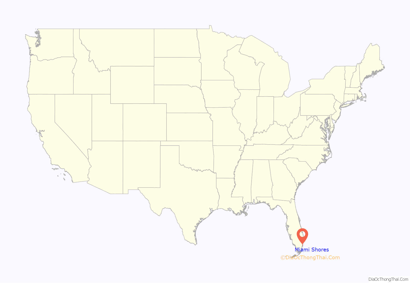
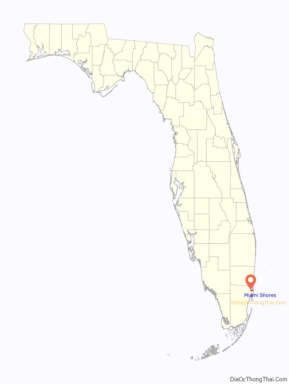
Miami Shores location map. Where is Miami Shores village?
History
By the early 1900s, the area encompassing today’s Miami Shores was occupied by a starch (coontie) mill, a tomato packing plant, a saw mill, a pineapple plantation and a grapefruit grove. These were the various enterprises in which the early pioneers were engaged, and with the coming of the railroad and its stop at the Biscayne station, they were able to live off the land. Two of the most successful growers were Major Hugh Gordon and T.V. Moore. T.V. Moore owned the land in what is today’s commercial district, while the Gordon Tract bordered the bay. By 1922, Lee T. Cooper, who had amassed his wealth from a patent medicine by the name of Tanlac, purchased T.V. Moore’s land holdings. Cooper planned to develop the area and named it “Bay View Estates”. In 1924, the Shoreland Company purchased the Gordon Tract, Bay View Estates and other scattered acreage in order to create Miami Shores, “America’s Mediterranean”.
Hugh M. Anderson, president of the Shoreland Company, and its board of directors were experienced real estate developers. They had previously completed the successful development of the Venetian Islands in Miami Beach, and they decided that their new project would be similar – residences of Italian-inspired architecture within a landscape associated with water. The master development plan for Greater Miami Shores included 9,000 building sites, 52⁄3 miles of bay frontage, four miles of inland waterways and ten miles of main roadways. The plans also called for the construction of a causeway to Miami Beach, a golf course, a country club, a yacht club, a business district, apartment buildings, hotels, a school and churches, a railroad station and beautifying features such as parks, plazas and entryways.
A total of 118 upscale Mediterranean homes were built by the Shoreland Company. These homes have great historic value, and 25 have been designated on the National Register of Historic Places so far. The commercial building program was in progress, sidewalks and roadways were being laid out, and lighting and landscape work was well underway. Record-setting sales and resales of property were being recorded. Unfortunately, on September 18, 1926, all plans for the community came to a halt with the arrival of a devastating hurricane. This and other factors contributed to the Shoreland Company’s bankruptcy in 1927.
In 1928, the New Miami Shores Corporation purchased the Shoreland Company’s holdings. This corporation was controlled by Bessemer Properties, part of the interests of the Wolstenholme family of New York. Roy H. Hawkins, the general manager of Bessemer Properties, proceeded with the plans for the community. He is credited as being the “principal founder” of Miami Shores. In 1931, under his leadership, a request to grant a charter creating the Miami Shores Village was presented in the state legislature.
The present Miami Shores roughly corresponds with the original “Biscayne” neighborhood of the city of Miami. With the arrival of the Great Depression, Miami gave up its jurisdiction and the area incorporated under the name “Miami Shores Village” in 1932. Previously, part of the area that now comprises the city of North Miami had been known as Miami Shores. Under the leadership of Roy H. Hawkins, a request to grant a charter creating Miami Shores Village was presented in the state legislature. On January 2, 1932, the village became official at a council meeting. The charter named the following five members to the first council: Hugh H. Gordon, a banker whose father had owned the Gordon Tract; Frank O. Pruitt, who was in the insurance business; John M. Carlisle, president of the Eli Witt Cigar Company; W.F. Andes, a prominent dentist; and M.R. Harrison, a general contractor, who constructed much of Biscayne Boulevard. At this first meeting, Pruitt was elected mayor, and other appointments were made including Village Manager Miller Williams, Village Attorney George E. Holt, and a single policeman, Ed Badger.
In the decades that followed its incorporation, growth was steady. A variety of architectural styles were introduced, yet the community emerged as the type of development the Shoreland Company had envisioned. The community retains many of its original characteristics – well situated and served by major highways, having tree-lined streets and wide roads, a downtown area, well-maintained homes provided with efficient services. and a variety of community activities.
Miami Shores is primarily a bedroom community for those working in the Miami metropolitan area, and it also has a sizable retired population. The village is mostly single family residential homes, with very few multi-family units and only two small commercial areas along Northeast 2nd Avenue and Biscayne Boulevard.
While it is frequently referred to as Miami Shores or the Village of Miami Shores, the municipality’s official name under its charter is Miami Shores Village.
Miami Shores Road Map
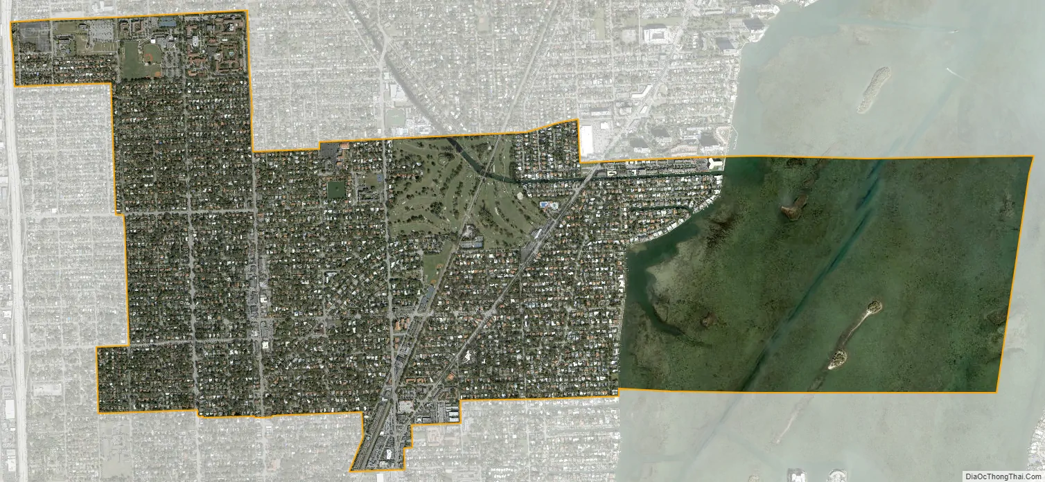
Miami Shores city Satellite Map
Geography
Miami Shores is located in northeastern Miami-Dade County at 25°51′55″N 80°11′18″W / 25.865240°N 80.188451°W / 25.865240; -80.188451. It is bordered to the north by Biscayne Park, to the west by unincorporated Pinewood, to the southwest by El Portal, to the south by the city of Miami, to the east by Biscayne Bay and, across the bay, by the city of Miami Beach.
According to the United States Census Bureau, the village has a total area of 3.78 square miles (9.79 km). 2.49 sq mi (6.45 km) of it are land, and 1.29 sq mi (3.34 km) of it (34.19%) are water.
See also
Map of Florida State and its subdivision:- Alachua
- Baker
- Bay
- Bradford
- Brevard
- Broward
- Calhoun
- Charlotte
- Citrus
- Clay
- Collier
- Columbia
- Desoto
- Dixie
- Duval
- Escambia
- Flagler
- Franklin
- Gadsden
- Gilchrist
- Glades
- Gulf
- Hamilton
- Hardee
- Hendry
- Hernando
- Highlands
- Hillsborough
- Holmes
- Indian River
- Jackson
- Jefferson
- Lafayette
- Lake
- Lee
- Leon
- Levy
- Liberty
- Madison
- Manatee
- Marion
- Martin
- Miami-Dade
- Monroe
- Nassau
- Okaloosa
- Okeechobee
- Orange
- Osceola
- Palm Beach
- Pasco
- Pinellas
- Polk
- Putnam
- Saint Johns
- Saint Lucie
- Santa Rosa
- Sarasota
- Seminole
- Sumter
- Suwannee
- Taylor
- Union
- Volusia
- Wakulla
- Walton
- Washington
- Alabama
- Alaska
- Arizona
- Arkansas
- California
- Colorado
- Connecticut
- Delaware
- District of Columbia
- Florida
- Georgia
- Hawaii
- Idaho
- Illinois
- Indiana
- Iowa
- Kansas
- Kentucky
- Louisiana
- Maine
- Maryland
- Massachusetts
- Michigan
- Minnesota
- Mississippi
- Missouri
- Montana
- Nebraska
- Nevada
- New Hampshire
- New Jersey
- New Mexico
- New York
- North Carolina
- North Dakota
- Ohio
- Oklahoma
- Oregon
- Pennsylvania
- Rhode Island
- South Carolina
- South Dakota
- Tennessee
- Texas
- Utah
- Vermont
- Virginia
- Washington
- West Virginia
- Wisconsin
- Wyoming


