Miami Beach is a coastal resort city in Miami-Dade County, Florida, United States. The municipality is located on natural and human-made barrier islands between the Atlantic Ocean and Biscayne Bay, the latter of which separates the Beach from the mainland city of Miami. The neighborhood of South Beach, comprising the southernmost 2.5 sq mi (6.5 km) of Miami Beach, along with Downtown Miami and the PortMiami, collectively form the commercial center of South Florida. Miami Beach’s population is 82,890 according to the 2020 census. It has been one of America’s pre-eminent beach resorts since the early 20th century.
In 1979, Miami Beach’s Art Deco Historic District was listed on the National Register of Historic Places. The Art Deco District is the largest collection of Art Deco architecture in the world and comprises hundreds of hotels, apartments and other structures erected between 1923 and 1943. Mediterranean, Streamline Moderne and Art Deco are all represented in the District.
The Historic District is bounded by the Atlantic Ocean on the East, Lenox Court on the West, 6th Street on the South and Dade Boulevard along the Collins Canal to the North. The movement to preserve the Art Deco District’s architectural heritage was led by former interior designer Barbara Baer Capitman, who now has a street in the District named in her honor.
| Name: | Miami Beach city |
|---|---|
| LSAD Code: | 25 |
| LSAD Description: | city (suffix) |
| State: | Florida |
| County: | Miami-Dade County |
| Incorporated: | March 26, 1915 |
| Elevation: | 4 ft (1.2 m) |
| Land Area: | 7.69 sq mi (19.92 km²) |
| Water Area: | 7.53 sq mi (19.49 km²) 62.37% |
| Population Density: | 10,774.73/sq mi (4,160.38/km²) |
| Area code: | 305, 786 |
| FIPS code: | 1245025 |
| GNISfeature ID: | 286750 |
| Website: | miamibeachfl.gov |
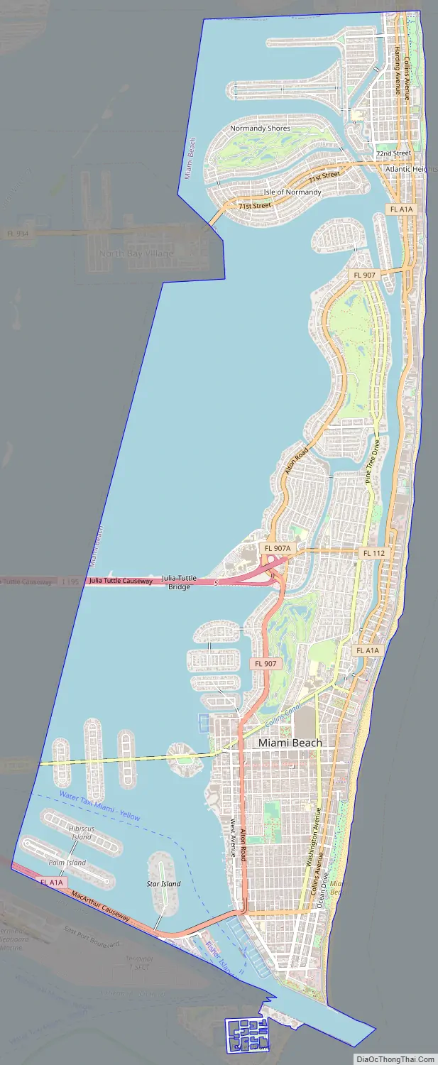
Online Interactive Map
Click on ![]() to view map in "full screen" mode.
to view map in "full screen" mode.
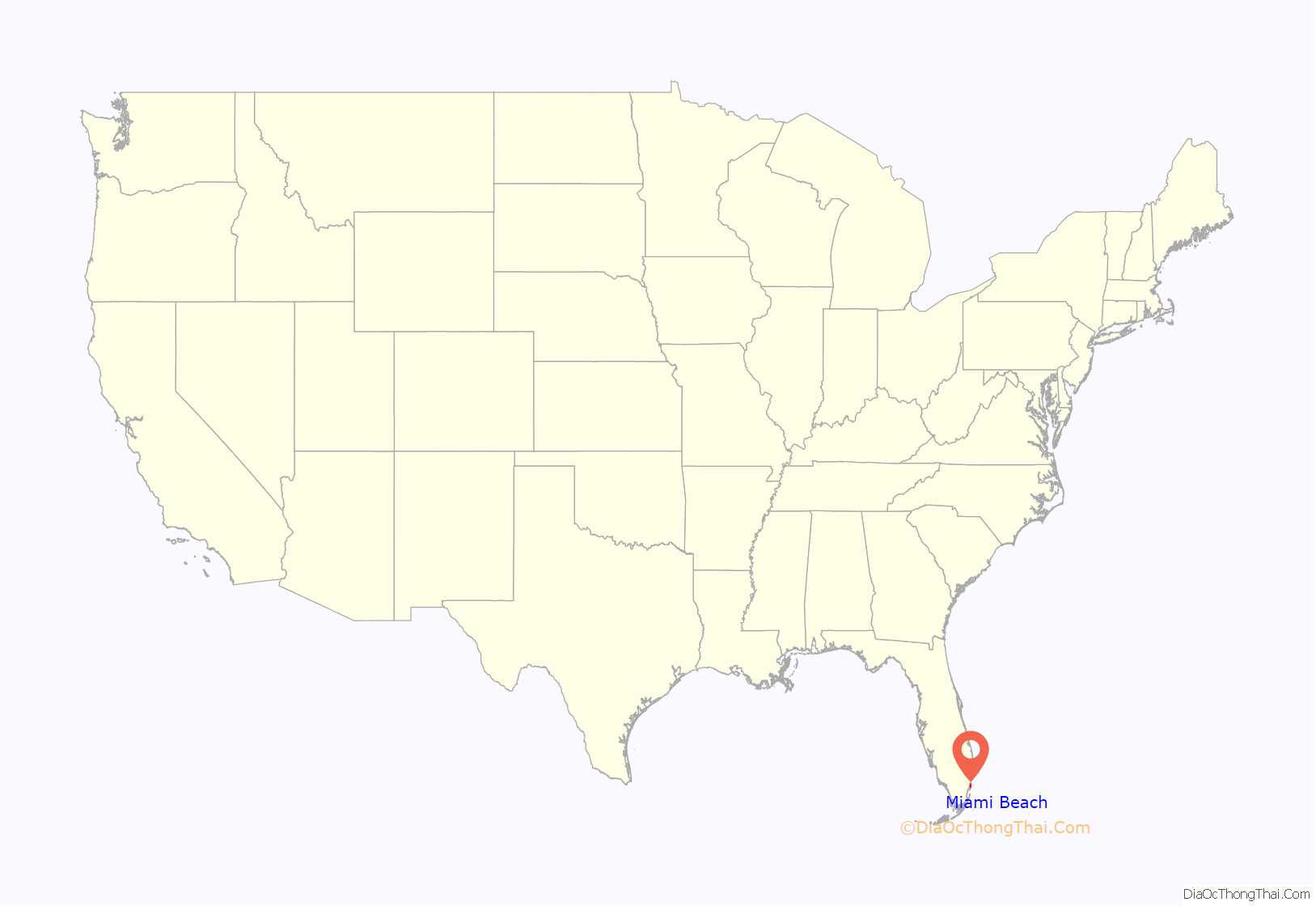
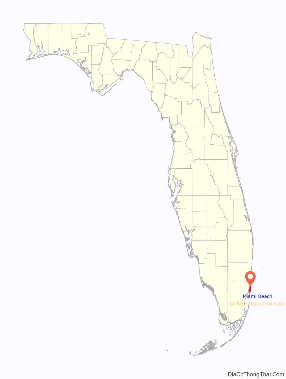
Miami Beach location map. Where is Miami Beach city?
History
In 1870, father and son Henry and Charles Lum purchased land on Miami Beach for 75 cents an acre. The first structure to be built on this uninhabited oceanfront was the Biscayne House of Refuge, constructed in 1876 by the United States Life-Saving Service through an executive order issued by President Ulysses S. Grant, at approximately 72nd Street. Its purpose was to provide food, water, and a return to civilization for people who were shipwrecked. The structure, which had fallen into disuse by the time the Life-Saving Service became the U.S. Coast Guard in 1915, was destroyed in the 1926 Miami Hurricane and never rebuilt.
The next step in the development of the future Miami Beach was the planting of a coconut plantation along the shore in the 1880s by New Jersey entrepreneurs Ezra Osborn and Elnathan T. Field, but this was a failed venture. One of the investors in the project was agriculturist John S. Collins, who achieved success by buying out other partners and planting different crops, notably avocados, on the land that would later become Miami Beach. In fact, the pine trees on today’s Pinetree Drive served as an erosion buffer for Collins’ plantations. Meanwhile, across Biscayne Bay, the City of Miami was established in 1896 with the arrival of the railroad and developed further as a port when the shipping channel of Government Cut was created in 1905, cutting off Fisher Island from the south end of the Miami Beach peninsula.
Collins’ family members saw the potential in developing the beach as a resort. This effort got underway in the early years of the 20th century by the Collins/Pancoast family, the Lummus brothers (bankers from Miami) and Indianapolis entrepreneur Carl G. Fisher. Until then, the beach here was only the destination for day-trips by ferry from Miami, across the bay. By 1912, Collins and Pancoast were working together to clear the land, plant crops, supervise the construction of canals to get their avocado crop to market and set up the Miami Beach Improvement Company. There were bathhouses and food stands, but no hotel until Brown’s Hotel was built in 1915 (still standing, at 112 Ocean Drive). Much of the interior landmass at that time was a tangled jungle of mangroves. Clearing it, deepening the channels and water bodies, and eliminating native growth almost everywhere in favor of landfill for development, was expensive. Once a 1600-acre, jungle-matted sand bar three miles out in the Atlantic, it grew to 2,800 acres when dredging and filling operations were completed.
With loans from the Lummus brothers, Collins had begun work on a 2½-mile-long wooden bridge, the world’s longest wooden bridge at the time, to connect the island to the mainland. When funds ran dry and construction work stalled, Indianapolis millionaire and recent Miami transplant Fisher intervened, providing the financing needed to complete the Collins Bridge the following year in return for a land swap deal. That transaction kicked off the island’s first real estate boom. The Collins Bridge cost over $150,000 and opened on June 12, 1913. Fisher helped by organizing an annual speed boat regatta, and by promoting Miami Beach as an Atlantic City-style playground and winter retreat for the wealthy. By 1915, Lummus, Collins, Pancoast, and Fisher were all living in mansions on the island, three hotels and two bathhouses had been erected, an aquarium built, and an 18-hole golf course landscaped.
The Town of Miami Beach was chartered on March 26, 1915; it grew to become a City in 1917. Even after the town was incorporated in 1915 under the name of Miami Beach, many visitors thought of the beach strip as Alton Beach, indicating just how well Fisher had advertised his interests there. The Lummus property was called Ocean Beach, with only the Collins interests previously referred to as Miami Beach. In 1925, the Collins Bridge was replaced by the Venetian Causeway, described as “a series of drawbridges and renamed the Venetian Causeway”.
Carl Fisher was the main promoter of Miami Beach’s development in the 1920s as the site for wealthy industrialists from the north and Midwest to and build their winter homes here. Many other Northerners were targeted to vacation on the island. To accommodate the wealthy tourists, several grand hotels were built, among them: The Flamingo Hotel, The Fleetwood Hotel, The Floridian, The Nautilus, and the Roney Plaza Hotel. In the 1920s, Fisher and others created much of Miami Beach as landfill by dredging Biscayne Bay; this human-made territory includes Star, Palm, and Hibiscus Islands, the Sunset Islands, much of Normandy Isle, and all of the Venetian Islands except Belle Isle. The Miami Beach peninsula became an island in April 1925 when Haulover Cut was opened, connecting the ocean to the bay, north of present-day Bal Harbour. The great 1926 Miami hurricane put an end to this prosperous era of the Florida Boom, but in the 1930s Miami Beach still attracted tourists, and investors constructed the mostly small-scale, stucco hotels and rooming houses, for seasonal rental, that comprise much of the present “Art Deco” historic district.
Carl Fisher brought Steve Hannagan to Miami Beach in 1925 as his chief publicist. Hannagan set-up the Miami Beach News Bureau and notified news editors that they could “Print anything you want about Miami Beach; just make sure you get our name right.” The News Bureau sent thousands of pictures of bathing beauties and press releases to columnists like Walter Winchell and Ed Sullivan. One of Hannagan’s favorite venues was a billboard in Times Square, New York City, where he ran two taglines: “‘It’s always June in Miami Beach’ and ‘Miami Beach, Where Summer Spends the Winter.'”
Anti-semitism was rampant in the 1920s and into the 30s. Developer Carl Fisher would sell property only to gentiles so Jews were required to live south of Fifth Street. As recently as the 1930s, hotels refused to accept Jews. As the 1930s developed, the “dismantling on Miami Beach of restrictive barriers to Jewish ownership of real estate” was underway; many Jews bought properties from others.
By the 1940s and 50s, an increasing number of Jewish families built hotels. The first “skyscraper” was the 18-story Lord Tarleton Hotel built in 1940 by Samuel Jacobs. The Jewish mobster Meyer Lansky, who ran some “carpet joints” (gambling operations) in Florida by 1936, and eventually controlled casinos in Cuba and Las Vegas, retired in Miami and died in Miami Beach.
During the Second World War, Jewish doctors were not granted staff privileges at any area hospitals so the community built Mount Sinai Medical Center (Miami) on Miami Beach. The North Shore Jewish Center was built in 1951 and became Temple Menorah after an expansion in 1963.
Post–World War II economic expansion brought a wave of immigrants to South Florida from the Northern United States, which significantly increased the population in Miami Beach within a few decades. After Fidel Castro’s rise to power in 1959, a wave of Cuban refugees entered South Florida and dramatically changed the demographic make-up of the area. In 2017, one study named zip code 33109 (Fisher Island, a 216-acre island located just south of Miami Beach), as having the 4th most expensive home sales and the highest average annual income ($2.5 million) in 2015.
The sun and warm climate attracted many Jewish families and retirees. One estimate states that “20,000 elderly Jews” were part of the population of the beach in the late 1970s”. In a 2017 interview, a demographer from the University of Miami estimated that there “might have been as many as 70,000 Jews in Miami Beach at one point” declining to “around 19,000 in 2014”. The decline was motivated partly by “increasing prices during the art deco movement and an increase in crime and changing cultural demographics”.
In 1980 however, 62 percent of the population of Miami Beach was still Jewish. During the 1980s many of the Jewish citizens left and moved to “Delray Beach, Lake Worth and Boca Raton”. During the 1990s, South Beach transformed into a home of the fashion industry and celebrities. In 1999, there were only 10,000 Jewish people living in Miami Beach.
Timeline
- 1896 – City of Miami founded with the recent arrival extension Henry Flagler’s FEC railroad.
- 1905 – Government Cut manmade shipping channel created separating Miami Beach and Fisher Island.
- 1912 – Miami Beach Improvement Company founded.
- 1913 – Collins Bridge (now Venetian Causeway), first bridge between Miami and Miami Beach, built.
- 1915
- Miami Beach incorporated.
- John Newton Lummus becomes first mayor of Miami Beach.
- Brown’s Hotel first hotel built in Miami Beach, still standing today at 112 Ocean Drive.
- 1920
- Population: 644.
- County Causeway (now MacArthur Causeway) connecting Miami and Miami Beach opens.
- 1925
- Venetian Causeway opens.
- Miami Beach becomes an island when the Haulover cut opens in April connecting the ocean to the bay just north of Bal Harbour, Florida
- 1926
- Miami Beach sustains significant damage from 1926 Miami hurricane
- 1928
- Al Capone buys property in Miami Beach.
- 1928 – 79th Street Causeway built to connect Miami Beach to Hialeah Park Race Track.
- 1930 – Population: 6,494.
- 1935 – Many of the famous Art Deco hotels along current day Ocean Drive are built between 1935 and 1941 before the onset of WWII ends construction. Colony (1935), Savoy Plaza (1935), The Tides (1936), Surf Hotel (1936), Beacon (1936), Cavalier (1936), Leslie (1937), Park Central (1937), Barbizon (1937), Waldorf Towers (1937), Victor (1937), Clevelander (1938), Crescent (1938), Carlyle (1939), Cardozo (1939), Winterhaven (1939), Bentley (1939), Breakwater (1939), Imperial (1939), Majestic (1940), Avalon (1941), Betsy Ross Hotel (1941), St. Charles (1941), Clyde Hotel (1941).
- 1937 – WKAT radio begins broadcasting.
- 1940 – Population: 28,012.
- 1954 – Fontainebleau Hotel in business.
- 1958 – Miami Beach Convention Center opens.
- 1959 – Miami International Airport dedicated near Miami Beach.
- 1960 – Population: 63,145.
- 1961 – The Julia Tuttle Causeway between Miami and Miami Beach opens.
- 1968 – August: 1968 Republican National Convention held in Miami Beach.
- 1971 – Annual South Florida Auto Show begins.
- 1972 – July: 1972 Democratic National Convention held in Miami Beach.
- 1972 – August: 1972 Republican National Convention held in Miami Beach.
- 1973 – February: A mentally ill man firebombs a crowded cafeteria on Collins Avenue, killing three people and injuring about 130.
- 1977 – September: 35th World Science Fiction Convention held in Miami Beach.
- 1979 – Much of Miami South Beach area becomes a historic preservation zone.
- 1984 – Popular NBC TV show Miami Vice filmed in many locations in Miami and Miami Beach for five seasons between 1984 and 1989.
- 1997 – July 15: Fashion designer Gianni Versace killed at Casa Casuarina.
- 2000 – Blue and Green Diamond hi-rises built.
- 2001 – Murano at Portofino hi-rise built.
- 2002
- Annual international Art Basel Miami Beach (art fair) begins.
- Continuum hi-rise built
- 2004 – Setai Hotel and ICON hi-rise built.
- 2007 – Matti Herrera Bower becomes mayor.
- 2010 – Population: 87,779.
- 2011 – November 1: Miami Beach mayoral election, 2011 held; Bower stays in office.
- 2013 – Philip Levine becomes mayor.
- 2015 – November 3: Miami Beach mayoral election, 2015 held; Levine stays in office.
- 2021 – Miami becomes first city to buy Bitcoin.
Miami Beach Road Map
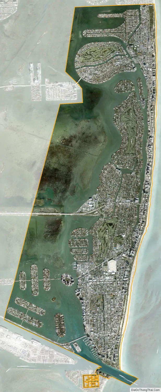
Miami Beach city Satellite Map
Geography
According to the U.S. Census Bureau, the city has a total area of 18.7 sq mi (48.5 km), of which 7.0 sq mi (18.2 km) is land and 11.7 sq mi (30.2 km) (62.37%) is water.
Elevation and tidal flooding
Miami Beach encounters tidal flooding of certain roads during the annual king tides, though some tidal flooding has been the case for decades, as the parts of the western side of South Beach are at virtually 0 ft (0 m) above normal high tide, with the entire city averaging only 4.4 ft (1.3 m) above mean sea level (AMSL). However, a recent study by the University of Miami showed that tidal flooding became much more common from the mid-2000s. The fall 2015 king tides exceeded expectations in longevity and height. Traditional sea level rise and storm mitigation measures including sea walls and dykes, such as those in the Netherlands and New Orleans, may not work in South Florida due to the porous nature of the ground and limestone beneath the surface.
In addition to present difficulty with below-grade development, some areas of southern Florida, especially Miami Beach, are beginning to engineer specifically for sea level rise and other potential effects of climate change. This includes a five-year, US$500 million project for the installation of 60 to 80 pumps, building of taller sea walls, planting of red mangrove trees along the sea walls, and the physical raising of road tarmac levels, as well as possible zoning and building code changes, which could eventually lead to retrofitting of existing and historic properties. Some streets and sidewalks were raised about 2.5 ft (0.76 m) over previous levels; the four initial pumps installed in 2014 are capable of pumping 4,000 US gallons per minute. However, this plan is not without criticism. Some residents worry that the efforts will not be sufficient to successfully adapt to rising sea levels and wish the city had pursued a more aggressive plan. On the other hand, some worry that the city is moving too quickly with untested solutions. Others yet have voiced concerns that the plan protects big-money interests in Miami Beach. Pump failures such as during construction or power outages, including a Tropical Storm Emily-related rain flood on August 1, 2017, can cause great unexpected flooding. Combined with the higher roads and sidewalks, this leaves unchanged properties relatively lower and prone to inundation.
See also
Map of Florida State and its subdivision:- Alachua
- Baker
- Bay
- Bradford
- Brevard
- Broward
- Calhoun
- Charlotte
- Citrus
- Clay
- Collier
- Columbia
- Desoto
- Dixie
- Duval
- Escambia
- Flagler
- Franklin
- Gadsden
- Gilchrist
- Glades
- Gulf
- Hamilton
- Hardee
- Hendry
- Hernando
- Highlands
- Hillsborough
- Holmes
- Indian River
- Jackson
- Jefferson
- Lafayette
- Lake
- Lee
- Leon
- Levy
- Liberty
- Madison
- Manatee
- Marion
- Martin
- Miami-Dade
- Monroe
- Nassau
- Okaloosa
- Okeechobee
- Orange
- Osceola
- Palm Beach
- Pasco
- Pinellas
- Polk
- Putnam
- Saint Johns
- Saint Lucie
- Santa Rosa
- Sarasota
- Seminole
- Sumter
- Suwannee
- Taylor
- Union
- Volusia
- Wakulla
- Walton
- Washington
- Alabama
- Alaska
- Arizona
- Arkansas
- California
- Colorado
- Connecticut
- Delaware
- District of Columbia
- Florida
- Georgia
- Hawaii
- Idaho
- Illinois
- Indiana
- Iowa
- Kansas
- Kentucky
- Louisiana
- Maine
- Maryland
- Massachusetts
- Michigan
- Minnesota
- Mississippi
- Missouri
- Montana
- Nebraska
- Nevada
- New Hampshire
- New Jersey
- New Mexico
- New York
- North Carolina
- North Dakota
- Ohio
- Oklahoma
- Oregon
- Pennsylvania
- Rhode Island
- South Carolina
- South Dakota
- Tennessee
- Texas
- Utah
- Vermont
- Virginia
- Washington
- West Virginia
- Wisconsin
- Wyoming


