Sunny Isles Beach (SIB, officially the City of Sunny Isles Beach) is a city located on a barrier island in northeast Miami-Dade County, Florida, United States. The city is bounded by the Atlantic Ocean on the east and the Intracoastal Waterway on the west. As of the 2020 census, it had a population of 22,342.
Sunny Isles Beach is an area of cultural diversity with stores lining Collins Avenue, the main thoroughfare through the city. It is renowned for having the 14th tallest skyline in the United States despite its relatively low population.
It is a growing resort area, and developers like Michael Dezer have invested heavily in construction of high-rise hotels and condominiums while licensing the Donald Trump name for some of the buildings for promotional purposes. Sunny Isles Beach has a central location, minutes from Bal Harbour to the south, and Aventura to the north and west.
Sunny Isles Beach was the 2008 site of MTV’s annual Spring Break celebration, with headquarters at the local Newport Beachside Resort.
| Name: | Sunny Isles Beach city |
|---|---|
| LSAD Code: | 25 |
| LSAD Description: | city (suffix) |
| State: | Florida |
| County: | Miami-Dade County |
| Total Area: | 1.81 sq mi (4.69 km²) |
| Land Area: | 1.01 sq mi (2.62 km²) |
| Water Area: | 0.80 sq mi (2.08 km²) |
| Total Population: | 22,342 |
| Population Density: | 22,098.91/sq mi (8,536.02/km²) |
| ZIP code: | 33160 |
| Area code: | 305, 786 |
| FIPS code: | 1269555 |
| Website: | www.sibfl.net |
Online Interactive Map
Click on ![]() to view map in "full screen" mode.
to view map in "full screen" mode.
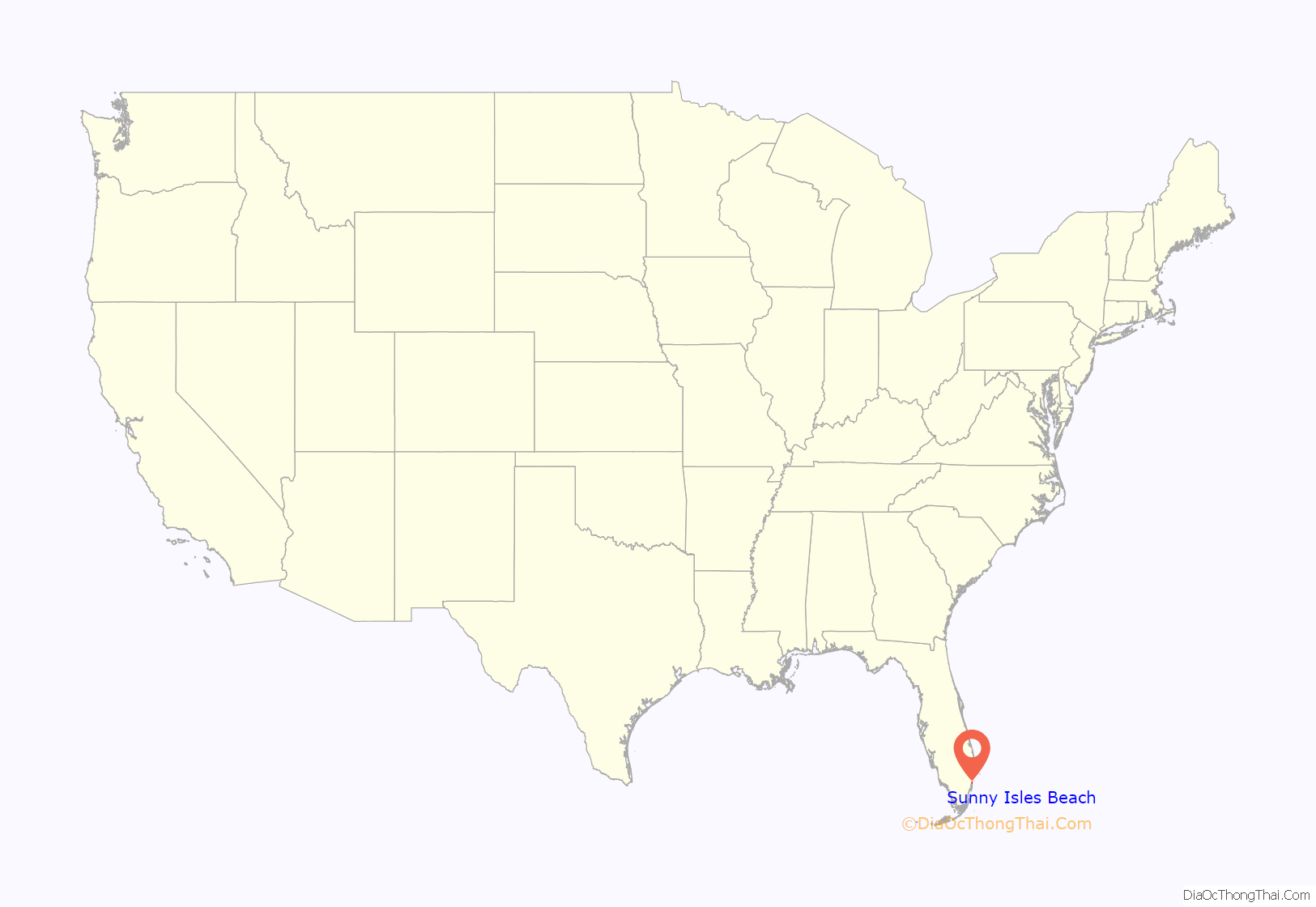
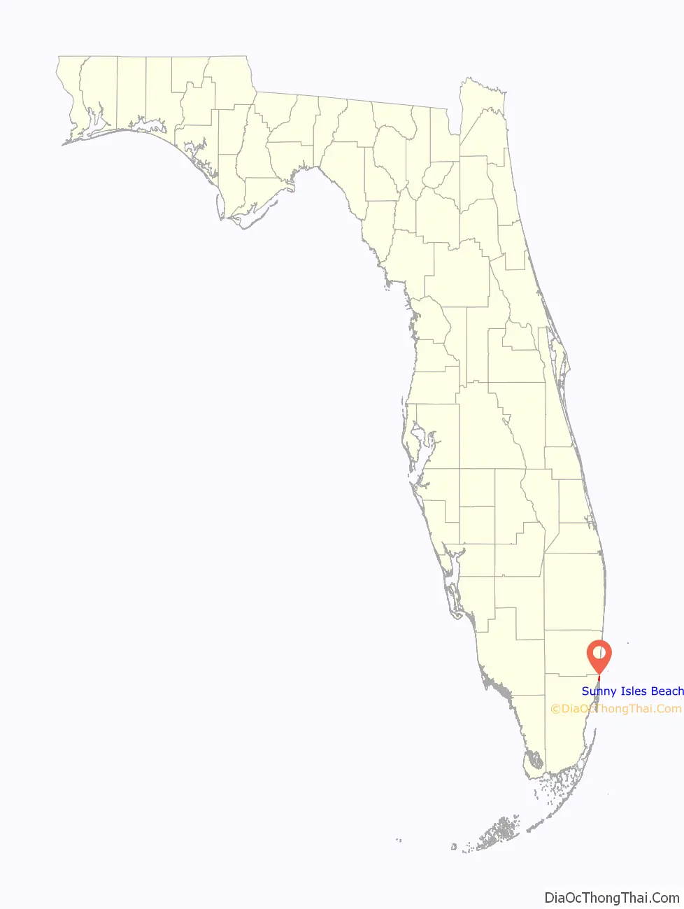
Sunny Isles Beach location map. Where is Sunny Isles Beach city?
History
In 1920, Harvey Baker Graves, a private investor, purchased a 2.26-square-mile (5.9 km) tract of land for development as a tourist resort. He named it “Sunny Isles, the America Riviera”.
When the Haulover bridge was completed in 1925, the area became accessible from Miami Beach, attracting developers who widened streams, dug canals and inlets and created islands and peninsulas for building waterfront properties on Biscayne Bay.
Sunny Isles Beach was known as North Miami Beach until 1931, then known as Sunny Isles until 1997.
In 1936, Milwaukee malt magnate Kurtis Froedtert bought Sunny Isles. The Sunny Isles Pier was built and soon became a popular destination. Sunny Isles developed slowly until the 1950s when the first single-family homes were built in the Golden Shores area. During the 1950s and 1960s more than 30 motels sprang up along Collins Avenue including the Ocean Palm, the first two-story motel in the U.S. Designed by Norman Giller in 1948 it was developed and owned by the Gingold family for the next 45 years and provided the springboard for Sunny Isles economic development. Tourists came from all over to vacation in themed motels of exotic design along “Motel Row”. One motel, The Fountainhead, was named by its owner Norman Giller after the novel by Ayn Rand. As of 2013, the Ocean Palm Motel is closed.
In 1982 the half-mile-long Sunny Isles Pier was designated a historic site. In the early-mid 1980s, it went through restoration and re-opened to the public in 1986. The pier was damaged severely in October 2005 by Hurricane Wilma. After eight years, it was remodeled and reopened as Newport Fishing Pier on June 15, 2013.
In 1997, the citizens of the area voted to incorporate as a municipality. Sunny Isles was renamed Sunny Isles Beach. Sunny Isles Beach began major redevelopment during the real estate boom of the early 2000s with mostly high-rise condominiums and some hotels under construction along the beach side of Collins Avenue (A1A) replacing most of the historic one- and two-story motels along Motel Row. In 2011, construction began on two more high-rises, Regalia, located on the northern border of the city along A1A, and The Mansions at Acqualina, located adjacent to the Acqualina Resort & Spa on the Beach.
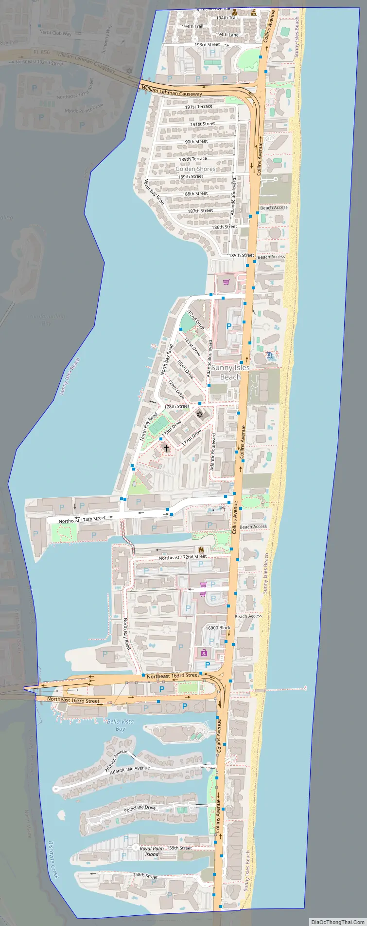
Sunny Isles Beach Road Map
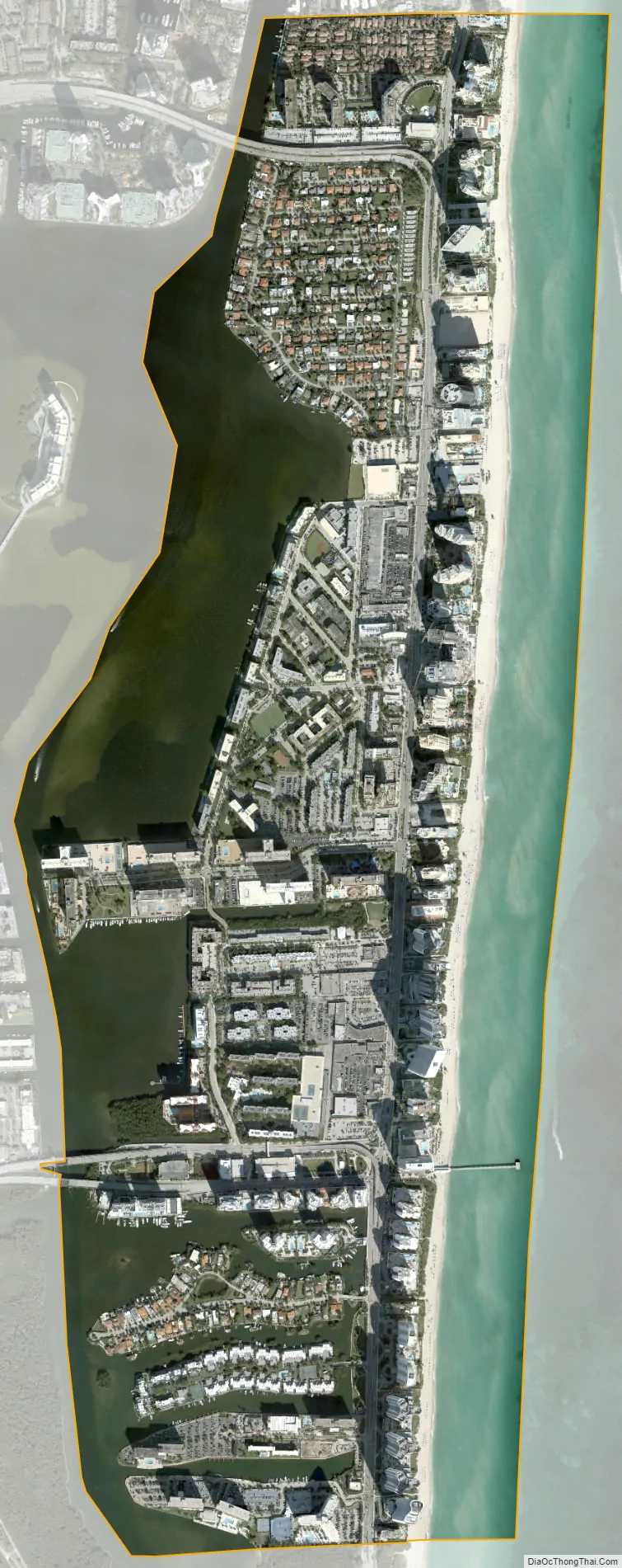
Sunny Isles Beach city Satellite Map
Geography
Sunny Isles Beach is located in northeastern Miami-Dade County at 25°56′30″N 80°7′30″W / 25.94167°N 80.12500°W / 25.94167; -80.12500 (25.941270, –80.125111). It is bordered to the north by the town of Golden Beach, to the west across the Intracoastal Waterway by the cities of Aventura and North Miami Beach, to the south by Miami-Dade County’s Haulover Park, and to the east by the Atlantic Ocean.
Florida State Road A1A is the main road through the city, leading north 4 miles (6 km) to Hollywood Beach and south 10 miles (16 km) to the center of Miami Beach. State Road 826 (Sunny Isles Boulevard) leads west into North Miami Beach, and State Road 856 (the William Lehman Causeway) leads west into Aventura from the north end of Sunny Isles Beach.
According to the United States Census Bureau, the city has a total area of 1.8 square miles (4.7 km), with 1.0 square mile (2.6 km) of it land and 0.8 square miles (2.1 km) of it (44.24%) as water.
Surrounding areas
- Golden Beach
- Aventura Atlantic Ocean
- Aventura, North Miami Beach, North Miami Atlantic Ocean
- North Miami Atlantic Ocean
- Unincorporated Miami-Dade County (Haulover Park)
See also
Map of Florida State and its subdivision:- Alachua
- Baker
- Bay
- Bradford
- Brevard
- Broward
- Calhoun
- Charlotte
- Citrus
- Clay
- Collier
- Columbia
- Desoto
- Dixie
- Duval
- Escambia
- Flagler
- Franklin
- Gadsden
- Gilchrist
- Glades
- Gulf
- Hamilton
- Hardee
- Hendry
- Hernando
- Highlands
- Hillsborough
- Holmes
- Indian River
- Jackson
- Jefferson
- Lafayette
- Lake
- Lee
- Leon
- Levy
- Liberty
- Madison
- Manatee
- Marion
- Martin
- Miami-Dade
- Monroe
- Nassau
- Okaloosa
- Okeechobee
- Orange
- Osceola
- Palm Beach
- Pasco
- Pinellas
- Polk
- Putnam
- Saint Johns
- Saint Lucie
- Santa Rosa
- Sarasota
- Seminole
- Sumter
- Suwannee
- Taylor
- Union
- Volusia
- Wakulla
- Walton
- Washington
- Alabama
- Alaska
- Arizona
- Arkansas
- California
- Colorado
- Connecticut
- Delaware
- District of Columbia
- Florida
- Georgia
- Hawaii
- Idaho
- Illinois
- Indiana
- Iowa
- Kansas
- Kentucky
- Louisiana
- Maine
- Maryland
- Massachusetts
- Michigan
- Minnesota
- Mississippi
- Missouri
- Montana
- Nebraska
- Nevada
- New Hampshire
- New Jersey
- New Mexico
- New York
- North Carolina
- North Dakota
- Ohio
- Oklahoma
- Oregon
- Pennsylvania
- Rhode Island
- South Carolina
- South Dakota
- Tennessee
- Texas
- Utah
- Vermont
- Virginia
- Washington
- West Virginia
- Wisconsin
- Wyoming


