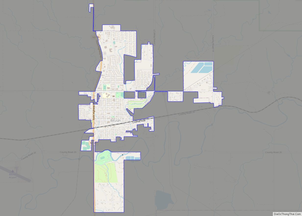
Beulah is a town in Mercer County, North Dakota, United States. The population was 3,058 at the 2020 census. Beulah is home to the Dakota Gasification Company. It is near the largest lignite mine in the United States, owned by North American Coal Corporation.
| Name: | Beulah city |
|---|---|
| LSAD Code: | 25 |
| LSAD Description: | city (suffix) |
| State: | North Dakota |
| County: | Mercer County |
| Elevation: | 1,785 ft (544 m) |
| Total Area: | 2.47 sq mi (6.39 km²) |
| Land Area: | 2.44 sq mi (6.32 km²) |
| Water Area: | 0.03 sq mi (0.06 km²) |
| Total Population: | 3,058 |
| Population Density: | 1,252.25/sq mi (483.52/km²) |
| ZIP code: | 58523 |
| Area code: | 701 |
| FIPS code: | 3806660 |
| GNISfeature ID: | 1027971 |
| Website: | beulahnd.org |
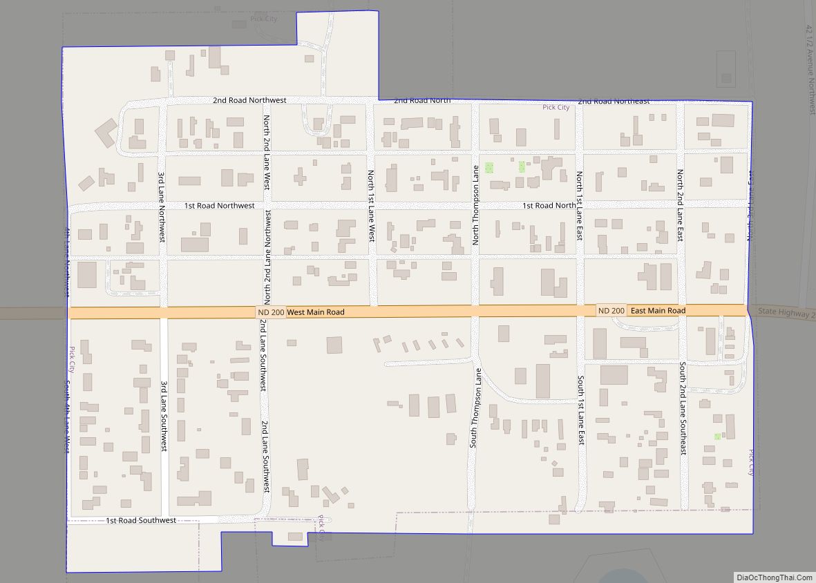
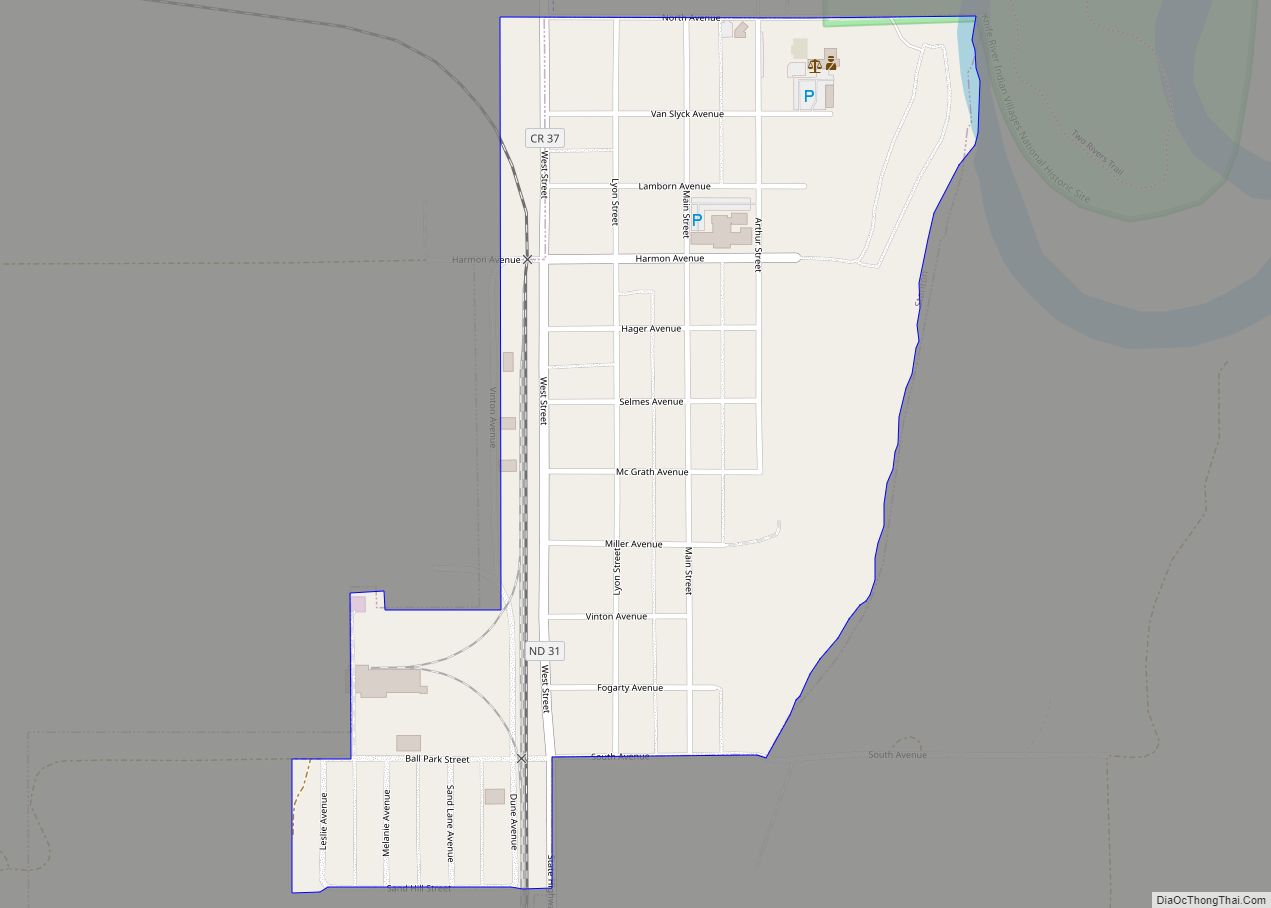
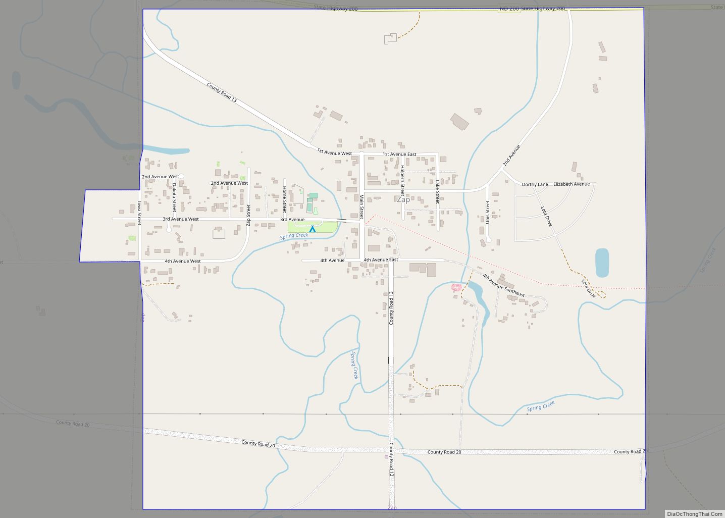
Online Interactive Map
Click on ![]() to view map in "full screen" mode.
to view map in "full screen" mode.
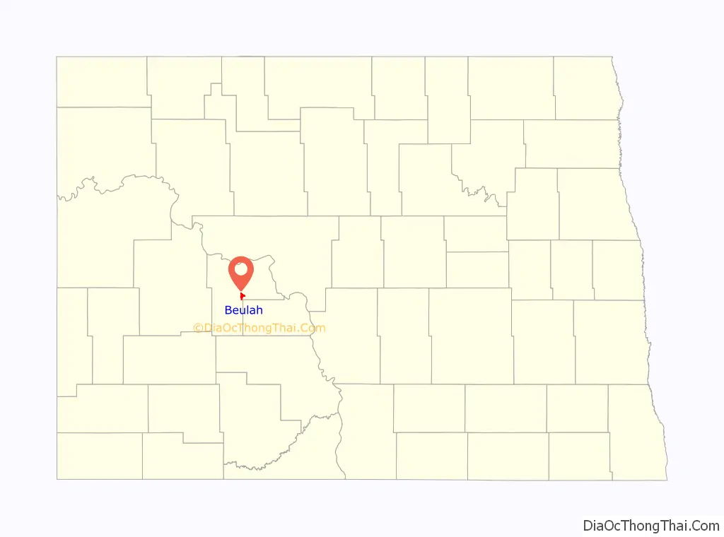
Beulah location map. Where is Beulah city?

History
Beulah was founded in 1914. It was named after Beulah Stinchcombe, the niece of a local land developer.
Beulah Road Map

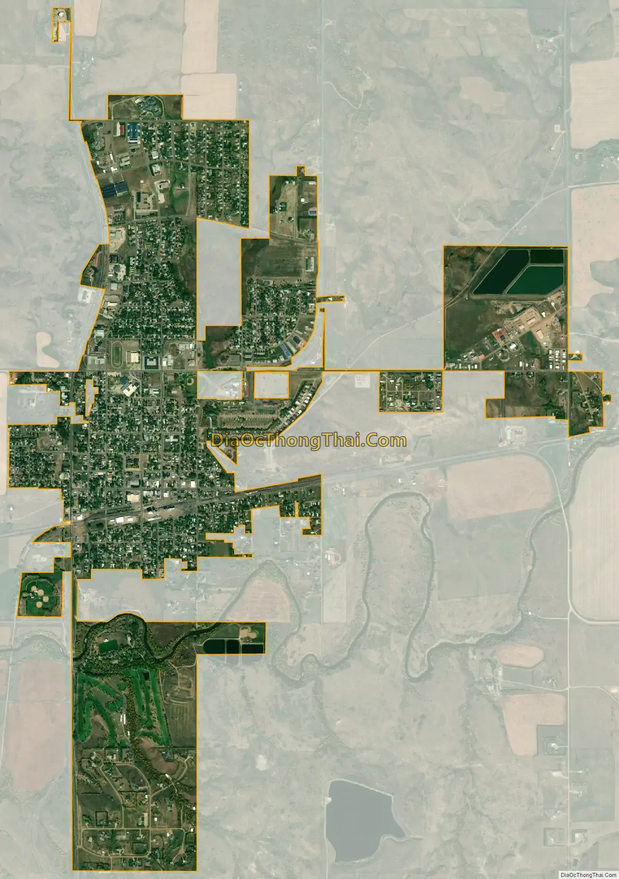
Beulah city Satellite Map
Geography
Beulah is located at 47°16′5″N 101°46′38″W / 47.26806°N 101.77722°W / 47.26806; -101.77722 (47.268088, −101.777229).
According to the United States Census Bureau, the town has a total area of 2.51 square miles (6.50 km), of which 2.49 square miles (6.45 km) is land and 0.02 square miles (0.05 km) is water.
See also
Map of North Dakota State and its subdivision:- Adams
- Barnes
- Benson
- Billings
- Bottineau
- Bowman
- Burke
- Burleigh
- Cass
- Cavalier
- Dickey
- Divide
- Dunn
- Eddy
- Emmons
- Foster
- Golden Valley
- Grand Forks
- Grant
- Griggs
- Hettinger
- Kidder
- Lamoure
- Logan
- McHenry
- McIntosh
- McKenzie
- McLean
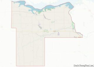
- Mercer
- Morton
- Mountrail
- Nelson
- Oliver
- Pembina
- Pierce
- Ramsey
- Ransom
- Renville
- Richland
- Rolette
- Sargent
- Sheridan
- Sioux
- Slope
- Stark
- Steele
- Stutsman
- Towner
- Traill
- Walsh
- Ward
- Wells
- Williams
- Alabama
- Alaska
- Arizona
- Arkansas
- California
- Colorado
- Connecticut
- Delaware
- District of Columbia
- Florida
- Georgia
- Hawaii
- Idaho
- Illinois
- Indiana
- Iowa
- Kansas
- Kentucky
- Louisiana
- Maine
- Maryland
- Massachusetts
- Michigan
- Minnesota
- Mississippi
- Missouri
- Montana
- Nebraska
- Nevada
- New Hampshire
- New Jersey
- New Mexico
- New York
- North Carolina
- North Dakota
- Ohio
- Oklahoma
- Oregon
- Pennsylvania
- Rhode Island
- South Carolina
- South Dakota
- Tennessee
- Texas
- Utah
- Vermont
- Virginia
- Washington
- West Virginia
- Wisconsin
- Wyoming