Binford is a city in Griggs County, North Dakota, United States. The population was 170 at the 2020 census. Binford was founded in 1899.
| Name: | Binford city |
|---|---|
| LSAD Code: | 25 |
| LSAD Description: | city (suffix) |
| State: | North Dakota |
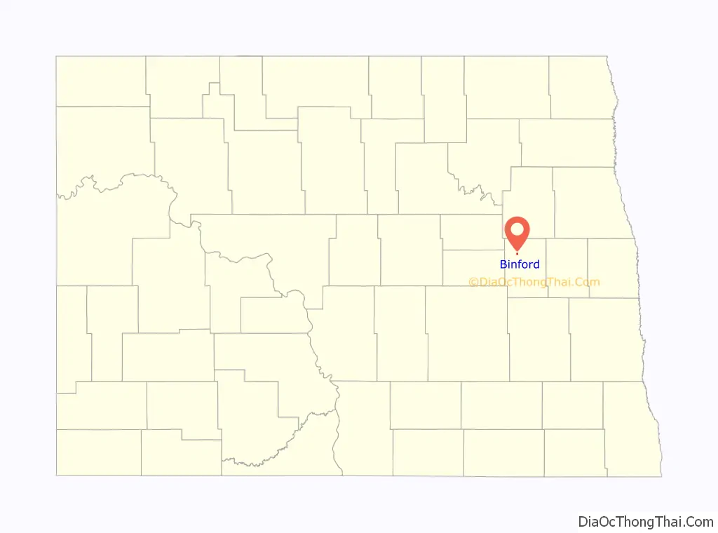
| County: | Griggs County |
| Founded: | 1899 |
| Elevation: | 1,526 ft (465 m) |
| Total Area: | 0.35 sq mi (0.91 km²) |
| Land Area: | 0.35 sq mi (0.91 km²) |
| Water Area: | 0.00 sq mi (0.00 km²) |
| Total Population: | 170 |
| Population Density: | 481.59/sq mi (185.89/km²) |
| ZIP code: | 58416 |
| Area code: | 701 |
| FIPS code: | 3807020 |
| GNISfeature ID: | 1028008 |
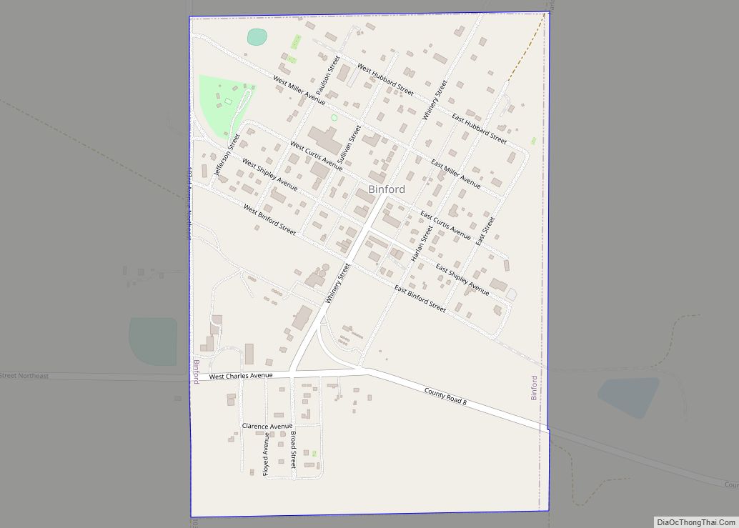
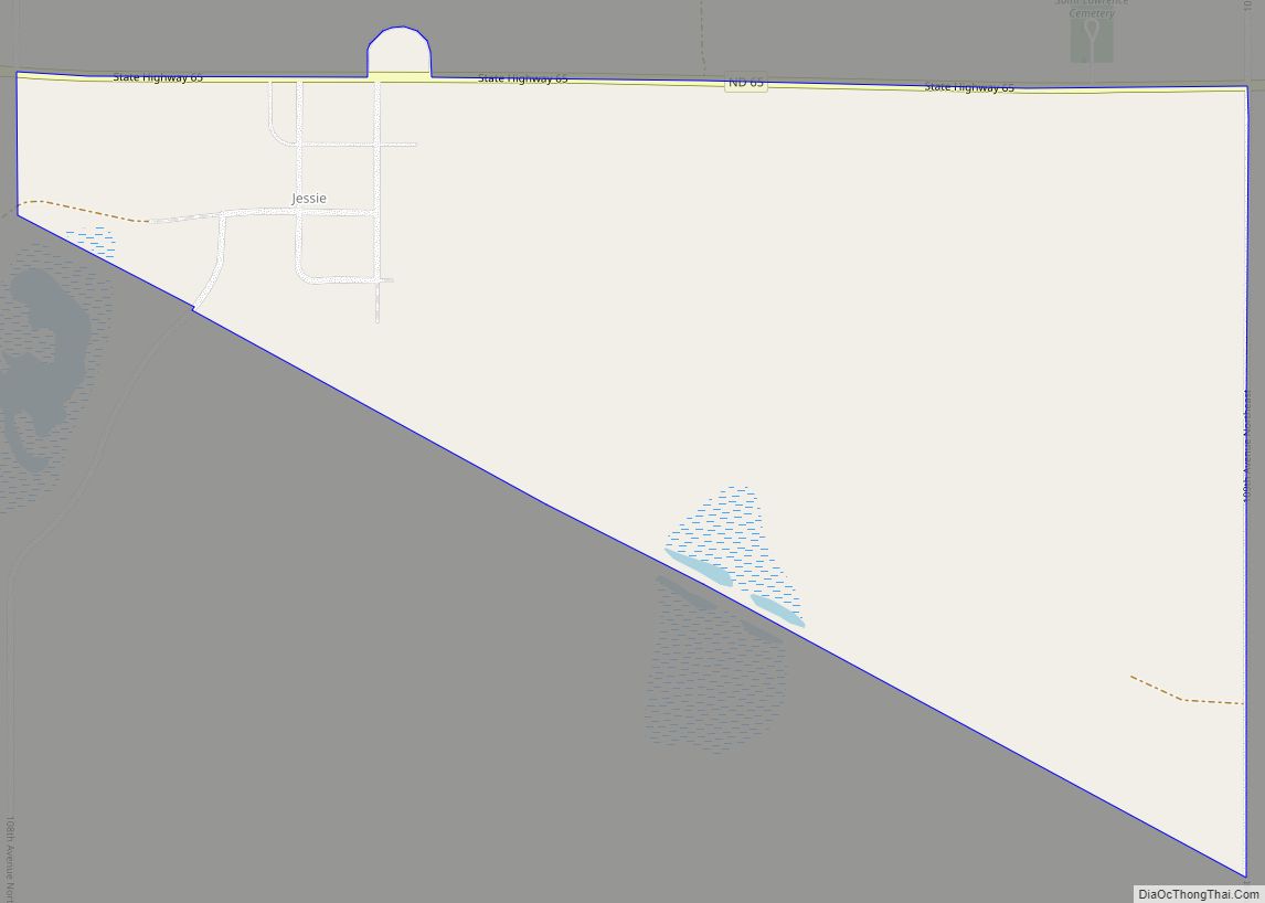
Online Interactive Map
Click on ![]() to view map in "full screen" mode.
to view map in "full screen" mode.
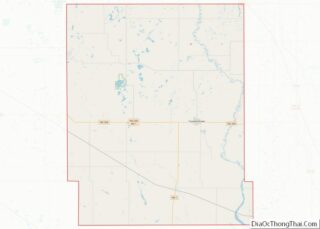
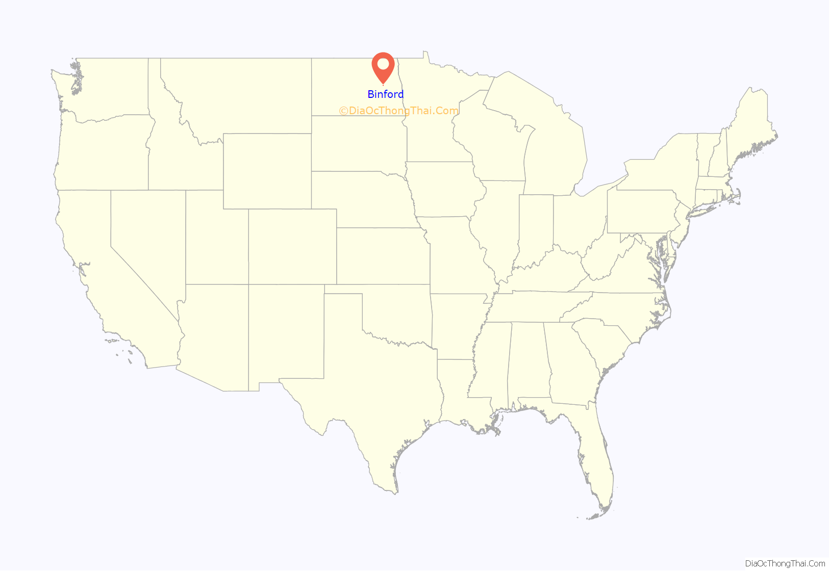
Binford location map. Where is Binford city?
History
The Johnson Land Company of Iowa purchased a flax field owned by Gabriel Gabrielson when the Northern Pacific Railway laid its tracks in 1899. The town of “Blooming Prairie” was renamed Binford after attorney Ray Binford of Charles City, Iowa who handled the Land Company’s purchase.
In the fall of 1899, a lumberyard and general store opened. A hotel was built in 1900. In 1905, Binford had its own newspaper, a bank, grain elevator, a hardware store, two groceries, a couple of pool hall-bowling alleys, two churches, and various other establishments.
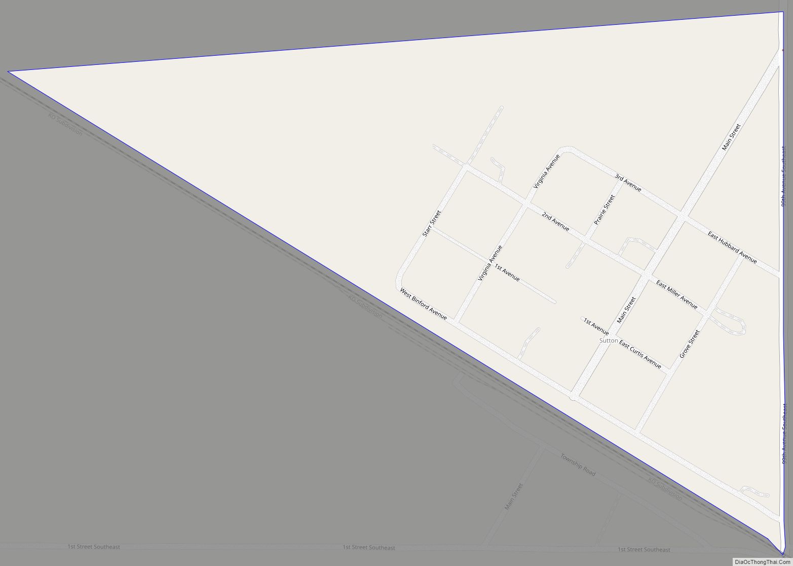
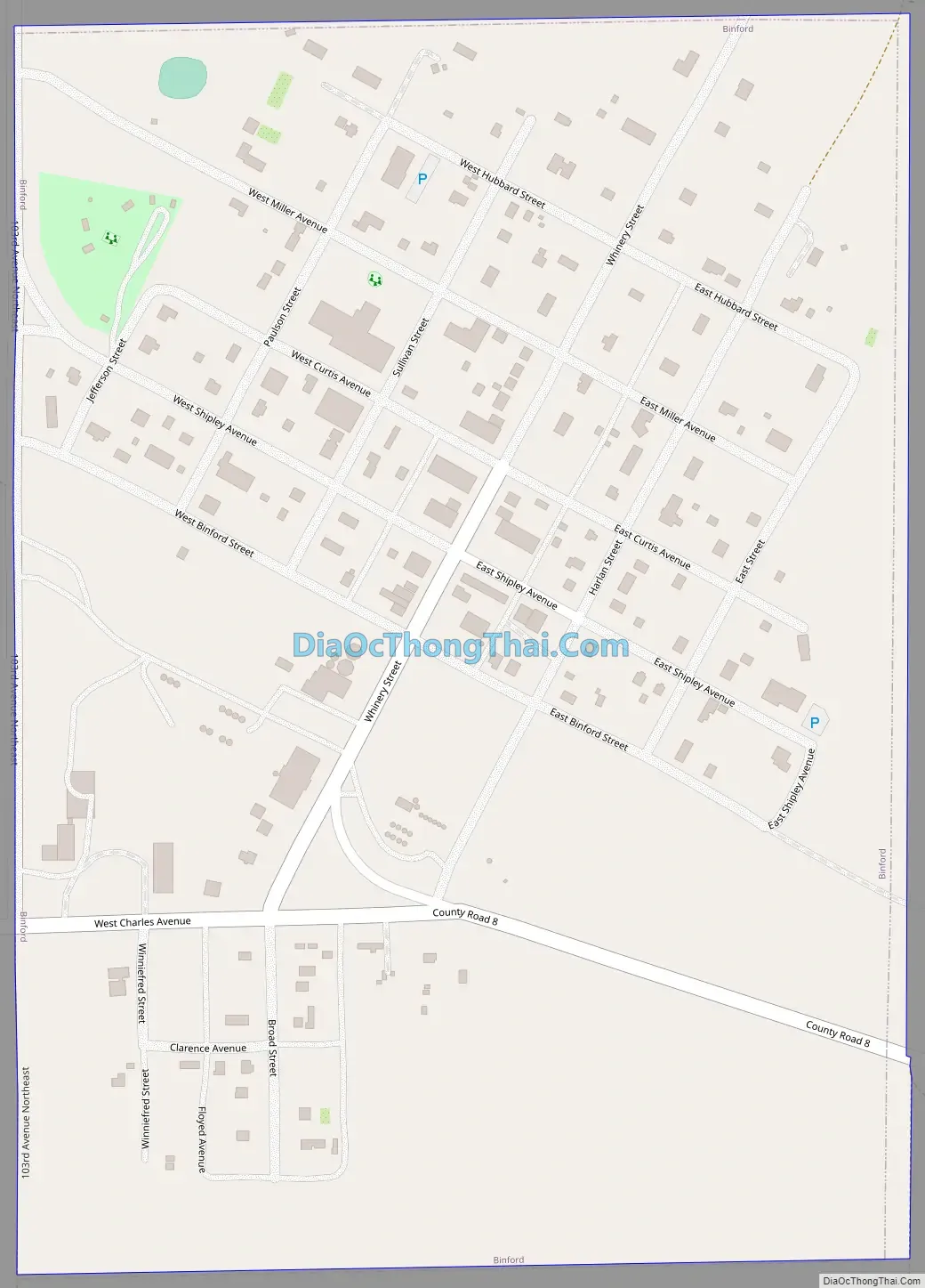
Binford Road Map
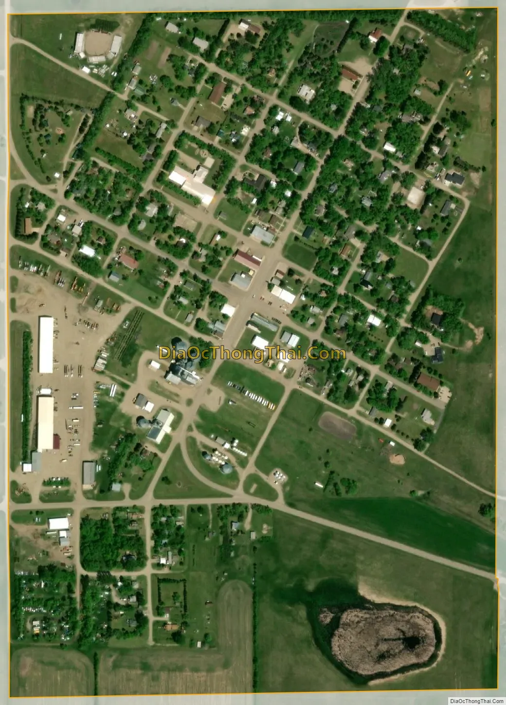
Binford city Satellite Map
Geography
Binford is located at 47°33′39″N 98°20′48″W / 47.56083°N 98.34667°W / 47.56083; -98.34667 (47.560954, -98.346733).
According to the United States Census Bureau, the city has a total area of 0.35 square miles (0.91 km), all land.
The city is located approximately one mile west of North Dakota Highway 1, which is one of the busier ND highways.
See also
Map of North Dakota State and its subdivision:- Adams
- Barnes
- Benson
- Billings
- Bottineau
- Bowman
- Burke
- Burleigh
- Cass
- Cavalier
- Dickey
- Divide
- Dunn
- Eddy
- Emmons
- Foster
- Golden Valley
- Grand Forks
- Grant
- Griggs
- Hettinger
- Kidder
- Lamoure
- Logan
- McHenry
- McIntosh
- McKenzie
- McLean
- Mercer
- Morton
- Mountrail
- Nelson
- Oliver
- Pembina
- Pierce
- Ramsey
- Ransom
- Renville
- Richland
- Rolette
- Sargent
- Sheridan
- Sioux
- Slope
- Stark
- Steele
- Stutsman
- Towner
- Traill
- Walsh
- Ward
- Wells
- Williams
- Alabama
- Alaska
- Arizona
- Arkansas
- California
- Colorado
- Connecticut
- Delaware
- District of Columbia
- Florida
- Georgia
- Hawaii
- Idaho
- Illinois
- Indiana
- Iowa
- Kansas
- Kentucky
- Louisiana
- Maine
- Maryland
- Massachusetts
- Michigan
- Minnesota
- Mississippi
- Missouri
- Montana
- Nebraska
- Nevada
- New Hampshire
- New Jersey
- New Mexico
- New York
- North Carolina
- North Dakota
- Ohio
- Oklahoma
- Oregon
- Pennsylvania
- Rhode Island
- South Carolina
- South Dakota
- Tennessee
- Texas
- Utah
- Vermont
- Virginia
- Washington
- West Virginia
- Wisconsin
- Wyoming