Casselton is a city in Cass County, North Dakota, United States. The population was 2,479 at the 2020 census. making it the 20th largest city in North Dakota. Casselton was founded in 1876. The city is named in honor of George Washington Cass, a president of the Northern Pacific Railway, which established a station there in 1876 to develop a town for homesteaders. Casselton is the hometown of five North Dakota governors.
| Name: | Casselton city |
|---|---|
| LSAD Code: | 25 |
| LSAD Description: | city (suffix) |
| State: | North Dakota |
| County: | Cass County |
| Elevation: | 935 ft (285 m) |
| Total Area: | 1.98 sq mi (5.14 km²) |
| Land Area: | 1.95 sq mi (5.06 km²) |
| Water Area: | 0.03 sq mi (0.08 km²) |
| Total Population: | 2,479 |
| Population Density: | 1,269.33/sq mi (490.05/km²) |
| ZIP code: | 58012 |
| Area code: | 701 |
| FIPS code: | 3812700 |
| GNISfeature ID: | 1028294 |
| Website: | casselton.com |
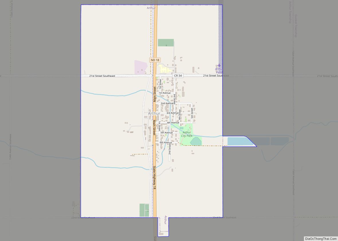
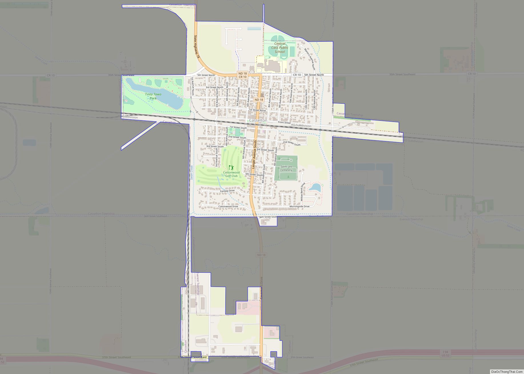
Online Interactive Map
Click on ![]() to view map in "full screen" mode.
to view map in "full screen" mode.
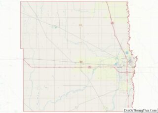
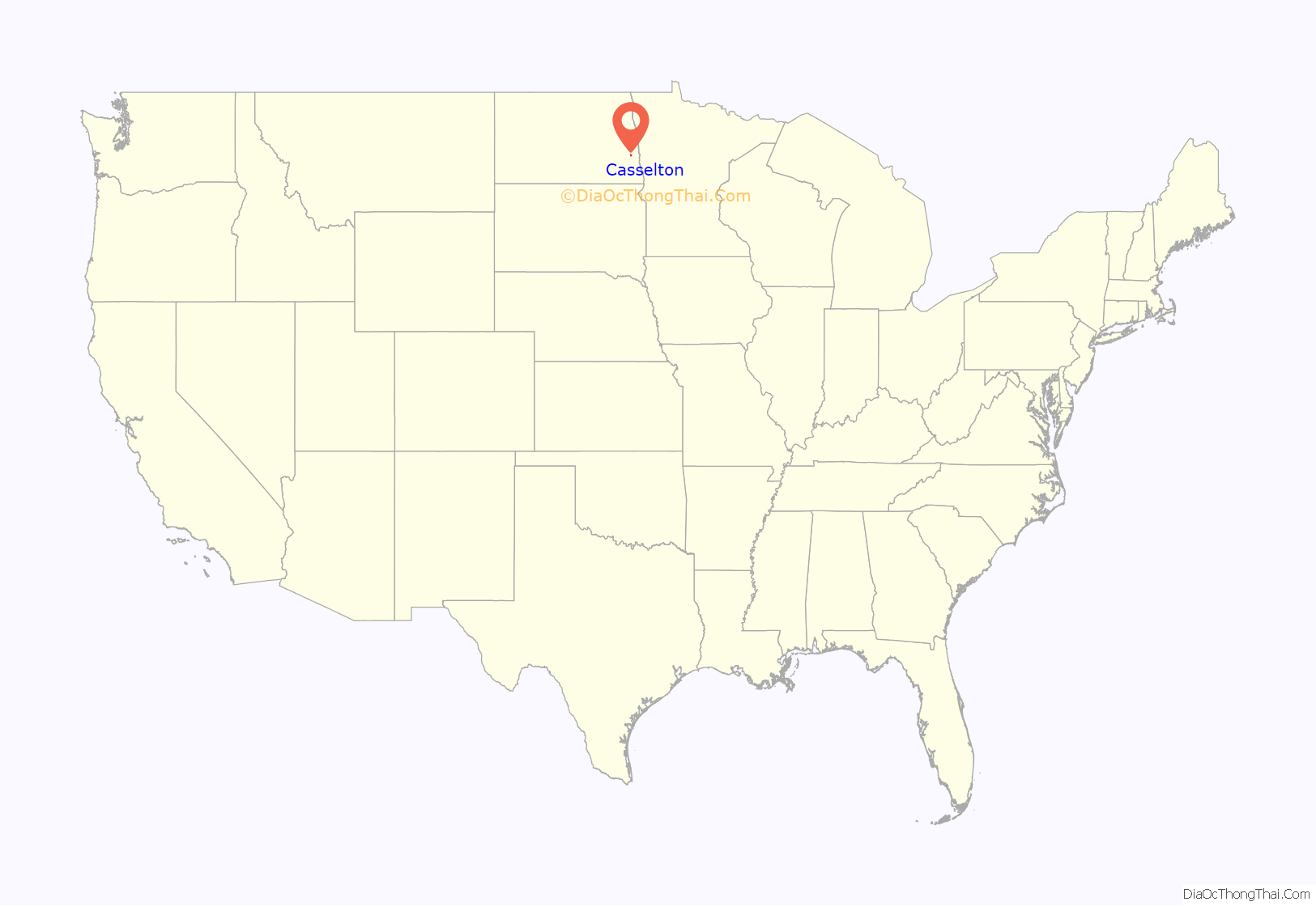
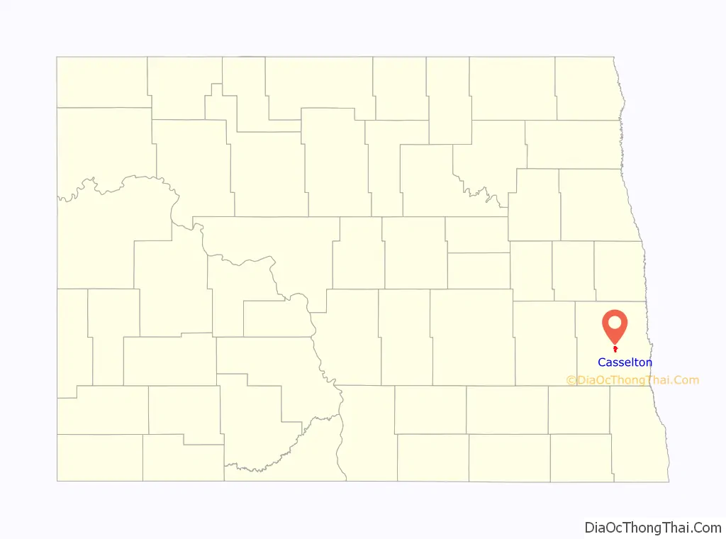
Casselton location map. Where is Casselton city?
History
Casselton had its origin in 1873 when the Northern Pacific Railway sent Mike Smith to plant cottonwood and willow trees in the area to serve as windbreaks along the right-of-way. They planned to harvest the trees for lumber to use as railroad ties, but the experiment failed for a number of reasons.
In 1874, Emil Priewe and his wife joined Mike Smith at the station. The Priewe’s son, Harry, was born on March 28, 1875, in a sod shanty, the first child born in the developing village. Others came to settle and by 1880, the town had a population of 376, according to the official census. A school was organized in 1876 and the town was incorporated as a village in 1880.
The hamlet was variously called “the Nursery”, “Goose Creek” and “Swan Creek”, named for the stream that meandered through the area. In 1876, the railroad established a station called Casstown, after George Cass, the railroad president. When the post office was established on August 8, 1876, the name Casselton was designated.
During the 1870s, George Cass and Peter Cheney traded their railroad stock for 10,000 acres (40 km) of land near Casselton and decided to develop the property as one large farm, rather than dividing the land into small tracts. They employed Oliver Dalrymple, of southern Minnesota, to head the operation. These Bonanza farms became highly successful and proved that the prairie was very suitable for agriculture.
Various means were used to attract immigrants from Europe and migrants from the East looking for a piece of land or the chance to become tradesmen and professionals. Casselton’s population reached 1365 in 1885.
The Great Northern Railway had an additional influence in the growth of Casselton. Several branches radiated from the city. The railroad excavated a reservoir to supply water for its steam engines. In 1906 the railway constructed a round house and service center which operated until 1920. In the 1920s, railroad personnel were transferred to other locations, and as a result, the population of Casselton fell 285 persons between 1920 and 1930.
Casselton installed a city water and sewer system in the mid-1920s. Water was pumped from artesian wells, and stored in a standpipe which was located on the east part of town. Today, that site is used as a winter skating rink. Looking like a gigantic culvert, the standpipe was 110 feet (34 m) tall and was kept until 1956.
By 1957, the Great Northern Railway no longer had a need for the Casselton reservoir. They deeded the 73 acres (300,000 m) of land, which encompassed that body of water, to the City of Casselton. The reservoir was developed to be used as a municipal water supply until March 1978, when the city’s water started to come from the Leonard Phase of the Cass Water Users System. The reservoir area has since been developed into a recreational center with softball diamonds, tennis courts, picnic tables and the like.
The streets of Casselton were improved through municipal and state efforts. In 1927, the downtown roads were graveled. In 1930, as a US Works Progress Administration project under the President Franklin D. Roosevelt administration during the Great Depression, the federal government paid local workers to pave State Highway No. 18 through the city. After World War II, the business district streets were paved with concrete. Since that time, all streets and avenues have been hard-topped, and a modern storm sewer system was installed at the same time.
The 1996–1997 school year opened with a newly completed, nearly $8 million Central Cass Public School building. It replaced a three-story building on the same site, that was dedicated in 1912 and cost $50,000. The school district covers nearly 400 square miles (1,000 km), and attracts over 800 students. Because of the continued growth, an addition to the school complex was completed in time for the 2003–2004 school year.
Casselton is known for its population of American red squirrels. Central Cass High School uses the squirrel as its mascot.
2013 train derailment
On December 30, 2013, a westbound BNSF train carrying soybeans derailed approximately one mile west of Casselton. An adjacent eastbound BNSF train carrying crude oil struck wreckage from the westbound train (accident location 46°54′4.82″N 97°13′59.42″W / 46.9013389°N 97.2331722°W / 46.9013389; -97.2331722). The collision ignited the crude oil and caused a chain of large explosions, which were heard and felt several miles away. The resulting fireball created a massive cloud of black smoke, which prompted authorities to issue a voluntary evacuation of the city and surrounding area as a precaution. The National Transportation Safety Board conducted an investigation, and in 2017 issued findings of probable cause, starting with a broken axle on the westbound train.
Although no casualties were reported, as the crew of the crude oil train abandoned the lead locomotives before they were engulfed in flames as soon as they had derailed and come to stop in a snowbank, the incident occurred in proximity to a populated area and renewed safety concerns regarding the transportation of hazardous materials by rail, especially in the wake of the Lac-Mégantic derailment in Canada earlier in the year. Casselton mayor Ed McConnell, acknowledging that the town “dodged a bullet”, publicly called on the federal government to review the dangers and urged lawmakers to consider pipelines as a safer option.
Casselton Road Map
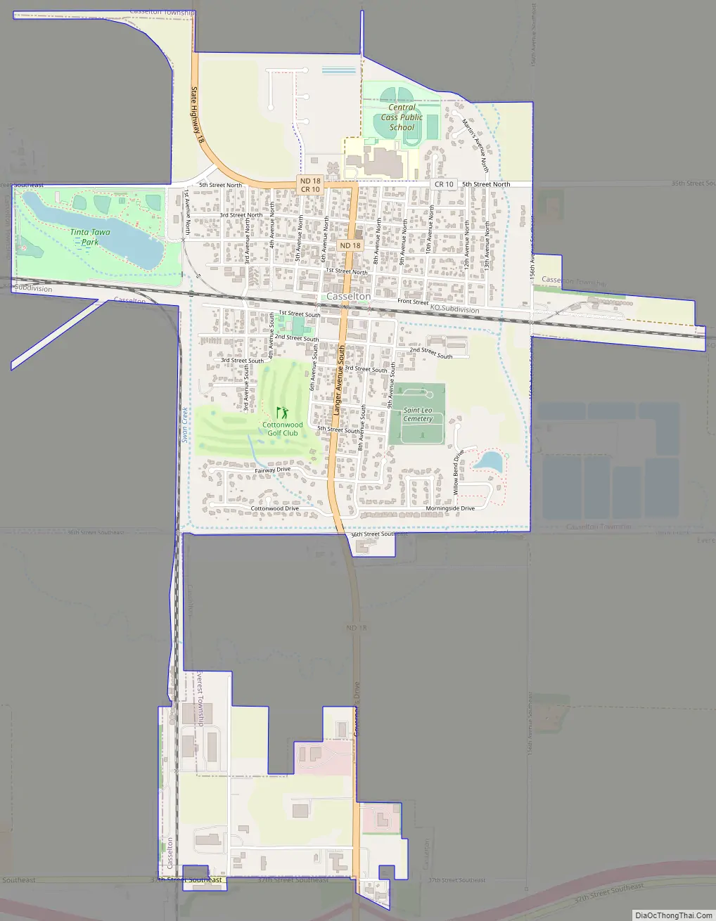
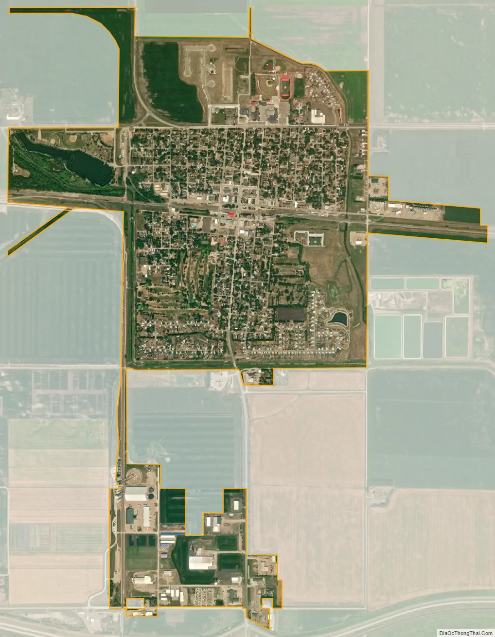
Casselton city Satellite Map
Geography
Casselton is located at 46°54′0″N 97°12′38″W / 46.90000°N 97.21056°W / 46.90000; -97.21056 (46.900028, −97.210668). According to the United States Census Bureau, the city has a total area of 1.90 square miles (4.92 km), of which 1.87 square miles (4.84 km) is land and 0.03 square miles (0.08 km) is water.
See also
Map of North Dakota State and its subdivision:- Adams
- Barnes
- Benson
- Billings
- Bottineau
- Bowman
- Burke
- Burleigh
- Cass
- Cavalier
- Dickey
- Divide
- Dunn
- Eddy
- Emmons
- Foster
- Golden Valley
- Grand Forks
- Grant
- Griggs
- Hettinger
- Kidder
- Lamoure
- Logan
- McHenry
- McIntosh
- McKenzie
- McLean
- Mercer
- Morton
- Mountrail
- Nelson
- Oliver
- Pembina
- Pierce
- Ramsey
- Ransom
- Renville
- Richland
- Rolette
- Sargent
- Sheridan
- Sioux
- Slope
- Stark
- Steele
- Stutsman
- Towner
- Traill
- Walsh
- Ward
- Wells
- Williams
- Alabama
- Alaska
- Arizona
- Arkansas
- California
- Colorado
- Connecticut
- Delaware
- District of Columbia
- Florida
- Georgia
- Hawaii
- Idaho
- Illinois
- Indiana
- Iowa
- Kansas
- Kentucky
- Louisiana
- Maine
- Maryland
- Massachusetts
- Michigan
- Minnesota
- Mississippi
- Missouri
- Montana
- Nebraska
- Nevada
- New Hampshire
- New Jersey
- New Mexico
- New York
- North Carolina
- North Dakota
- Ohio
- Oklahoma
- Oregon
- Pennsylvania
- Rhode Island
- South Carolina
- South Dakota
- Tennessee
- Texas
- Utah
- Vermont
- Virginia
- Washington
- West Virginia
- Wisconsin
- Wyoming