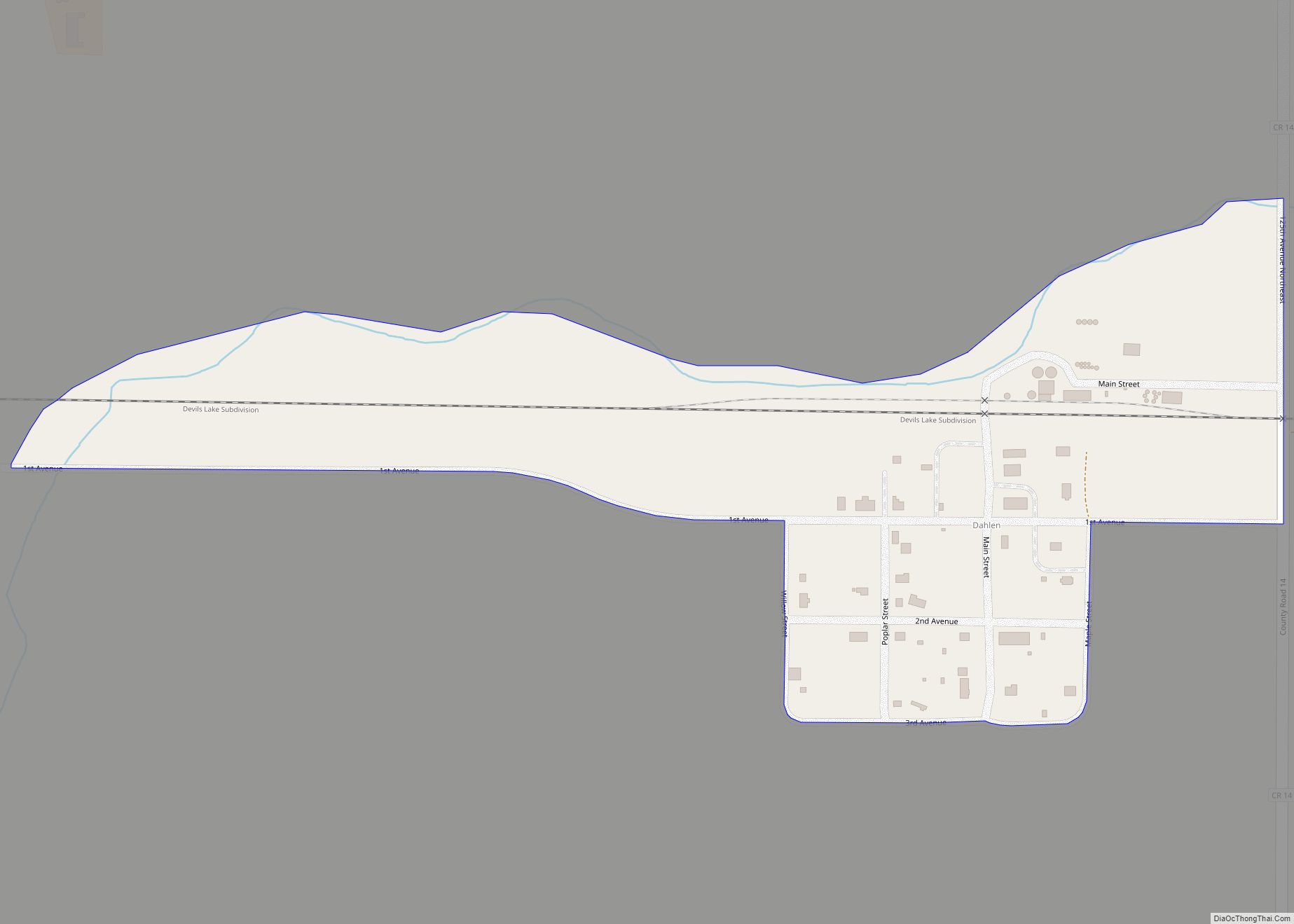
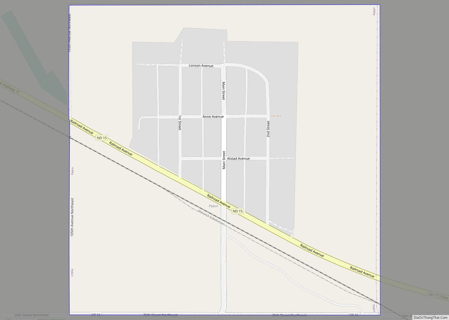
Dahlen (Urban East Norwegian: [ˈdɑːɳ]) is a census-designated place and an unincorporated community in Nelson County, North Dakota, United States. It was designated as part of the United States Census Bureau’s Participant Statistical Areas Program on March 31, 2010. It was not counted separately during the 2000 census, but was included in the 2010 census, where a population of 18 was reported. The population was 17 at the 2020 census.
Dahlen is also the home to North Dakota’s third tallest tower, the WDAZ TV Tower, which is 445.2 meters (1,461 feet) tall. The tower is used by television station WDAZ of Grand Forks. The tower was also used by KGFE of Grand Forks until an ice storm damaged equipment in 2004.
| Name: | Dahlen CDP |
|---|---|
| LSAD Code: | 57 |
| LSAD Description: | CDP (suffix) |
| State: | North Dakota |
| County: | Nelson County |
| Founded: | 1912 |
| Elevation: | 1,414 ft (431 m) |
| Total Area: | 0.14 sq mi (0.36 km²) |
| Land Area: | 0.14 sq mi (0.36 km²) |
| Water Area: | 0.00 sq mi (0.00 km²) |
| Total Population: | 17 |
| Population Density: | 121.43/sq mi (46.96/km²) |
| ZIP code: | 58224 |
| Area code: | 701 |
| FIPS code: | 3817620 |
| GNISfeature ID: | 2584339 |
Online Interactive Map
Click on ![]() to view map in "full screen" mode.
to view map in "full screen" mode.
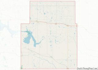
Dahlen location map. Where is Dahlen CDP?
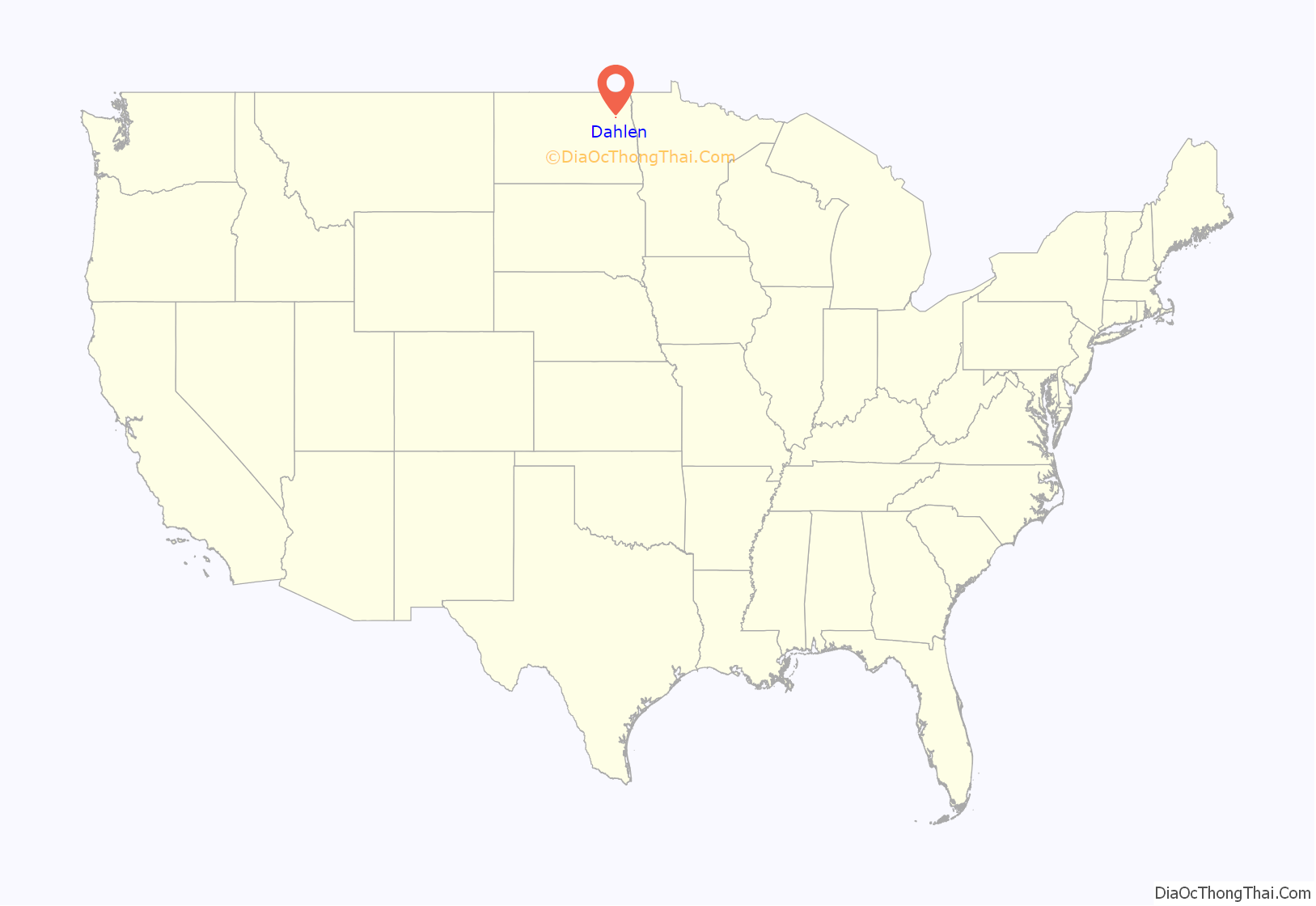
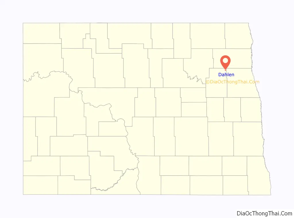
Dahlen Road Map
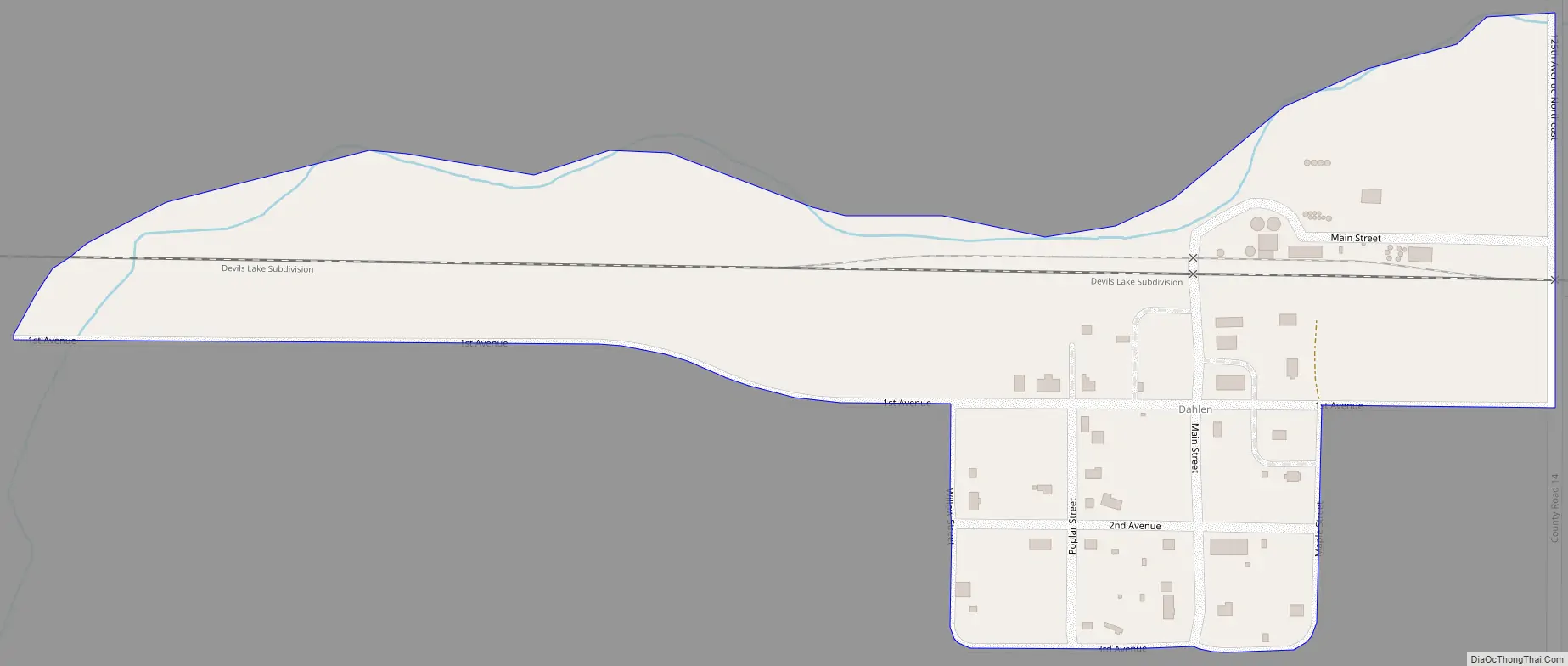
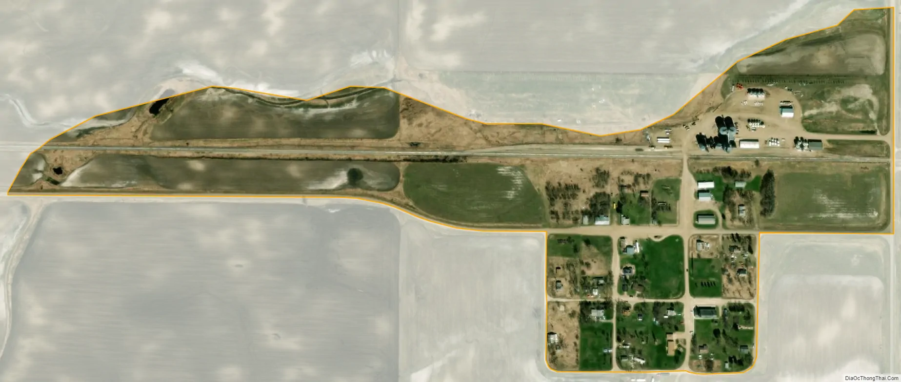
Dahlen city Satellite Map
See also
Map of North Dakota State and its subdivision:- Adams
- Barnes
- Benson
- Billings
- Bottineau
- Bowman
- Burke
- Burleigh
- Cass
- Cavalier
- Dickey
- Divide
- Dunn
- Eddy
- Emmons
- Foster
- Golden Valley
- Grand Forks
- Grant
- Griggs
- Hettinger
- Kidder
- Lamoure
- Logan
- McHenry
- McIntosh
- McKenzie
- McLean
- Mercer
- Morton
- Mountrail
- Nelson
- Oliver
- Pembina
- Pierce
- Ramsey
- Ransom
- Renville
- Richland
- Rolette
- Sargent
- Sheridan
- Sioux
- Slope
- Stark
- Steele
- Stutsman
- Towner
- Traill
- Walsh
- Ward
- Wells
- Williams
- Alabama
- Alaska
- Arizona
- Arkansas
- California
- Colorado
- Connecticut
- Delaware
- District of Columbia
- Florida
- Georgia
- Hawaii
- Idaho
- Illinois
- Indiana
- Iowa
- Kansas
- Kentucky
- Louisiana
- Maine
- Maryland
- Massachusetts
- Michigan
- Minnesota
- Mississippi
- Missouri
- Montana
- Nebraska
- Nevada
- New Hampshire
- New Jersey
- New Mexico
- New York
- North Carolina
- North Dakota
- Ohio
- Oklahoma
- Oregon
- Pennsylvania
- Rhode Island
- South Carolina
- South Dakota
- Tennessee
- Texas
- Utah
- Vermont
- Virginia
- Washington
- West Virginia
- Wisconsin
- Wyoming