Grafton is a city in the State of North Dakota and is the county seat of Walsh County. As of the 2020 Census, the city of Grafton had a population of 4,170, making it the fifteenth largest city in North Dakota. Grafton was founded in 1881.
| Name: | Grafton city |
|---|---|
| LSAD Code: | 25 |
| LSAD Description: | city (suffix) |
| State: | North Dakota |
| County: | Walsh County |
| Founded: | 1881 |
| Elevation: | 830 ft (253 m) |
| Total Area: | 3.57 sq mi (9.24 km²) |
| Land Area: | 3.30 sq mi (8.55 km²) |
| Water Area: | 0.26 sq mi (0.68 km²) |
| Total Population: | 4,170 |
| Population Density: | 1,262.49/sq mi (487.47/km²) |
| ZIP code: | 58237 |
| Area code: | 701 |
| FIPS code: | 3831820 |
| GNISfeature ID: | 1029194 |
| Website: | graftongov.com |
Online Interactive Map
Click on ![]() to view map in "full screen" mode.
to view map in "full screen" mode.
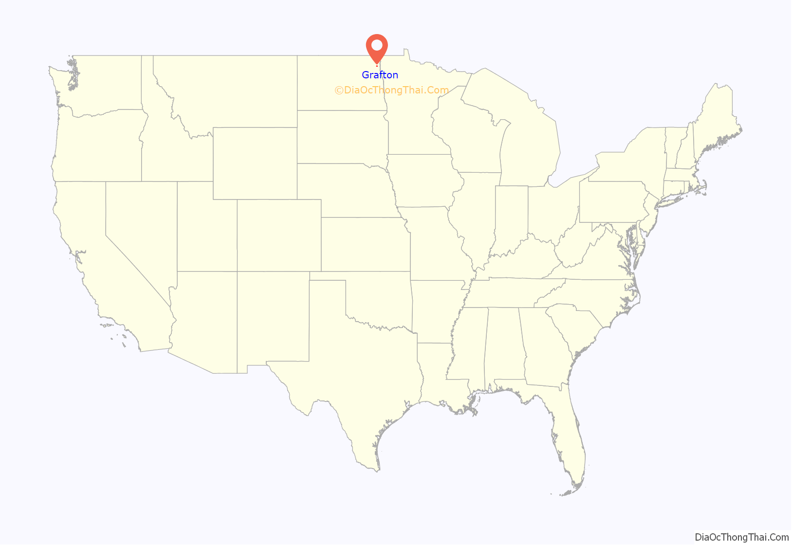
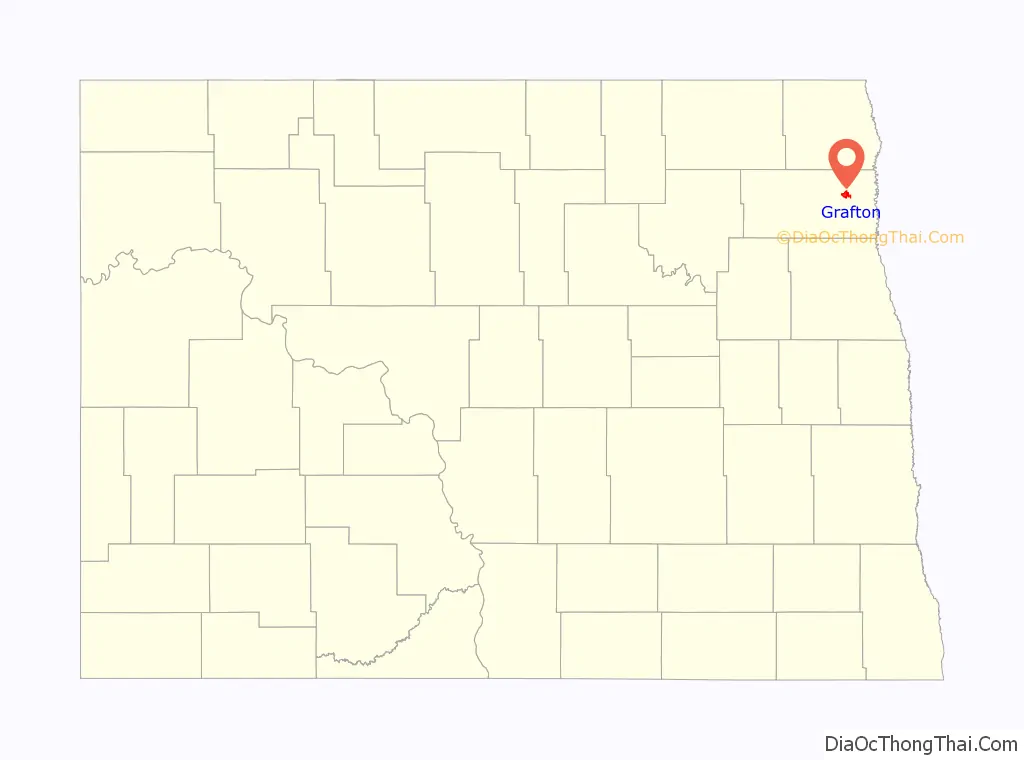
Grafton location map. Where is Grafton city?
History
The Grafton area was homesteaded by Nils Monson. Nils Monson was a 29-year-old bachelor who walked to the area from Winnipeg in the fall of 1878 to homestead. He was the first to deed his 160-acre homestead to the town. The Grafton area was later settled by Thomas E Cooper in early 1879. He became postmaster later that year when a post office was constructed as part of expansions in service for the Northern Pacific Railway and the Great Northern Railway. It was incorporated as a village in 1881 and then became a city in 1903. In 1881, Walsh County was established and Grafton was subsequently designated the county seat. The city was named for Grafton County, New Hampshire, the native home of a large share of its early settlers.
The Grafton State School, a home for the developmentally disabled, is listed on the National Register of Historic Places.
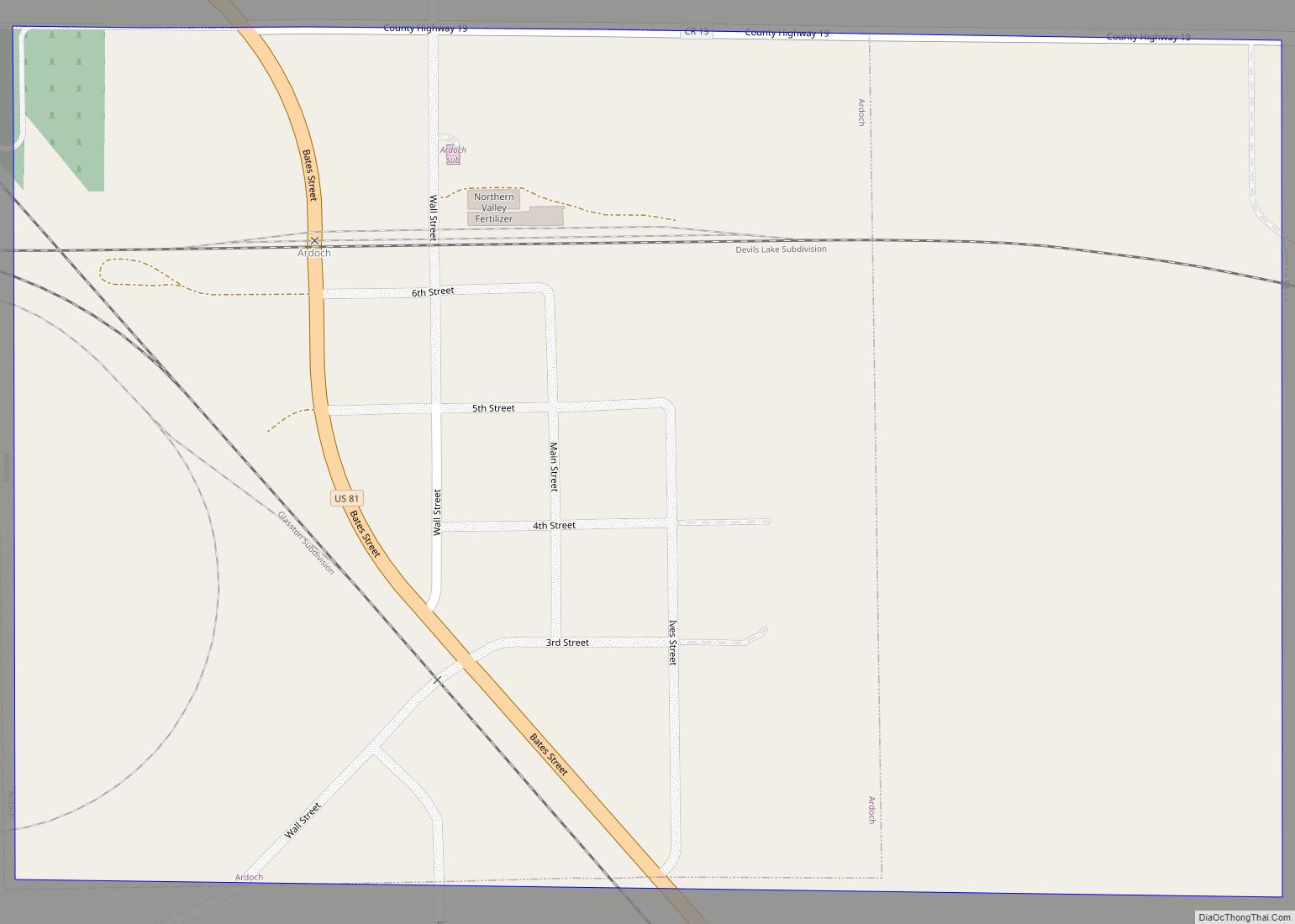
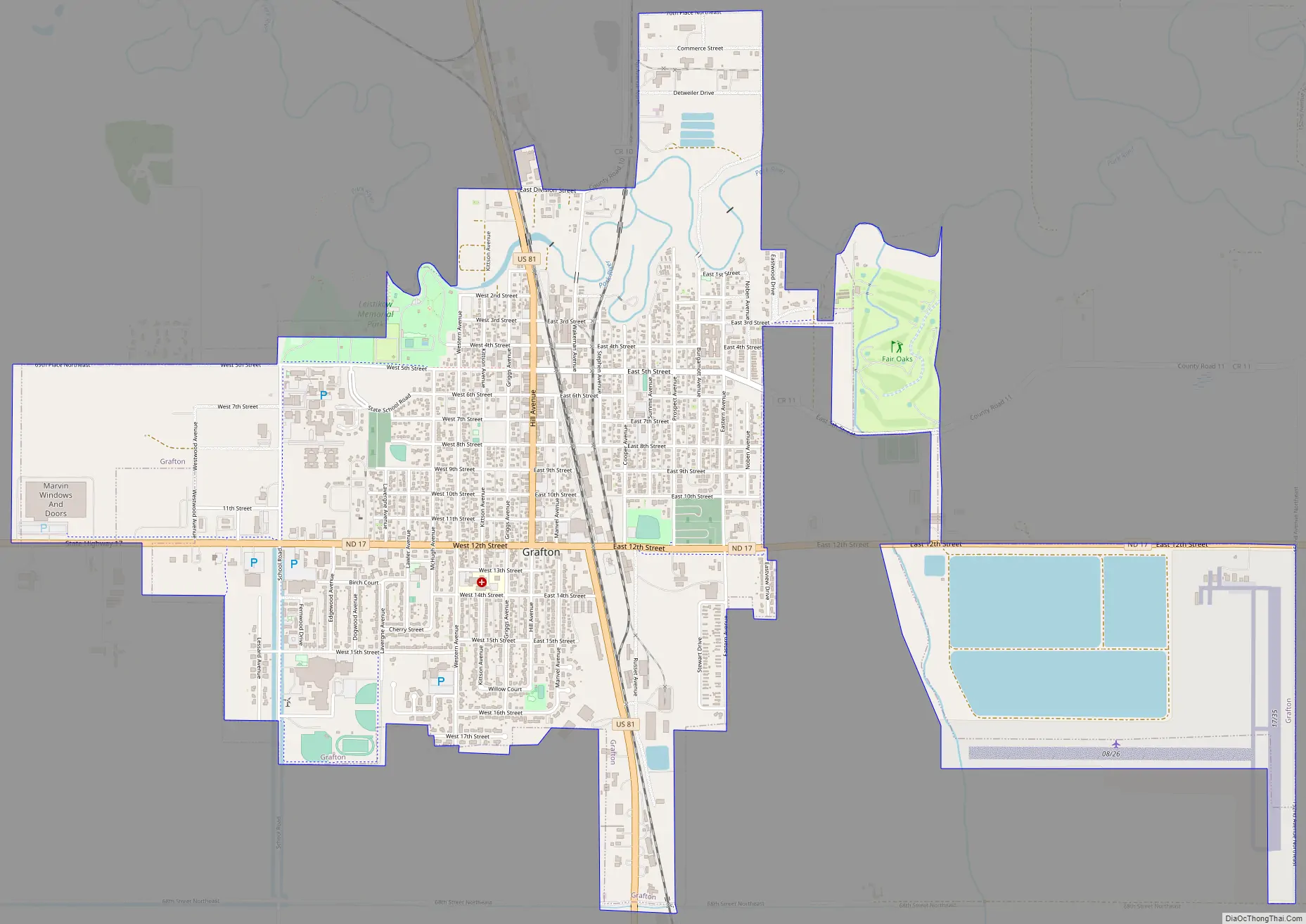
Grafton Road Map
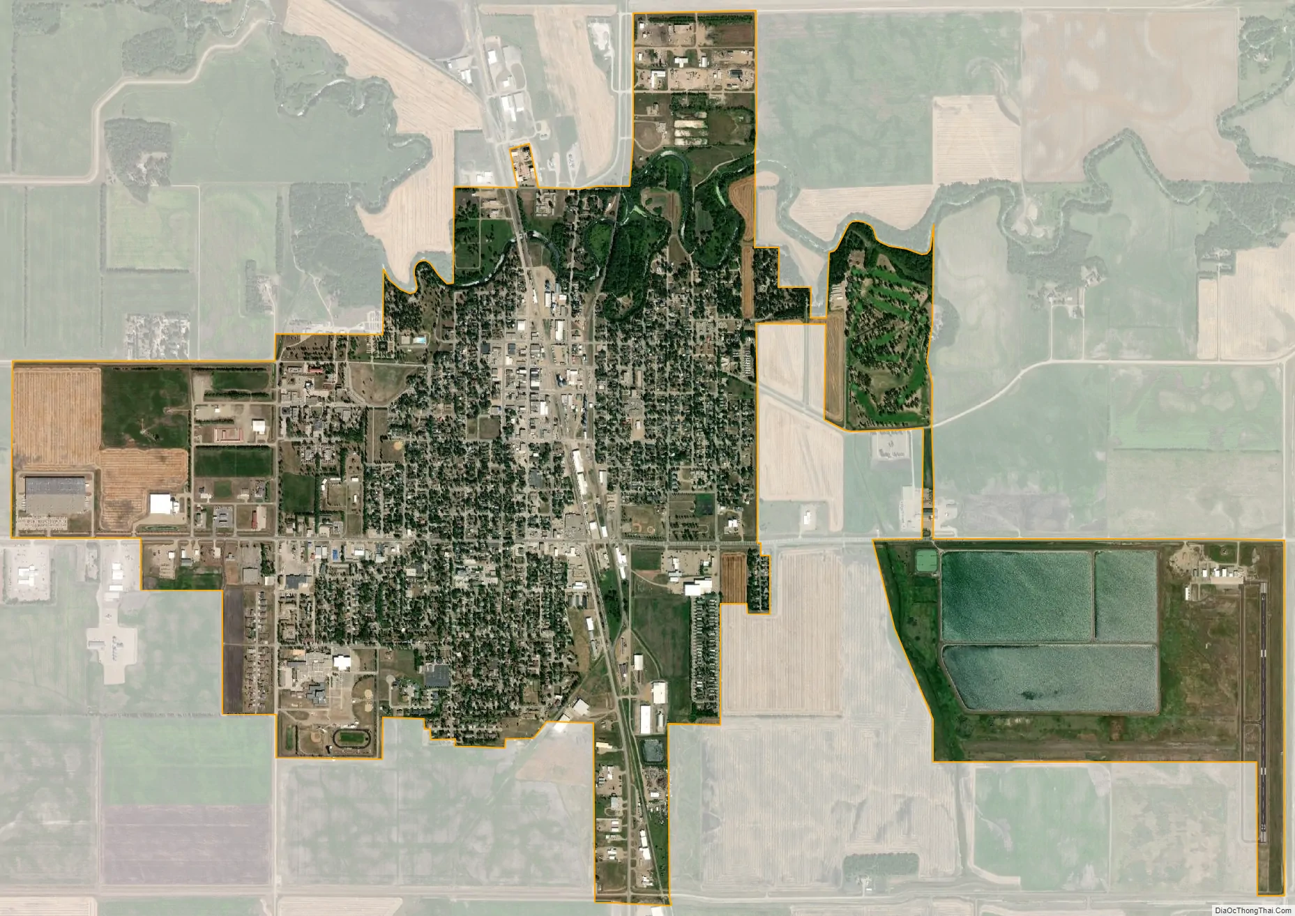
Grafton city Satellite Map
Geography
Grafton is located at 48°24′58″N 97°24′38″W / 48.416082°N 97.410633°W / 48.416082; -97.410633 (48.416082, −97.410633).
According to the United States Census Bureau, the city has a total area of 3.40 square miles (8.81 km), all land.
See also
Map of North Dakota State and its subdivision:- Adams
- Barnes
- Benson
- Billings
- Bottineau
- Bowman
- Burke
- Burleigh
- Cass
- Cavalier
- Dickey
- Divide
- Dunn
- Eddy
- Emmons
- Foster
- Golden Valley
- Grand Forks
- Grant
- Griggs
- Hettinger
- Kidder
- Lamoure
- Logan
- McHenry
- McIntosh
- McKenzie
- McLean
- Mercer
- Morton
- Mountrail
- Nelson
- Oliver
- Pembina
- Pierce
- Ramsey
- Ransom
- Renville
- Richland
- Rolette
- Sargent
- Sheridan
- Sioux
- Slope
- Stark
- Steele
- Stutsman
- Towner
- Traill
- Walsh
- Ward
- Wells
- Williams
- Alabama
- Alaska
- Arizona
- Arkansas
- California
- Colorado
- Connecticut
- Delaware
- District of Columbia
- Florida
- Georgia
- Hawaii
- Idaho
- Illinois
- Indiana
- Iowa
- Kansas
- Kentucky
- Louisiana
- Maine
- Maryland
- Massachusetts
- Michigan
- Minnesota
- Mississippi
- Missouri
- Montana
- Nebraska
- Nevada
- New Hampshire
- New Jersey
- New Mexico
- New York
- North Carolina
- North Dakota
- Ohio
- Oklahoma
- Oregon
- Pennsylvania
- Rhode Island
- South Carolina
- South Dakota
- Tennessee
- Texas
- Utah
- Vermont
- Virginia
- Washington
- West Virginia
- Wisconsin
- Wyoming