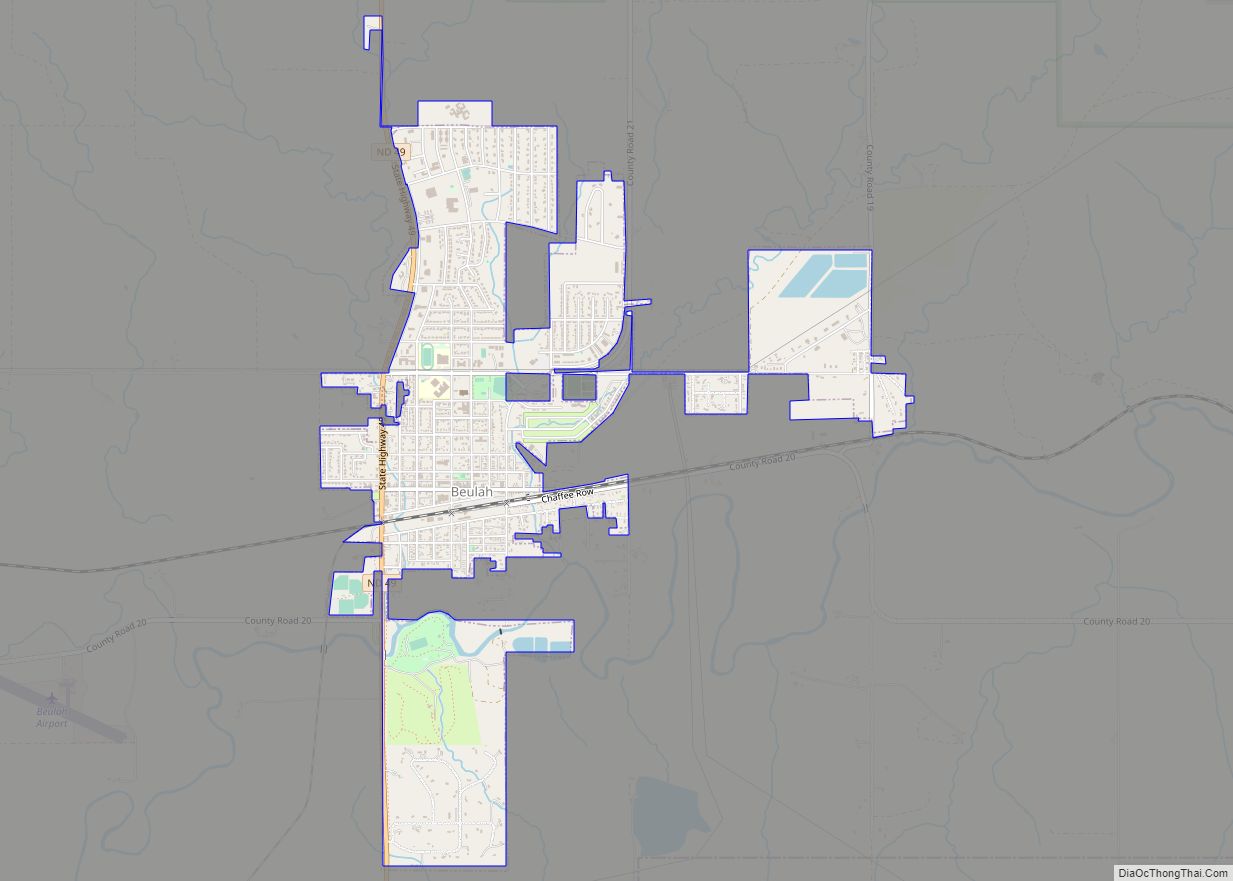
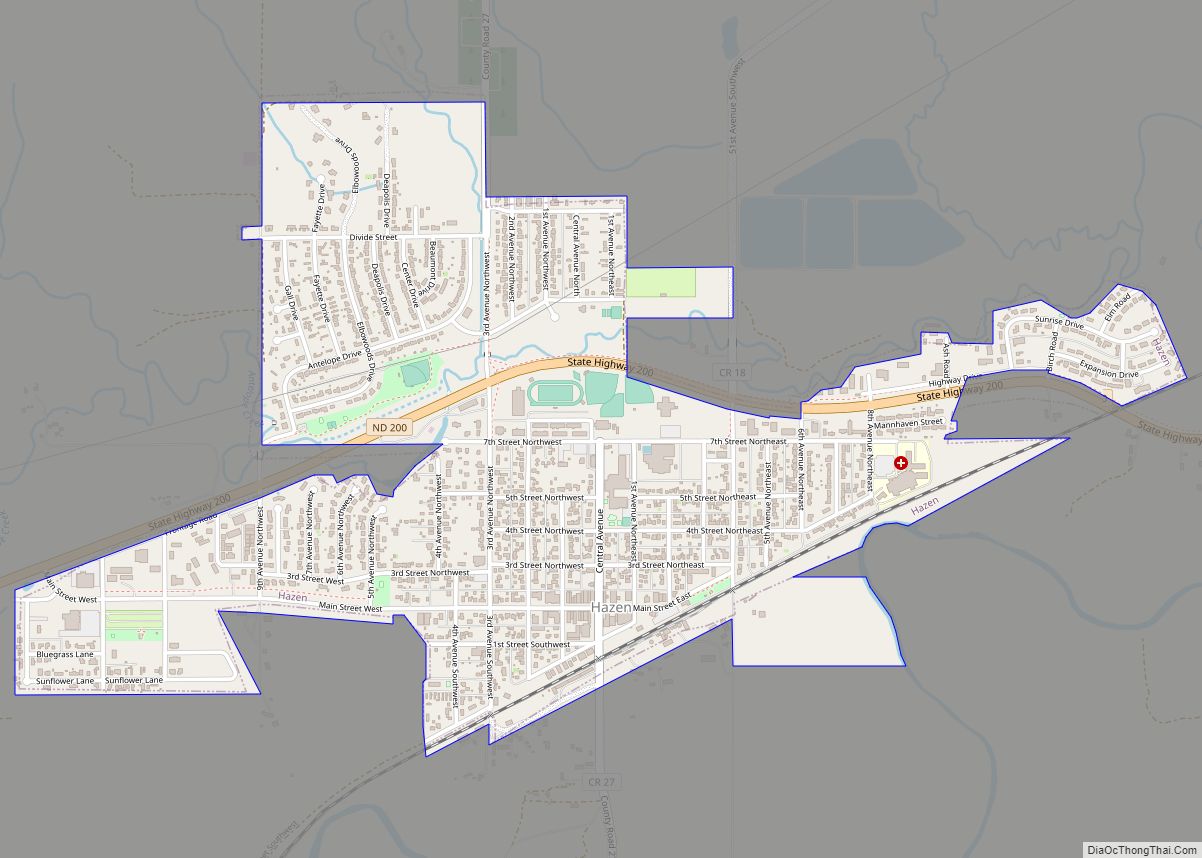
Hazen is a city in Mercer County, North Dakota, United States. The population was 2,281 at the 2020 census. Hazen was founded in 1913. Hazen has a K–12 school system.
It is located about fifteen minutes south of Lake Sakakawea, the largest lake in North Dakota and the third largest man-made lake in the United States.
| Name: | Hazen city |
|---|---|
| LSAD Code: | 25 |
| LSAD Description: | city (suffix) |
| State: | North Dakota |
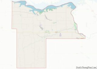
| County: | Mercer County |
| Elevation: | 1,742 ft (531 m) |
| Total Area: | 1.41 sq mi (3.66 km²) |
| Land Area: | 1.41 sq mi (3.65 km²) |
| Water Area: | 0.01 sq mi (0.01 km²) |
| Total Population: | 2,281 |
| Population Density: | 1,620.03/sq mi (625.68/km²) |
| ZIP code: | 58545 |
| Area code: | 701 |
| FIPS code: | 3836780 |
| GNISfeature ID: | 1029361 |
| Website: | hazennd.org |
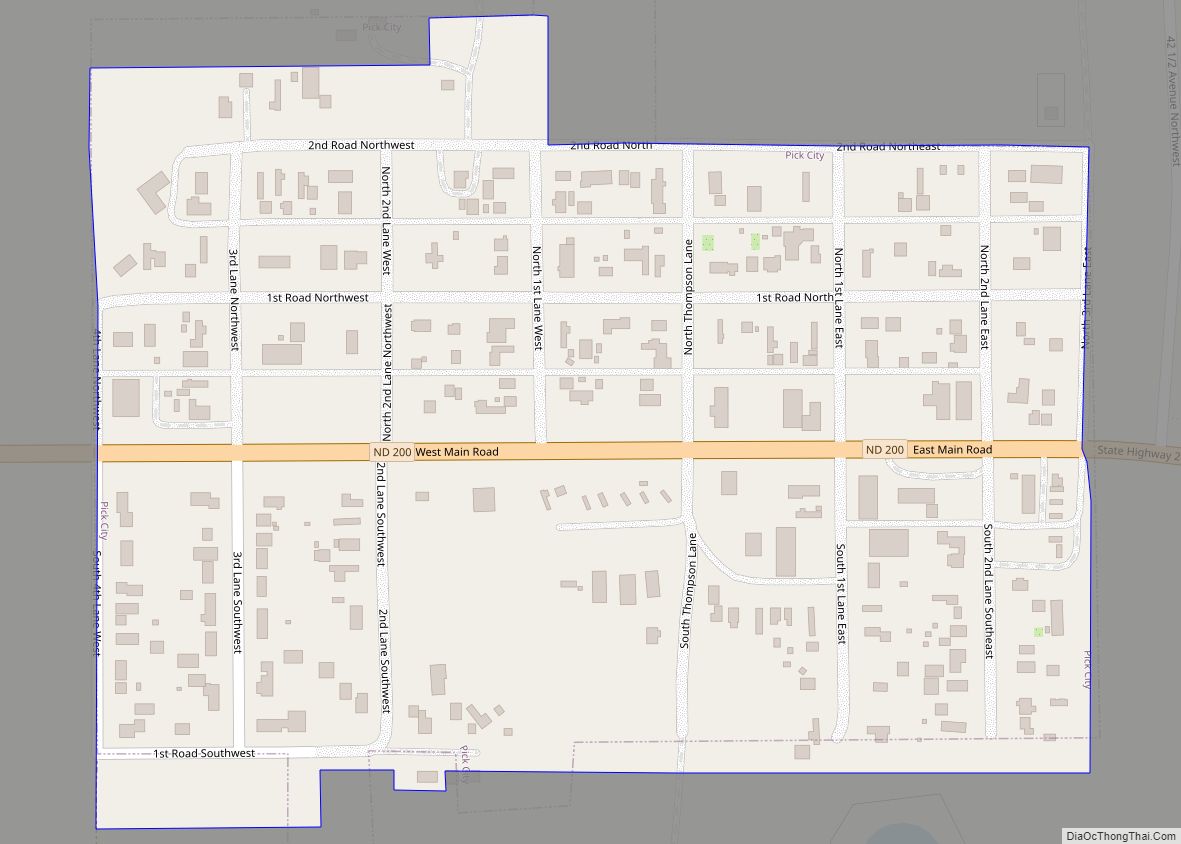
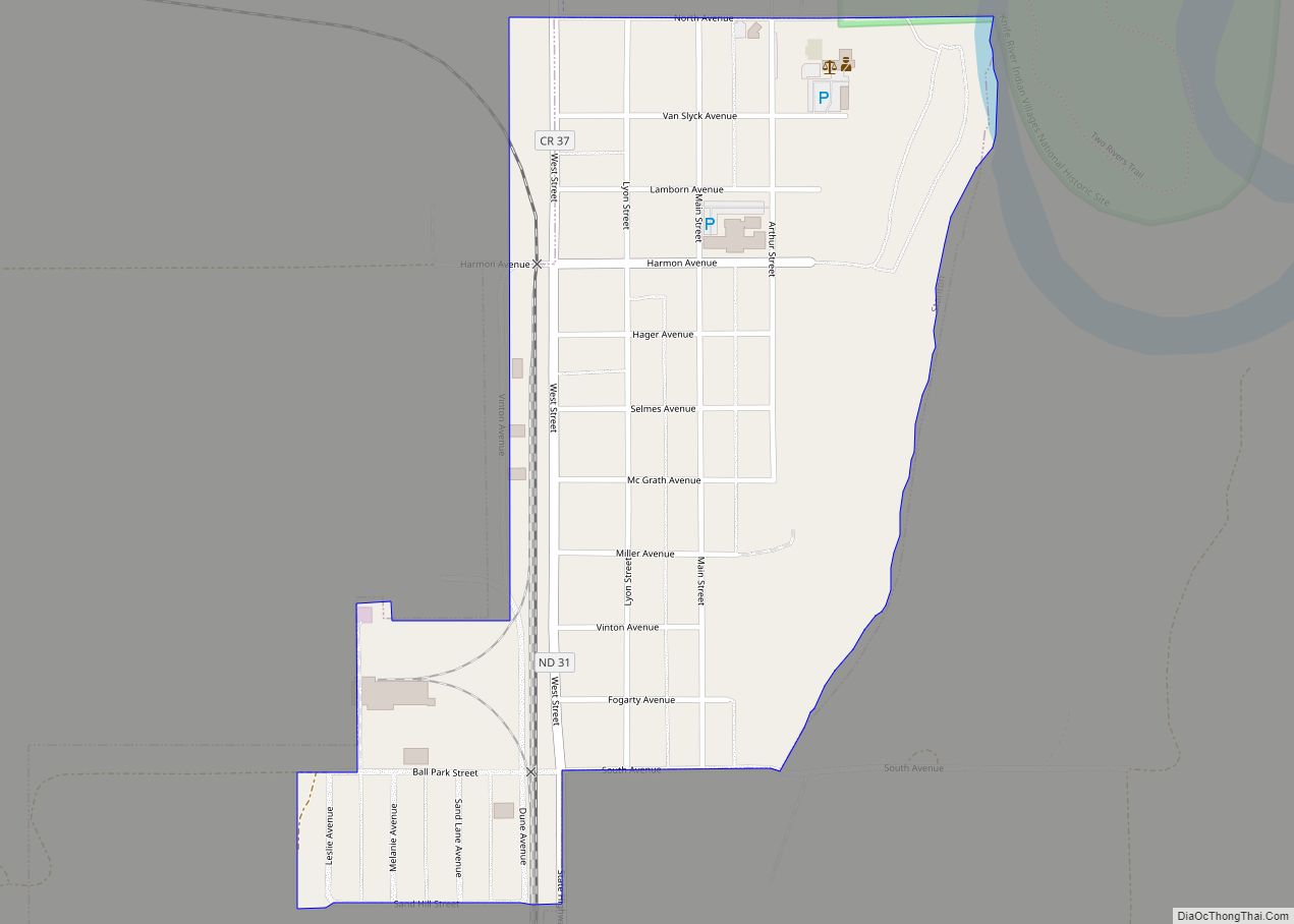
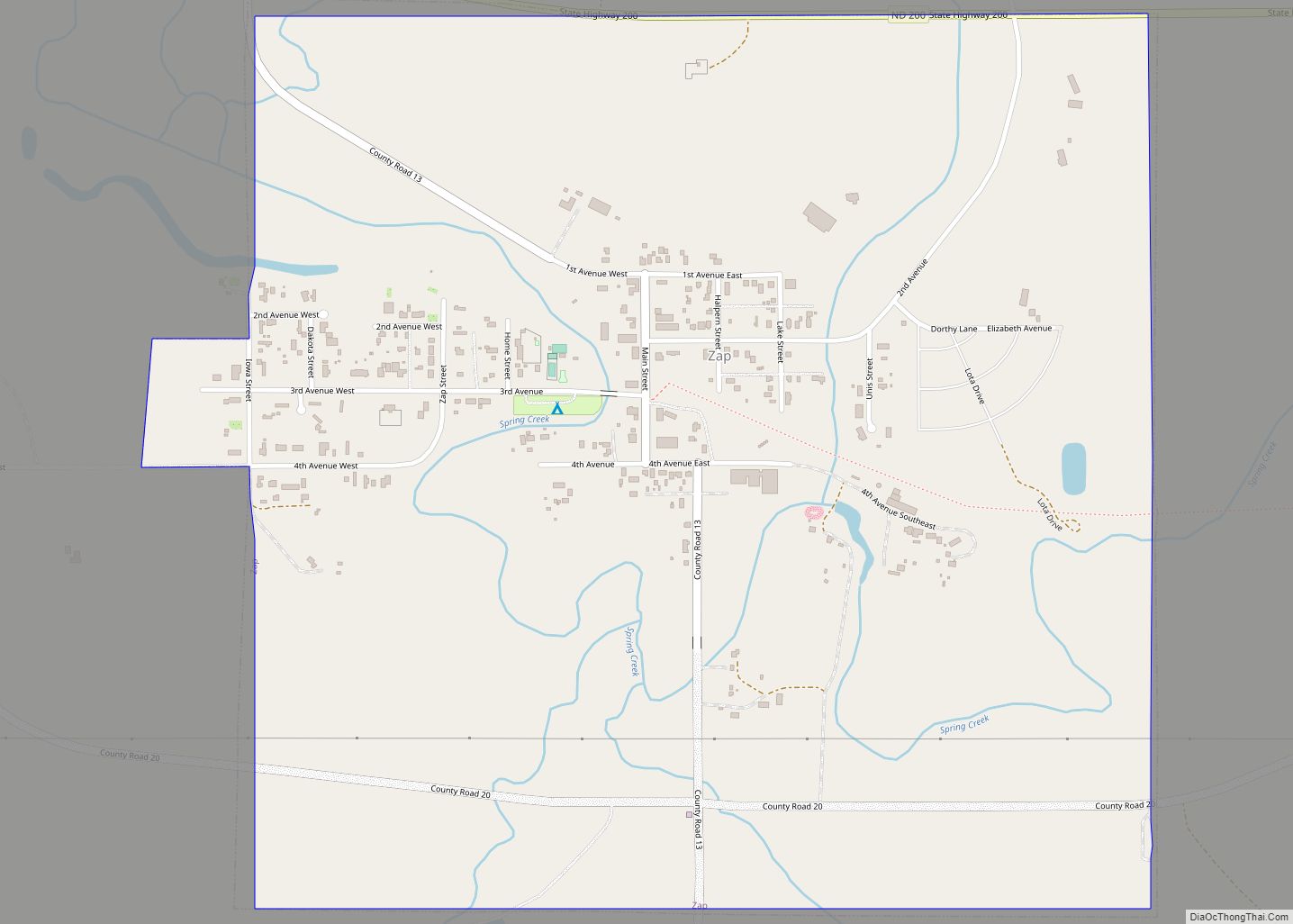
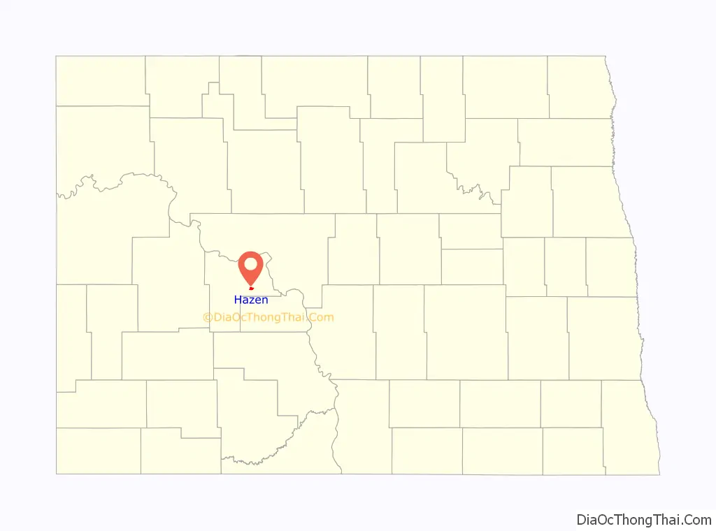
Online Interactive Map
Click on ![]() to view map in "full screen" mode.
to view map in "full screen" mode.
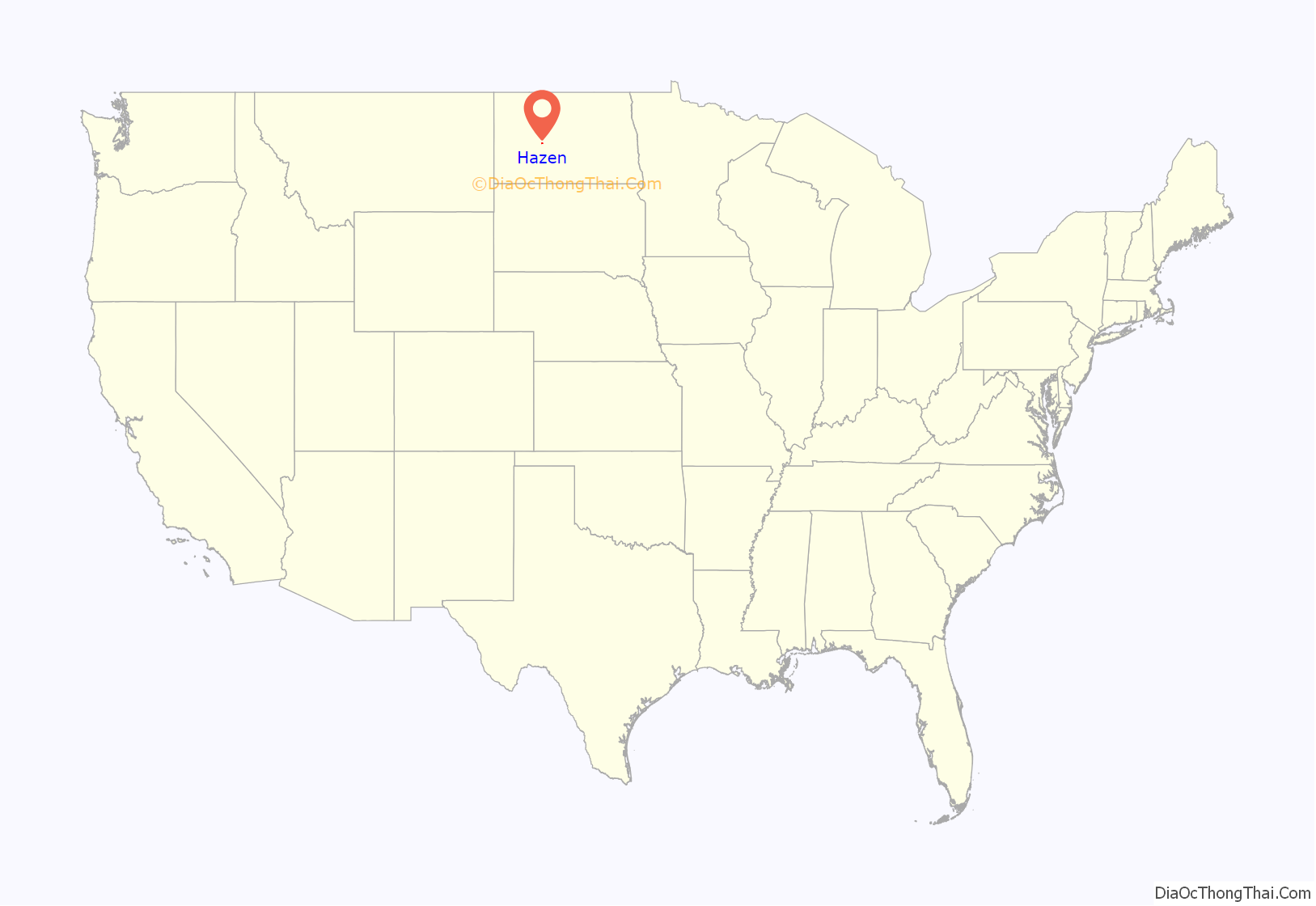
Hazen location map. Where is Hazen city?
History
A post office has been in operation at Hazen since 1885. A. D. Hazen, an early postmaster, gave the settlement its name. Hazen was laid out in 1913, when the railroad was extended to that point. The Fred Krause House, now on the National Register of Historic Places, was built in 1916.
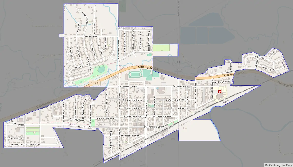
Hazen Road Map
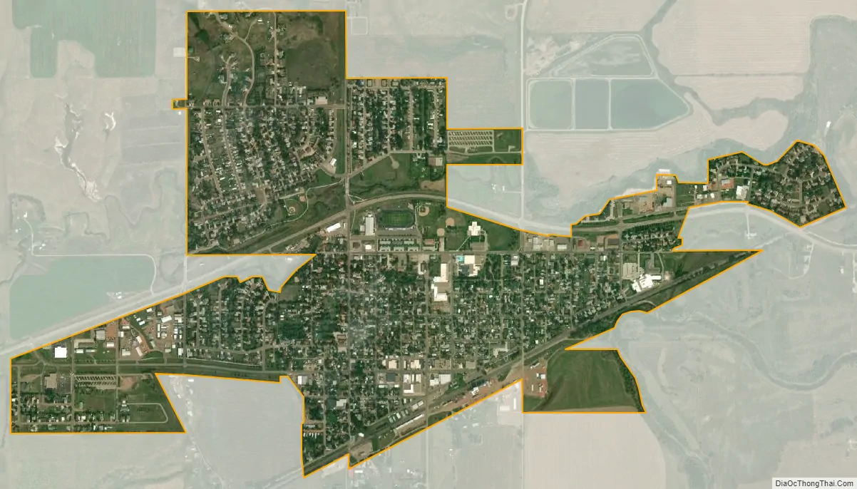
Hazen city Satellite Map
Geography
Hazen is located at 47°17′49″N 101°37′25″W / 47.29694°N 101.62361°W / 47.29694; -101.62361 (47.297083, −101.623616).
According to the United States Census Bureau, the city has a total area of 1.27 square miles (3.29 km), all land.
See also
Map of North Dakota State and its subdivision:- Adams
- Barnes
- Benson
- Billings
- Bottineau
- Bowman
- Burke
- Burleigh
- Cass
- Cavalier
- Dickey
- Divide
- Dunn
- Eddy
- Emmons
- Foster
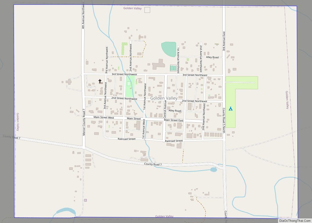
- Golden Valley
- Grand Forks
- Grant
- Griggs
- Hettinger
- Kidder
- Lamoure
- Logan
- McHenry
- McIntosh
- McKenzie
- McLean
- Mercer
- Morton
- Mountrail
- Nelson
- Oliver
- Pembina
- Pierce
- Ramsey
- Ransom
- Renville
- Richland
- Rolette
- Sargent
- Sheridan
- Sioux
- Slope
- Stark
- Steele
- Stutsman
- Towner
- Traill
- Walsh
- Ward
- Wells
- Williams
- Alabama
- Alaska
- Arizona
- Arkansas
- California
- Colorado
- Connecticut
- Delaware
- District of Columbia
- Florida
- Georgia
- Hawaii
- Idaho
- Illinois
- Indiana
- Iowa
- Kansas
- Kentucky
- Louisiana
- Maine
- Maryland
- Massachusetts
- Michigan
- Minnesota
- Mississippi
- Missouri
- Montana
- Nebraska
- Nevada
- New Hampshire
- New Jersey
- New Mexico
- New York
- North Carolina
- North Dakota
- Ohio
- Oklahoma
- Oregon
- Pennsylvania
- Rhode Island
- South Carolina
- South Dakota
- Tennessee
- Texas
- Utah
- Vermont
- Virginia
- Washington
- West Virginia
- Wisconsin
- Wyoming