Horace is a city in Cass County, North Dakota, United States. As of the 2020 census, the population was 3,085.
The city is a suburb of the Fargo-Moorhead metropolitan area. It is the sixteenth-largest city in North Dakota. Horace was founded in 1882 at a time of widespread European-American settlement in the territory.
| Name: | Horace city |
|---|---|
| LSAD Code: | 25 |
| LSAD Description: | city (suffix) |
| State: | North Dakota |
| County: | Cass County |
| Founded: | 1882 |
| Elevation: | 915 ft (279 m) |
| Total Area: | 11.65 sq mi (30.17 km²) |
| Land Area: | 11.65 sq mi (30.17 km²) |
| Water Area: | 0.00 sq mi (0.01 km²) |
| Total Population: | 3,085 |
| Population Density: | 264.88/sq mi (102.27/km²) |
| ZIP code: | 58047 |
| Area code: | 701 |
| FIPS code: | 3838900 |
| GNISfeature ID: | 1029530 |
| Website: | cityofhorace.com |
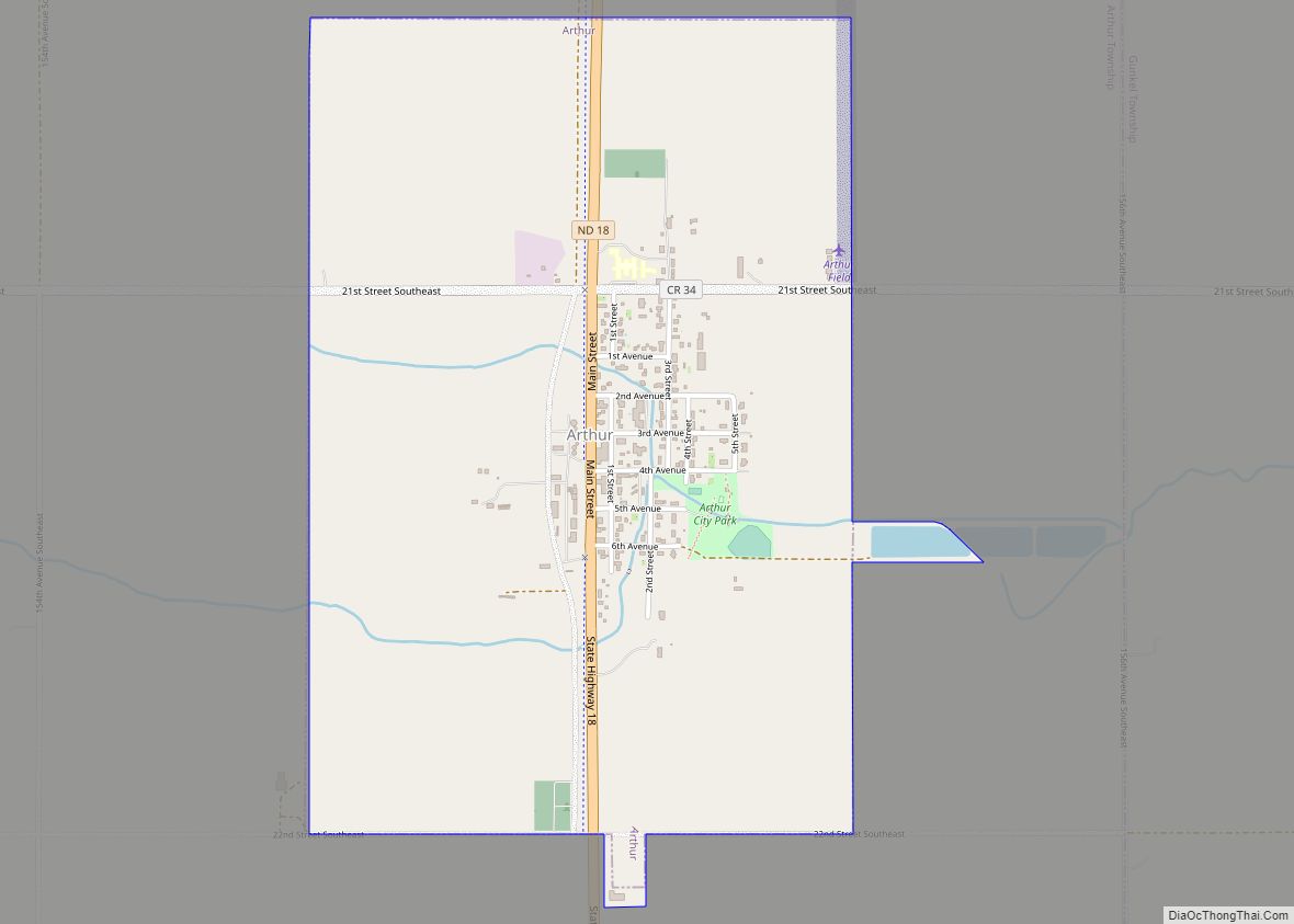
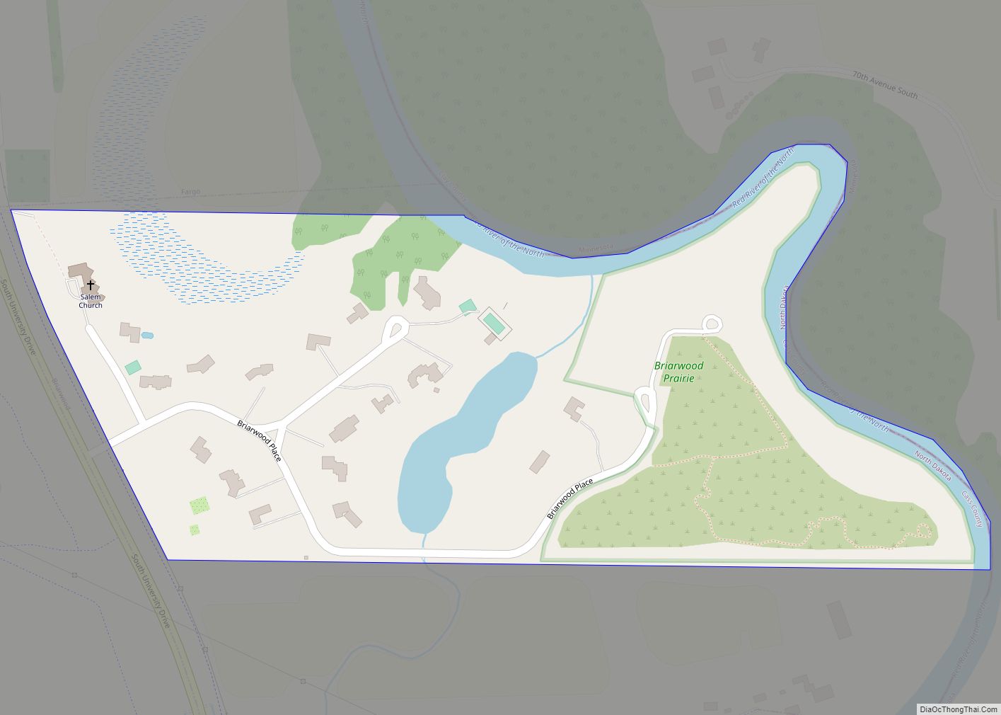
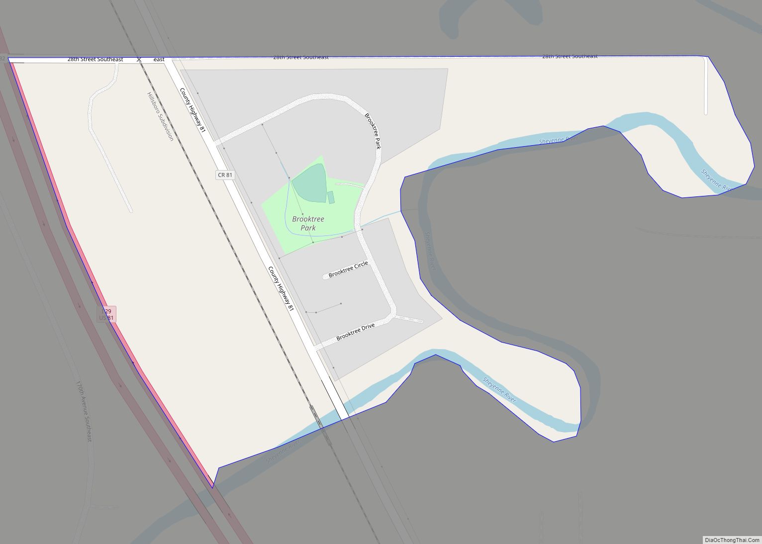
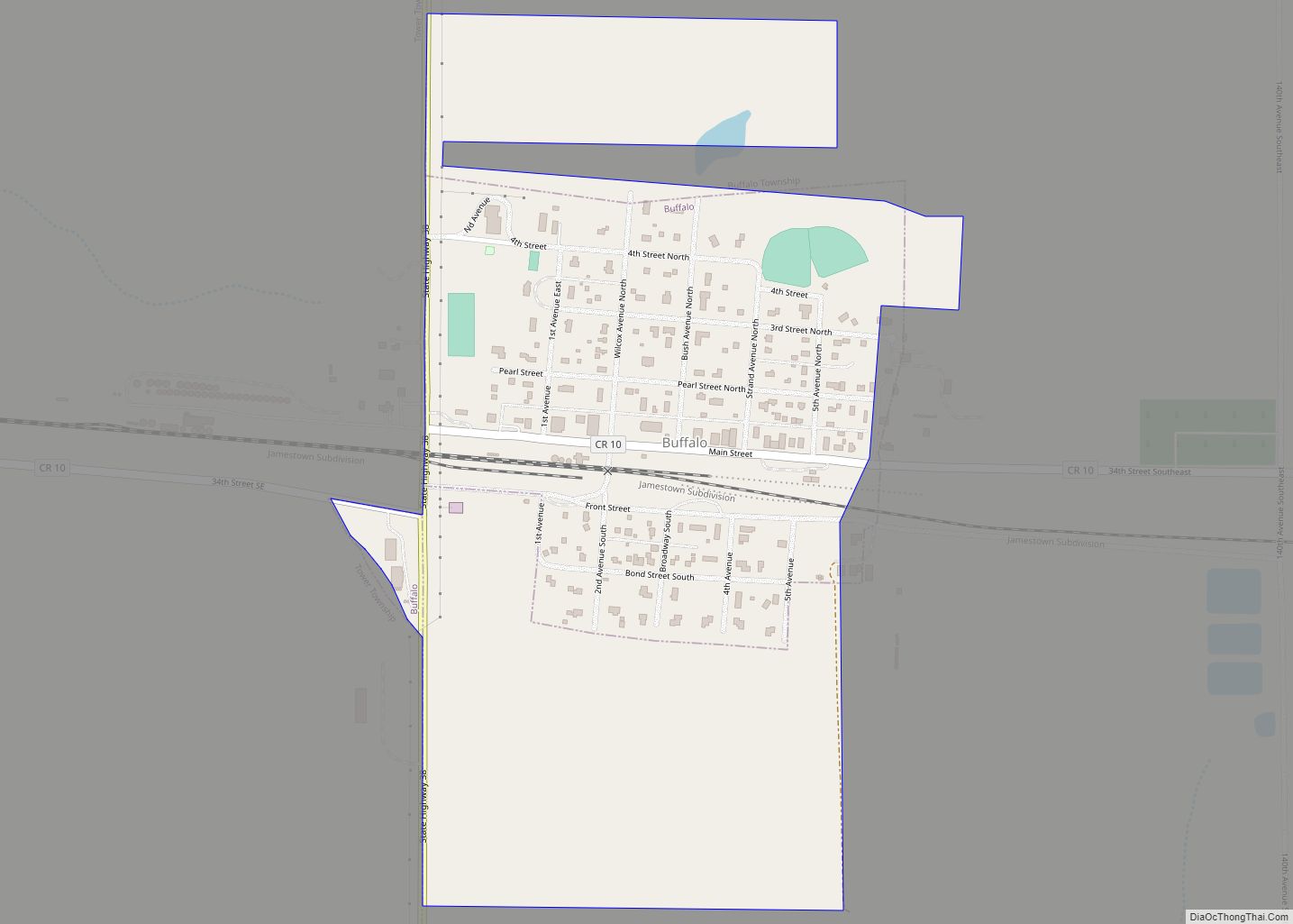
Online Interactive Map
Click on ![]() to view map in "full screen" mode.
to view map in "full screen" mode.
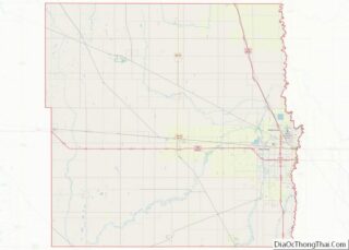
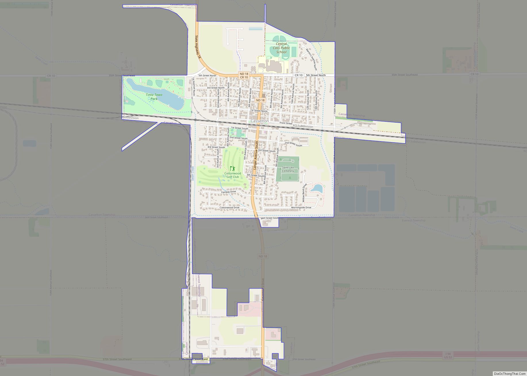
Horace location map. Where is Horace city?


History
A post office has been in operation at Horace since 1875. The city is named after Horace Greeley of Chappaqua, New York, editor of the New York Tribune. Greeley encouraged western settlement with the motto “Go West, young man”.
The city is bordered on the west by the Sheyenne River, a tributary of the Red River. To reduce damage from seasonal flooding, which sometimes was severe, the state and federal government collaborated on the Sheyenne Diversion Project, constructing a canal and associated support in 1990–1992 to move Sheyenne flood waters to the west and south of Horace, and north past the western side of West Fargo. This has proved its worth, protecting the Sheyenne cities from damage that resulted from the large 1997 Red River flood, which destroyed areas of Grand Forks and East Grand Forks to the north.
Horace Road Map

Horace city Satellite Map

Geography
Horace is located at 46°45′35″N 96°54′15″W / 46.75972°N 96.90417°W / 46.75972; -96.90417 (46.759795, −96.904122).
According to the United States Census Bureau, the city has a total area of 10.77 square miles (27.89 km), all land.
See also
Map of North Dakota State and its subdivision:- Adams
- Barnes
- Benson
- Billings
- Bottineau
- Bowman
- Burke
- Burleigh
- Cass
- Cavalier
- Dickey
- Divide
- Dunn
- Eddy
- Emmons
- Foster
- Golden Valley
- Grand Forks
- Grant
- Griggs
- Hettinger
- Kidder
- Lamoure
- Logan
- McHenry
- McIntosh
- McKenzie
- McLean
- Mercer
- Morton
- Mountrail
- Nelson
- Oliver
- Pembina
- Pierce
- Ramsey
- Ransom
- Renville
- Richland
- Rolette
- Sargent
- Sheridan
- Sioux
- Slope
- Stark
- Steele
- Stutsman
- Towner
- Traill
- Walsh
- Ward
- Wells
- Williams
- Alabama
- Alaska
- Arizona
- Arkansas
- California
- Colorado
- Connecticut
- Delaware
- District of Columbia
- Florida
- Georgia
- Hawaii
- Idaho
- Illinois
- Indiana
- Iowa
- Kansas
- Kentucky
- Louisiana
- Maine
- Maryland
- Massachusetts
- Michigan
- Minnesota
- Mississippi
- Missouri
- Montana
- Nebraska
- Nevada
- New Hampshire
- New Jersey
- New Mexico
- New York
- North Carolina
- North Dakota
- Ohio
- Oklahoma
- Oregon
- Pennsylvania
- Rhode Island
- South Carolina
- South Dakota
- Tennessee
- Texas
- Utah
- Vermont
- Virginia
- Washington
- West Virginia
- Wisconsin
- Wyoming