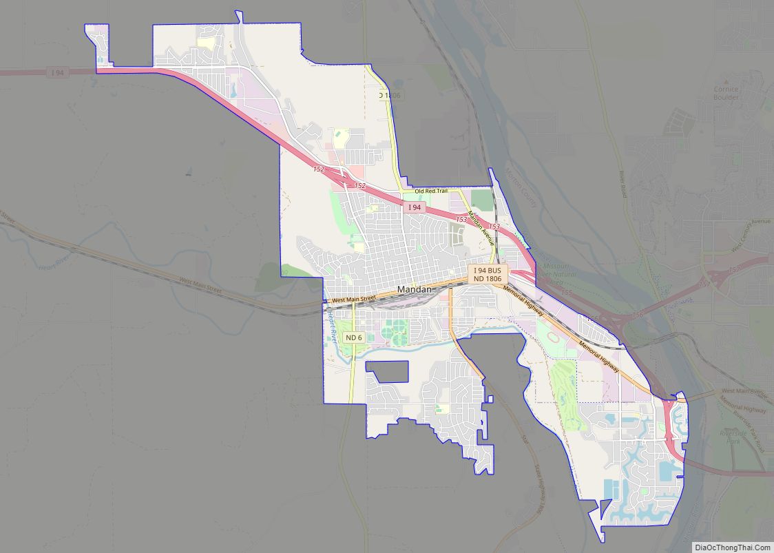
Mandan is a city on the eastern border of Morton County and the eighth-largest city in North Dakota. Founded in 1879 on the west side of the upper Missouri River, it was designated in 1881 as the county seat of Morton County. The population was 24,206 at the 2020 census. Across the Missouri River from Bismarck, Mandan is a core city of the Bismarck-Mandan Metropolitan Statistical Area.
| Name: | Mandan city |
|---|---|
| LSAD Code: | 25 |
| LSAD Description: | city (suffix) |
| State: | North Dakota |
| County: | Morton County |
| Founded: | 1881 |
| Elevation: | 1,647 ft (502 m) |
| Total Area: | 13.66 sq mi (35.39 km²) |
| Land Area: | 13.52 sq mi (35.01 km²) |
| Water Area: | 0.15 sq mi (0.38 km²) |
| Total Population: | 24,206 |
| Population Density: | 1,790.78/sq mi (691.42/km²) |
| ZIP code: | 58554 |
| Area code: | 701 |
| FIPS code: | 3849900 |
| GNISfeature ID: | 1030076 |
| Website: | cityofmandan.com |
Online Interactive Map
Click on ![]() to view map in "full screen" mode.
to view map in "full screen" mode.
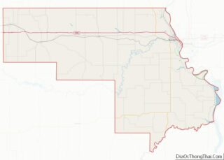
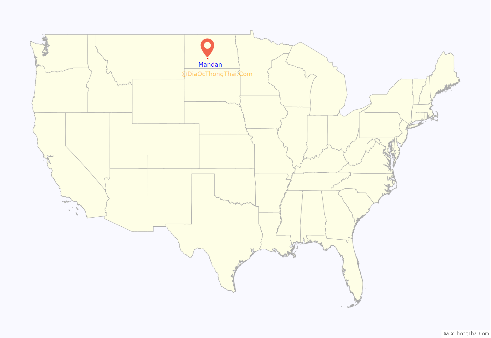
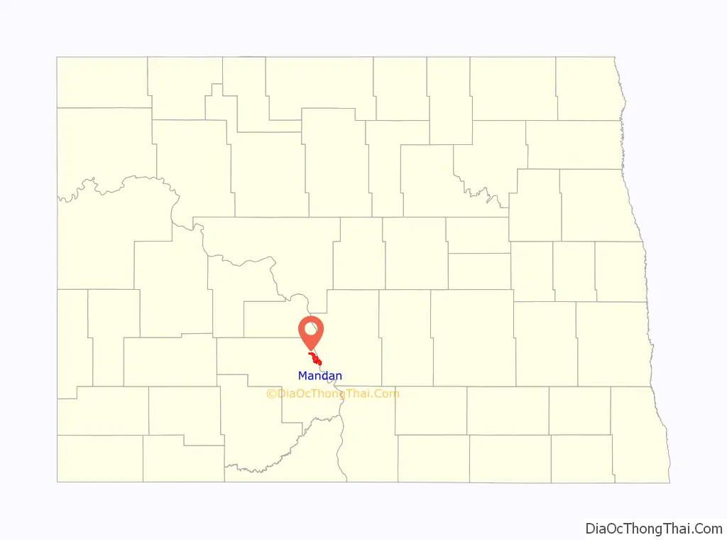
Mandan location map. Where is Mandan city?
History
Early history
While Native Americans had long established settlements in the area along the river, the first white explorer was Frenchman Sieure de la Verendyre, whose expedition arrived in 1738. Not until the early 1800s did Euro-American frontiersmen come to the area with any regularity, the Lewis and Clark Expedition in 1804 and 1806, George Catlin in 1832, and Prince Maximilian and Karl Bodmer in 1834 being the most notable. In 1830 the American Fur Company established the Fort Clark Trading Post 40 miles upstream on the Missouri River to support trappers. To provide protection for the approaching rail line from the east and the homesteaders who would surely follow, the US Army established two outposts in the area in 1872 and 1873. Fort Greeley (later renamed Fort Hancock) was founded first on the river’s east side. On the west side, an infantry post, Fort McKeen, was constructed on bluffs above the confluence of Heart and Missouri Rivers. In 1873 Congress authorized the addition of a cavalry post and changed its designation to Fort Abraham Lincoln when foot soldiers were deemed ineffective against their mounted adversaries. A permanent civilian settlement known as Lincoln was adjacent to the fort’s north side.
When the Northern Pacific Railroad announced a pending river crossing in 1872, land speculators rushed to establish claims at probable locations for the inevitable city to be established on the west side of the crossing. But due to the national financial crisis in 1873, Northern Pacific postponed the river bridge project. Once its final location was announced, about five miles north of Fort Abraham Lincoln, a work camp appeared on the west riverbank in December 1878, complete with its own post office. The settlement also served as the base for the westward survey of the rail line.
On March 3, 1879, the post office was moved from the west bank of the Missouri River to the railroad’s city site within blocks of Mandan’s first railroad depot and freight building at Main Street and Stark Avenue (today’s Collins Avenue). Four city names coincided exactly with four postmasters. The original railroad work camp’s post office in 1878 was known as Morton. The name Mandan stuck for only eight days in March 1879 before being renamed Cushman by a postmaster with that surname. In September 1879, the post office returned to its designation of Mandan.
The City of Mandan was formally incorporated on February 24, 1881, and was named for the Mantani Indians, or “people of the bank.” Mandan became the county seat for the replatted Morton County after the North Dakota legislature restored the prior county boundaries in 1881 after Burleigh County’s land grab in 1879. The city of Lincoln had been county seat from 1878 to 1879.
Upon completion of the railroad to Montana in 1881, Fort Abraham Lincoln had fulfilled its primary purpose and gradually declined until it was formally abandoned in 1891. The City of Lincoln eventually dwindled into obscurity.
Transportation development
In the earliest days of Euro-American settlement, the main commercial transportation route was the Missouri River. Even after the rail arrived in the 1870s, the river remained the main north–south route until the mid-1930s’ development of the national highway system. Steamboats used coal for fuel and the mine at Sims seven miles west of Mandan was a major source of lignite coal. If unavailable, steamboat crews bought wood from farmers along the river. Bellows Landing, the site of today’s R M Hesket Power Station, was a refueling station with an icehouse. Historical records indicate it served steamboat traffic as early as 1832 when the riverboat Yellowstone reached Fort Union. Regular steamboat service on the Missouri began in 1860. Bellows Landing was renamed Rock Haven when the US government took over the operation in the late 1870s. The Army Corps of Engineers made extensive riverside improvements, including adding dry-dock and boat repair facilities. It supported the supply ships for the US Army’s frontier forts and was considered the best landing on the river. Unlike most river harbors, the area was permanent and safe even during spring river ice breakup. It ceased operations in 1934.
Recent history
In 2013, Mandan was selected a finalist in the Rand McNally “Most Patriotic City” competition.
As part of the Bismarck-Mandan MSA, the area has repeatedly been ranked in the top 5 on both the Forbes list of “Best Small Places for Business and Careers” and the Milken Institutes’ “Best Small Cities” list. The sister cities have also been included in CNN Money’s list of the top 100 places to live.
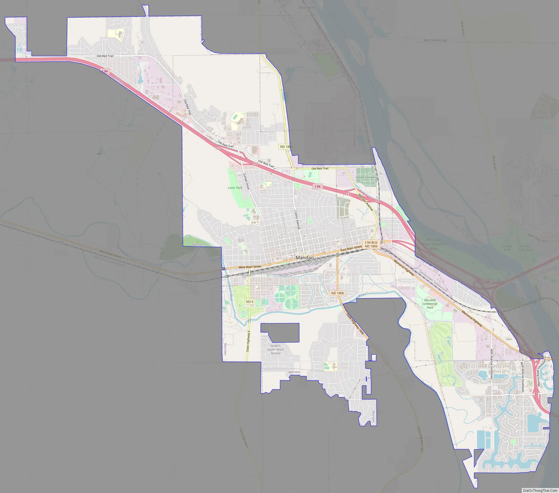
Mandan Road Map
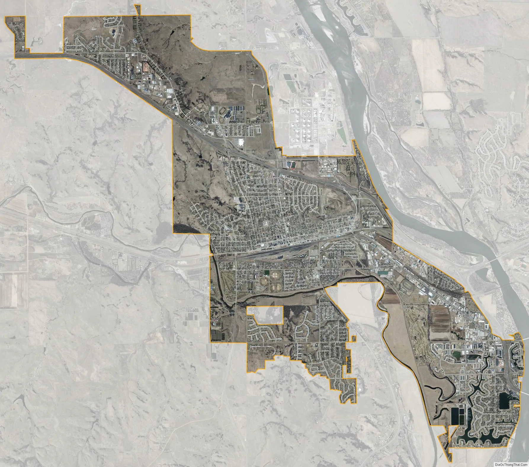
Mandan city Satellite Map
Geography
According to the United States Census Bureau, the city has an area of 11.13 square miles (28.83 km), of which 11.03 square miles (28.57 km) is land and 0.10 square miles (0.26 km) is water.
Climate
This climatic region is typified by large seasonal temperature differences, with warm to hot (and often humid) summers and cold (sometimes severely cold) winters. According to the Köppen Climate Classification system, Mandan has a humid continental climate, abbreviated “Dfb” on climate maps.
See also
Map of North Dakota State and its subdivision:- Adams
- Barnes
- Benson
- Billings
- Bottineau
- Bowman
- Burke
- Burleigh
- Cass
- Cavalier
- Dickey
- Divide
- Dunn
- Eddy
- Emmons
- Foster
- Golden Valley
- Grand Forks
- Grant
- Griggs
- Hettinger
- Kidder
- Lamoure
- Logan
- McHenry
- McIntosh
- McKenzie
- McLean
- Mercer
- Morton
- Mountrail
- Nelson
- Oliver
- Pembina
- Pierce
- Ramsey
- Ransom
- Renville
- Richland
- Rolette
- Sargent
- Sheridan
- Sioux
- Slope
- Stark
- Steele
- Stutsman
- Towner
- Traill
- Walsh
- Ward
- Wells
- Williams
- Alabama
- Alaska
- Arizona
- Arkansas
- California
- Colorado
- Connecticut
- Delaware
- District of Columbia
- Florida
- Georgia
- Hawaii
- Idaho
- Illinois
- Indiana
- Iowa
- Kansas
- Kentucky
- Louisiana
- Maine
- Maryland
- Massachusetts
- Michigan
- Minnesota
- Mississippi
- Missouri
- Montana
- Nebraska
- Nevada
- New Hampshire
- New Jersey
- New Mexico
- New York
- North Carolina
- North Dakota
- Ohio
- Oklahoma
- Oregon
- Pennsylvania
- Rhode Island
- South Carolina
- South Dakota
- Tennessee
- Texas
- Utah
- Vermont
- Virginia
- Washington
- West Virginia
- Wisconsin
- Wyoming