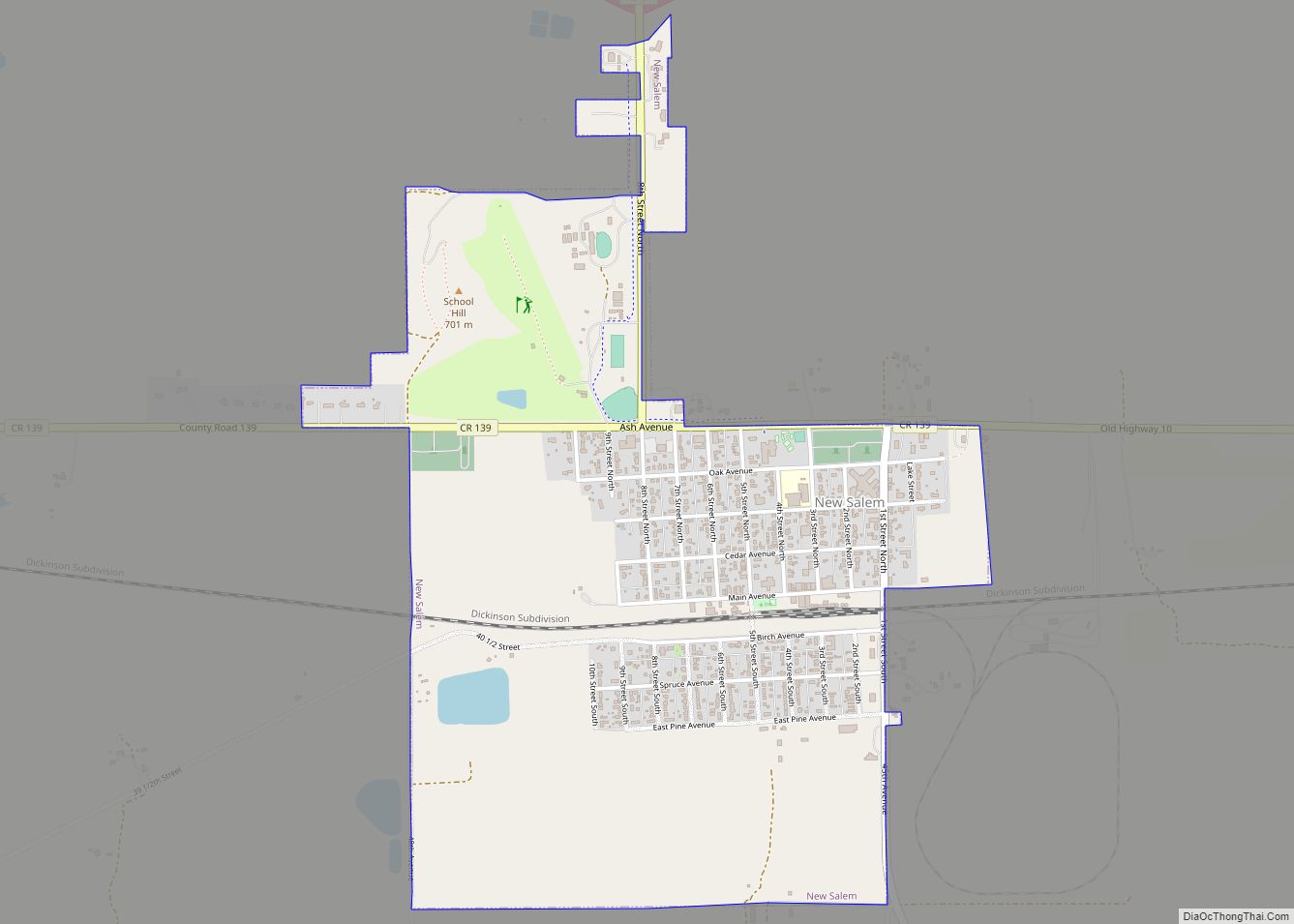
New Salem is a city in Morton County, North Dakota, United States. It is part of the “Bismarck, ND Metropolitan Statistical Area” or “Bismarck-Mandan”. The population was 973 at the 2020 census. New Salem was founded in 1883.
| Name: | New Salem city |
|---|---|
| LSAD Code: | 25 |
| LSAD Description: | city (suffix) |
| State: | North Dakota |
| County: | Morton County |
| Elevation: | 2,185 ft (665.98 m) |
| Total Area: | 1.40 sq mi (3.62 km²) |
| Land Area: | 1.39 sq mi (3.59 km²) |
| Water Area: | 0.01 sq mi (0.03 km²) |
| Total Population: | 973 |
| Population Density: | 702.53/sq mi (271.31/km²) |
| ZIP code: | 58563 |
| Area code: | 701 |
| FIPS code: | 3856700 |
| GNISfeature ID: | 1030399 |
| Website: | newsalem-nd.com |
Online Interactive Map
Click on ![]() to view map in "full screen" mode.
to view map in "full screen" mode.
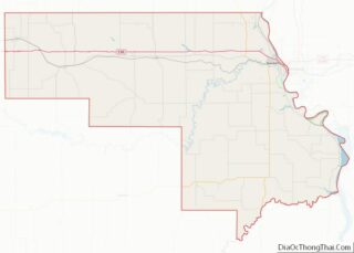
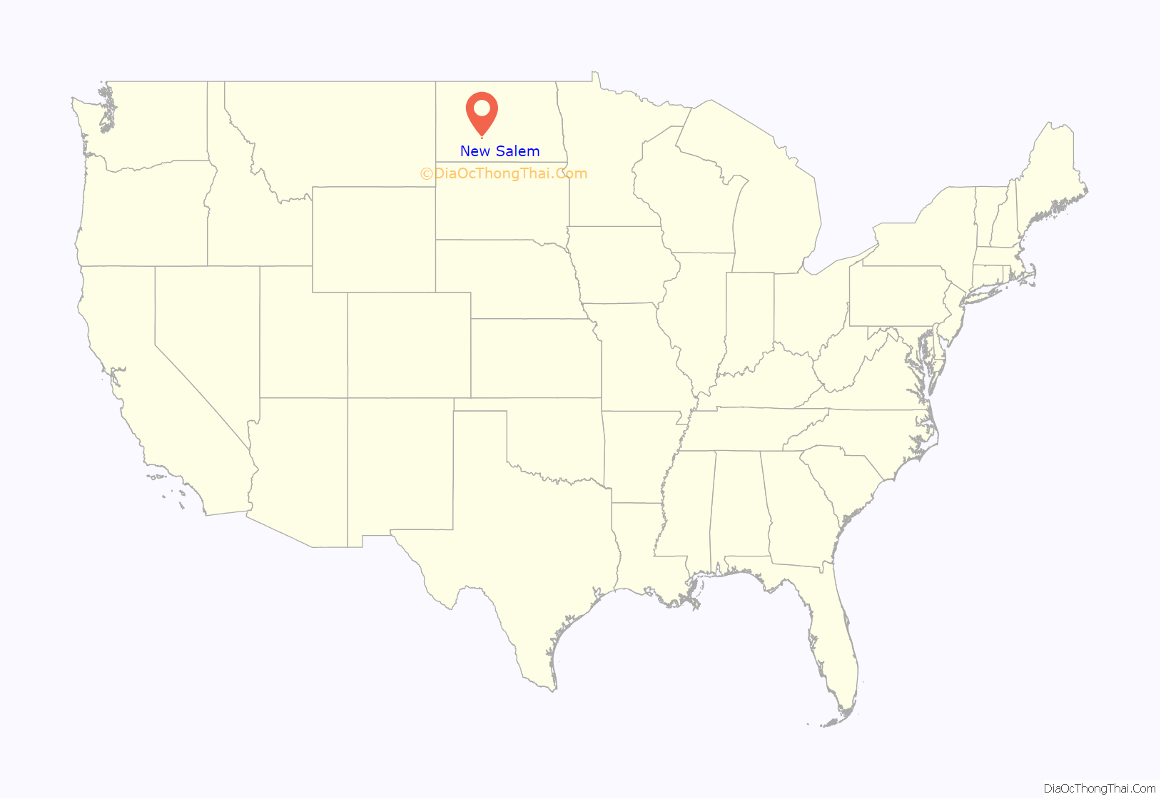
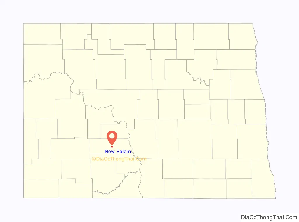
New Salem location map. Where is New Salem city?
History
New Salem began in April 1882 when John Christiansen hopped off a westbound freight train. The only sign of civilization he saw were the train tracks behind him and the belongings he brought. Soon after his arrival a Colonization Bureau out of Chicago sent settlers to the area and gave the colony its independence for $600. A church, land office, lumber yard, drugstore, and general store were soon built, and by the end of 1883, the town was ready for Great Plains living.
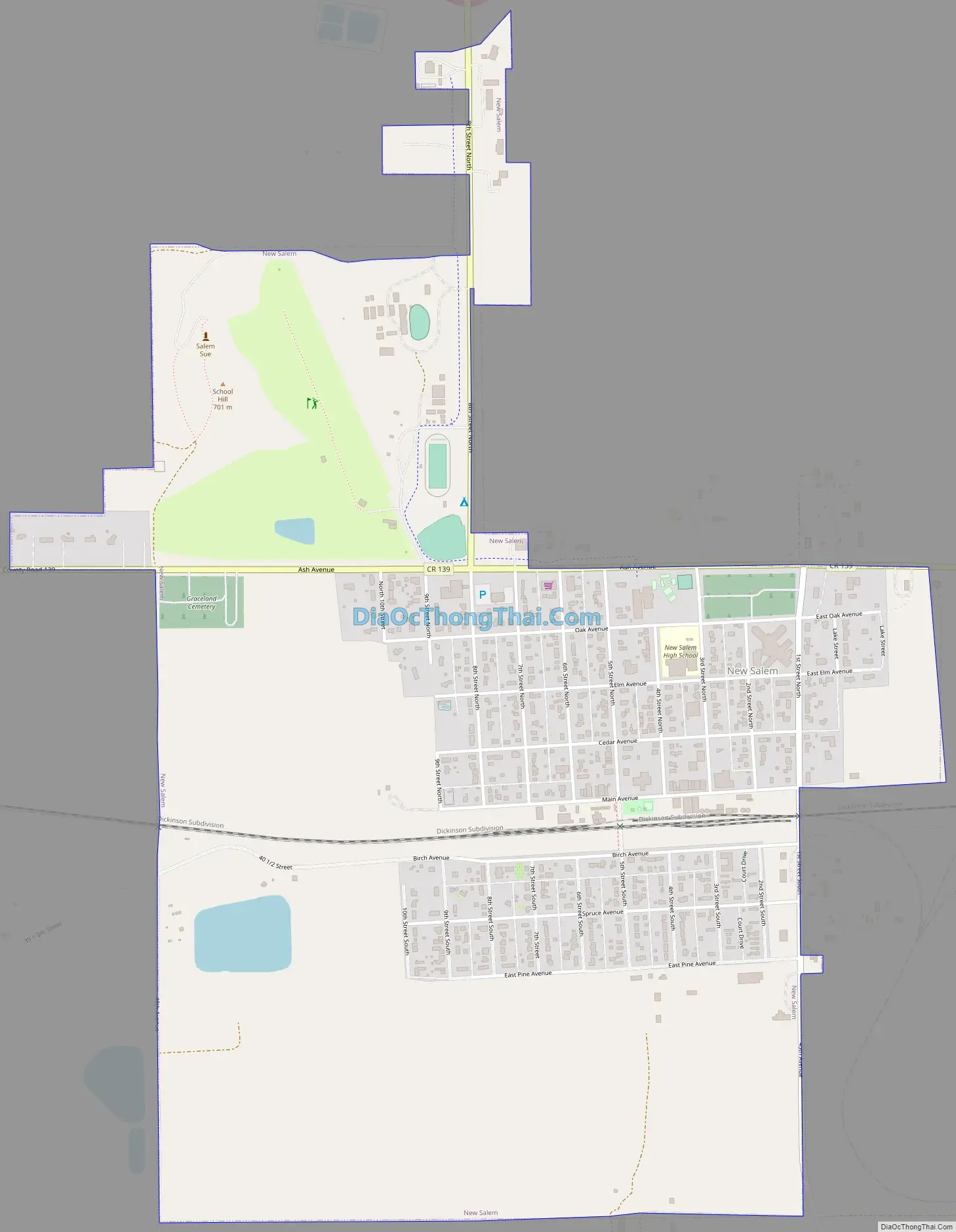
New Salem Road Map
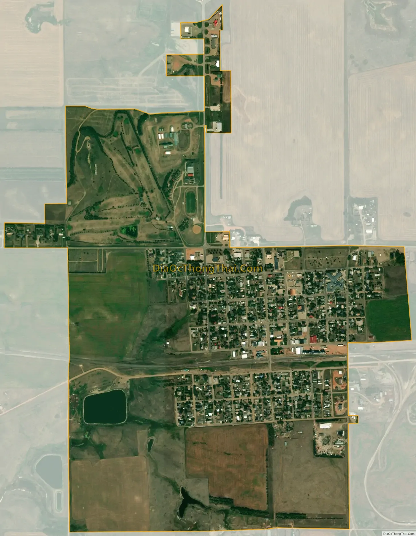
New Salem city Satellite Map
Geography
New Salem is located at 46°50′35″N 101°24′43″W / 46.84306°N 101.41194°W / 46.84306; -101.41194 (46.842993, -101.412058).
According to the United States Census Bureau, the city has a total area of 1.47 square miles (3.81 km), of which, 1.46 square miles (3.78 km) is land and 0.01 square miles (0.03 km) is water.
New Salem is one mile south of Interstate 94.
See also
Map of North Dakota State and its subdivision:- Adams
- Barnes
- Benson
- Billings
- Bottineau
- Bowman
- Burke
- Burleigh
- Cass
- Cavalier
- Dickey
- Divide
- Dunn
- Eddy
- Emmons
- Foster
- Golden Valley
- Grand Forks
- Grant
- Griggs
- Hettinger
- Kidder
- Lamoure
- Logan
- McHenry
- McIntosh
- McKenzie
- McLean
- Mercer
- Morton
- Mountrail
- Nelson
- Oliver
- Pembina
- Pierce
- Ramsey
- Ransom
- Renville
- Richland
- Rolette
- Sargent
- Sheridan
- Sioux
- Slope
- Stark
- Steele
- Stutsman
- Towner
- Traill
- Walsh
- Ward
- Wells
- Williams
- Alabama
- Alaska
- Arizona
- Arkansas
- California
- Colorado
- Connecticut
- Delaware
- District of Columbia
- Florida
- Georgia
- Hawaii
- Idaho
- Illinois
- Indiana
- Iowa
- Kansas
- Kentucky
- Louisiana
- Maine
- Maryland
- Massachusetts
- Michigan
- Minnesota
- Mississippi
- Missouri
- Montana
- Nebraska
- Nevada
- New Hampshire
- New Jersey
- New Mexico
- New York
- North Carolina
- North Dakota
- Ohio
- Oklahoma
- Oregon
- Pennsylvania
- Rhode Island
- South Carolina
- South Dakota
- Tennessee
- Texas
- Utah
- Vermont
- Virginia
- Washington
- West Virginia
- Wisconsin
- Wyoming