Tilden is a city in Antelope and Madison counties in the U.S. state of Nebraska. The population was 953 at the 2010 census. The Madison County portion of Tilden is part of the Norfolk, Nebraska Micropolitan Statistical Area.
| Name: | Tilden city |
|---|---|
| LSAD Code: | 25 |
| LSAD Description: | city (suffix) |
| State: | Nebraska |
| County: | Antelope County, Madison County |
| Elevation: | 1,683 ft (513 m) |
| Total Area: | 0.78 sq mi (2.01 km²) |
| Land Area: | 0.78 sq mi (2.01 km²) |
| Water Area: | 0.00 sq mi (0.00 km²) |
| Total Population: | 992 |
| Population Density: | 1,278.35/sq mi (493.88/km²) |
| ZIP code: | 68781 |
| Area code: | 402 |
| FIPS code: | 3148935 |
| GNISfeature ID: | 0834109 |
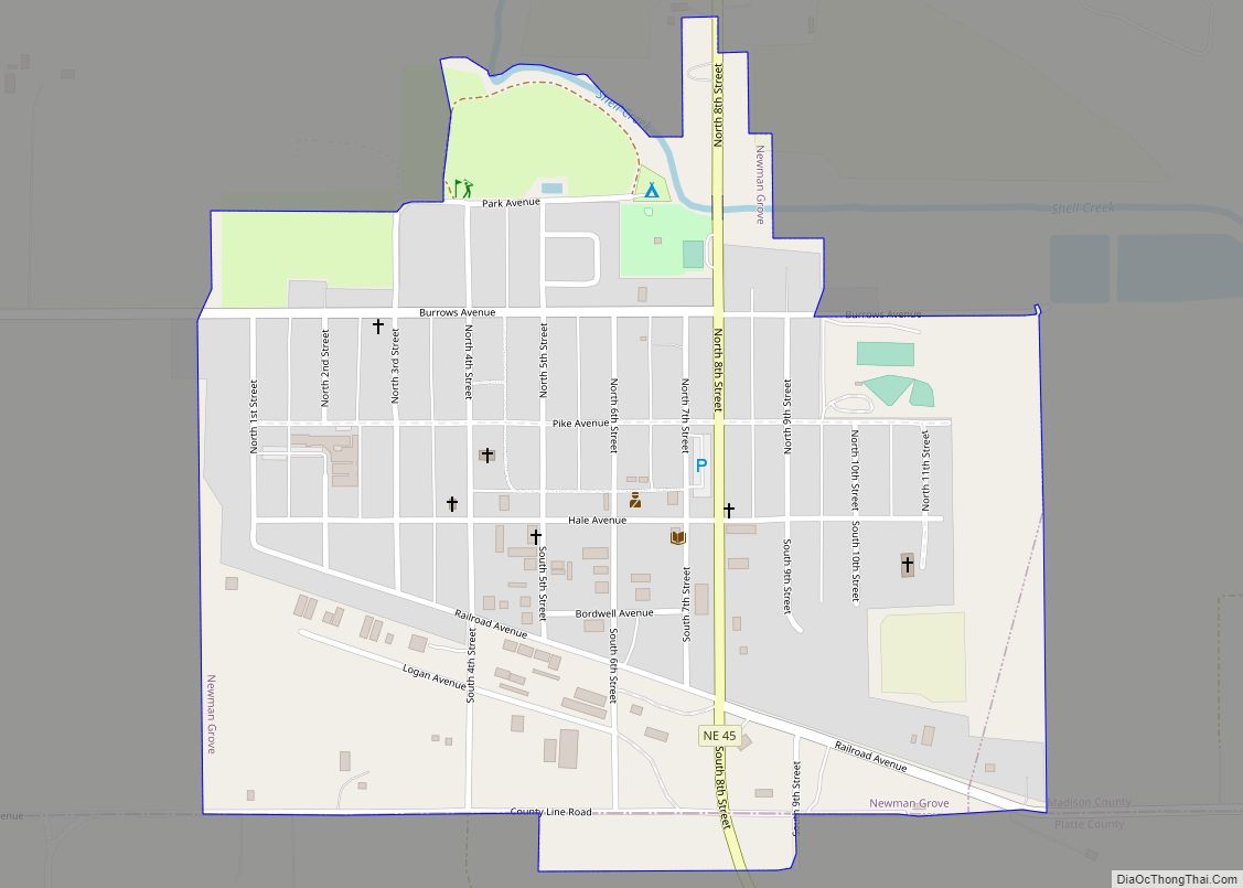
Online Interactive Map
Click on ![]() to view map in "full screen" mode.
to view map in "full screen" mode.
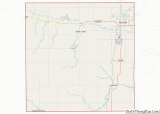
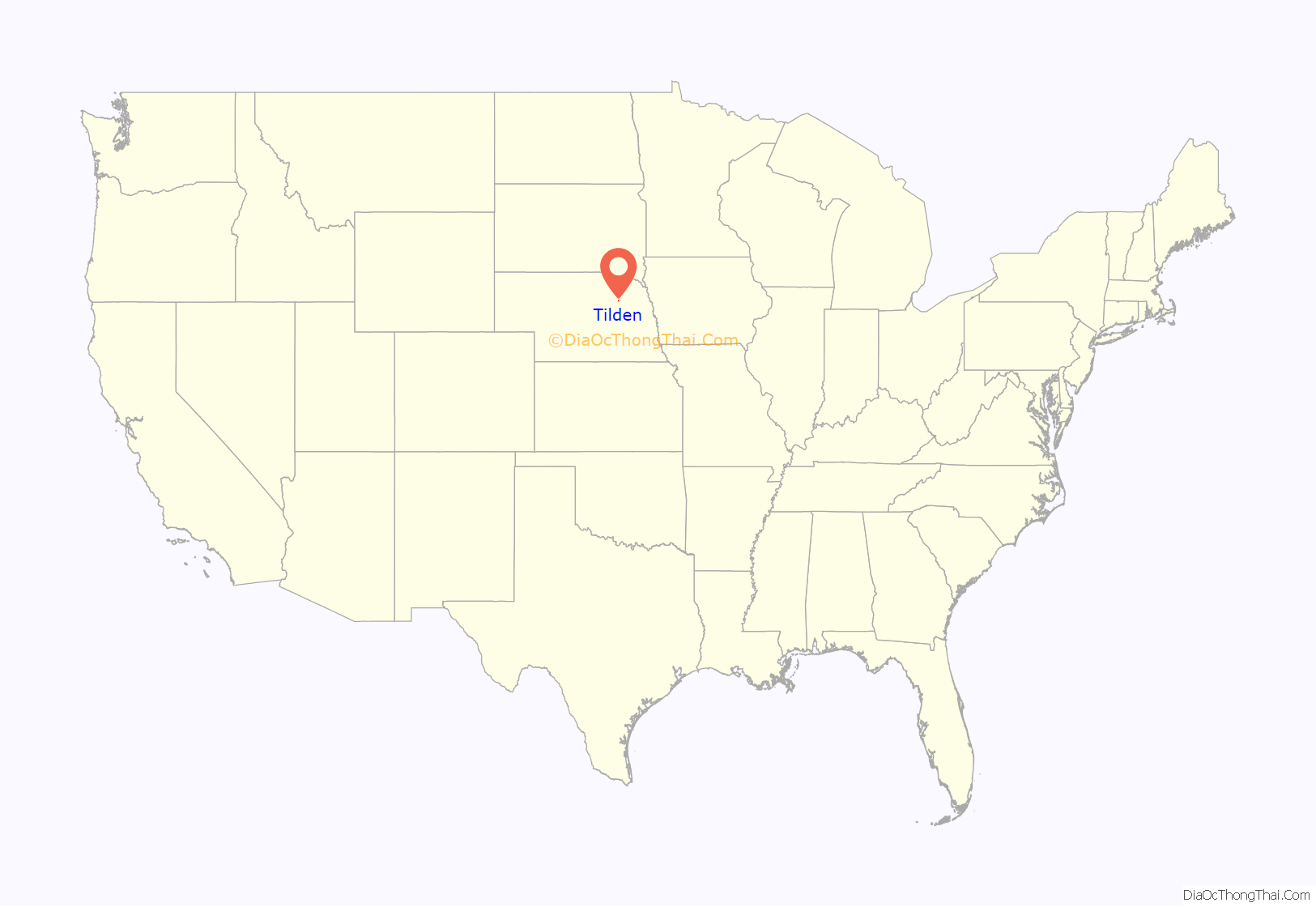
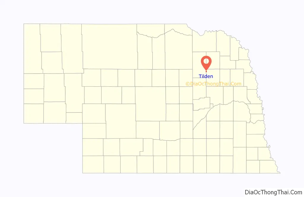
Tilden location map. Where is Tilden city?
History
Tilden was originally called Burnett, and under the latter name was laid out by the railroad in 1880. It was then incorporated as Burnett in 1885, but the U.S. Post Office officially changed the name of the village in 1887, after presidential candidate Samuel J. Tilden, due to confusion with Bennet, Nebraska. Tilden was incorporated as a city in 1919.
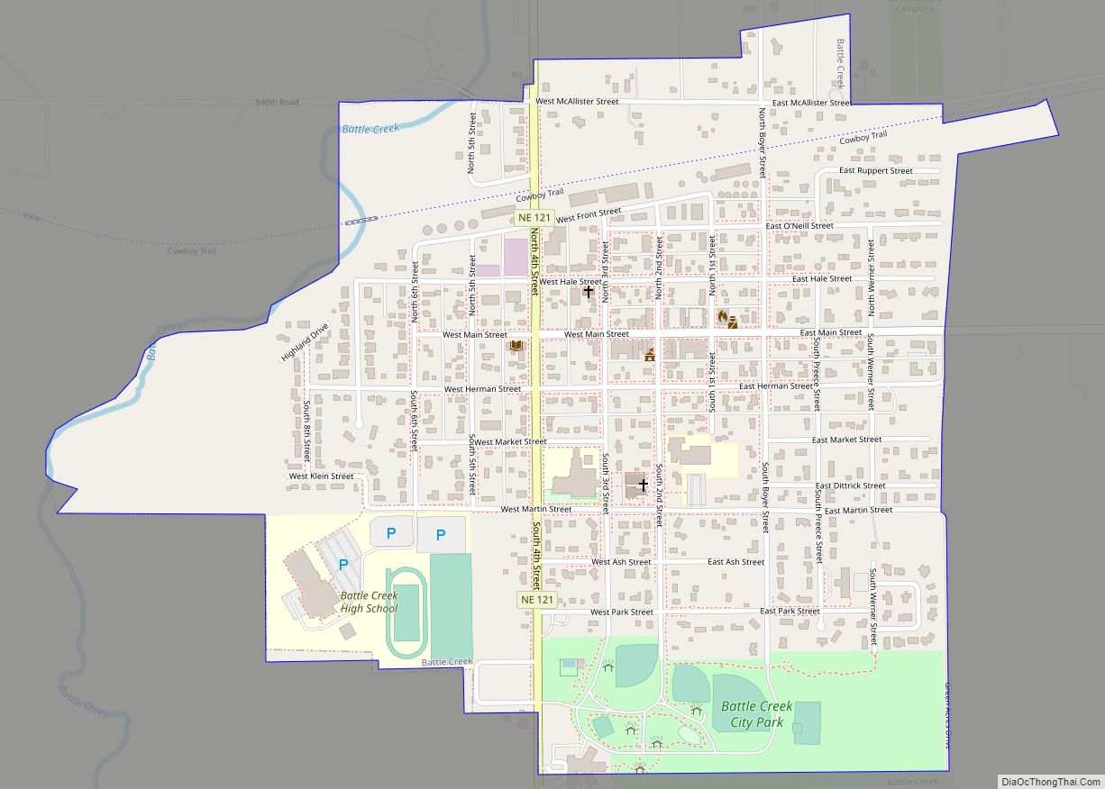
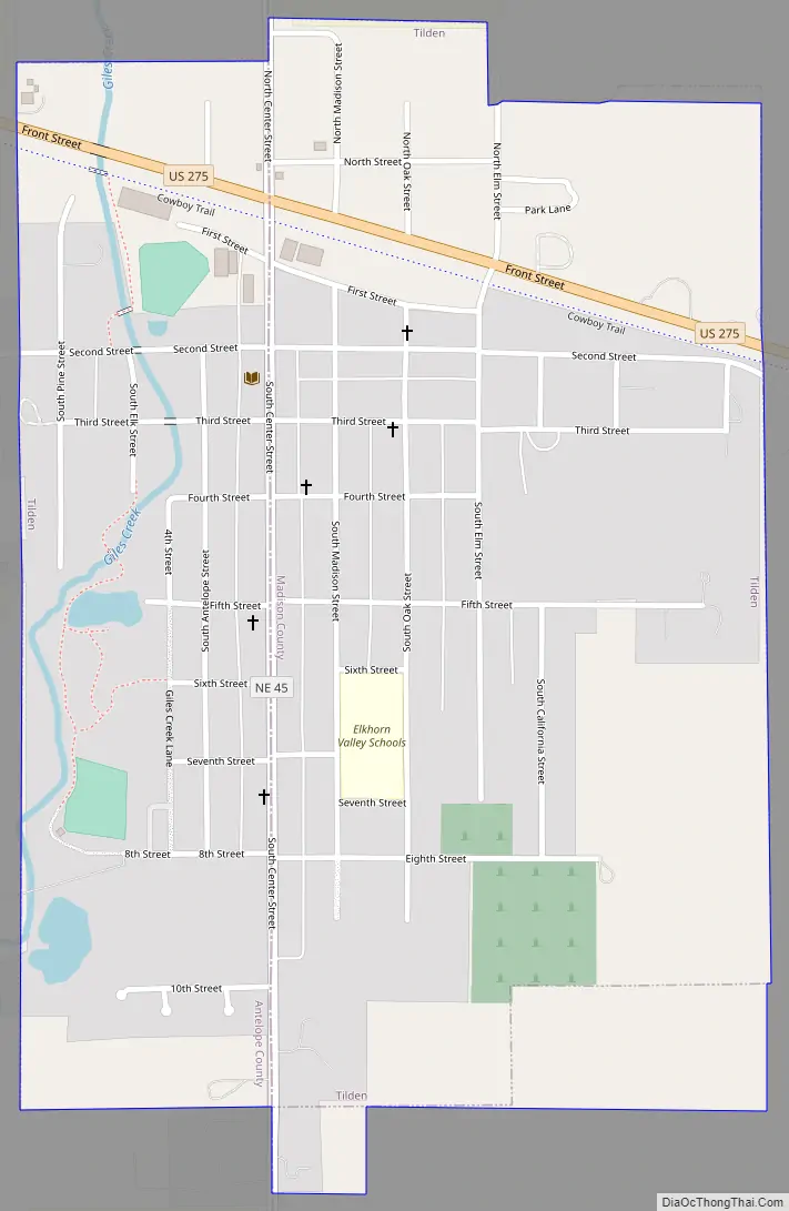
Tilden Road Map
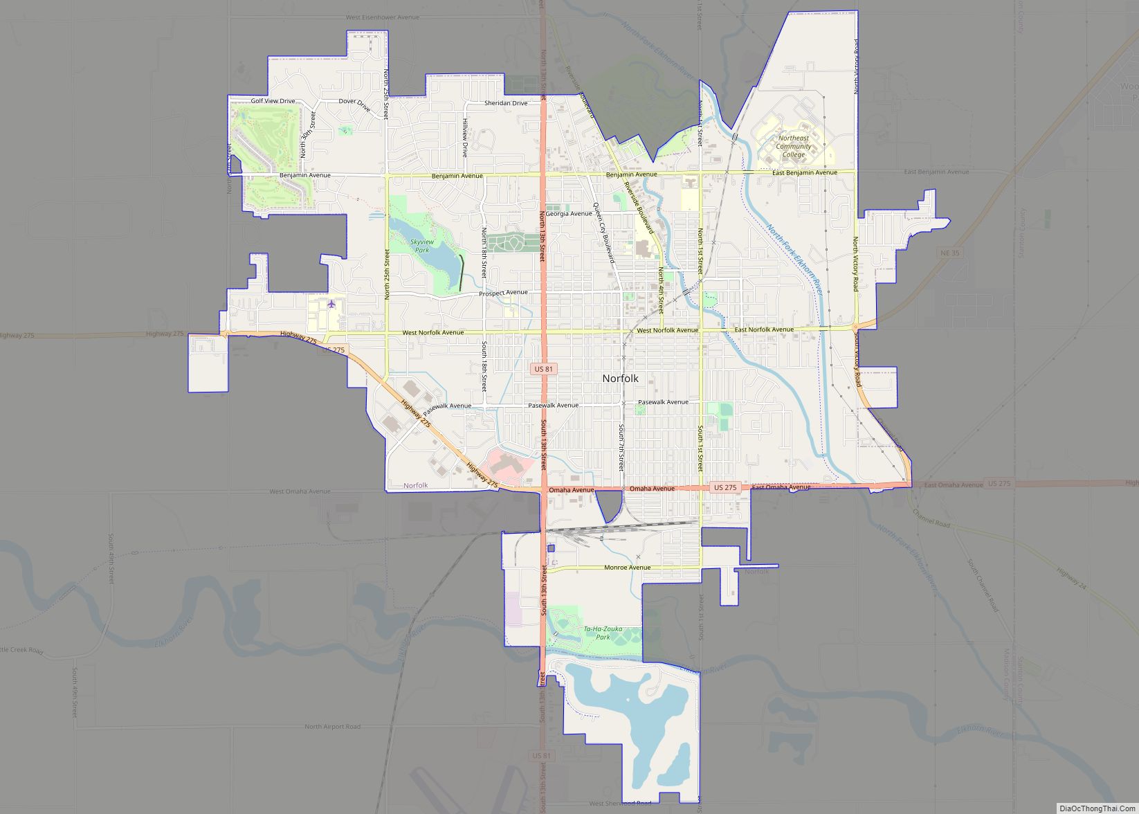
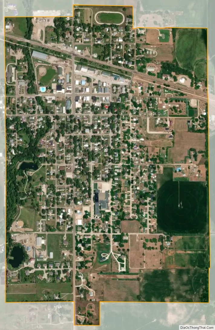
Tilden city Satellite Map
Geography
Tilden is located at 42°2′43″N 97°50′1″W / 42.04528°N 97.83361°W / 42.04528; -97.83361 (42.045297, -97.833599). The city is located mostly within Madison County, with a portion of the city in Antelope County.
According to the United States Census Bureau, the city has a total area of 0.74 square miles (1.92 km), all land.
Tilden was located on the Cowboy Line of the Chicago and Northwestern Railroad. The line was abandoned in 1992, and with it the antique wigwag signal that protected the main crossing in town. The abandoned line has been converted to the Cowboy Trail, running 321 miles from Norfolk to Chadron; when complete, it will be the longest rails-to-trails line in the United States.
See also
Map of Nebraska State and its subdivision:- Adams
- Antelope
- Arthur
- Banner
- Blaine
- Boone
- Box Butte
- Boyd
- Brown
- Buffalo
- Burt
- Butler
- Cass
- Cedar
- Chase
- Cherry
- Cheyenne
- Clay
- Colfax
- Cuming
- Custer
- Dakota
- Dawes
- Dawson
- Deuel
- Dixon
- Dodge
- Douglas
- Dundy
- Fillmore
- Franklin
- Frontier
- Furnas
- Gage
- Garden
- Garfield
- Gosper
- Grant
- Greeley
- Hall
- Hamilton
- Harlan
- Hayes
- Hitchcock
- Holt
- Hooker
- Howard
- Jefferson
- Johnson
- Kearney
- Keith
- Keya Paha
- Kimball
- Knox
- Lancaster
- Lincoln
- Logan
- Loup
- Madison
- McPherson
- Merrick
- Morrill
- Nance
- Nemaha
- Nuckolls
- Otoe
- Pawnee
- Perkins
- Phelps
- Pierce
- Platte
- Polk
- Red Willow
- Richardson
- Rock
- Saline
- Sarpy
- Saunders
- Scotts Bluff
- Seward
- Sheridan
- Sherman
- Sioux
- Stanton
- Thayer
- Thomas
- Thurston
- Valley
- Washington
- Wayne
- Webster
- Wheeler
- York
- Alabama
- Alaska
- Arizona
- Arkansas
- California
- Colorado
- Connecticut
- Delaware
- District of Columbia
- Florida
- Georgia
- Hawaii
- Idaho
- Illinois
- Indiana
- Iowa
- Kansas
- Kentucky
- Louisiana
- Maine
- Maryland
- Massachusetts
- Michigan
- Minnesota
- Mississippi
- Missouri
- Montana
- Nebraska
- Nevada
- New Hampshire
- New Jersey
- New Mexico
- New York
- North Carolina
- North Dakota
- Ohio
- Oklahoma
- Oregon
- Pennsylvania
- Rhode Island
- South Carolina
- South Dakota
- Tennessee
- Texas
- Utah
- Vermont
- Virginia
- Washington
- West Virginia
- Wisconsin
- Wyoming