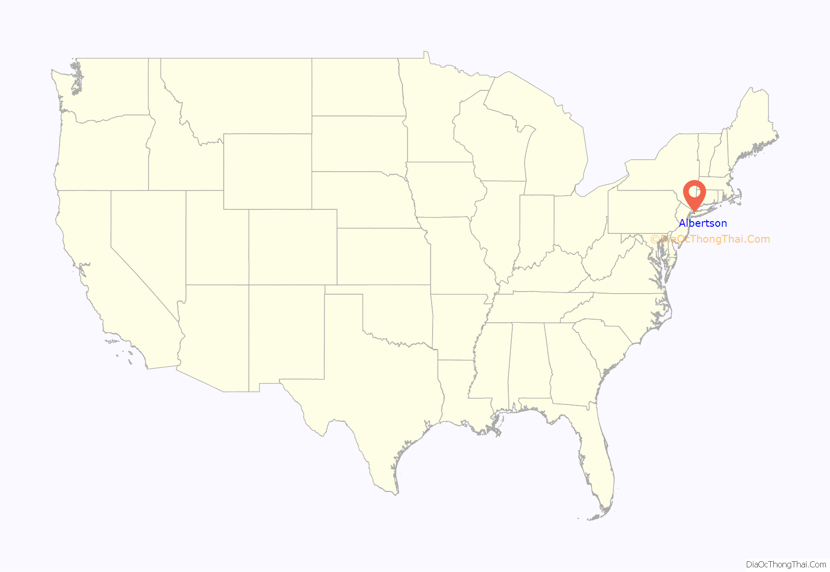
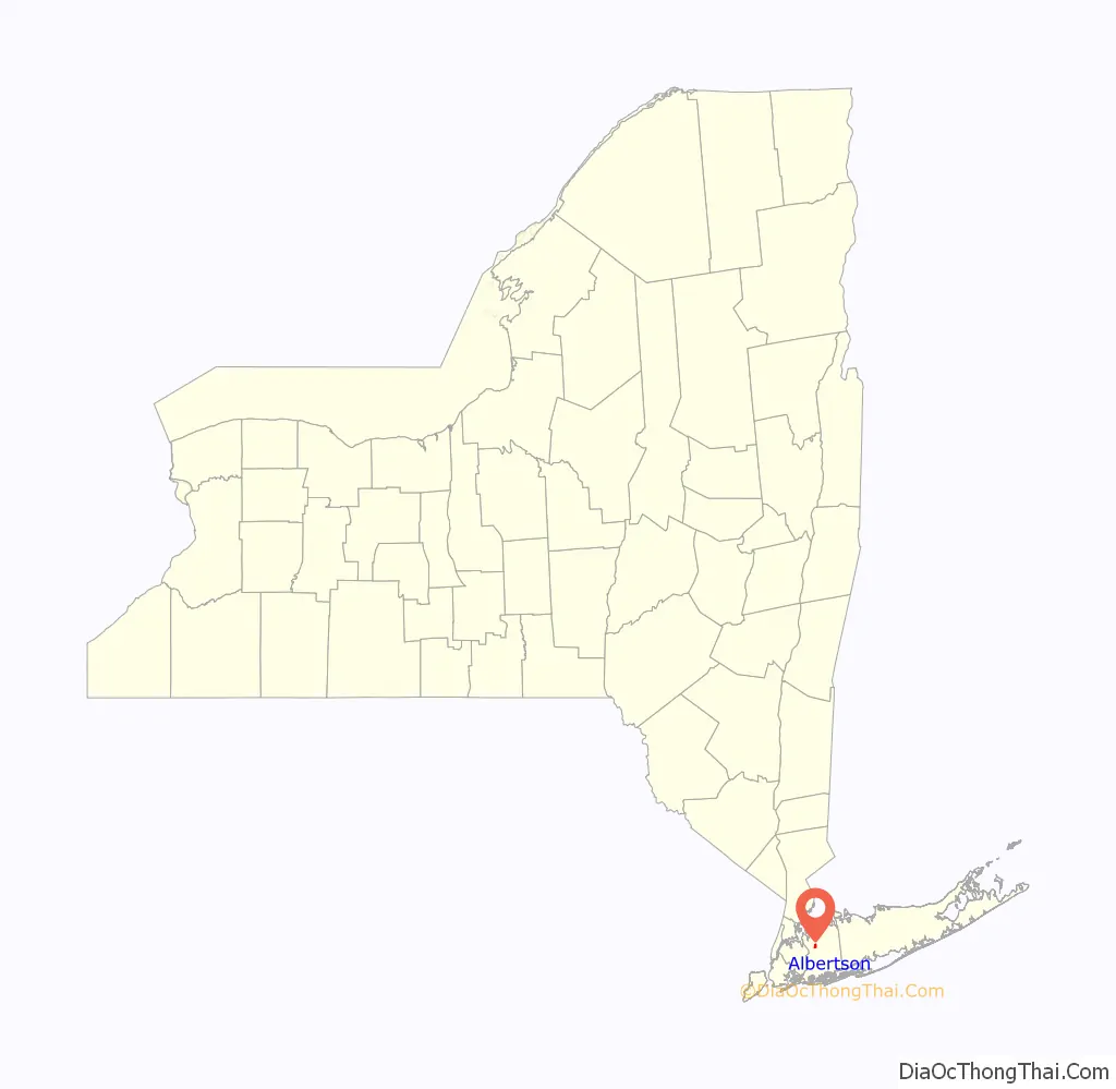
Albertson is a hamlet and census-designated place (CDP) in the Town of North Hempstead in Nassau County, on Long Island, in New York, United States. The population was 5,182 at the 2010 census.
| Name: | Albertson CDP |
|---|---|
| LSAD Code: | 57 |
| LSAD Description: | CDP (suffix) |
| State: | New York |
| County: | Nassau County |
| Elevation: | 128 ft (39 m) |
| Total Area: | 0.68 sq mi (1.76 km²) |
| Land Area: | 0.68 sq mi (1.76 km²) |
| Water Area: | 0.00 sq mi (0.00 km²) |
| Total Population: | 5,220 |
| Population Density: | 7,687.78/sq mi (2,968.34/km²) |
| ZIP code: | 11507 |
| Area code: | 516, 363 |
| FIPS code: | 3601011 |
| GNISfeature ID: | 0942241 |
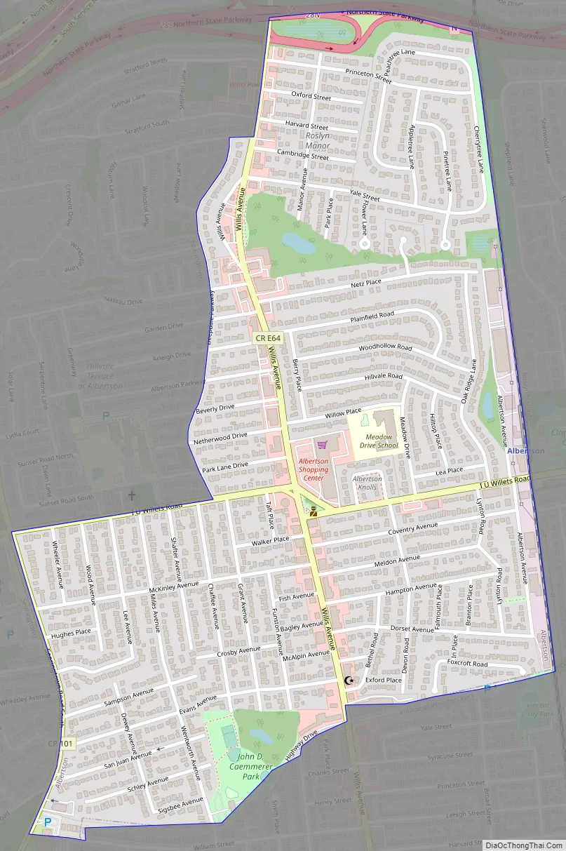
Online Interactive Map
Click on ![]() to view map in "full screen" mode.
to view map in "full screen" mode.
Albertson location map. Where is Albertson CDP?
History
The first European settler was John Seren who came from Connecticut in 1644. Later Townsend Albertson started a farm and gristmill and the community became known as Albertson.
In 1850, a road was built through Albertson on the lands of Isaac Underhill Willets. The road is still known as I.U. Willets Road. (Willets complained that Long Island has more roads than it would ever need). The Long Island Rail Road opened an Albertson train station in 1864.
In 1908, the Vanderbilt Motor Parkway was built on the southern border of Albertson. In 1938, it was closed, and in 1940, it was replaced by the Northern State Parkway, which runs along the northern border of Albertson.
In 1946, suburbanization began with a small development by William Levitt. The last farms were developed in the mid-1960s.
The Searingtown School (now in Albertson) was one of the schools involved in the landmark Supreme Court case Engel v. Vitale (1962), which disallowed government-directed prayers in public schools.
Albertson Road Map
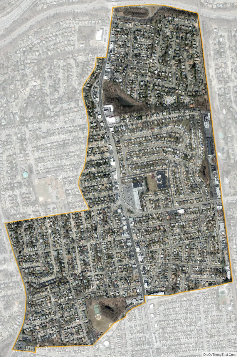
Albertson city Satellite Map
Geography
According to the United States Census Bureau, the CDP has a total area of 0.7 square miles (1.8 km), all land.
Albertson is located south of Roslyn and east of Searingtown.
See also
Map of New York State and its subdivision:- Albany
- Allegany
- Bronx
- Broome
- Cattaraugus
- Cayuga
- Chautauqua
- Chemung
- Chenango
- Clinton
- Columbia
- Cortland
- Delaware
- Dutchess
- Erie
- Essex
- Franklin
- Fulton
- Genesee
- Greene
- Hamilton
- Herkimer
- Jefferson
- Kings
- Lake Ontario
- Lewis
- Livingston
- Madison
- Monroe
- Montgomery
- Nassau
- New York
- Niagara
- Oneida
- Onondaga
- Ontario
- Orange
- Orleans
- Oswego
- Otsego
- Putnam
- Queens
- Rensselaer
- Richmond
- Rockland
- Saint Lawrence
- Saratoga
- Schenectady
- Schoharie
- Schuyler
- Seneca
- Steuben
- Suffolk
- Sullivan
- Tioga
- Tompkins
- Ulster
- Warren
- Washington
- Wayne
- Westchester
- Wyoming
- Yates
- Alabama
- Alaska
- Arizona
- Arkansas
- California
- Colorado
- Connecticut
- Delaware
- District of Columbia
- Florida
- Georgia
- Hawaii
- Idaho
- Illinois
- Indiana
- Iowa
- Kansas
- Kentucky
- Louisiana
- Maine
- Maryland
- Massachusetts
- Michigan
- Minnesota
- Mississippi
- Missouri
- Montana
- Nebraska
- Nevada
- New Hampshire
- New Jersey
- New Mexico
- New York
- North Carolina
- North Dakota
- Ohio
- Oklahoma
- Oregon
- Pennsylvania
- Rhode Island
- South Carolina
- South Dakota
- Tennessee
- Texas
- Utah
- Vermont
- Virginia
- Washington
- West Virginia
- Wisconsin
- Wyoming


