Avon is a village in the town of Avon, Livingston County, New York, United States. The village population was 3,394 at the 2010 census, out of 7,146 people in the entire town. The village and town are named after the River Avon in England.
| Name: | Avon village |
|---|---|
| LSAD Code: | 47 |
| LSAD Description: | village (suffix) |
| State: | New York |
| County: | Livingston County |
| Elevation: | 650 ft (198 m) |
| Total Area: | 3.15 sq mi (8.15 km²) |
| Land Area: | 3.15 sq mi (8.15 km²) |
| Water Area: | 0.00 sq mi (0.00 km²) |
| Total Population: | 3,399 |
| Population Density: | 1,080.42/sq mi (417.11/km²) |
| ZIP code: | 14414 |
| Area code: | 585 |
| FIPS code: | 3603353 |
| GNISfeature ID: | 0942736 |
| Website: | avon-ny.org |
Online Interactive Map
Click on ![]() to view map in "full screen" mode.
to view map in "full screen" mode.
Avon location map. Where is Avon village?
History
Avon was founded by European Americans along the Genesee River, across from the historic Seneca village known as Conawagus (in a transliterated spelling; also spelled as Ca-noh-wa-gas, Conewaugus, or Canawaugus, and as Ga:non’wagês in the Seneca language). The Seneca were among the original Five Nations of the Iroquois Confederacy and had occupied this territory for many hundreds of years prior to European encounter.
The Seneca village was located on the east side of the Genesee River, “about a mile above the ford”. Ga:non’wagês was an important village to the Seneca during the eighteenth century. Their religious leader Handsome Lake was born here about 1735. One of his nephews, later known as Governor Blacksnake, moved here with his family shortly after his birth. He was an important war chief who allied with the British during the Revolutionary War; later he became one of the first Native Americans to publish his memoirs, aided by a fellow Seneca who translated them into English. An edited version of this memoir was published in 2005, with explanations of material about his people. The leader Cornplanter, a maternal uncle of Chainbreaker, was born in this village around 1750.
European-American (white) settlers did not reach any number until about 1785, after the Americans had gained independence in the Revolutionary War and forced the Iroquois nations who had been allied with the British to cede their lands in the region. Many of these new settlers were from New England and eastern New York. They organized the town in 1789 as “Hartford”, and changed the name in 1808 to “Avon”.
In the early 19th century, the village was noted as a spa and resort destination because of its nearby mineral springs. The village was incorporated in 1858. The Avon station on the Erie Railroad opened in 1865; railroads had superseded the Erie and related canals as the chief means of transportation of freight and passengers in the state. Avon was known historically in the late 19th and early 20th centuries for harness racing at the Avon Driving Park.
The Aaron Barber Memorial Building, Avon Inn, First Methodist Episcopal Church of Avon, Hall’s Opera Block, and J. Francis Kellogg House are listed on the National Register of Historic Places.
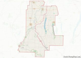
Avon Road Map
Avon city Satellite Map
Geography
Avon is located at 42°54′37″N 77°44′51″W / 42.91028°N 77.74750°W / 42.91028; -77.74750 (42.91029, -77.747687). According to the United States Census Bureau, the village has a total area of 3.1 square miles (8.1 km), all land. The Genesee River forms the western boundary of the village. Avon is in the north part of Livingston County, near the border of Monroe County.
U.S. Route 20, New York State Route 5, and New York State Route 39 all were constructed to pass through the village or follow existing routes. Two miles to the east is Interstate 390. Rochester is 20 miles (32 km) to the north, Canandaigua is 24 miles (39 km) to the east, Geneseo, the Livingston county seat, is 9 miles (14 km) to the south, and Batavia is 24 miles (39 km) to the northwest.
See also
Map of New York State and its subdivision:- Albany
- Allegany
- Bronx
- Broome
- Cattaraugus
- Cayuga
- Chautauqua
- Chemung
- Chenango
- Clinton
- Columbia
- Cortland
- Delaware
- Dutchess
- Erie
- Essex
- Franklin
- Fulton
- Genesee
- Greene
- Hamilton
- Herkimer
- Jefferson
- Kings
- Lake Ontario
- Lewis
- Livingston
- Madison
- Monroe
- Montgomery
- Nassau
- New York
- Niagara
- Oneida
- Onondaga
- Ontario
- Orange
- Orleans
- Oswego
- Otsego
- Putnam
- Queens
- Rensselaer
- Richmond
- Rockland
- Saint Lawrence
- Saratoga
- Schenectady
- Schoharie
- Schuyler
- Seneca
- Steuben
- Suffolk
- Sullivan
- Tioga
- Tompkins
- Ulster
- Warren
- Washington
- Wayne
- Westchester
- Wyoming
- Yates
- Alabama
- Alaska
- Arizona
- Arkansas
- California
- Colorado
- Connecticut
- Delaware
- District of Columbia
- Florida
- Georgia
- Hawaii
- Idaho
- Illinois
- Indiana
- Iowa
- Kansas
- Kentucky
- Louisiana
- Maine
- Maryland
- Massachusetts
- Michigan
- Minnesota
- Mississippi
- Missouri
- Montana
- Nebraska
- Nevada
- New Hampshire
- New Jersey
- New Mexico
- New York
- North Carolina
- North Dakota
- Ohio
- Oklahoma
- Oregon
- Pennsylvania
- Rhode Island
- South Carolina
- South Dakota
- Tennessee
- Texas
- Utah
- Vermont
- Virginia
- Washington
- West Virginia
- Wisconsin
- Wyoming


