Belleville is a hamlet and census-designated place (CDP) in the town of Ellisburg, Jefferson County, New York, United States. The population was 226 at the 2010 census.
It was an incorporated village from 1860 to 1930.
| Name: | Belleville CDP |
|---|---|
| LSAD Code: | 57 |
| LSAD Description: | CDP (suffix) |
| State: | New York |
| County: | Jefferson County |
| Elevation: | 459 ft (140 m) |
| Total Area: | 0.68 sq mi (1.75 km²) |
| Land Area: | 0.66 sq mi (1.70 km²) |
| Water Area: | 0.02 sq mi (0.04 km²) |
| Total Population: | 233 |
| Population Density: | 354.10/sq mi (136.81/km²) |
| ZIP code: | 13611 |
| Area code: | 315 |
| FIPS code: | 3605683 |
| GNISfeature ID: | 943612 |
Online Interactive Map
Click on ![]() to view map in "full screen" mode.
to view map in "full screen" mode.
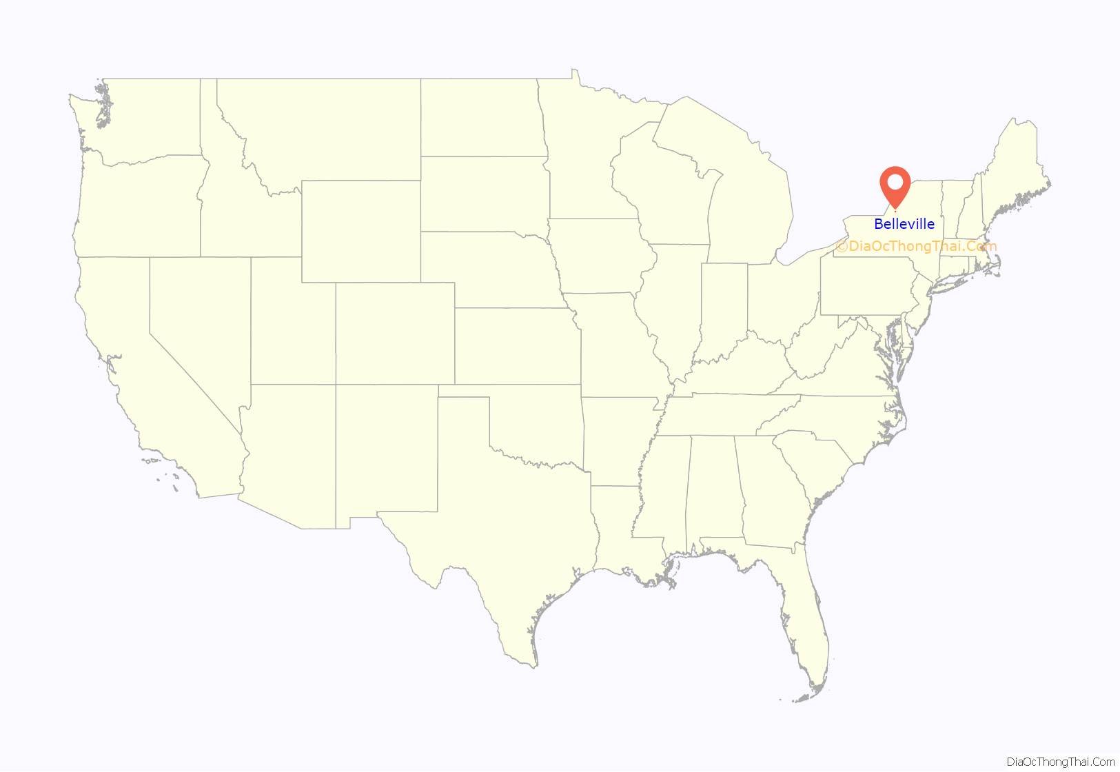
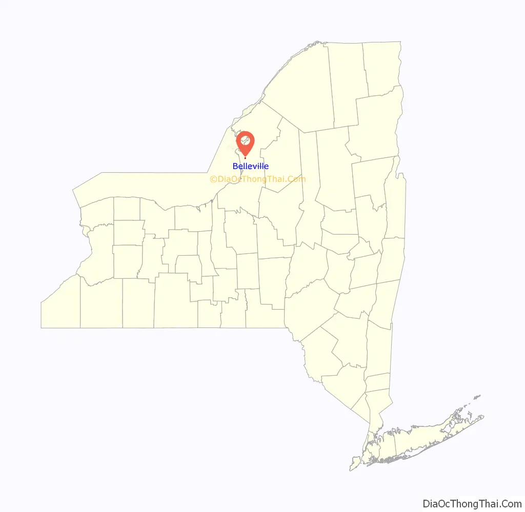
Belleville location map. Where is Belleville CDP?
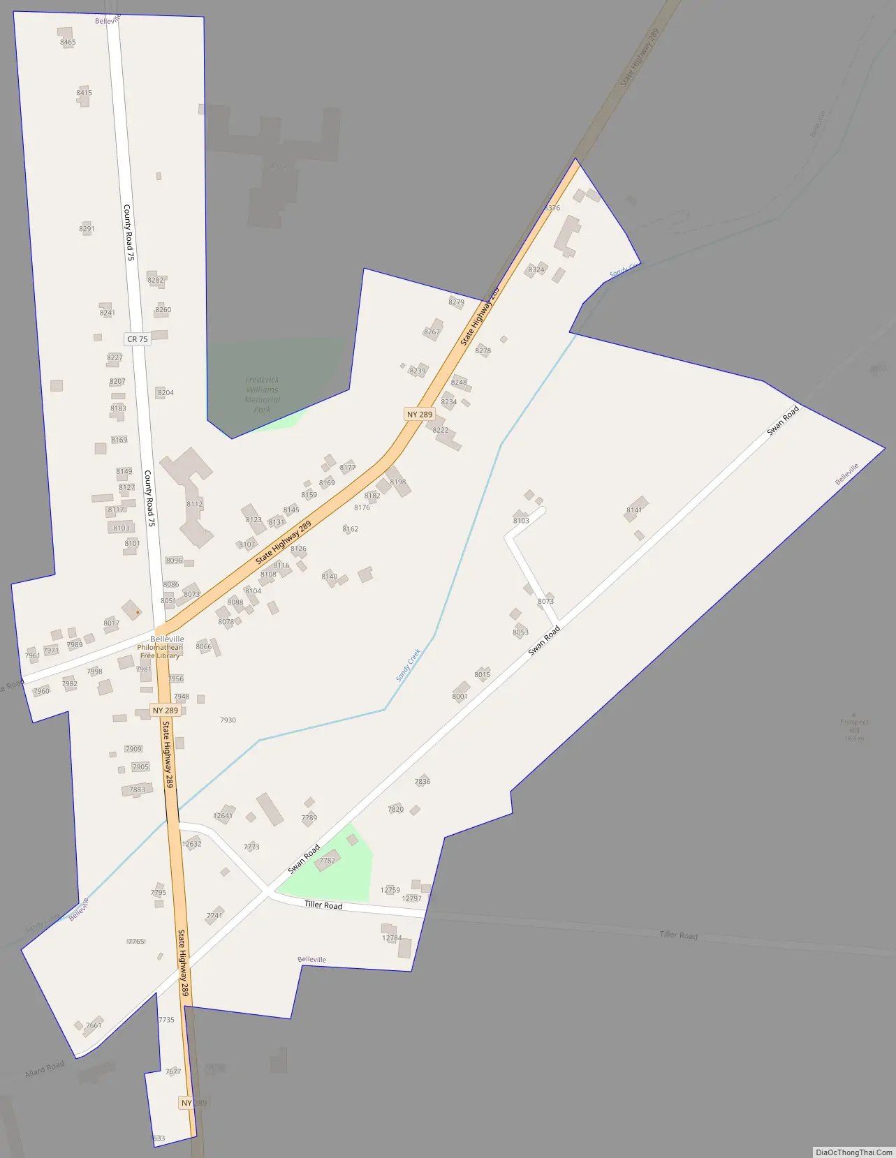
Belleville Road Map
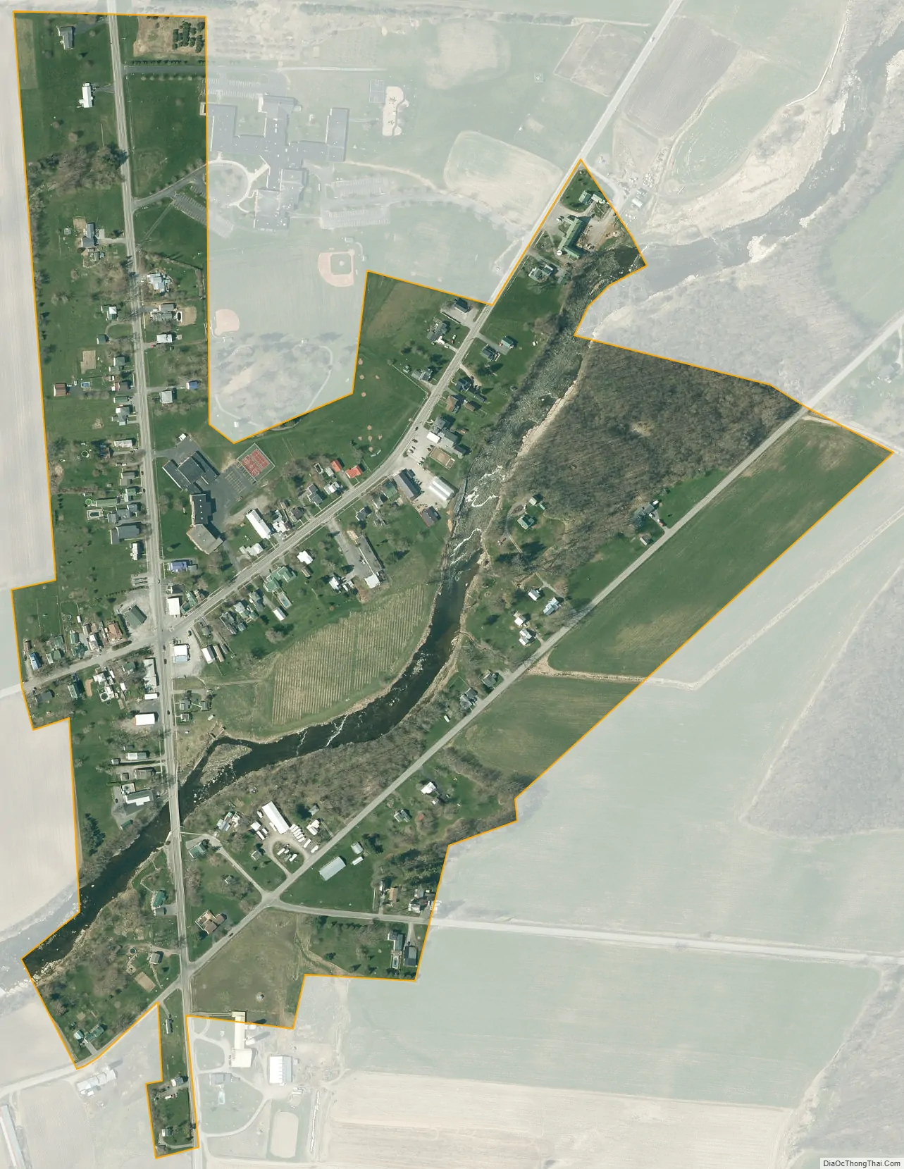
Belleville city Satellite Map
Geography
Belleville is in southern Jefferson County, in the northern part of the town of Ellisburg. The community sits on both sides of Sandy Creek, a southwesterly-flowing direct tributary of Lake Ontario. The main crossroads in the hamlet is on the north side of the creek. New York State Route 289 leads south 3.5 miles (5.6 km) to the village of Ellisburg and northeast (upstream) 2 miles (3 km) to New York State Route 178. County Route 75 runs north and southwest from the Belleville crossroads.
According to the U.S. Census Bureau, the Belleville CDP has an area of 0.26 square miles (0.68 km), all land.
See also
Map of New York State and its subdivision:- Albany
- Allegany
- Bronx
- Broome
- Cattaraugus
- Cayuga
- Chautauqua
- Chemung
- Chenango
- Clinton
- Columbia
- Cortland
- Delaware
- Dutchess
- Erie
- Essex
- Franklin
- Fulton
- Genesee
- Greene
- Hamilton
- Herkimer
- Jefferson
- Kings
- Lake Ontario
- Lewis
- Livingston
- Madison
- Monroe
- Montgomery
- Nassau
- New York
- Niagara
- Oneida
- Onondaga
- Ontario
- Orange
- Orleans
- Oswego
- Otsego
- Putnam
- Queens
- Rensselaer
- Richmond
- Rockland
- Saint Lawrence
- Saratoga
- Schenectady
- Schoharie
- Schuyler
- Seneca
- Steuben
- Suffolk
- Sullivan
- Tioga
- Tompkins
- Ulster
- Warren
- Washington
- Wayne
- Westchester
- Wyoming
- Yates
- Alabama
- Alaska
- Arizona
- Arkansas
- California
- Colorado
- Connecticut
- Delaware
- District of Columbia
- Florida
- Georgia
- Hawaii
- Idaho
- Illinois
- Indiana
- Iowa
- Kansas
- Kentucky
- Louisiana
- Maine
- Maryland
- Massachusetts
- Michigan
- Minnesota
- Mississippi
- Missouri
- Montana
- Nebraska
- Nevada
- New Hampshire
- New Jersey
- New Mexico
- New York
- North Carolina
- North Dakota
- Ohio
- Oklahoma
- Oregon
- Pennsylvania
- Rhode Island
- South Carolina
- South Dakota
- Tennessee
- Texas
- Utah
- Vermont
- Virginia
- Washington
- West Virginia
- Wisconsin
- Wyoming


