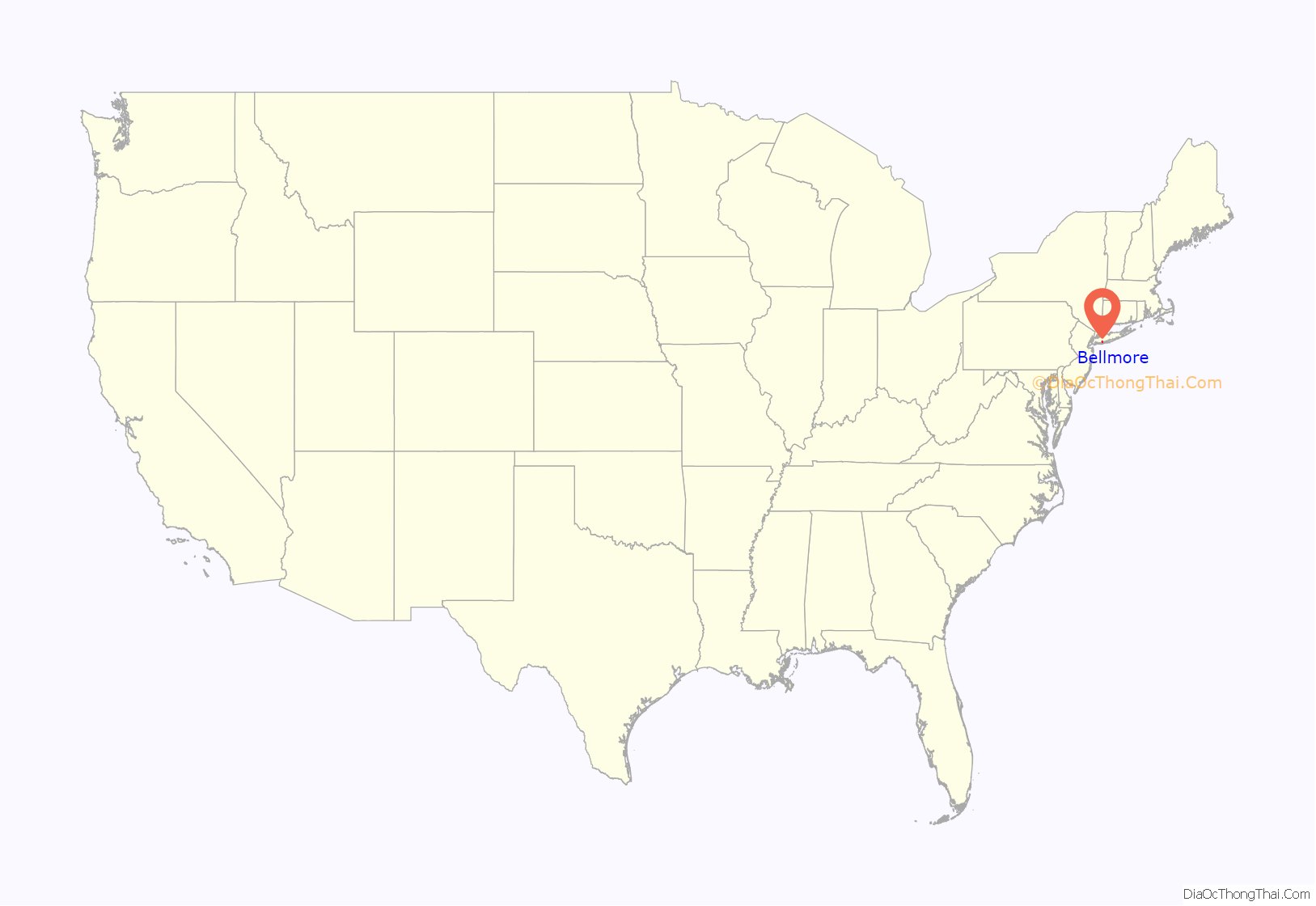
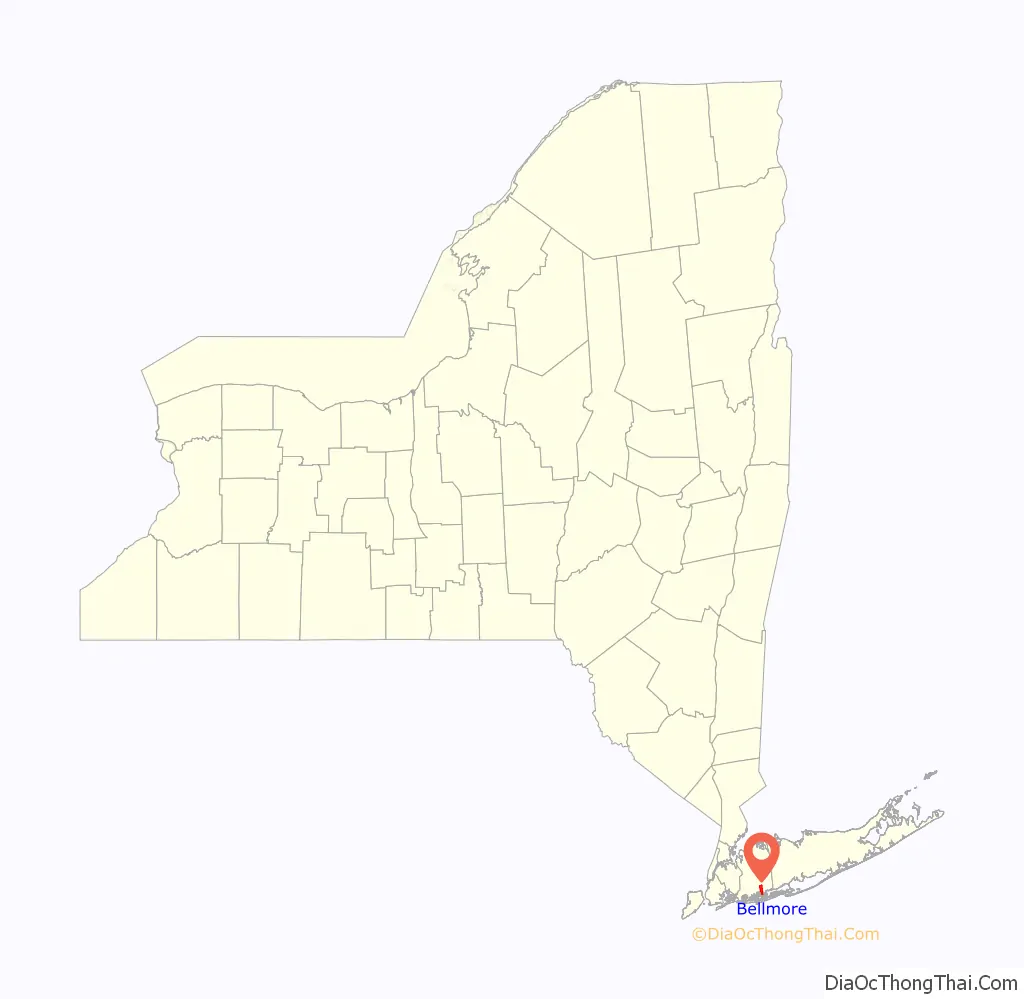
Bellmore is a hamlet and census-designated place (CDP) in Nassau County, New York, United States. The population according to the 2010 census was 16,218. Bellmore is located on the south shore of Long Island 5 miles from Jones Beach State Park, approximately 27 miles (43 km) east of Manhattan, and 10 miles (16 km) east of the Nassau-Queens (New York City) Line.
Bellmore, along with North Bellmore, are referred to collectively as “The Bellmores”. The part of the latter area south of Merrick Road (or possibly south of Sunrise Highway) is sometimes called “South Bellmore”.
Bellmore serves as a suburb of New York City on Long Island. Penn Station in Manhattan is typically a 45-minute direct ride from the station on the Long Island Rail Road’s Babylon Branch. John F. Kennedy Int’l Airport is located within 15 miles (24 km) of Bellmore, making it convenient for travelers. Major thoroughfares that wind through the suburb include Sunrise Highway, Southern State Parkway, Merrick Road, Bellmore Avenue, Jerusalem Avenue, and Newbridge Road.
| Name: | Bellmore CDP |
|---|---|
| LSAD Code: | 57 |
| LSAD Description: | CDP (suffix) |
| State: | New York |
| County: | Nassau County |
| Total Area: | 3.0 sq mi (8 km²) |
| Land Area: | 2.5 sq mi (6 km²) |
| Water Area: | 0.5 sq mi (1 km²) |
| Total Population: | 16,218 |
| Population Density: | 5,400/sq mi (2,100/km²) |
| ZIP code: | 11710 |
| Area code: | 516 |
| FIPS code: | 3605738 |
| Website: | https://www.bellmore.li |
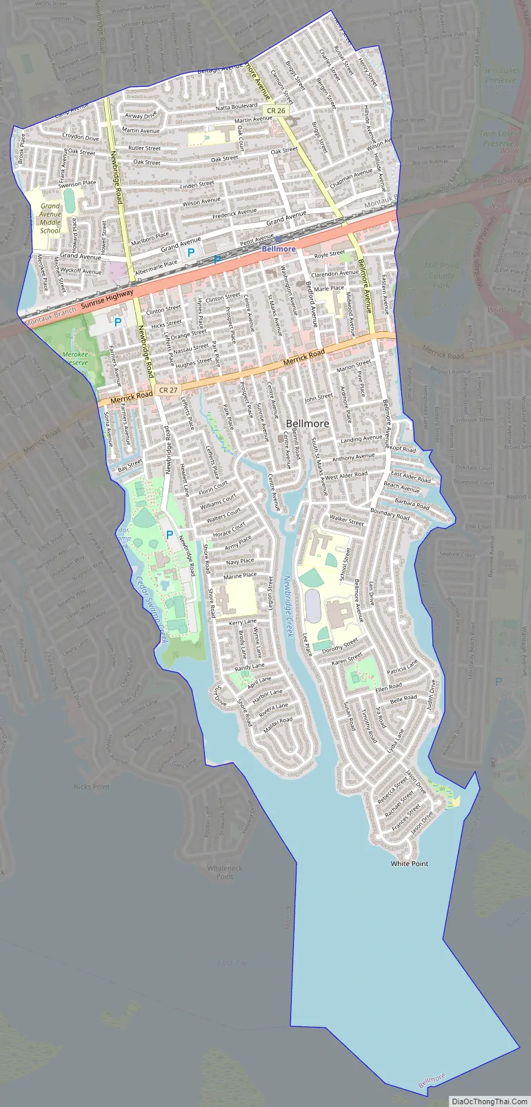
Online Interactive Map
Click on ![]() to view map in "full screen" mode.
to view map in "full screen" mode.
Bellmore location map. Where is Bellmore CDP?
History
In 1643, Bellmore was a farming and fishing town known then as “Little Neck and “New Bridge”. Bellmore was settled primarily by Englishmen who crossed Long Island Sound from Connecticut in the middle of the seventeenth century. Bradley Vogel purchased a 214-acre (0.9 km) farm in what is now North Bellmore in 1655. Further south, near the bay, John Smith deeded 100 acres (0.4 km) to his son, Jeremiah in 1676. John Bedell married Sarah Southard and moved into their new home on Merrick Road in about 1689. Two communities grew out of these beginnings. Smithville (later Smithville South) was named for the many Smith families who lived in the area, and New Bridge, named for the bridge that joined the peninsulas south of Merrick Road.
When the railroad was built through the area in 1867 they arbitrarily named their station Bellmore. Development followed as both communities grew towards the railroad and adopted the name Bellmore. By 1920, the Bellmores had a population of 3000 as well as stores along Bedford Avenue. The town was officially named Bellmore in 1900, when the post office was established.
The Bellmore Memorial Library, was founded in 1948. It was started in an old schoolhouse. This library has lasted since 1948 until present, keeping it as the main library of Bellmore, New York.
In 1968, the Supreme Court ruled against Sam’s Stationery and Luncheonette of Bellmore. In Ginsberg v. New York, the Court found that it was well within the state’s power to protect minors and that just because the material is not classified as obscene to adults it may still be regulated with minors.
Bellmore Road Map
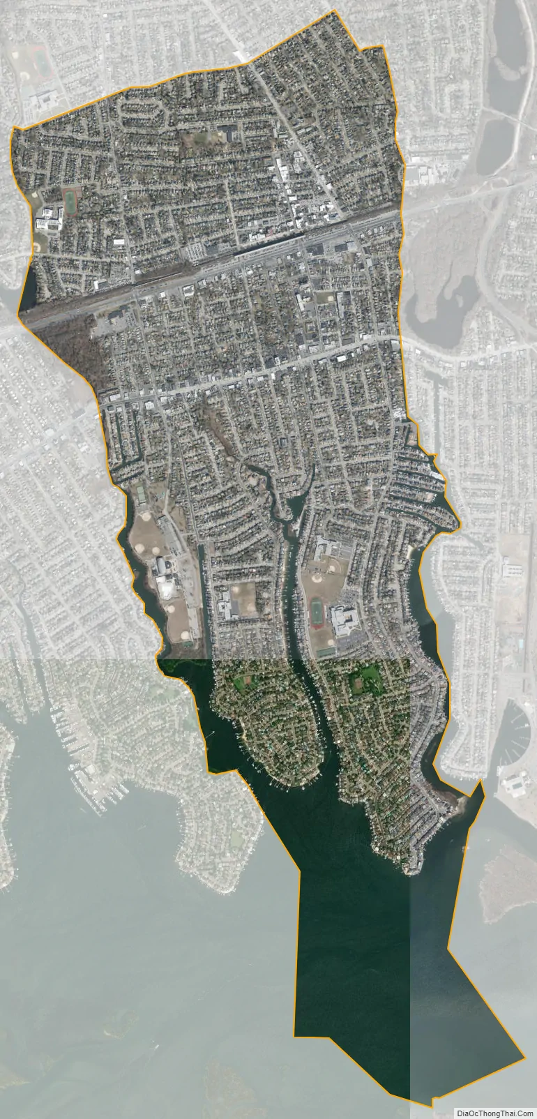
Bellmore city Satellite Map
Geography
Bellmore is located at 40°39′40″N 73°31′44″W / 40.66111°N 73.52889°W / 40.66111; -73.52889 (40.661188, −73.529005).
According to the United States Census Bureau, the CDP has a total area of 3.0 square miles (7.8 km), of which, 2.5 square miles (6.5 km) of it is land and 0.5 square miles (1.3 km) of it (17.67%) is water.
See also
Map of New York State and its subdivision:- Albany
- Allegany
- Bronx
- Broome
- Cattaraugus
- Cayuga
- Chautauqua
- Chemung
- Chenango
- Clinton
- Columbia
- Cortland
- Delaware
- Dutchess
- Erie
- Essex
- Franklin
- Fulton
- Genesee
- Greene
- Hamilton
- Herkimer
- Jefferson
- Kings
- Lake Ontario
- Lewis
- Livingston
- Madison
- Monroe
- Montgomery
- Nassau
- New York
- Niagara
- Oneida
- Onondaga
- Ontario
- Orange
- Orleans
- Oswego
- Otsego
- Putnam
- Queens
- Rensselaer
- Richmond
- Rockland
- Saint Lawrence
- Saratoga
- Schenectady
- Schoharie
- Schuyler
- Seneca
- Steuben
- Suffolk
- Sullivan
- Tioga
- Tompkins
- Ulster
- Warren
- Washington
- Wayne
- Westchester
- Wyoming
- Yates
- Alabama
- Alaska
- Arizona
- Arkansas
- California
- Colorado
- Connecticut
- Delaware
- District of Columbia
- Florida
- Georgia
- Hawaii
- Idaho
- Illinois
- Indiana
- Iowa
- Kansas
- Kentucky
- Louisiana
- Maine
- Maryland
- Massachusetts
- Michigan
- Minnesota
- Mississippi
- Missouri
- Montana
- Nebraska
- Nevada
- New Hampshire
- New Jersey
- New Mexico
- New York
- North Carolina
- North Dakota
- Ohio
- Oklahoma
- Oregon
- Pennsylvania
- Rhode Island
- South Carolina
- South Dakota
- Tennessee
- Texas
- Utah
- Vermont
- Virginia
- Washington
- West Virginia
- Wisconsin
- Wyoming


