Brightwaters is an incorporated village in the southwestern part of the Town of Islip in Suffolk County, on Long Island, in New York, United States. The population was 3,103 at the time of the 2010 census.
| Name: | Brightwaters village |
|---|---|
| LSAD Code: | 47 |
| LSAD Description: | village (suffix) |
| State: | New York |
| County: | Suffolk County |
| Incorporated: | November 30, 1916 |
| Elevation: | 23 ft (7 m) |
| Total Area: | 0.99 sq mi (2.56 km²) |
| Land Area: | 0.97 sq mi (2.50 km²) |
| Water Area: | 0.02 sq mi (0.06 km²) |
| Total Population: | 3,181 |
| Population Density: | 3,292.96/sq mi (1,271.92/km²) |
| ZIP code: | 11718 |
| Area code: | 631 |
| FIPS code: | 3608323 |
| GNISfeature ID: | 0975774 |
| Website: | www.villageofbrightwaters.com |
Online Interactive Map
Click on ![]() to view map in "full screen" mode.
to view map in "full screen" mode.
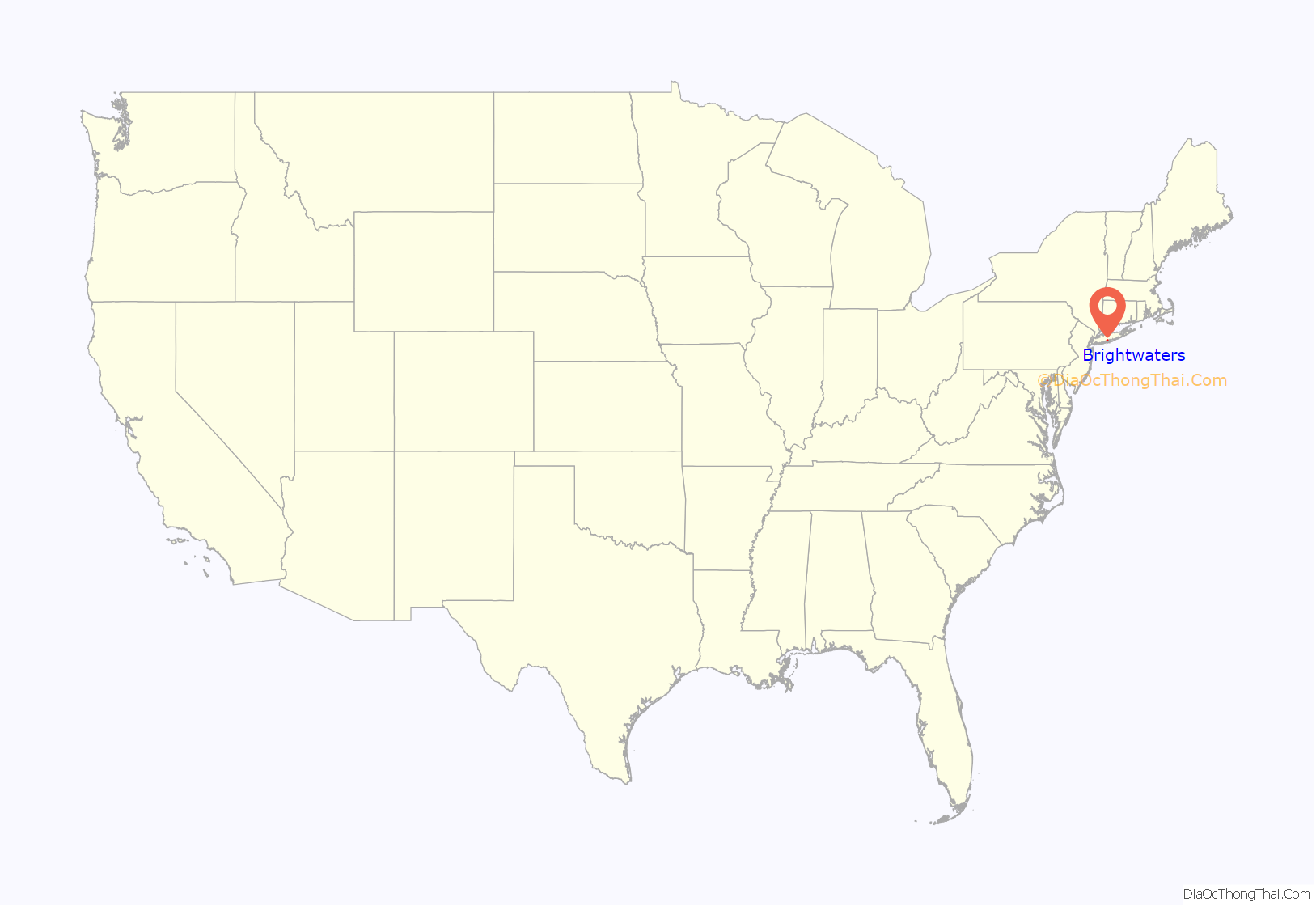
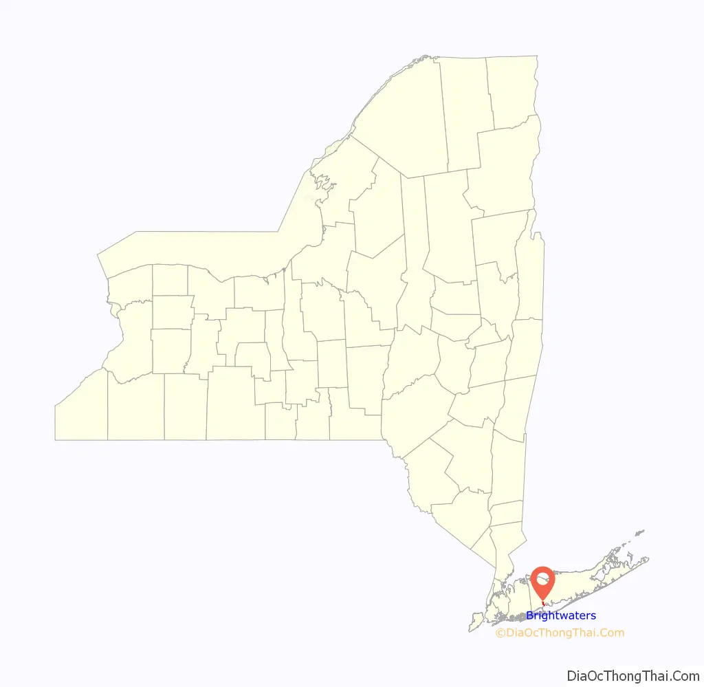
Brightwaters location map. Where is Brightwaters village?
History
Brightwaters was developed in the early 20th Century by the T.B. Ackerson Company, which was known for its work in Brooklyn.
By 1916, locals felt that their community, which at the time was still an unincorporated part of the Town of Islip, would be better off if they were to incorporate as a village, citing concerns over how their community was being taxed and how they had to pay for private subscriptions for things which the believed should have been provided through taxes paid to Islip. This led to locals signing a petition to incorporate Brightwaters as a village. The petition was given to the Town of Islip on September 20, 1916, and Brightwaters became an incorporated village on November 30, 1916.
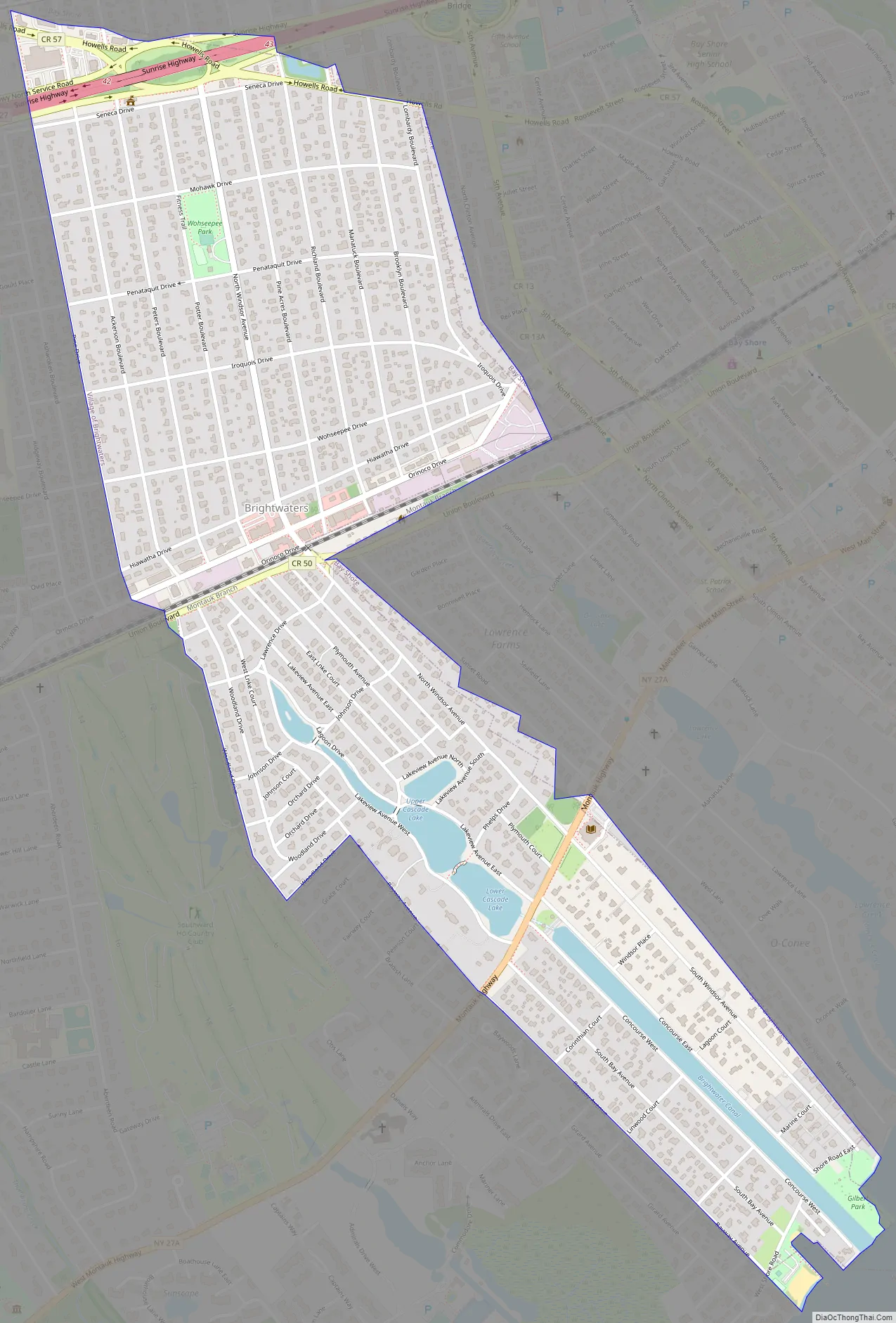
Brightwaters Road Map
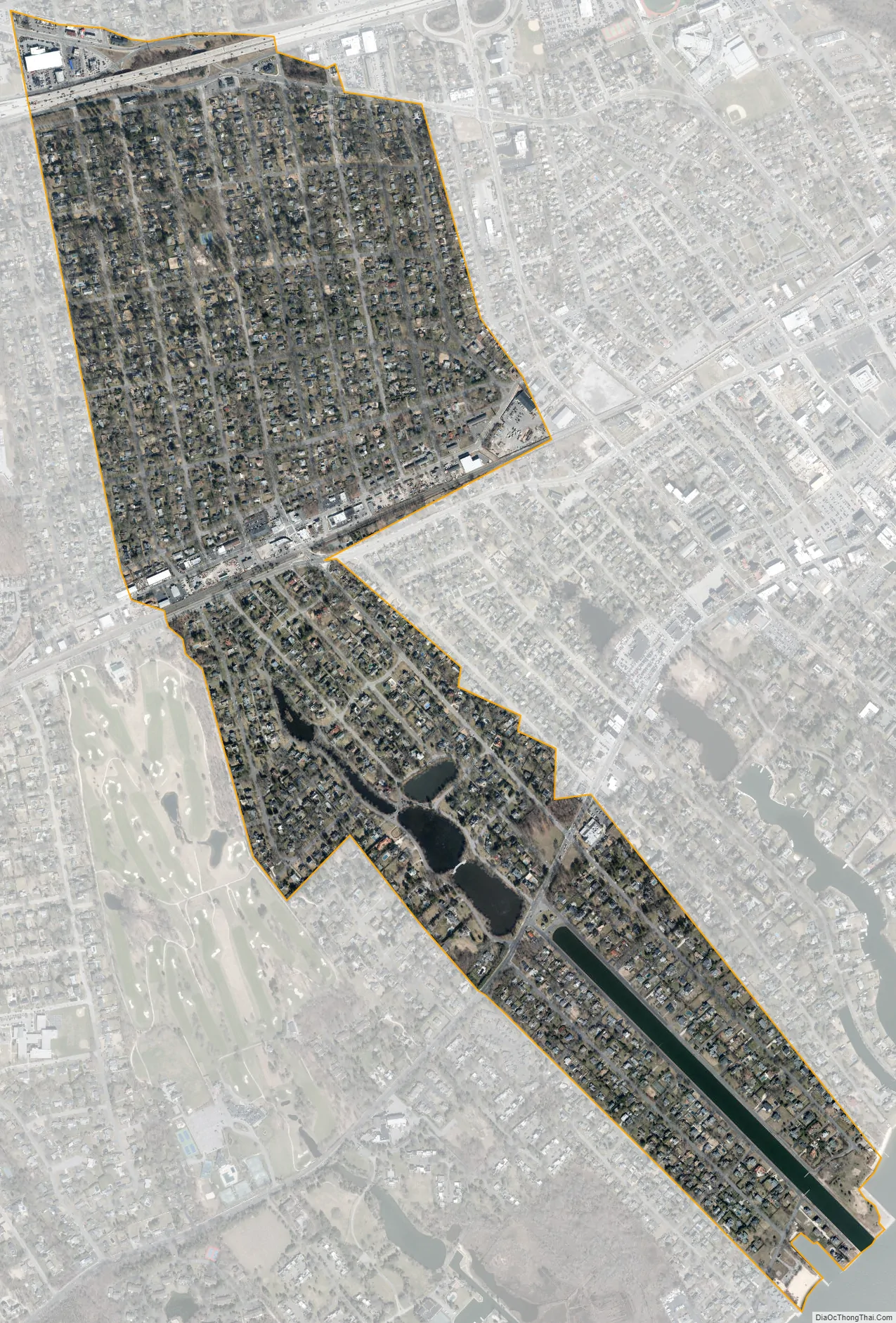
Brightwaters city Satellite Map
Geography
According to the United States Census Bureau, the village has a total area of 1.0 square mile (2.6 km), of which 0.97 square miles (2.5 km) is land and 0.04 square miles (0.1 km), or 2.26%, is water.
It contains Wohseepee Park in northern Brightwaters, the Brightwaters Canal directly south of Montauk Highway, and four lakes directly north of Montauk Highway: Cascades Lake, Mirror Lake, Lagoon Lake and Nosrekca Lake. The village’s businesses are located at the intersection of Windsor Avenue and Orinoco Drive (referred to as Brightwaters Village). These geographic features make up the three districts of the village; the Canal District (southern Brightwaters, everything south of Montauk Highway), the Lakes District (central Brightwaters, everything north of the highway to Union Boulevard) and the Wohseepee Park District (northern Brightwaters, everything north of Union Boulevard to Seneca Drive).
Brightwaters uses the 11718 ZIP code, which is distinct from the Bay Shore Postal District (11706).
See also
Map of New York State and its subdivision:- Albany
- Allegany
- Bronx
- Broome
- Cattaraugus
- Cayuga
- Chautauqua
- Chemung
- Chenango
- Clinton
- Columbia
- Cortland
- Delaware
- Dutchess
- Erie
- Essex
- Franklin
- Fulton
- Genesee
- Greene
- Hamilton
- Herkimer
- Jefferson
- Kings
- Lake Ontario
- Lewis
- Livingston
- Madison
- Monroe
- Montgomery
- Nassau
- New York
- Niagara
- Oneida
- Onondaga
- Ontario
- Orange
- Orleans
- Oswego
- Otsego
- Putnam
- Queens
- Rensselaer
- Richmond
- Rockland
- Saint Lawrence
- Saratoga
- Schenectady
- Schoharie
- Schuyler
- Seneca
- Steuben
- Suffolk
- Sullivan
- Tioga
- Tompkins
- Ulster
- Warren
- Washington
- Wayne
- Westchester
- Wyoming
- Yates
- Alabama
- Alaska
- Arizona
- Arkansas
- California
- Colorado
- Connecticut
- Delaware
- District of Columbia
- Florida
- Georgia
- Hawaii
- Idaho
- Illinois
- Indiana
- Iowa
- Kansas
- Kentucky
- Louisiana
- Maine
- Maryland
- Massachusetts
- Michigan
- Minnesota
- Mississippi
- Missouri
- Montana
- Nebraska
- Nevada
- New Hampshire
- New Jersey
- New Mexico
- New York
- North Carolina
- North Dakota
- Ohio
- Oklahoma
- Oregon
- Pennsylvania
- Rhode Island
- South Carolina
- South Dakota
- Tennessee
- Texas
- Utah
- Vermont
- Virginia
- Washington
- West Virginia
- Wisconsin
- Wyoming


