Calverton is a hamlet and census-designated place (CDP) on eastern Long Island in Suffolk County, New York, United States. The population was 6,510 at the 2010 census.
Most of Calverton is in the Town of Riverhead, while the area south of the Peconic River is a mostly undeveloped smaller portion in the Town of Brookhaven.
| Name: | Calverton CDP |
|---|---|
| LSAD Code: | 57 |
| LSAD Description: | CDP (suffix) |
| State: | New York |
| County: | Suffolk County |
| Elevation: | 30 ft (9 m) |
| Total Area: | 26.71 sq mi (69.19 km²) |
| Land Area: | 26.21 sq mi (67.90 km²) |
| Water Area: | 0.50 sq mi (1.29 km²) |
| Total Population: | 5,934 |
| Population Density: | 226.36/sq mi (87.40/km²) |
| ZIP code: | 11933 |
| Area code: | 631, 934 |
| FIPS code: | 3611781 |
| GNISfeature ID: | 0945505 |
Online Interactive Map
Click on ![]() to view map in "full screen" mode.
to view map in "full screen" mode.
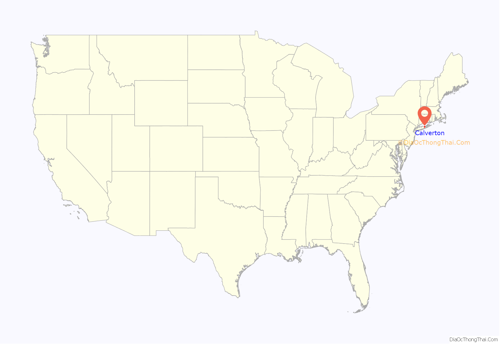
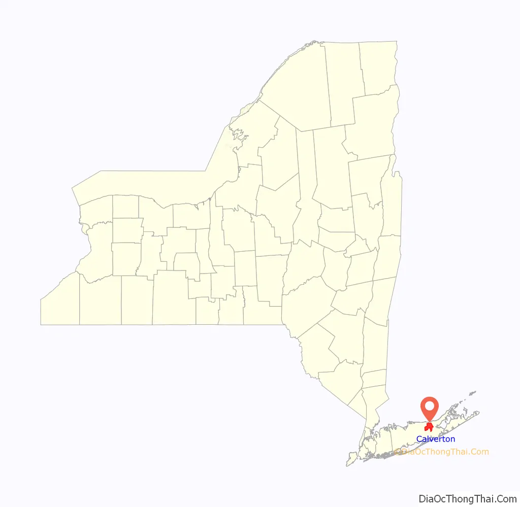
Calverton location map. Where is Calverton CDP?
History
Calverton was first referred to as “Baiting Hollow Station” when the Long Island Rail Road arrived in 1844. The station closed in 1958, but the sheltered shed for the station remained standing as of 2007.
The area’s Native American name was Conungum or Kanungum, meaning “fixed line” or “boundary”. In 1868, the Calverton post office opened, named for Bernard J. Calvert. It remained a small farming community specializing in cranberries, which grew in swampy areas along the Peconic River until the Navy purchase.
Calverton’s history is tied closely to Naval Weapons Industrial Reserve Plant, Calverton. In 1953, the United States Navy purchased 6,000 acres (24 km) around Calverton from a local farmer named Harry Edwards, including the mansion of a grandson of Frank Winfield Woolworth’s, so that Grumman could test and finish jets. A 10,000-foot (3,000 m) runway was built, and most of Grumman’s F-14 Tomcat and E-2C Hawkeye aircraft were to pass through the plant.
In 1965, Nelson Rockefeller proposed using the base as the fourth major airport for the New York metropolitan area. Grumman and local opposition ended the quest.
In 1978, more than 1,000 acres (4.0 km) of the base were used to create Calverton National Cemetery, which is the largest and busiest (in terms of burials per day) United States national cemetery. In 1995, after Northrop acquired Grumman, the new Northrop Grumman pulled out of the base, and the Navy began liquidating the land. In 1996, before the base could be turned over the Town of Riverhead, the base was used to reassemble the wreckage of TWA Flight 800 which had crashed about 20 miles (32 km) south in the ocean. In 2000, Skydive Long Island (formerly located at East Moriches) moved to the airport, and to this day continues to generate the majority of the current air traffic as a key destination for New York-based skydivers.
Through 2007, debates raged about whether or not to turn the base into a mega complex around a NASCAR track, called EPCAL Centre, or a giant ski resort based construction of an artificial 350-foot (110 m) high indoor ski mountain. In January 2008, the Riverhead Town Board, with newly elected officers, signed a deal to sell the airport for $155 million to Riverhead Resorts, to build the ski mountain, tear up the airport runway, and replace it with a lake, overruling a December vote to give the NASCAR track the go-ahead. It would have taken up to three years to get the necessary environmental permits, and the proposed opening date of the project was 2012. On November 12, 2010, however, the town of Riverhead voted 4-1 to cancel all plans for the indoor ski resort/water park.
A portion of the base is being developed as an industrial/office park.
Several new medium size industrial companies have sprung up in the area, including Crown Recycling and a Federal Express Distribution Center.
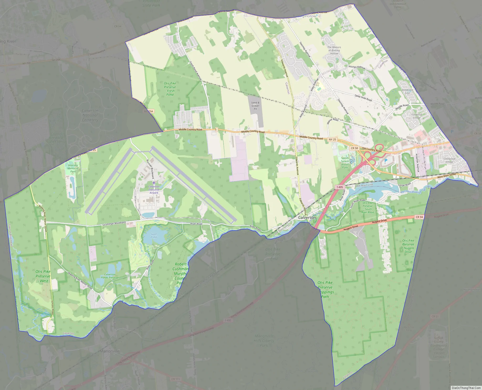
Calverton Road Map
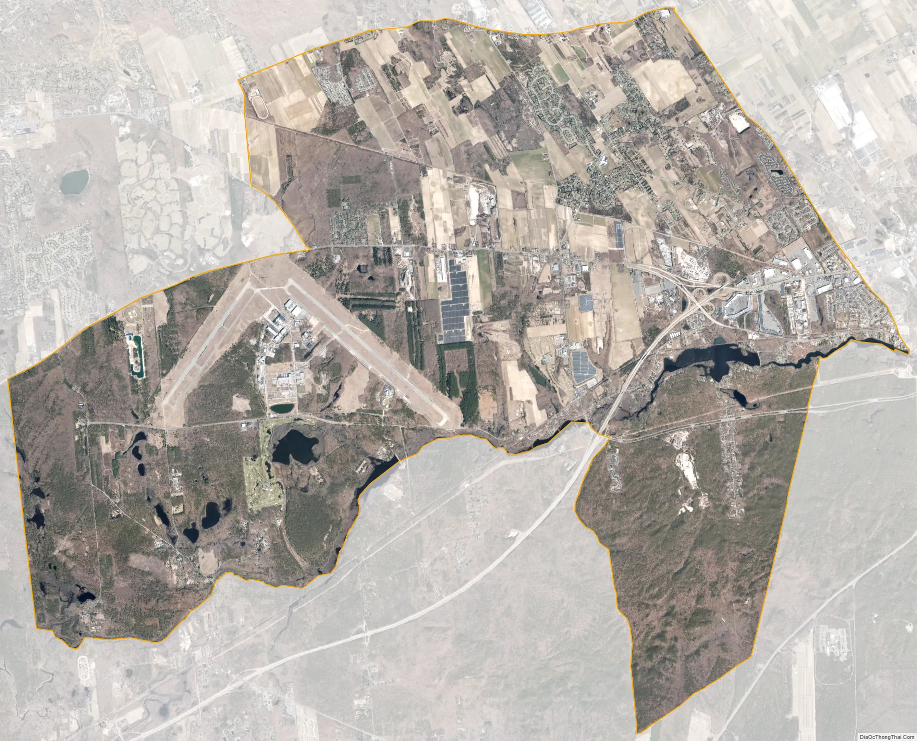
Calverton city Satellite Map
Geography
According to the United States Census Bureau, the CDP has a total area of 28.5 square miles (74 km), of which 28.0 square miles (73 km) is land and 0.5 square miles (1.3 km), or 1.82%, is water.
The former Naval Weapons Industrial Reserve Plant became the Naval Weapons Industrial Reserve Plant, Calverton (IATA code “CTO”) in the late 20th century.
See also
Map of New York State and its subdivision:- Albany
- Allegany
- Bronx
- Broome
- Cattaraugus
- Cayuga
- Chautauqua
- Chemung
- Chenango
- Clinton
- Columbia
- Cortland
- Delaware
- Dutchess
- Erie
- Essex
- Franklin
- Fulton
- Genesee
- Greene
- Hamilton
- Herkimer
- Jefferson
- Kings
- Lake Ontario
- Lewis
- Livingston
- Madison
- Monroe
- Montgomery
- Nassau
- New York
- Niagara
- Oneida
- Onondaga
- Ontario
- Orange
- Orleans
- Oswego
- Otsego
- Putnam
- Queens
- Rensselaer
- Richmond
- Rockland
- Saint Lawrence
- Saratoga
- Schenectady
- Schoharie
- Schuyler
- Seneca
- Steuben
- Suffolk
- Sullivan
- Tioga
- Tompkins
- Ulster
- Warren
- Washington
- Wayne
- Westchester
- Wyoming
- Yates
- Alabama
- Alaska
- Arizona
- Arkansas
- California
- Colorado
- Connecticut
- Delaware
- District of Columbia
- Florida
- Georgia
- Hawaii
- Idaho
- Illinois
- Indiana
- Iowa
- Kansas
- Kentucky
- Louisiana
- Maine
- Maryland
- Massachusetts
- Michigan
- Minnesota
- Mississippi
- Missouri
- Montana
- Nebraska
- Nevada
- New Hampshire
- New Jersey
- New Mexico
- New York
- North Carolina
- North Dakota
- Ohio
- Oklahoma
- Oregon
- Pennsylvania
- Rhode Island
- South Carolina
- South Dakota
- Tennessee
- Texas
- Utah
- Vermont
- Virginia
- Washington
- West Virginia
- Wisconsin
- Wyoming


