Centerport is a hamlet and census-designated place (CDP) in Suffolk County, New York, United States, on the notably affluent North Shore of Long Island, historically known as the Gold Coast. Formerly known as Little Cow Harbor in about 1700, as Centerport in 1836, and as Centerport after 1895, the name refers to its geographic position midway between the east and west boundaries of the town of Huntington.
As of the 2010 United States Census, the CDP population was 5,508. It is located in the town of Huntington. Huntington and its surrounding hamlets mark the east end of Long Island’s renowned “Gold Coast”, the name deriving from the traditional wealth and gentility associated with the area. The association dates back to the early twentieth century in which many affluent families built their homes along the north shore of the island. In Centerport, an example of this is the estate of William Kissam Vanderbilt II, otherwise known as Eagles Nest.
Centerport is highly residential, characterized by winding driveways and beachfront hills. As is common among the many beachfront locations on Long Island’s North Shore, Centerport has developed a large boating and sailing culture. An important part of this culture is the Centerport Yacht Club, which was founded in 1947 and has served as the social and athletic focal point for the boating community in both Centerport and its surrounding areas. The yacht club sponsors a variety of racing fleets and regattas every year generally beginning in the late spring and ending mid-autumn.
Suydam House, built in 1730, a saltbox house, is one of the oldest surviving houses in Centerport.
| Name: | Centerport CDP |
|---|---|
| LSAD Code: | 57 |
| LSAD Description: | CDP (suffix) |
| State: | New York |
| County: | Suffolk County |
| Elevation: | 49 ft (15 m) |
| Total Area: | 3.65 sq mi (9.44 km²) |
| Land Area: | 2.21 sq mi (5.73 km²) |
| Water Area: | 1.43 sq mi (3.71 km²) |
| Total Population: | 5,822 |
| Population Density: | 2,632.01/sq mi (1,016.38/km²) |
| ZIP code: | 11721 |
| Area code: | 631 |
| FIPS code: | 3613442 |
| GNISfeature ID: | 0946210 |
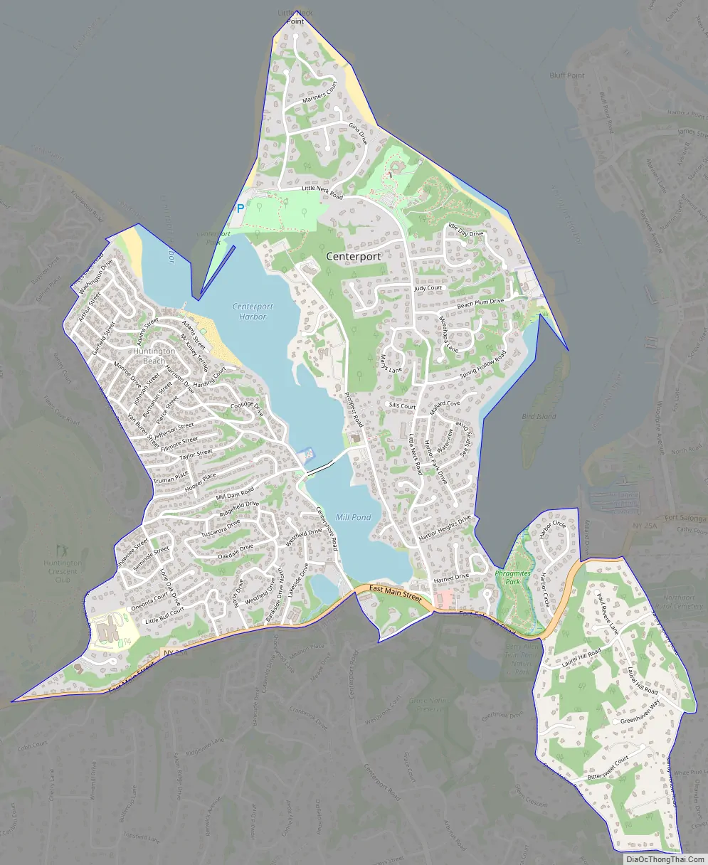
Online Interactive Map
Click on ![]() to view map in "full screen" mode.
to view map in "full screen" mode.
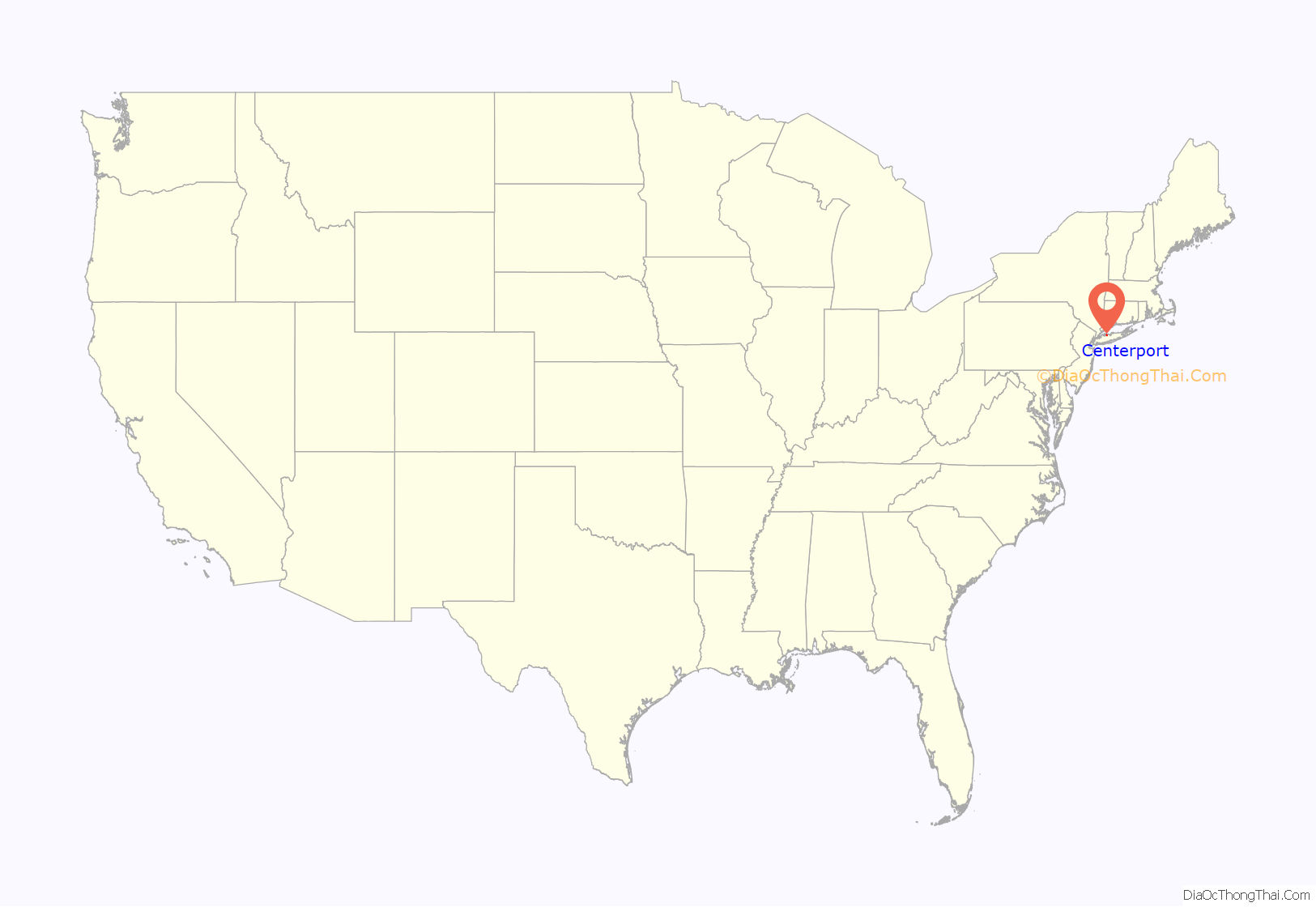
Centerport location map. Where is Centerport CDP?
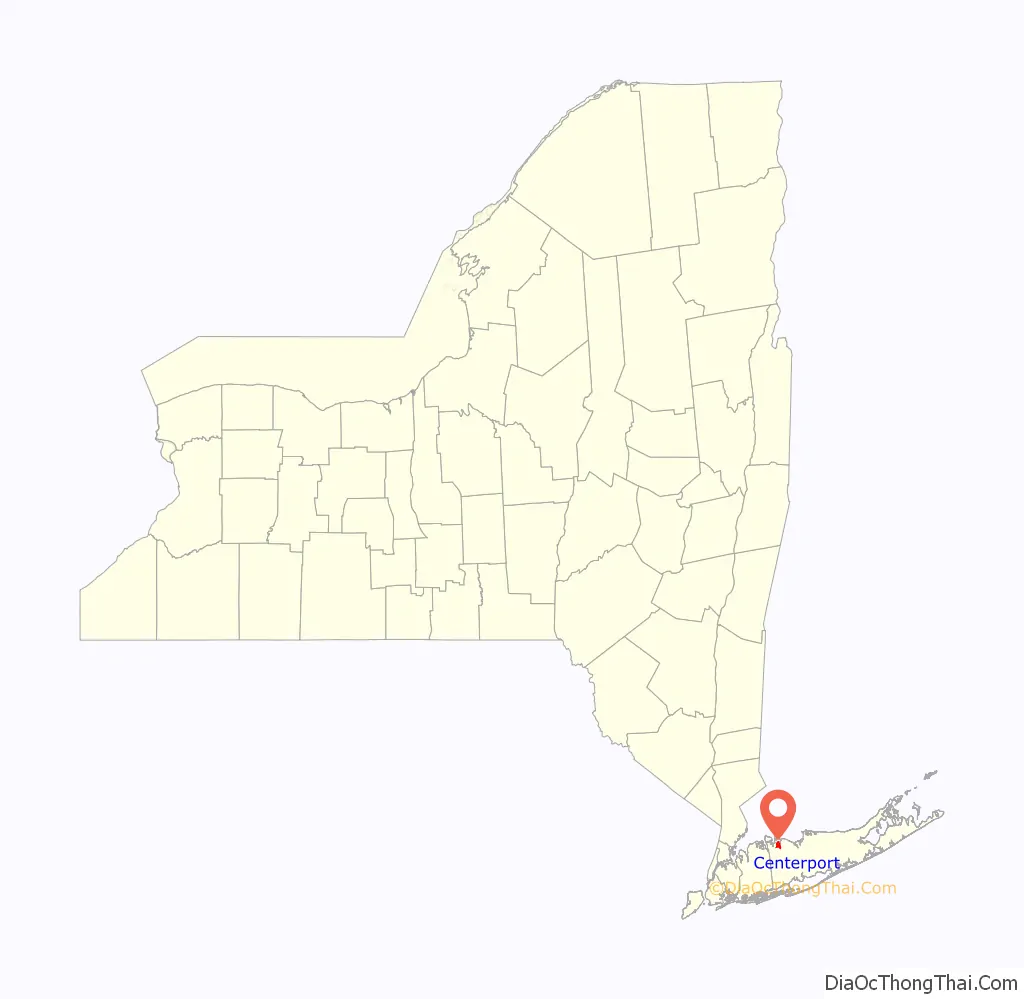
Centerport Road Map
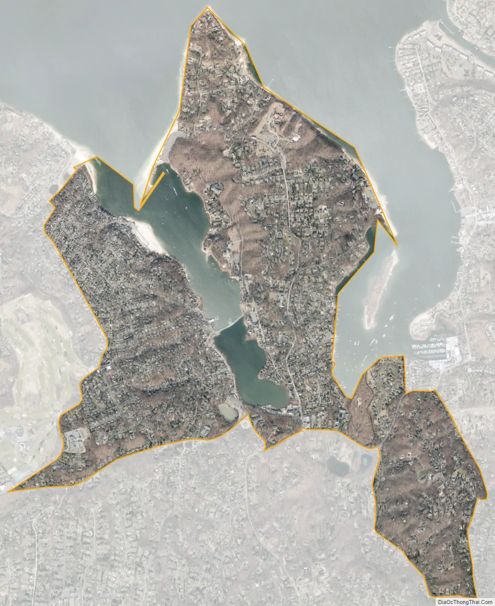
Centerport city Satellite Map
Geography
Centerport is located at 40°53′34″N 73°22′41″W / 40.89278°N 73.37806°W / 40.89278; -73.37806 (40.892848, -73.378007). According to the United States Census Bureau, the CDP has a total area of 2.3 square miles (6.0 km), of which 2.1 square miles (5.5 km) is land and 0.19 square miles (0.5 km), or 8.29%, is water.
Centerport is the site of the estate and Eagle’s Nest mansion of William Kissam Vanderbilt II. This 43-acre (170,000 m) estate now contains the Vanderbilt museum and planetarium.
Camp Alvernia in Centerport was the first Catholic summer camp in the United States, established in 1888. Camp Alvernia is still in operation, serving over 900 local children aged 3–14 each summer.
See also
Map of New York State and its subdivision:- Albany
- Allegany
- Bronx
- Broome
- Cattaraugus
- Cayuga
- Chautauqua
- Chemung
- Chenango
- Clinton
- Columbia
- Cortland
- Delaware
- Dutchess
- Erie
- Essex
- Franklin
- Fulton
- Genesee
- Greene
- Hamilton
- Herkimer
- Jefferson
- Kings
- Lake Ontario
- Lewis
- Livingston
- Madison
- Monroe
- Montgomery
- Nassau
- New York
- Niagara
- Oneida
- Onondaga
- Ontario
- Orange
- Orleans
- Oswego
- Otsego
- Putnam
- Queens
- Rensselaer
- Richmond
- Rockland
- Saint Lawrence
- Saratoga
- Schenectady
- Schoharie
- Schuyler
- Seneca
- Steuben
- Suffolk
- Sullivan
- Tioga
- Tompkins
- Ulster
- Warren
- Washington
- Wayne
- Westchester
- Wyoming
- Yates
- Alabama
- Alaska
- Arizona
- Arkansas
- California
- Colorado
- Connecticut
- Delaware
- District of Columbia
- Florida
- Georgia
- Hawaii
- Idaho
- Illinois
- Indiana
- Iowa
- Kansas
- Kentucky
- Louisiana
- Maine
- Maryland
- Massachusetts
- Michigan
- Minnesota
- Mississippi
- Missouri
- Montana
- Nebraska
- Nevada
- New Hampshire
- New Jersey
- New Mexico
- New York
- North Carolina
- North Dakota
- Ohio
- Oklahoma
- Oregon
- Pennsylvania
- Rhode Island
- South Carolina
- South Dakota
- Tennessee
- Texas
- Utah
- Vermont
- Virginia
- Washington
- West Virginia
- Wisconsin
- Wyoming


