Commack (/ˈkoʊmæk/ KOH-mak) is a hamlet and census-designated place (CDP) that roughly corresponds to the hamlet by the same name in the towns of Huntington and Smithtown in Suffolk County, on Long Island, in New York. The CDP’s population was 36,124 at the 2010 census.
| Name: | Commack CDP |
|---|---|
| LSAD Code: | 57 |
| LSAD Description: | CDP (suffix) |
| State: | New York |
| County: | Suffolk County |
| Elevation: | 131 ft (40 m) |
| Total Area: | 12.25 sq mi (31.72 km²) |
| Land Area: | 12.25 sq mi (31.72 km²) |
| Water Area: | 0.00 sq mi (0.00 km²) |
| Total Population: | 36,536 |
| Population Density: | 2,983.02/sq mi (1,151.71/km²) |
| ZIP code: | 11725 |
| Area code: | 631, 934 |
| FIPS code: | 3617530 |
| GNISfeature ID: | 0947221 |
Online Interactive Map
Click on ![]() to view map in "full screen" mode.
to view map in "full screen" mode.
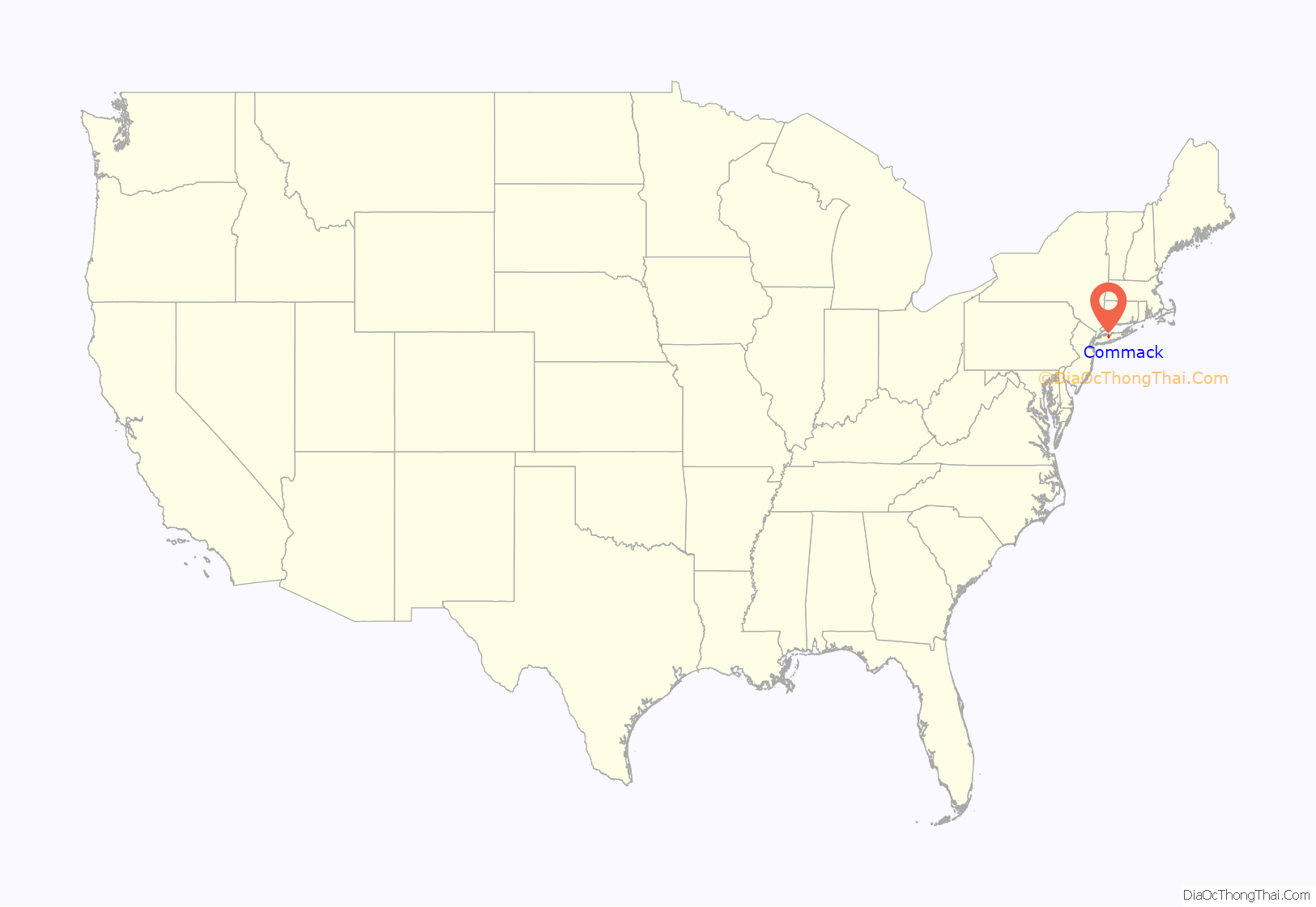
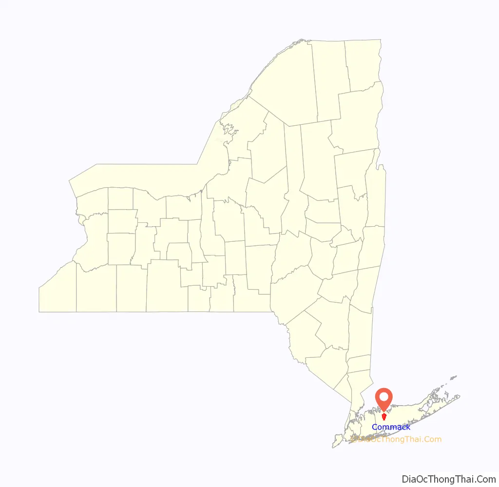
Commack location map. Where is Commack CDP?
History
The name “Commack” comes from the Secatogue Native American tribe who lived on the South Shore of Long Island between Copiague and Bayport. The Secatogue named their northern lands in the center of the island Winnecomac which means “pleasant lands.” The name may have been inspired because of the area’s flat lands with rich soil, and thick oak forests abounding with plants and wildlife. From its earliest days, Commack or originally spelled as Comac was known for its fertile soil which made it the perfect land for farming.
Today all of Commack is settled and suburbanized and, like most unincorporated areas of Long Island, does not have a true, walkable downtown or “Main Street”.
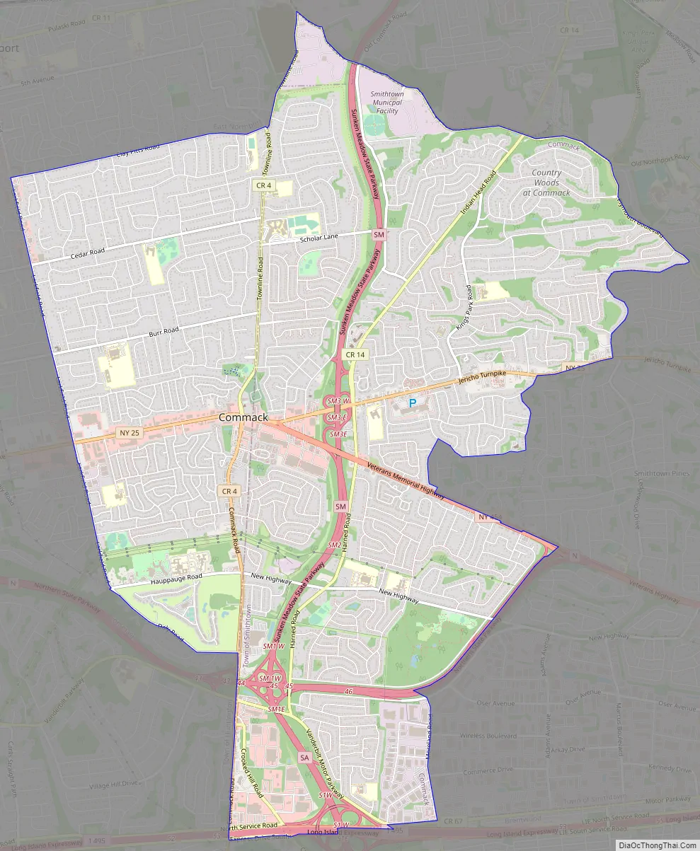
Commack Road Map
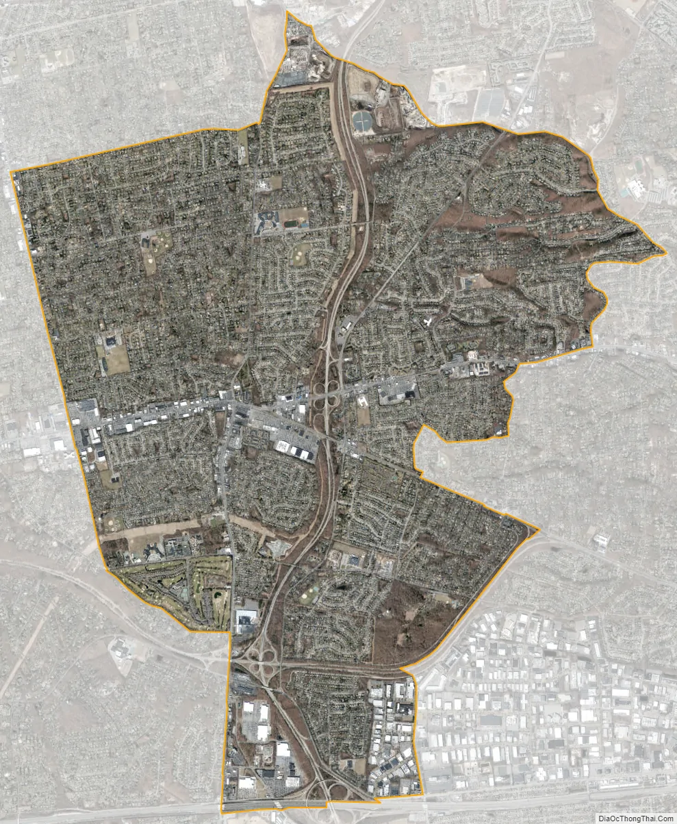
Commack city Satellite Map
Geography
According to the United States Census Bureau, the CDP has a total area of 12.0 square miles (31.0 km), all land.
See also
Map of New York State and its subdivision:- Albany
- Allegany
- Bronx
- Broome
- Cattaraugus
- Cayuga
- Chautauqua
- Chemung
- Chenango
- Clinton
- Columbia
- Cortland
- Delaware
- Dutchess
- Erie
- Essex
- Franklin
- Fulton
- Genesee
- Greene
- Hamilton
- Herkimer
- Jefferson
- Kings
- Lake Ontario
- Lewis
- Livingston
- Madison
- Monroe
- Montgomery
- Nassau
- New York
- Niagara
- Oneida
- Onondaga
- Ontario
- Orange
- Orleans
- Oswego
- Otsego
- Putnam
- Queens
- Rensselaer
- Richmond
- Rockland
- Saint Lawrence
- Saratoga
- Schenectady
- Schoharie
- Schuyler
- Seneca
- Steuben
- Suffolk
- Sullivan
- Tioga
- Tompkins
- Ulster
- Warren
- Washington
- Wayne
- Westchester
- Wyoming
- Yates
- Alabama
- Alaska
- Arizona
- Arkansas
- California
- Colorado
- Connecticut
- Delaware
- District of Columbia
- Florida
- Georgia
- Hawaii
- Idaho
- Illinois
- Indiana
- Iowa
- Kansas
- Kentucky
- Louisiana
- Maine
- Maryland
- Massachusetts
- Michigan
- Minnesota
- Mississippi
- Missouri
- Montana
- Nebraska
- Nevada
- New Hampshire
- New Jersey
- New Mexico
- New York
- North Carolina
- North Dakota
- Ohio
- Oklahoma
- Oregon
- Pennsylvania
- Rhode Island
- South Carolina
- South Dakota
- Tennessee
- Texas
- Utah
- Vermont
- Virginia
- Washington
- West Virginia
- Wisconsin
- Wyoming


