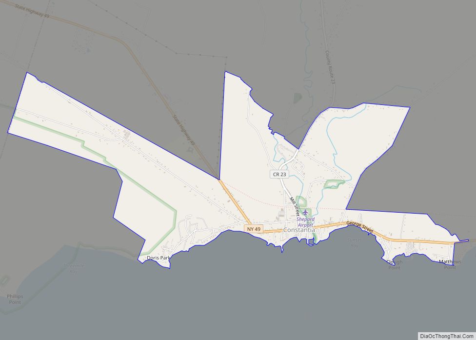
Constantia is a census-designated place (CDP) in the town of Constantia in Oswego County, New York, United States. Located on Oneida Lake, the community lies along State Route 49 and Scriba Creek. The population was 1,182 at the 2010 census.
| Name: | Constantia CDP |
|---|---|
| LSAD Code: | 57 |
| LSAD Description: | CDP (suffix) |
| State: | New York |
| County: | Oswego County |
| Elevation: | 384 ft (117 m) |
| Total Area: | 3.04 sq mi (7.87 km²) |
| Land Area: | 3.03 sq mi (7.85 km²) |
| Water Area: | 0.01 sq mi (0.02 km²) |
| Total Population: | 1,109 |
| Population Density: | 365.89/sq mi (141.26/km²) |
| ZIP code: | 13044 |
| Area code: | 315 |
| FIPS code: | 3617893 |
| GNISfeature ID: | 0947327 |
Online Interactive Map
Click on ![]() to view map in "full screen" mode.
to view map in "full screen" mode.
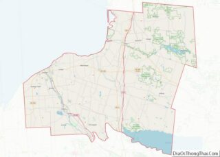
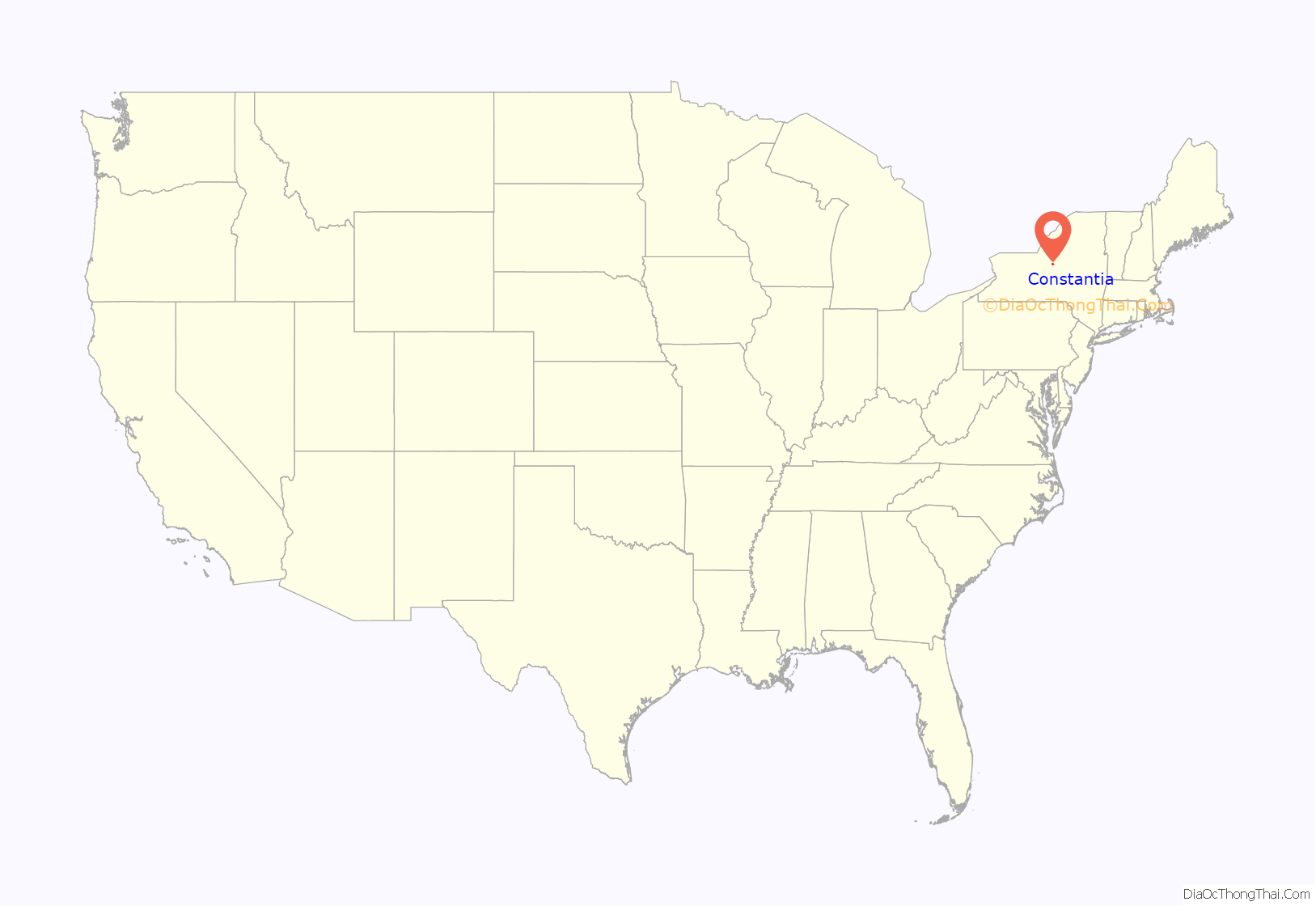
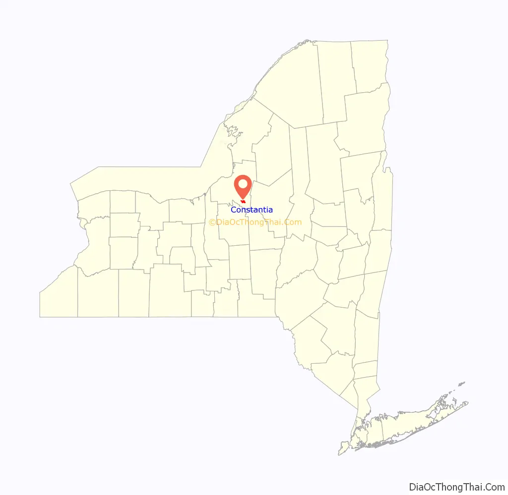
Constantia location map. Where is Constantia CDP?
History
Constantia was incorporated as a village in 1836, but abandoned that status in 1923.
The Trinity Church was listed on the National Register of Historic Places in 1982.
Constantia Road Map
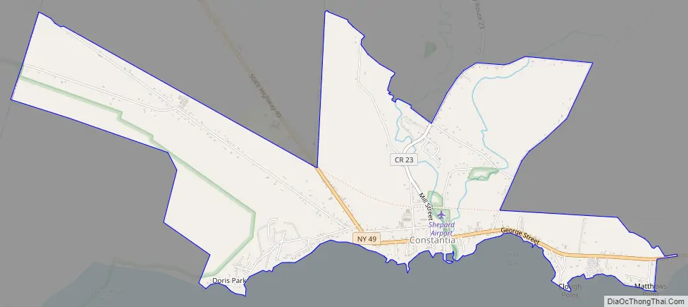
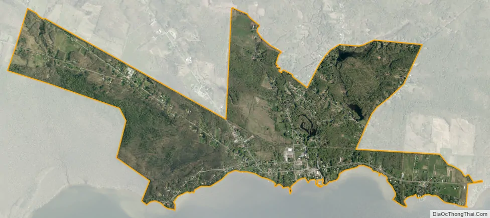
Constantia city Satellite Map
Geography
Constantia is located at 43°15′3″N 76°0′5″W / 43.25083°N 76.00139°W / 43.25083; -76.00139 (43.250905, -76.001641).
According to the United States Census Bureau, the CDP has a total area of 2.1 square miles (5.5 km), of which 2.1 square miles (5.5 km) is land and 0.47% is water.
See also
Map of New York State and its subdivision:- Albany
- Allegany
- Bronx
- Broome
- Cattaraugus
- Cayuga
- Chautauqua
- Chemung
- Chenango
- Clinton
- Columbia
- Cortland
- Delaware
- Dutchess
- Erie
- Essex
- Franklin
- Fulton
- Genesee
- Greene
- Hamilton
- Herkimer
- Jefferson
- Kings
- Lake Ontario
- Lewis
- Livingston
- Madison
- Monroe
- Montgomery
- Nassau
- New York
- Niagara
- Oneida
- Onondaga
- Ontario
- Orange
- Orleans
- Oswego
- Otsego
- Putnam
- Queens
- Rensselaer
- Richmond
- Rockland
- Saint Lawrence
- Saratoga
- Schenectady
- Schoharie
- Schuyler
- Seneca
- Steuben
- Suffolk
- Sullivan
- Tioga
- Tompkins
- Ulster
- Warren
- Washington
- Wayne
- Westchester
- Wyoming
- Yates
- Alabama
- Alaska
- Arizona
- Arkansas
- California
- Colorado
- Connecticut
- Delaware
- District of Columbia
- Florida
- Georgia
- Hawaii
- Idaho
- Illinois
- Indiana
- Iowa
- Kansas
- Kentucky
- Louisiana
- Maine
- Maryland
- Massachusetts
- Michigan
- Minnesota
- Mississippi
- Missouri
- Montana
- Nebraska
- Nevada
- New Hampshire
- New Jersey
- New Mexico
- New York
- North Carolina
- North Dakota
- Ohio
- Oklahoma
- Oregon
- Pennsylvania
- Rhode Island
- South Carolina
- South Dakota
- Tennessee
- Texas
- Utah
- Vermont
- Virginia
- Washington
- West Virginia
- Wisconsin
- Wyoming