Depew (/dəˈpju/) is a village in Erie County, New York. The population was 15,303 at the time of the 2010 census. It is part of the Buffalo–Niagara Falls metropolitan area. The village is named for Chauncey Depew, a politician and one of the original investors who bought the land for the village, which was incorporated in 1894.
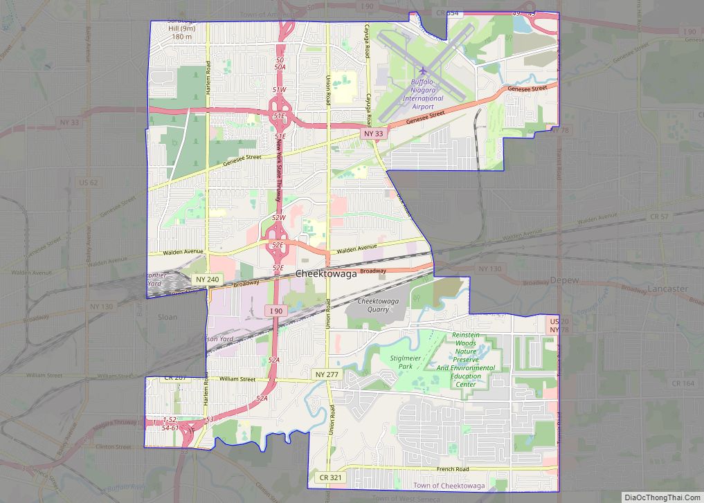
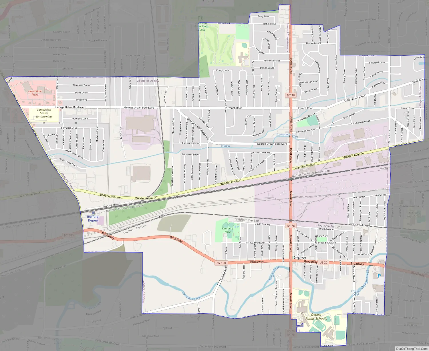
The village extends across the boundary between the towns of Lancaster and Cheektowaga. The village lies on both sides of NY Route 78 (Transit Road), a major north-south route.
Village residents voted on January 17, 2017 to not dissolve the Village of Depew into the Towns of Lancaster and Cheektowaga, by a margin of 3,006–1,165.
| Name: | Depew village |
|---|---|
| LSAD Code: | 47 |
| LSAD Description: | village (suffix) |
| State: | New York |
| County: | Erie County |
| Elevation: | 673 ft (205 m) |
| Total Area: | 5.08 sq mi (13.15 km²) |
| Land Area: | 5.08 sq mi (13.15 km²) |
| Water Area: | 0.00 sq mi (0.00 km²) |
| Total Population: | 15,178 |
| Population Density: | 2,990.15/sq mi (1,154.42/km²) |
| ZIP code: | 14043 |
| Area code: | 716 |
| FIPS code: | 3620313 |
| GNISfeature ID: | 0948333 |
| Website: | www.villageofdepew.org |
Online Interactive Map
Click on ![]() to view map in "full screen" mode.
to view map in "full screen" mode.
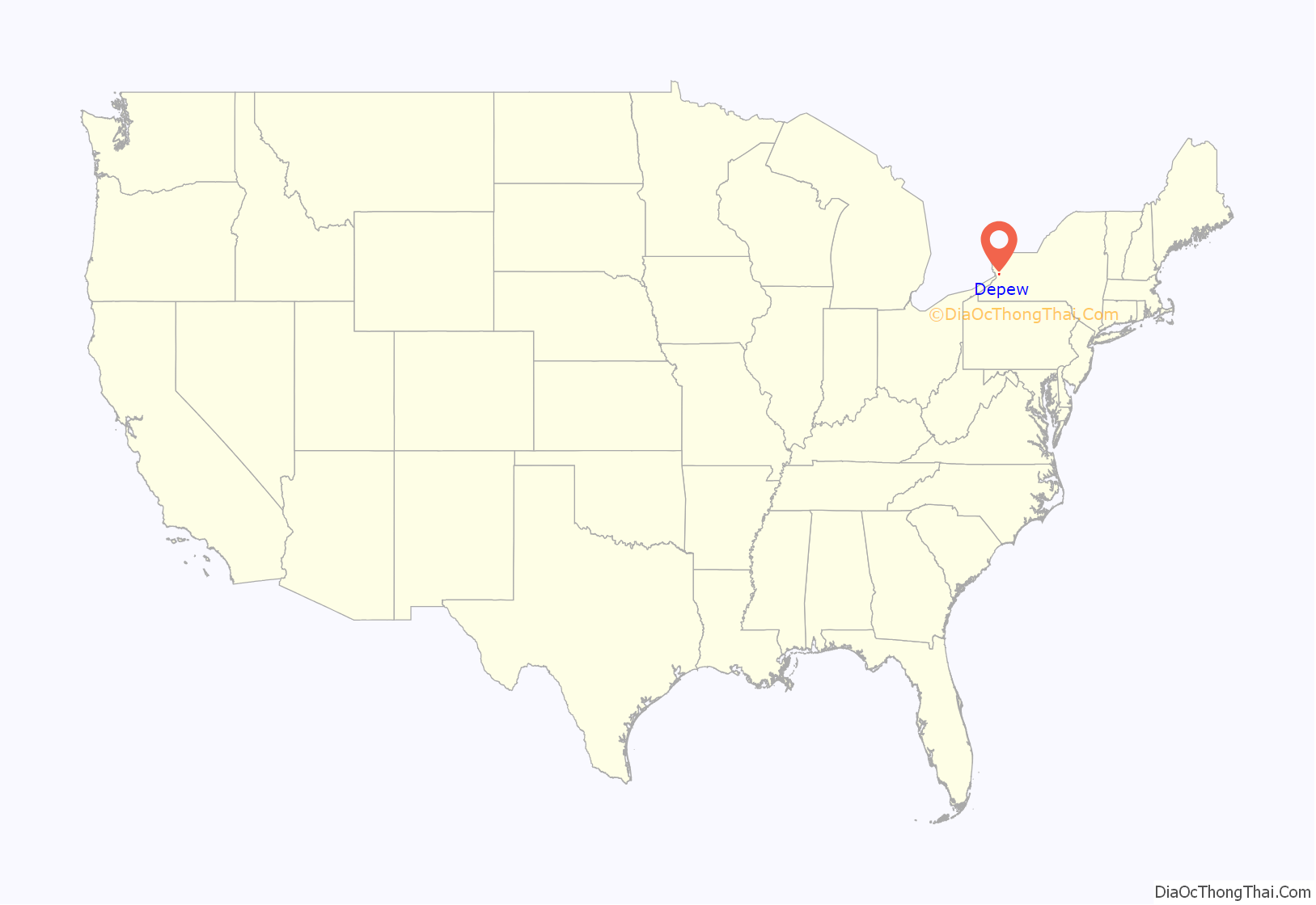
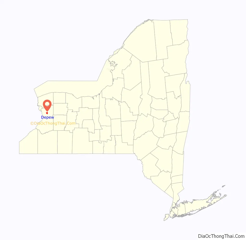
Depew location map. Where is Depew village?
History
Part of the area that Depew currently inhabits was first settled in 1808 by Apollos Hitchcock, just north of Cayuga Creek on the main road that connected Buffalo (spelled as “Buffaloe” at the time) with Lancaster village in what was then Jukdowaageh (now Cheektowaga), which some say meant “land of the crab apple” or “land of fruit and flowers”. The land had been bought and surveyed by the Holland Land Company.
The following is from Our County and Its People A Descriptive Work of Erie County New York, edited by Truman C. White:
Named after Chauncey Depew, the village was founded and it became a hub of rapid growth. Founded in 1892 as a rail center, the Village of Depew was incorporated on July 23, 1894. The Depew economy in the 19th century was based primarily on railroad-related industries, such as the Gould Coupler Company, manufacturers of knuckle-type railroad couplers.
In 1904, Quebec political figure William C. Clendinneng died in Depew after being hit by a train.
Depew High School has a long-standing rivalry, starting in 1919, with Lancaster High School. The rivalry between has been strong and it is still a great battle between the smaller school versus the larger school despite the fact that Lancaster has won a majority of the games between the two rivals.
Depew Road Map
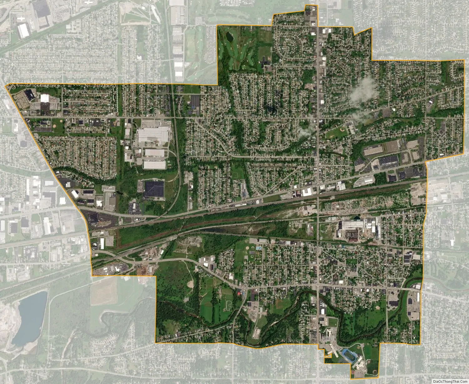
Depew city Satellite Map
Geography
Depew is located at 42°54′42″N 78°42′6″W / 42.91167°N 78.70167°W / 42.91167; -78.70167 (42.911758, -78.701600).
According to the United States Census Bureau, the village has a total area of 5.1 square miles (13 km), all land.
Depew straddles the towns of Lancaster and Cheektowaga and is 11 miles (18 km) east of downtown Buffalo. Depew is bordered to the east by the village of Lancaster.
See also
Map of New York State and its subdivision:- Albany
- Allegany
- Bronx
- Broome
- Cattaraugus
- Cayuga
- Chautauqua
- Chemung
- Chenango
- Clinton
- Columbia
- Cortland
- Delaware
- Dutchess
- Erie
- Essex
- Franklin
- Fulton
- Genesee
- Greene
- Hamilton
- Herkimer
- Jefferson
- Kings
- Lake Ontario
- Lewis
- Livingston
- Madison
- Monroe
- Montgomery
- Nassau
- New York
- Niagara
- Oneida
- Onondaga
- Ontario
- Orange
- Orleans
- Oswego
- Otsego
- Putnam
- Queens
- Rensselaer
- Richmond
- Rockland
- Saint Lawrence
- Saratoga
- Schenectady
- Schoharie
- Schuyler
- Seneca
- Steuben
- Suffolk
- Sullivan
- Tioga
- Tompkins
- Ulster
- Warren
- Washington
- Wayne
- Westchester
- Wyoming
- Yates
- Alabama
- Alaska
- Arizona
- Arkansas
- California
- Colorado
- Connecticut
- Delaware
- District of Columbia
- Florida
- Georgia
- Hawaii
- Idaho
- Illinois
- Indiana
- Iowa
- Kansas
- Kentucky
- Louisiana
- Maine
- Maryland
- Massachusetts
- Michigan
- Minnesota
- Mississippi
- Missouri
- Montana
- Nebraska
- Nevada
- New Hampshire
- New Jersey
- New Mexico
- New York
- North Carolina
- North Dakota
- Ohio
- Oklahoma
- Oregon
- Pennsylvania
- Rhode Island
- South Carolina
- South Dakota
- Tennessee
- Texas
- Utah
- Vermont
- Virginia
- Washington
- West Virginia
- Wisconsin
- Wyoming