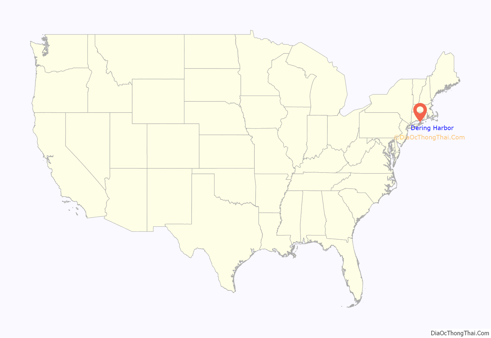
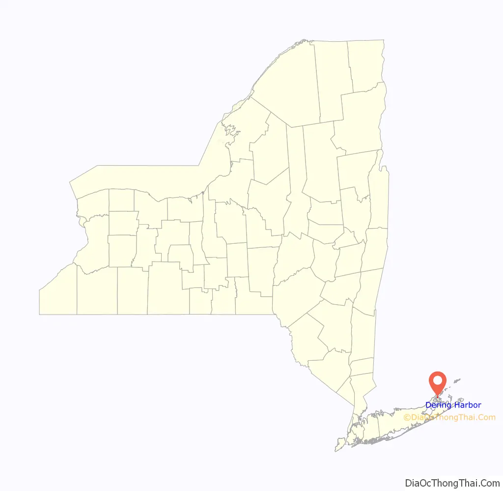
Dering Harbor is a village in the Town of Shelter Island, in Suffolk County, New York, United States. As of the 2010 census, the village population was 11, making it the least populous village in the State of New York.
The Incorporated Village of Dering Harbor is located on the northern side of Shelter Island, east of the hamlet of Shelter Island Heights.
| Name: | Dering Harbor village |
|---|---|
| LSAD Code: | 47 |
| LSAD Description: | village (suffix) |
| State: | New York |
| County: | Suffolk County |
| Incorporated: | 1916 |
| Elevation: | 7 ft (2 m) |
| Total Area: | 0.26 sq mi (0.67 km²) |
| Land Area: | 0.25 sq mi (0.64 km²) |
| Water Area: | 0.01 sq mi (0.03 km²) |
| Total Population: | 50 |
| Population Density: | 203.25/sq mi (78.59/km²) |
| FIPS code: | 3620379 |
| GNISfeature ID: | 0948345 |
| Website: | deringharborvillage.org |
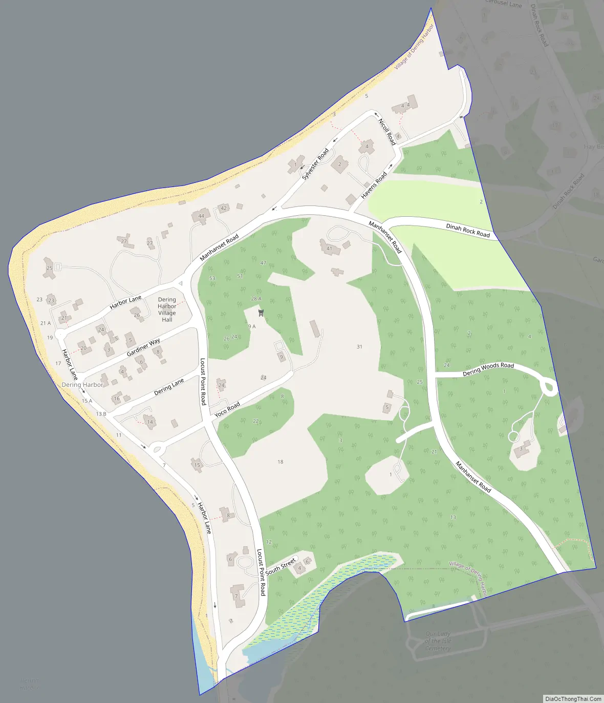
Online Interactive Map
Click on ![]() to view map in "full screen" mode.
to view map in "full screen" mode.
Dering Harbor location map. Where is Dering Harbor village?
History
Dering Harbor incorporated as a village in 1969. It had been a popular resort community since the 19th Century. According to The New York Times, it is rumored that the village decided to incorporate as a means of preventing “Coney Island-style concessions” from popping up in the area.
Dering Harbor Road Map
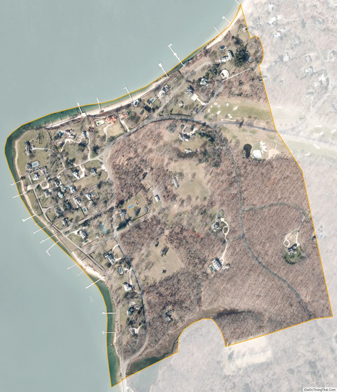
Dering Harbor city Satellite Map
Geography
According to the United States Census Bureau, the village has a total area of 0.2 square miles (0.52 km), of which 0.2 square miles (0.52 km) is land and 4.00% is water.
See also
Map of New York State and its subdivision:- Albany
- Allegany
- Bronx
- Broome
- Cattaraugus
- Cayuga
- Chautauqua
- Chemung
- Chenango
- Clinton
- Columbia
- Cortland
- Delaware
- Dutchess
- Erie
- Essex
- Franklin
- Fulton
- Genesee
- Greene
- Hamilton
- Herkimer
- Jefferson
- Kings
- Lake Ontario
- Lewis
- Livingston
- Madison
- Monroe
- Montgomery
- Nassau
- New York
- Niagara
- Oneida
- Onondaga
- Ontario
- Orange
- Orleans
- Oswego
- Otsego
- Putnam
- Queens
- Rensselaer
- Richmond
- Rockland
- Saint Lawrence
- Saratoga
- Schenectady
- Schoharie
- Schuyler
- Seneca
- Steuben
- Suffolk
- Sullivan
- Tioga
- Tompkins
- Ulster
- Warren
- Washington
- Wayne
- Westchester
- Wyoming
- Yates
- Alabama
- Alaska
- Arizona
- Arkansas
- California
- Colorado
- Connecticut
- Delaware
- District of Columbia
- Florida
- Georgia
- Hawaii
- Idaho
- Illinois
- Indiana
- Iowa
- Kansas
- Kentucky
- Louisiana
- Maine
- Maryland
- Massachusetts
- Michigan
- Minnesota
- Mississippi
- Missouri
- Montana
- Nebraska
- Nevada
- New Hampshire
- New Jersey
- New Mexico
- New York
- North Carolina
- North Dakota
- Ohio
- Oklahoma
- Oregon
- Pennsylvania
- Rhode Island
- South Carolina
- South Dakota
- Tennessee
- Texas
- Utah
- Vermont
- Virginia
- Washington
- West Virginia
- Wisconsin
- Wyoming


