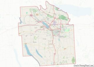
Fairmount is a hamlet (and census-designated place) in Onondaga County, New York, United States. Fairmount is a western suburb of Syracuse, located in the far southeastern corner of the town of Camillus. Its zip code is 13219 (Syracuse). It is located within the West Genesee Central School District. The population was 10,224 at the 2010 census.
| Name: | Fairmount CDP |
|---|---|
| LSAD Code: | 57 |
| LSAD Description: | CDP (suffix) |
| State: | New York |
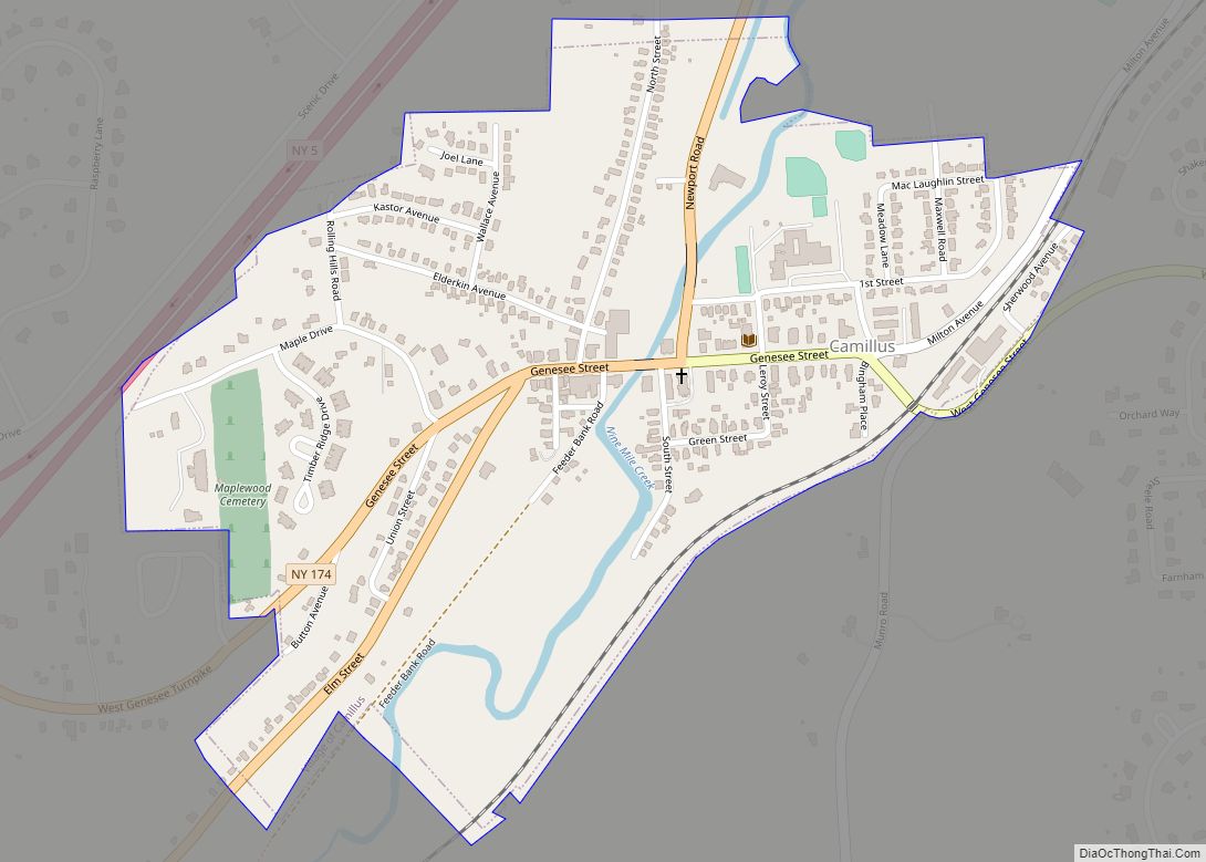
| County: | Onondaga County |
| Elevation: | 492 ft (150 m) |
| Total Area: | 3.37 sq mi (8.71 km²) |
| Land Area: | 3.37 sq mi (8.71 km²) |
| Water Area: | 0.00 sq mi (0.00 km²) |
| Total Population: | 10,248 |
| Population Density: | 3,045.47/sq mi (1,175.91/km²) |
| FIPS code: | 3625043 |
| GNISfeature ID: | 0949818 |
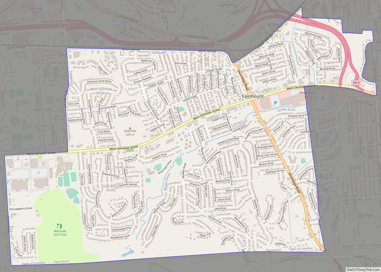
Online Interactive Map
Click on ![]() to view map in "full screen" mode.
to view map in "full screen" mode.
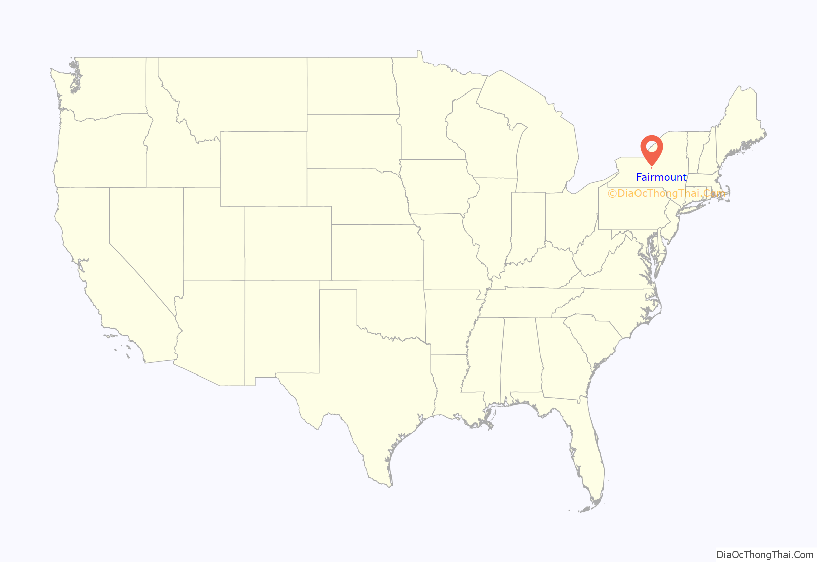
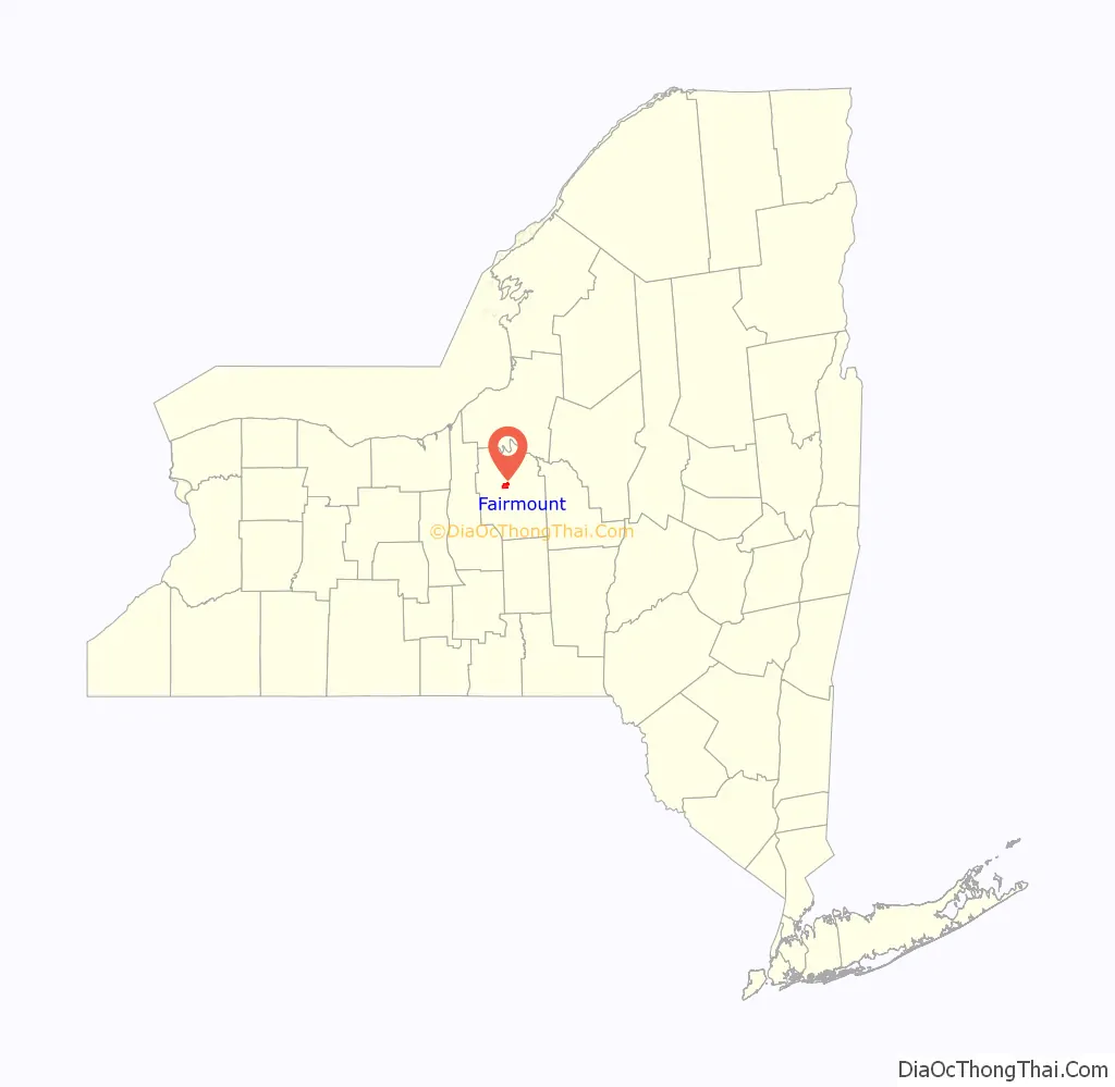
Fairmount location map. Where is Fairmount CDP?
History
The Fairmount area was part of the original 108-square-mile Onondaga Reservation lands which were acquired by the State of New York from the Onondagas in transactions that took place between 1793 and 1795. Formerly part of the Town of Onondaga, it was annexed to the town of Camillus in 1834. Prior to that date, census enumerations for Fairmount were included in the town of Onondaga census. The name originates from 1798 when engineer and politician James Geddes built his estate, called “Fair Mount” at the intersection of Genesee Road (now West Genesee Street) and Onondaga Road. The Brockway Tavern building, located on the northwest corner of West Genesee and Onondaga, formerly housed a tavern, motor inn, restaurants and later a funeral home, and now houses a credit union. The house was built c. 1808 and survives as one of the oldest structures in the hamlet. The oldest house still used as a residence dates from 1876.
Previously known as Tyler or Jeromeville, the area became formally identified as Fairmount when its post office (formerly designated “Tyler”) was renamed on January 1, 1846. (This post office was discontinued in 1899.) Fairmount was also a minor station on the Auburn and Syracuse Railroad and its successor railroads (including the New York Central Railroad) from 1838 to the end of the 19th century. The Fairmount Farm Colony, a working farm for the vocational training of young men with intellectual disabilities, was established by the Syracuse State School north of the hamlet in 1883. Farmland in the hamlet was developed into residential tracts from the 1890s through the 1990s, with intense residential and commercial development during the 1950s and 1960s. A large area of undeveloped land, formerly used for quarrying and a munitions factory in the 19th and early 20th centuries, borders Fairmount to the south at Split Rock.
The Geddes family’s “Fair Mount” mansion was demolished in 1929, although a carriage house from the estate survived until 2014. Small sections of the estate’s stone fences are still extant.
In 2007, Fairmount was 27th on Newsweek’s “Best Places to Raise Your Kids” list.
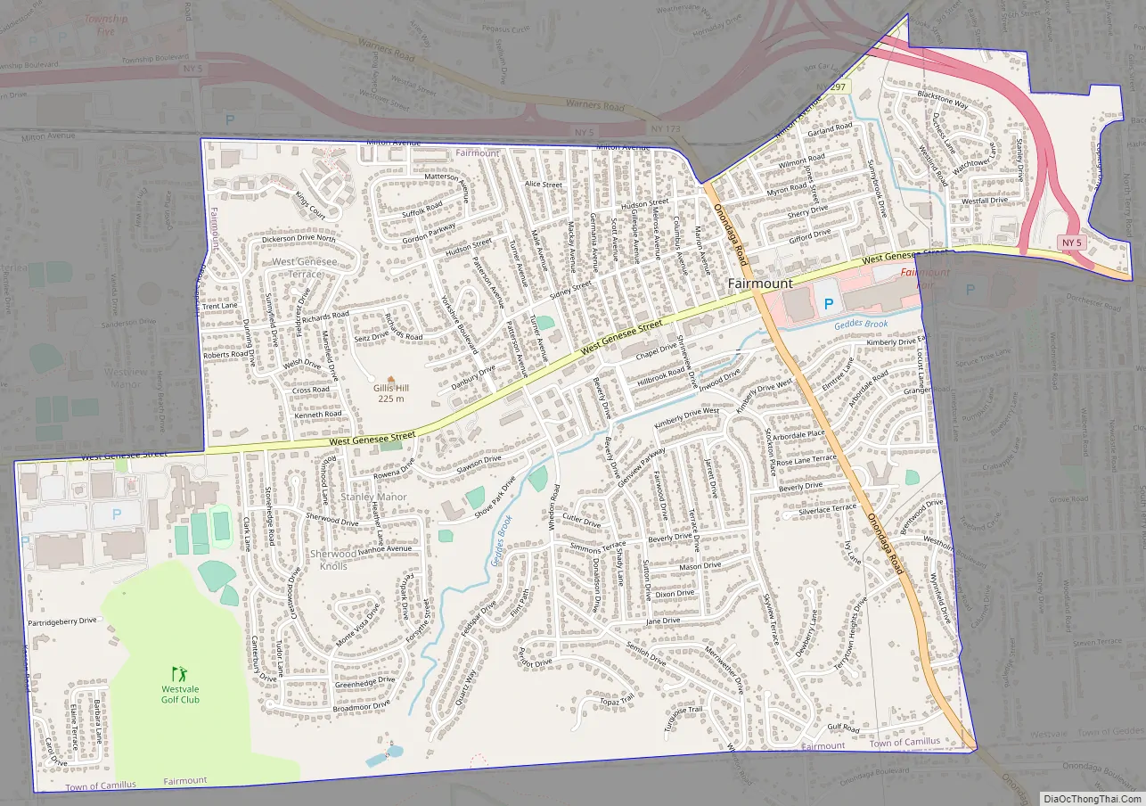
Fairmount Road Map
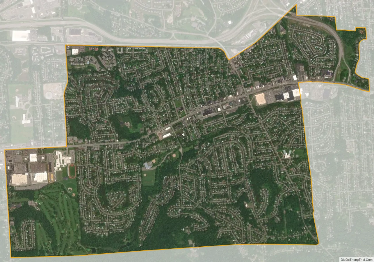
Fairmount city Satellite Map
Geography
Fairmount is located at 43°2′37″N 76°14′44″W / 43.04361°N 76.24556°W / 43.04361; -76.24556 (43.043616, -76.245462).
According to the United States Census Bureau, the CDP has a total area of 3.4 square miles (8.8 km), all land.
See also
Map of New York State and its subdivision:- Albany
- Allegany
- Bronx
- Broome
- Cattaraugus
- Cayuga
- Chautauqua
- Chemung
- Chenango
- Clinton
- Columbia
- Cortland
- Delaware
- Dutchess
- Erie
- Essex
- Franklin
- Fulton
- Genesee
- Greene
- Hamilton
- Herkimer
- Jefferson
- Kings
- Lake Ontario
- Lewis
- Livingston
- Madison
- Monroe
- Montgomery
- Nassau
- New York
- Niagara
- Oneida
- Onondaga
- Ontario
- Orange
- Orleans
- Oswego
- Otsego
- Putnam
- Queens
- Rensselaer
- Richmond
- Rockland
- Saint Lawrence
- Saratoga
- Schenectady
- Schoharie
- Schuyler
- Seneca
- Steuben
- Suffolk
- Sullivan
- Tioga
- Tompkins
- Ulster
- Warren
- Washington
- Wayne
- Westchester
- Wyoming
- Yates
- Alabama
- Alaska
- Arizona
- Arkansas
- California
- Colorado
- Connecticut
- Delaware
- District of Columbia
- Florida
- Georgia
- Hawaii
- Idaho
- Illinois
- Indiana
- Iowa
- Kansas
- Kentucky
- Louisiana
- Maine
- Maryland
- Massachusetts
- Michigan
- Minnesota
- Mississippi
- Missouri
- Montana
- Nebraska
- Nevada
- New Hampshire
- New Jersey
- New Mexico
- New York
- North Carolina
- North Dakota
- Ohio
- Oklahoma
- Oregon
- Pennsylvania
- Rhode Island
- South Carolina
- South Dakota
- Tennessee
- Texas
- Utah
- Vermont
- Virginia
- Washington
- West Virginia
- Wisconsin
- Wyoming