Fairport is a village located in the Town of Perinton, which is part of Monroe County, New York, United States. Fairport is a suburb 9 miles (14 km) east of Rochester. It is also known as the “Crown Jewel of the Erie Canal”. In 2005, it was named as one of the “Best Places to Live” by Money Magazine. The population of the Village of Fairport was 5,353 as of the 2010 census.
| Name: | Fairport village |
|---|---|
| LSAD Code: | 47 |
| LSAD Description: | village (suffix) |
| State: | New York |
| County: | Monroe County |
| Incorporated: | 1867; 156 years ago (1867) |
| Elevation: | 474 ft (144 m) |
| Total Area: | 1.62 sq mi (4.19 km²) |
| Land Area: | 1.58 sq mi (4.09 km²) |
| Water Area: | 0.04 sq mi (0.10 km²) |
| Total Population: | 5,501 |
| Population Density: | 3,481.65/sq mi (1,344.36/km²) |
| ZIP code: | 14450 |
| Area code: | 585 |
| FIPS code: | 3625076 |
| Website: | http://www.village.fairport.ny.us/ |
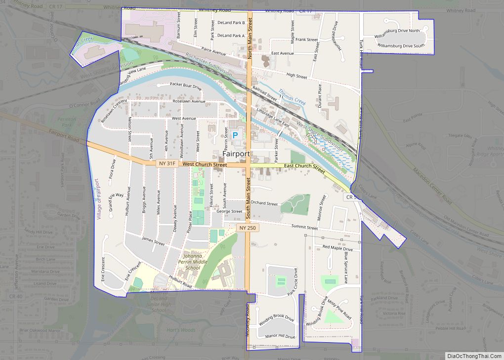
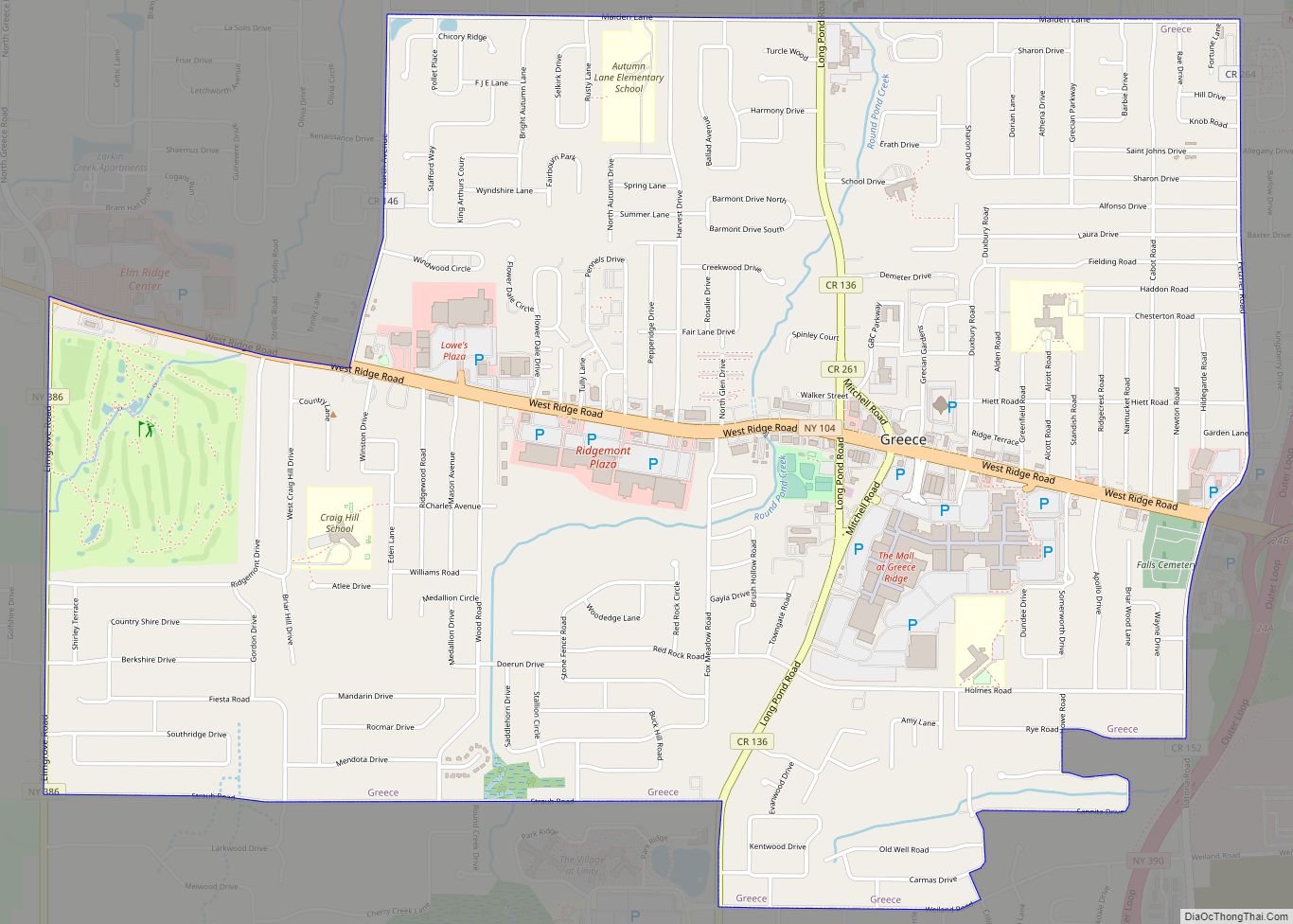
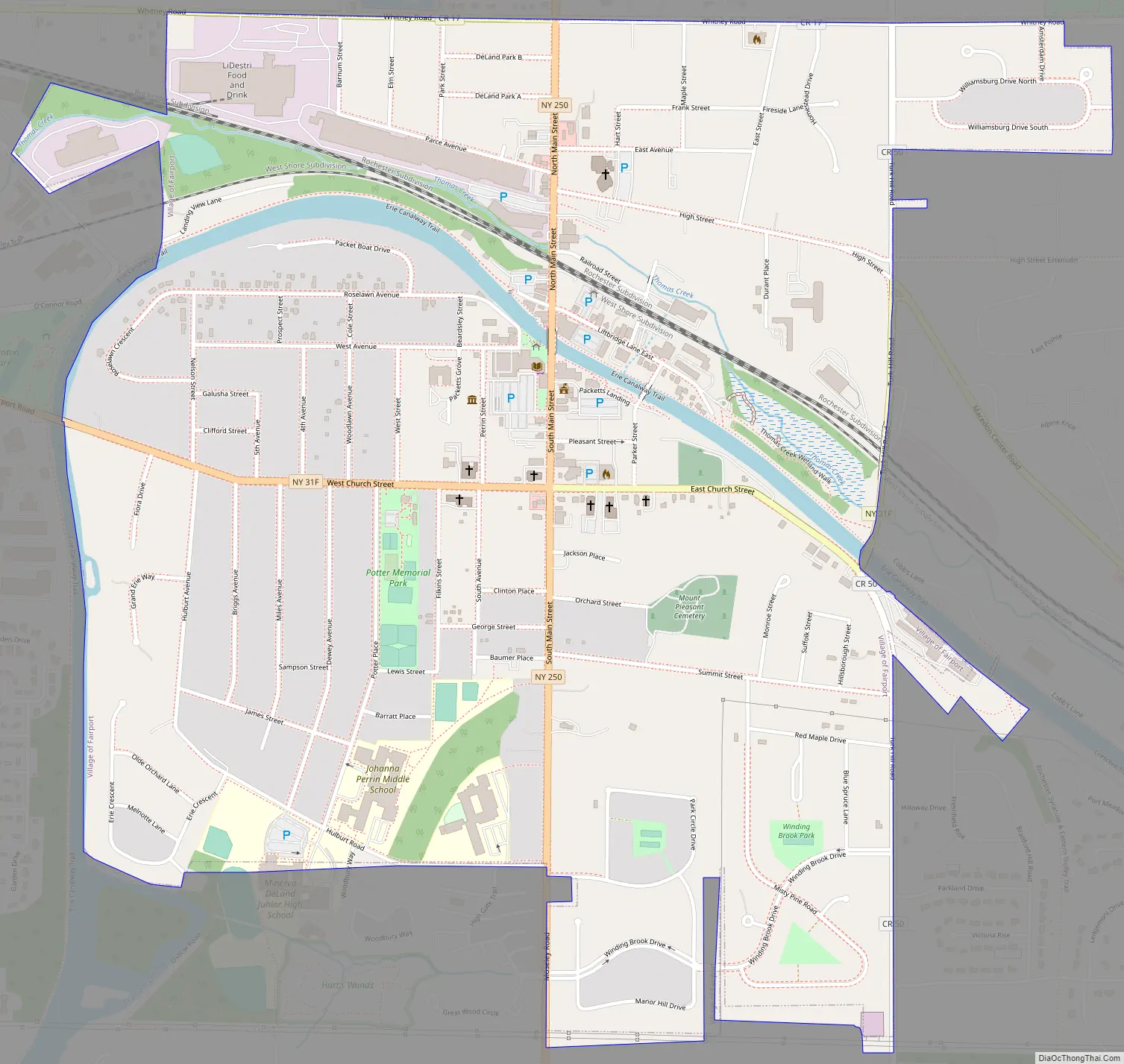
Online Interactive Map
Click on ![]() to view map in "full screen" mode.
to view map in "full screen" mode.
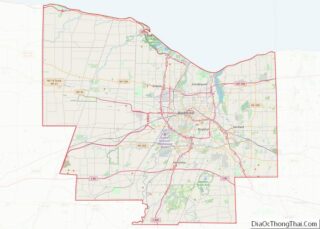
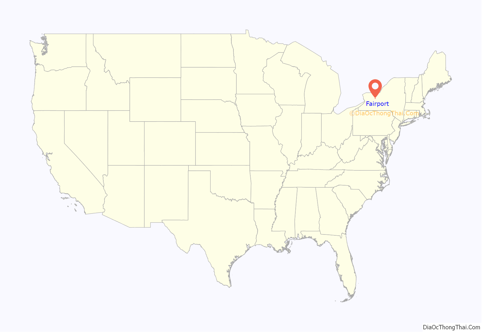
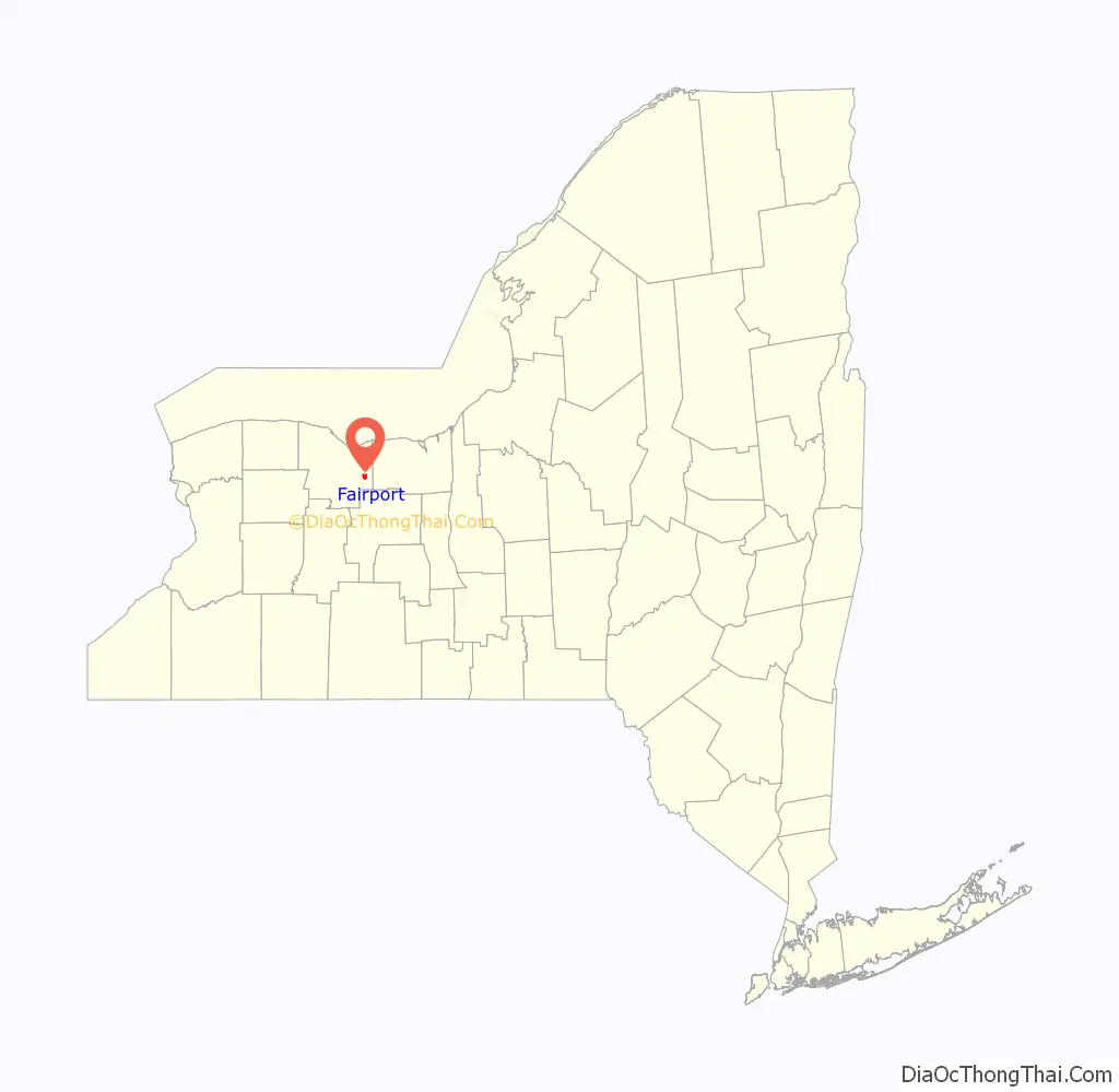
Fairport location map. Where is Fairport village?
History
The town of Perinton was first settled by European Americans in the two flat areas of Perinton Center (Turk Hill and Ayrault Roads) and Egypt. The first settlers in Perinton were Glover Perrin, his wife Johanna and his brother Jesse. What was developed as the village of Fairport was a swampy area within the Town of Perinton until the 1820s, when it was drained by construction of the new Erie Canal. With the opening of the Canal, what was then known as Perrinsville quickly became a busy canal port with a reputation for being a “fair port.” A further boon to the area’s reputation as an industry and transportation center came with the construction of railroads in 1853. This now booming section of Perrinsville was incorporated as a village on April 30, 1867 and eventually became the center of activity for the town of Perinton.
In the 19th century industry moved into Fairport, including Deland Chemical (baking soda), Cobb Preserving (the predecessor to American Can), and the Trescott Company (fruit grading and packing systems). Deland Chemical later became Fairport Vinegar Works, makers of Certo brand pectin used to gel and preserve foodstuffs.
In the early 20th century, the Erie Canal was expanded and renamed the Barge Canal. (It reverted to its original name in 1992). Barge transportation rapidly declined as automobiles and trucks became popular. The town began to expand away from the canal. The Erie Canal is now used mainly for recreation.
Fairport acquired its name in the mid-19th century from a traveler on the Erie Canal who was overheard at Mallett’s Tavern referring to the village as a fair port. Local legend has it that the same visitor vociferously complained the next morning that the Millstone Block Hotel had bedbugs, and he stormed out of Fairport, never to be seen again. The name, however, stuck.
In 2005, Money Magazine and CNN/Money ranked Fairport as #62 on their “Best Places to Live” list.
In 2008, Relocate America included Fairport in their “Top 100 Places To Live” list.
The First Baptist Church of Fairport, Wilbur House, Minerva and Daniel DeLand House, and Henry DeLand House are listed on the National Register of Historic Places.
Most residents of the Town of Perinton reside within both the Fairport Central School District and the Fairport postal district; as a result, it is common for Perinton residents to describe their place of residence as “Fairport” even if they live outside of the village.
Fairport Road Map
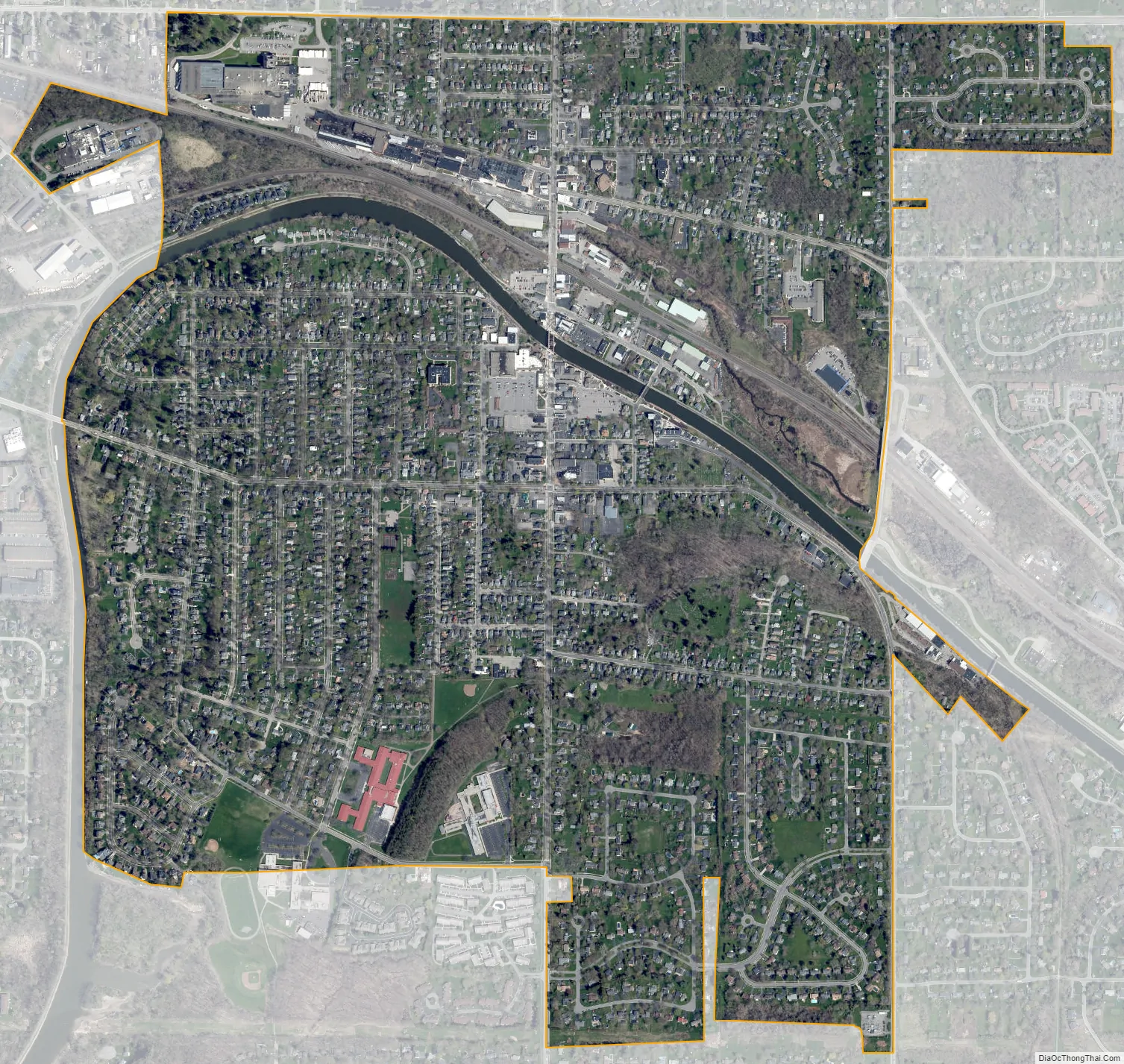
Fairport city Satellite Map
Geography
Fairport is located at 43°5’58” North, 77°26’35” West (43.099433, -77.443015).
According to the United States Census Bureau, the village has a total area of 1.6 square miles (4.1 km), of which 1.6 square miles (4.1 km) is land and 0.1 square miles (0.26 km) is water. The total area is 3.09% water.
Although officially the name of only the village, “Fairport” is often used to refer to a large portion of the encompassing Town of Perinton as well. Both the Fairport Central School District and Fairport zip codes overlap closely with the borders of the Town of Perinton.
See also
Map of New York State and its subdivision:- Albany
- Allegany
- Bronx
- Broome
- Cattaraugus
- Cayuga
- Chautauqua
- Chemung
- Chenango
- Clinton
- Columbia
- Cortland
- Delaware
- Dutchess
- Erie
- Essex
- Franklin
- Fulton
- Genesee
- Greene
- Hamilton
- Herkimer
- Jefferson
- Kings
- Lake Ontario
- Lewis
- Livingston
- Madison
- Monroe
- Montgomery
- Nassau
- New York
- Niagara
- Oneida
- Onondaga
- Ontario
- Orange
- Orleans
- Oswego
- Otsego
- Putnam
- Queens
- Rensselaer
- Richmond
- Rockland
- Saint Lawrence
- Saratoga
- Schenectady
- Schoharie
- Schuyler
- Seneca
- Steuben
- Suffolk
- Sullivan
- Tioga
- Tompkins
- Ulster
- Warren
- Washington
- Wayne
- Westchester
- Wyoming
- Yates
- Alabama
- Alaska
- Arizona
- Arkansas
- California
- Colorado
- Connecticut
- Delaware
- District of Columbia
- Florida
- Georgia
- Hawaii
- Idaho
- Illinois
- Indiana
- Iowa
- Kansas
- Kentucky
- Louisiana
- Maine
- Maryland
- Massachusetts
- Michigan
- Minnesota
- Mississippi
- Missouri
- Montana
- Nebraska
- Nevada
- New Hampshire
- New Jersey
- New Mexico
- New York
- North Carolina
- North Dakota
- Ohio
- Oklahoma
- Oregon
- Pennsylvania
- Rhode Island
- South Carolina
- South Dakota
- Tennessee
- Texas
- Utah
- Vermont
- Virginia
- Washington
- West Virginia
- Wisconsin
- Wyoming