Fayetteville is a village located in Onondaga County, New York, United States. As of the 2020 U.S. Census, the population was 4,225. The village is named after the Marquis de Lafayette, a national hero of both France and the United States. It is part of the Syracuse Metropolitan Statistical Area.
Fayetteville is located in the town of Manlius and is an eastern suburb of Syracuse.
| Name: | Fayetteville village |
|---|---|
| LSAD Code: | 47 |
| LSAD Description: | village (suffix) |
| State: | New York |
| County: | Onondaga County |
| Elevation: | 535 ft (163 m) |
| Total Area: | 1.74 sq mi (4.49 km²) |
| Land Area: | 1.74 sq mi (4.49 km²) |
| Water Area: | 0.00 sq mi (0.00 km²) |
| Total Population: | 4,225 |
| Population Density: | 2,435.16/sq mi (940.48/km²) |
| ZIP code: | 13066 |
| Area code: | 315 |
| FIPS code: | 3625527 |
| GNISfeature ID: | 0949943 |
| Website: | www.fayettevilleny.gov |
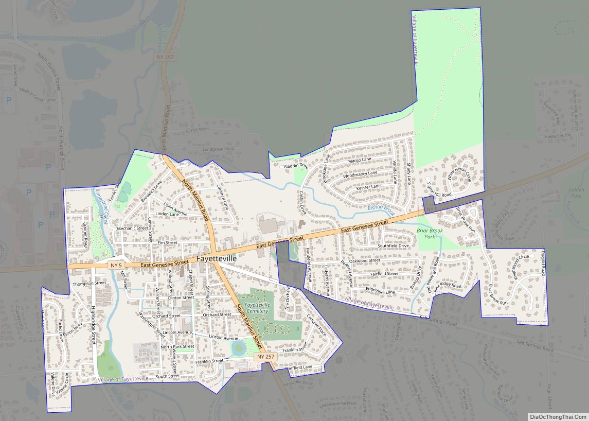
Online Interactive Map
Click on ![]() to view map in "full screen" mode.
to view map in "full screen" mode.
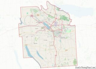
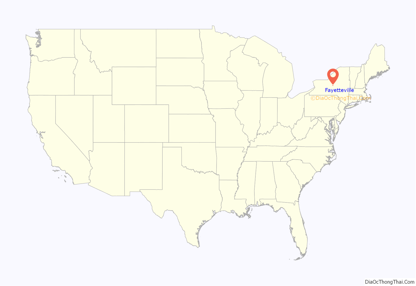
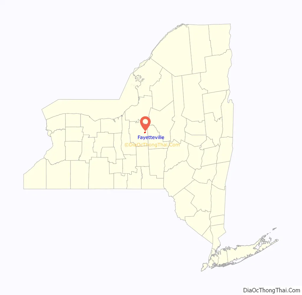
Fayetteville location map. Where is Fayetteville village?
History
The Charles Estabrook Mansion, Genesee Street Hill-Limestone Plaza Historic District, and Levi Snell House are listed on the National Register of Historic Places.
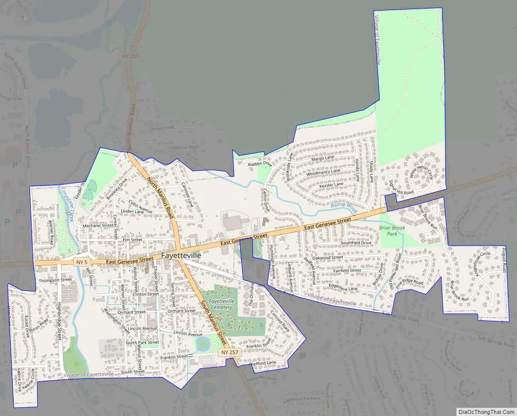
Fayetteville Road Map
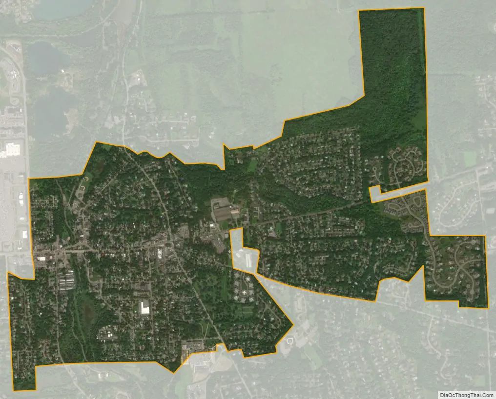
Fayetteville city Satellite Map
Geography
Fayetteville is in Central New York, at the intersection of New York State Route 5 and Route 257, at 43°1′43″N 76°0′15″W / 43.02861°N 76.00417°W / 43.02861; -76.00417 (43.028516, -76.004268).
According to the United States Census Bureau, the village has a total area of 1.7 square miles (4.4 km), all land.
See also
Map of New York State and its subdivision:- Albany
- Allegany
- Bronx
- Broome
- Cattaraugus
- Cayuga
- Chautauqua
- Chemung
- Chenango
- Clinton
- Columbia
- Cortland
- Delaware
- Dutchess
- Erie
- Essex
- Franklin
- Fulton
- Genesee
- Greene
- Hamilton
- Herkimer
- Jefferson
- Kings
- Lake Ontario
- Lewis
- Livingston
- Madison
- Monroe
- Montgomery
- Nassau
- New York
- Niagara
- Oneida
- Onondaga
- Ontario
- Orange
- Orleans
- Oswego
- Otsego
- Putnam
- Queens
- Rensselaer
- Richmond
- Rockland
- Saint Lawrence
- Saratoga
- Schenectady
- Schoharie
- Schuyler
- Seneca
- Steuben
- Suffolk
- Sullivan
- Tioga
- Tompkins
- Ulster
- Warren
- Washington
- Wayne
- Westchester
- Wyoming
- Yates
- Alabama
- Alaska
- Arizona
- Arkansas
- California
- Colorado
- Connecticut
- Delaware
- District of Columbia
- Florida
- Georgia
- Hawaii
- Idaho
- Illinois
- Indiana
- Iowa
- Kansas
- Kentucky
- Louisiana
- Maine
- Maryland
- Massachusetts
- Michigan
- Minnesota
- Mississippi
- Missouri
- Montana
- Nebraska
- Nevada
- New Hampshire
- New Jersey
- New Mexico
- New York
- North Carolina
- North Dakota
- Ohio
- Oklahoma
- Oregon
- Pennsylvania
- Rhode Island
- South Carolina
- South Dakota
- Tennessee
- Texas
- Utah
- Vermont
- Virginia
- Washington
- West Virginia
- Wisconsin
- Wyoming