Flower Hill is a village in Nassau County, on the North Shore of Long Island, in New York, United States. The eastern half is considered part of the Greater Roslyn area, which is anchored by the Incorporated Village of Roslyn. Western and northern parts are more closely associated with Manhasset and Port Washington. The population was 4,794 at the 2020 census.
The Incorporated Village of Flower Hill is located entirely within the Town of North Hempstead, and has been recognized as a Tree City USA since 2013.
| Name: | Flower Hill village |
|---|---|
| LSAD Code: | 47 |
| LSAD Description: | village (suffix) |
| State: | New York |
| County: | Nassau County |
| Incorporated: | May 25, 1931 |
| Elevation: | 167 ft (51 m) |
| Total Area: | 1.61 sq mi (4.18 km²) |
| Land Area: | 1.61 sq mi (4.18 km²) |
| Water Area: | 0.00 sq mi (0.00 km²) |
| Total Population: | 4,794 |
| Population Density: | 2,973.95/sq mi (1,148.26/km²) |
| FIPS code: | 3626352 |
| GNISfeature ID: | 0950308 |
| Website: | www.villageflowerhill.org |
Online Interactive Map
Click on ![]() to view map in "full screen" mode.
to view map in "full screen" mode.
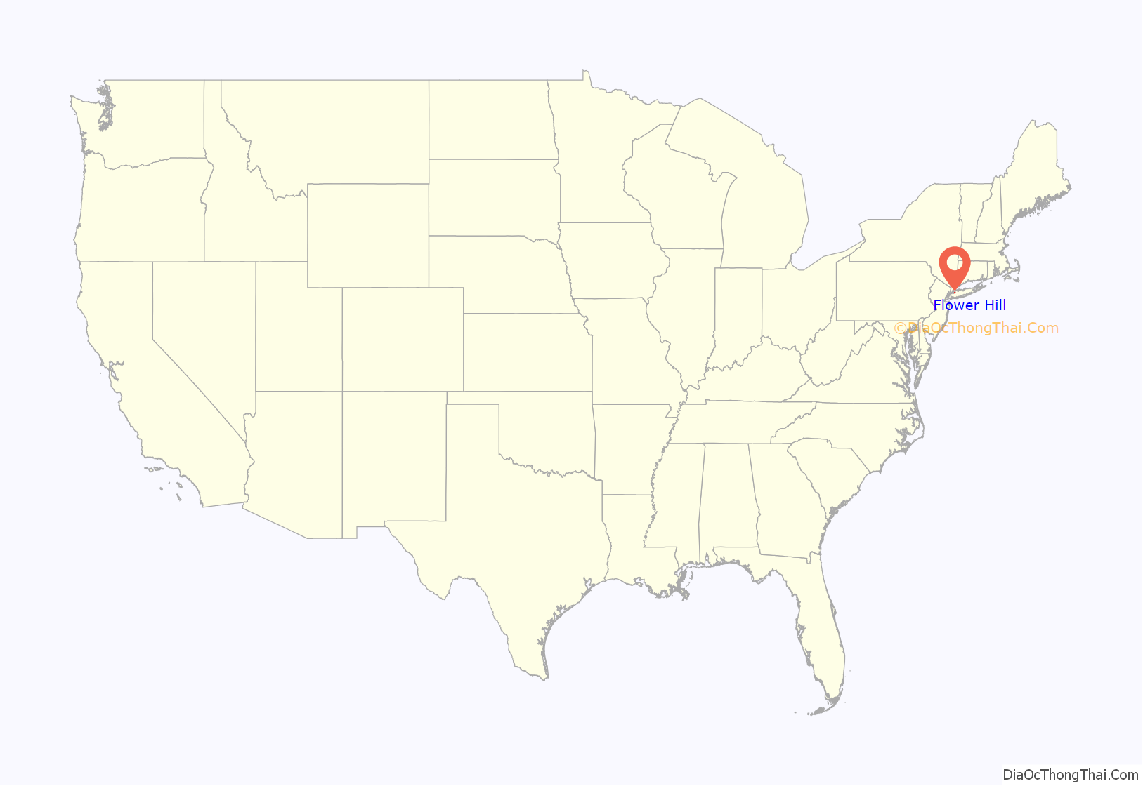
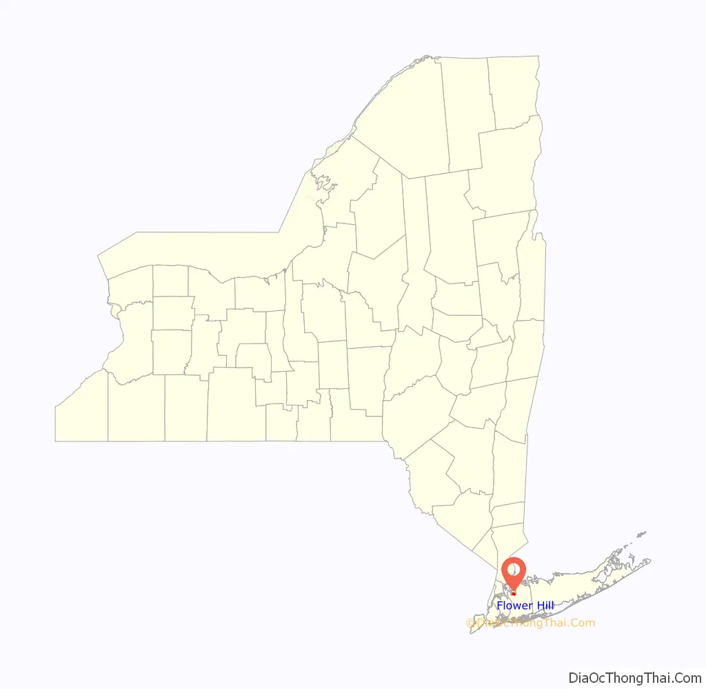
Flower Hill location map. Where is Flower Hill village?
History
Before the village (pre-colonization – 1930)
The area where Flower Hill is located was originally inhabited by Algonquin Native Americans. In the 17th century, European colonists started to settle in the area, specifically settlers of Dutch and English heritage.
This era saw members of prominent colonial families settled in the area, including members of the Hewlett family (the same family after whom Hewlett, New York is named, as well as Hewlett Lane in Flower Hill). Members of the family settled in the area during this time, and constructed the former Hewlett Homestead circa 1713.
During this time, the area consisted of many farms, and was in an ideal location for them, as the goods produced in the area would be brought down to either Manhasset Bay in Manhasset or Port Washington, or to Hempstead Harbor in Roslyn for shipment to destinations in New York City and beyond.
At this time, the heart of Flower Hill was located where modern-day Port Washington Boulevard, Bonnie Heights Road, and Country Club Drive intersect. This area included a blacksmith, general store, tavern, a village well, and a cemetery, in addition to a small number of homes.
Circa 1900, Carlos Munson – the heir to the Munson Steamship Company – and his wife, Mabel, settled in Flower Hill. Carlos and Mabel Munson were unhappy to be living near so many intoxicated locals found in this area, which prompted Mabel asking Carlos to do something to get rid of them. Carlos responded by purchasing the land, despite having no need for it. To further eliminate this issue, the Munsons gave some of this land to the Franciscan Missionaries of Mary.
In the early decades of the 20th century, the New York & North Shore Traction Company operated a trolley line connecting Mineola, Roslyn, and Port Washington – as well as one connecting Flushing and Roslyn – through the village, utilizing Northern Boulevard, Middle Neck Road, and Port Washington Boulevard.
The two lines intersected at a junction located at the intersection of Middle Neck Road and Northern Boulevard. This was also the site of the company’s former Roslyn trolley yard and a substation; it was located at the northwestern corner of the intersection.
Additionally, a trolley siding existed in Flower Hill on the east side of Port Washington Boulevard, near its intersection with modern-day Farmview Road.
Push for incorporation (1930 – 1931)
The push for Flower Hill’s incorporation first started in 1930, when word was spread that Port Washington was planning to incorporate itself as a city. Upon hearing these rumors, residents of Flower Hill feared that the Flower Hill area would be placed within the boundaries of the proposed City of Greater Port Washington if those plans were ultimately to be approved. As a result, the residents of Flower Hill saw a need to incorporate the locality as a village, in order to prevent the area from becoming part of the rumored city.
After two unsuccessful attempts to hold a hearing on Flower Hill’s incorporation as a village, residents tried for a third time in April 1931, and were successful. With the approval of the application for a hearing, a vote to decide whether or not Flower Hill should incorporate itself was set for April 27 of that year; the vote would be held in Carlos Munson’s real estate office.
During the vote on April 27, the residents of Flower Hill voted unanimously in favor of incorporating Flower Hill as a village, and the Incorporated Village of Flower Hill was ultimately born.
Village of Flower Hill (1931 – present)
In May 1931, a few weeks after the birth of the village, its certificate of incorporation was signed. Carlos Munson was originally selected to serve as its first Mayor but turned down the position, which was subsequently given to Arthur G. Elvin. When founded, the population of Flower Hill was 288. The first village meeting took place in Carlos Munson’s real estate office; Village Hall now occupies this parcel of land.
In the mid-1930s, the Franciscan Missionaries of Mary would establish St. Francis Hospital as a cardiac sanatorium for children, on the land given to them by Carlos Munson. The first children arrived at this facility on February 8, 1937.
Flower Hill started to see new housing developments be built in the coming years. One of the notable developments built during this time is a large part of the Flower Hill Estates subdivision, which was built by Walter Uhl. Uhl began to build many of these first homes in the vicinity of Country Club Drive, located in the Port Washington section of the village, and adjacent to the North Hempstead Country Club. Uhl built many of these homes in the colonial style, to ensure that they would fit in with existing buildings and surroundings. Some of these homes were also built with reused wood from barns in their ceilings. During the subdivision’s construction process in 1939, an old Spanish “piece-of-eight” was unearthed by a construction worker. The coin, dating back to 1793, was presented by Uhl to the Port Washington Library.
In the years and decades following the Second World War, Flower Hill continued to be suburbanized, and many new developments were built as a result. Many of these new developments were built over former estates (such as the Chanticlare at Flower Hill subdivision, which was built over the former estate of Jesse Ricks), farms (such as the Hewlett Farm subdivision, which was built over portions of the former Hewlett Homestead), and even former sand mines (such as certain parts of the Wildwood at Flower Hill development, built on land once owned by the Colonial Sand & Stone Company). A notable housing development built during this time is Flower Hill Country Estates, which was developed by Country Estates, Incorporated. The firm also built the Country Estates subdivision of nearby East Hills around the same time, over Clarence Mackay’s former estate.
In 1946, Marjorie Church Logan (wife of William John Logan) was murdered in her home on Bonnie Heights Road, and her daughter, Marjory Jeanne, was shot and raped. The suspect, Ward Beecher Caraway, was a butler and chauffeur at another estate in Flower Hill, and was ultimately sentenced to death for the crimes.
In 1948, Flower Hill Village Hall was built. It was designed by Roslyn-based architect Henry W. Johanson, and is located where Carlos Munson’s real estate office had previously stood.
The construction of so many new subdivisions and homes in the village and the subsequent influx of children prompted the Roslyn Union Free School District to construct the Roslyn–Flower Hill Elementary School (as well as several other new schools) to better serve the needs of the section of area of Flower Hill zoned for Roslyn’s schools, as well as to resolve overcrowding at the district’s other schools. Built and opened in the early 1950s and sandwiched between the Wildwood and Broadridge subdivisions, the Roslyn–Flower Hill Elementary School served the community until September 1980, when it was closed due to the declining enrollment numbers following the baby-boom era. The former school’s property was later subdivided to become the Mashady Estates subdivision in the 1980s, and now consists of multiple single-family homes; it was developed by the N & H Development Corporation.
Between 2012 and 2016, Elaine Phillips served as the Mayor of Flower Hill. She served in this capacity until being elected to the New York State Senate in November 2016. The Phillips Administration oversaw the rehabilitation and modernization of the village-owned Flower Hill Park, which included the installation of a state-of-the-art playground for children.
On October 29, 2012, Superstorm Sandy made landfall, and caused widespread damage throughout the New York metropolitan area. The entirety of the Village of Flower Hill lost power as a result of this storm. Due to communication errors from the Long Island Power Authority, some residents were without power for two unusually cold weeks. Village officials kept Village Hall open despite the fact that telephone lines and the heating system were initially down. Village officials also as regularly reached out to LIPA and local residents, and assisted in removing downed trees. Some officials even checked in on every senior living alone in the village, also offering them free transportation to and from shelters and ensuring that they were stocked with food. When the generators for Village Hall started to run, village officials started offering residents with heat, power, and even coffee at the building. There were no storm-related fatalities in Flower Hill, and only one home was lost within the village, when its generator caught fire.
In response to all of the trees lost in Flower Hill due to Hurricane Sandy, the village created a tree planting program, through which residents can receive a free tree for their property, given that the tree is planted in the village’s right-of-way. This program helped the village become recognized as a Tree City USA.
Robert McNamara became Mayor in 2016, succeeding Senator Phillips. A notable accomplishment of the McNamara Administration was the initiation of the process of village’s takeover of Middle Neck Road (former CR D55) – which connects Northern and Port Washington Boulevards – from Nassau County, which had been a goal of the village’s for several years, given the poor upkeep from the Nassau County Department of Public Works. In the deal, the Nassau County would repair the road and repave the road, and would then sell it to the Village of Flower Hill for $1. In the past, the Village of Flower Hill also purchased the Flower Hill Park and the Flower Hill section of Stonytown Road from Nassau County.
McNamara’s administration also implemented a construction impact fee for large construction projects.
Mayor McNamara, who long-suffered from health complications, died on April 15, 2020. Deputy Mayor Brian Herrington assumed the duties of Mayor, in light of McNamara’s passing.
On August 4, 2020, Hurricane Isaias struck the New York metropolitan area as a strong tropical storm, causing widespread power outages and damage across the region. Many trees in Flower Hill were uprooted, and much of the village lost power. Due to communication errors from PSEG Long Island, many delays took place in restoring power to the entirety of the village, resulting in some residents being without power for more than a week. Village officials designated Village Hall as a cooling center and phone charging center for residents that were without power, following COVID-19 social distancing guidelines.
The 2020 mayoral election was supposed to take place on March 18, 2020 – but was postponed first until April 28 and then again until September, due to an order signed by Governor Andrew M. Cuomo as a result of COVID-19. The election ultimately took place on Tuesday, September 15, 2020. The election, which was highly contested, saw then-Trustee Kate Hirsch challenging incumbent Mayor Brian Herrington. Herrington was ultimately re-elected by Flower Hill voters to serve a full term, defeating Hirsch; Herrington received 596 votes, and Hirsch received 233.
On February 23, 2021, the Arbor Day Foundation designated Flower Hill as a Tree City USA for the seventh consecutive year.
In early 2022, ownership of Middle Neck Road was officially transferred to the Village from Nassau County.
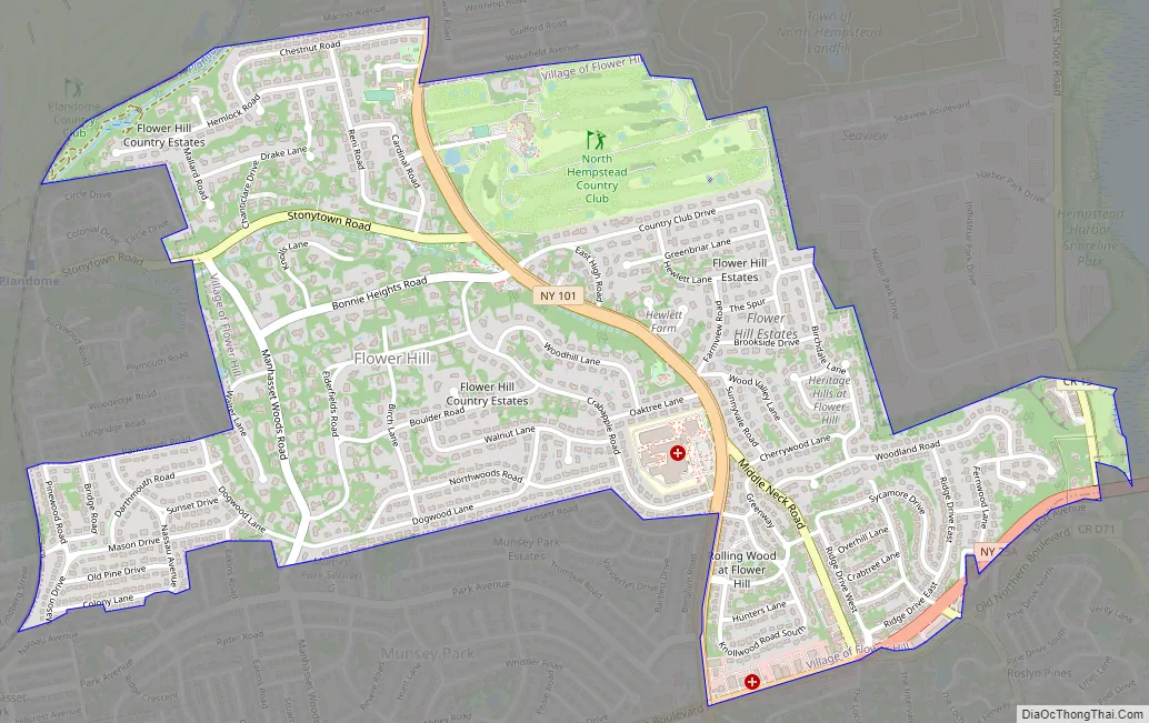
Flower Hill Road Map
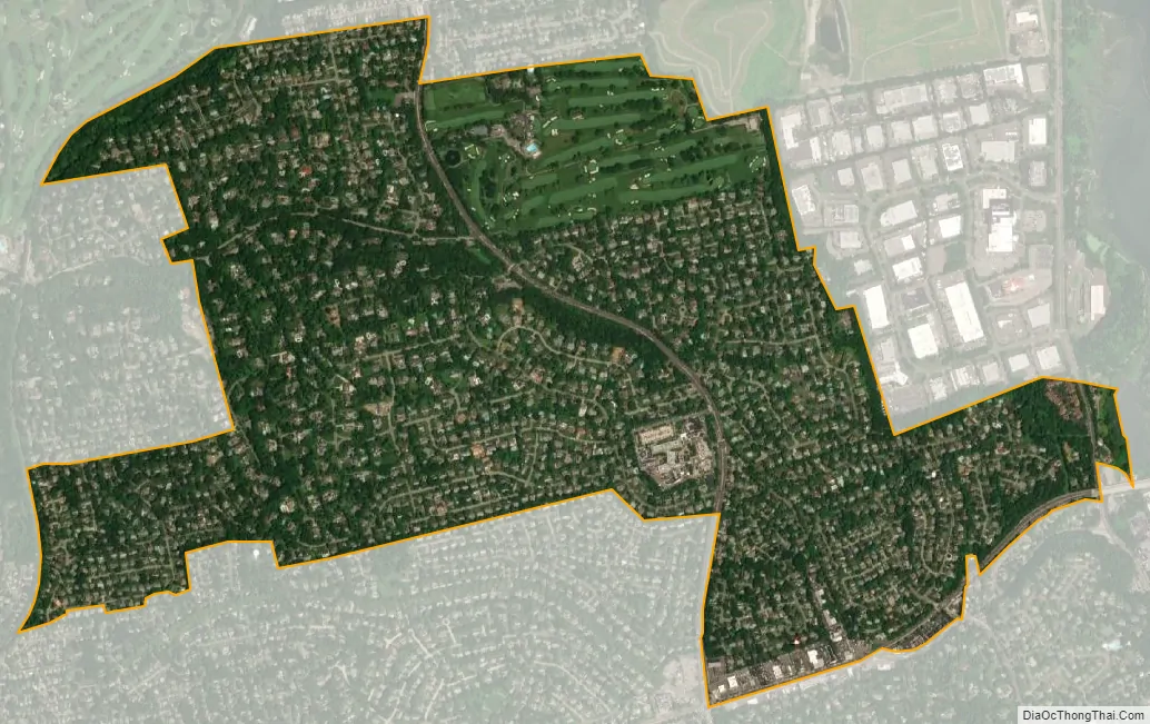
Flower Hill city Satellite Map
Geography
According to the United States Census Bureau, the village has a total area of 1.6 square miles (4.1 km), all land.
Additionally, Flower Hill is located on the southern portion of the Cow Neck Peninsula.
Topography
Like the rest of Long Island’s North Shore, Flower Hill is situated on a terminal moraine, which is named the Harbor Hill Moraine. This moraine was formed by glaciers during the Wisconsin Glacial Episode, and is named for Harbor Hill in Roslyn; Harbor Hill is the highest geographic point in Nassau County.
Some of the hills in Flower Hill reach elevations high enough that on a clear day, the skyline of New York City can easily be seen from the ground – notably in the Manhasset portion of the village.
The highest point in Flower Hill is on Ridge Drive East, at 219 feet (67 m). The lowest point is Hempstead Harbor, which is at sea level. Both the highest and lowest points in Flower Hill are within the portion of the village served by the Roslyn Post Office.
Geology
Flower Hill is the namesake of the Flower Hill sand – a geologic unit of the Manhasset Formation.
Drainage
Flower Hill is split among three minor drainage areas: Inner Hempstead Harbor (part of the Hempstead Harbor Watershed), Leeds Pond, and Whitney Pond (both of which are part of the Manhasset Bay Watershed).
Furthermore, the village, as a whole, is located within the larger Long Island Sound/Atlantic Ocean Watershed.
Climate
The Village of Flower Hill features a humid subtropical climate (Cfa) under the Köppen climate classification and is located near the transitional zone between humid subtropical and humid continental (Dfa) climates. As such, the village experiences hot, humid summers and cold winters, and experiences precipitation throughout the entirety of the year.
According to the United States Department of Agriculture (USDA), Flower Hill is located in the transition zone between hardiness zones 7a and 7b.
See also
Map of New York State and its subdivision:- Albany
- Allegany
- Bronx
- Broome
- Cattaraugus
- Cayuga
- Chautauqua
- Chemung
- Chenango
- Clinton
- Columbia
- Cortland
- Delaware
- Dutchess
- Erie
- Essex
- Franklin
- Fulton
- Genesee
- Greene
- Hamilton
- Herkimer
- Jefferson
- Kings
- Lake Ontario
- Lewis
- Livingston
- Madison
- Monroe
- Montgomery
- Nassau
- New York
- Niagara
- Oneida
- Onondaga
- Ontario
- Orange
- Orleans
- Oswego
- Otsego
- Putnam
- Queens
- Rensselaer
- Richmond
- Rockland
- Saint Lawrence
- Saratoga
- Schenectady
- Schoharie
- Schuyler
- Seneca
- Steuben
- Suffolk
- Sullivan
- Tioga
- Tompkins
- Ulster
- Warren
- Washington
- Wayne
- Westchester
- Wyoming
- Yates
- Alabama
- Alaska
- Arizona
- Arkansas
- California
- Colorado
- Connecticut
- Delaware
- District of Columbia
- Florida
- Georgia
- Hawaii
- Idaho
- Illinois
- Indiana
- Iowa
- Kansas
- Kentucky
- Louisiana
- Maine
- Maryland
- Massachusetts
- Michigan
- Minnesota
- Mississippi
- Missouri
- Montana
- Nebraska
- Nevada
- New Hampshire
- New Jersey
- New Mexico
- New York
- North Carolina
- North Dakota
- Ohio
- Oklahoma
- Oregon
- Pennsylvania
- Rhode Island
- South Carolina
- South Dakota
- Tennessee
- Texas
- Utah
- Vermont
- Virginia
- Washington
- West Virginia
- Wisconsin
- Wyoming


