Fowlerville is a hamlet and census-designated place (CDP) in the town of York in Livingston County, New York, United States. The population of the CDP was 227 at the 2010 census.
The community is named for Wells Fowler, the first settler.
It should not be confused with other New York hamlets named Fowlerville in Erie County and Sullivan County, or with the similarly named hamlet of Fowlersville in Lewis County
| Name: | Fowlerville CDP |
|---|---|
| LSAD Code: | 57 |
| LSAD Description: | CDP (suffix) |
| State: | New York |
| County: | Livingston County |
| Elevation: | 636 ft (194 m) |
| Total Area: | 0.90 sq mi (2.33 km²) |
| Land Area: | 0.90 sq mi (2.33 km²) |
| Water Area: | 0.00 sq mi (0.00 km²) |
| Total Population: | 163 |
| Population Density: | 180.91/sq mi (69.83/km²) |
| Area code: | 585 |
| FIPS code: | 3627133 |
| GNISfeature ID: | 950550 |
Online Interactive Map
Click on ![]() to view map in "full screen" mode.
to view map in "full screen" mode.
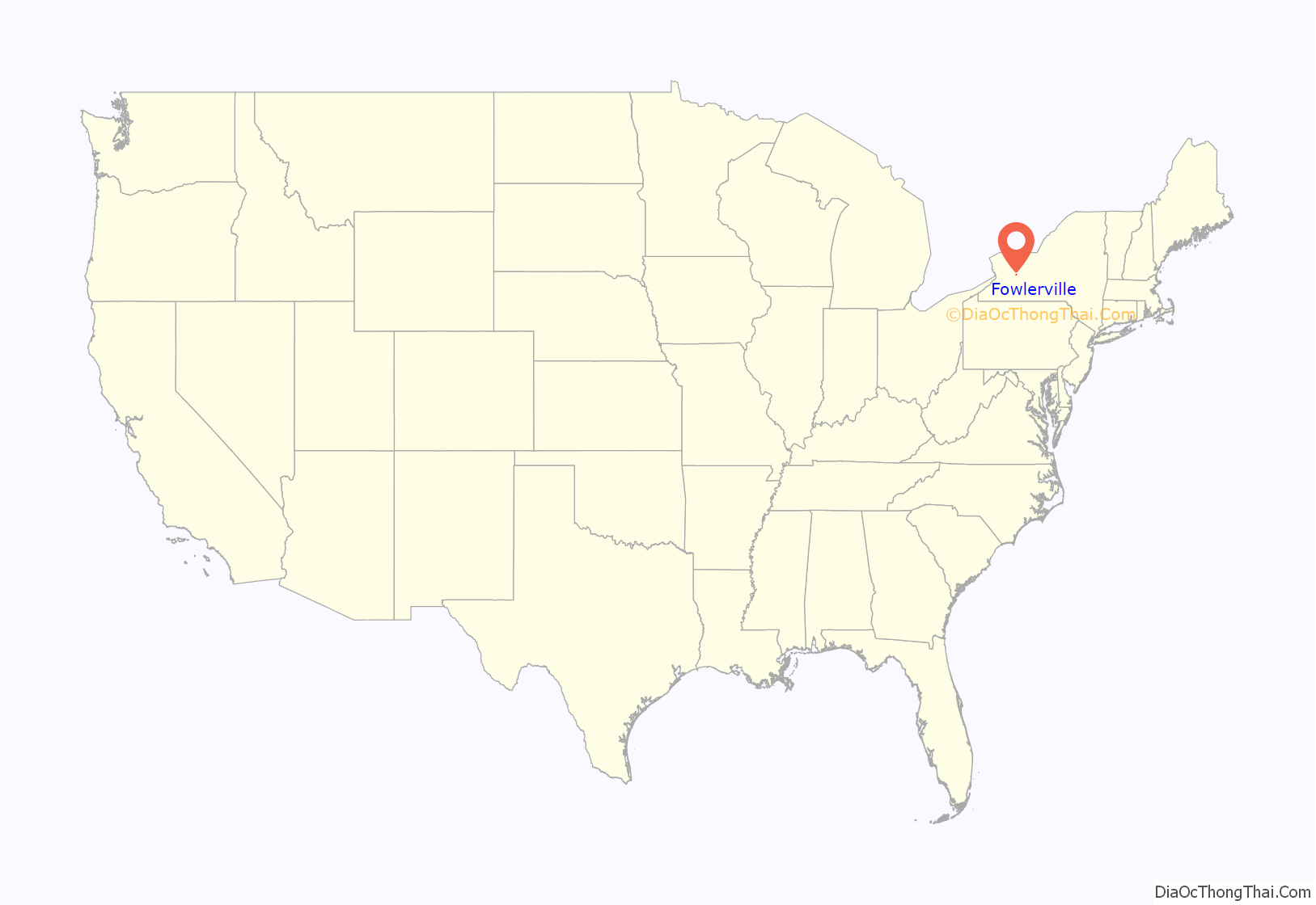
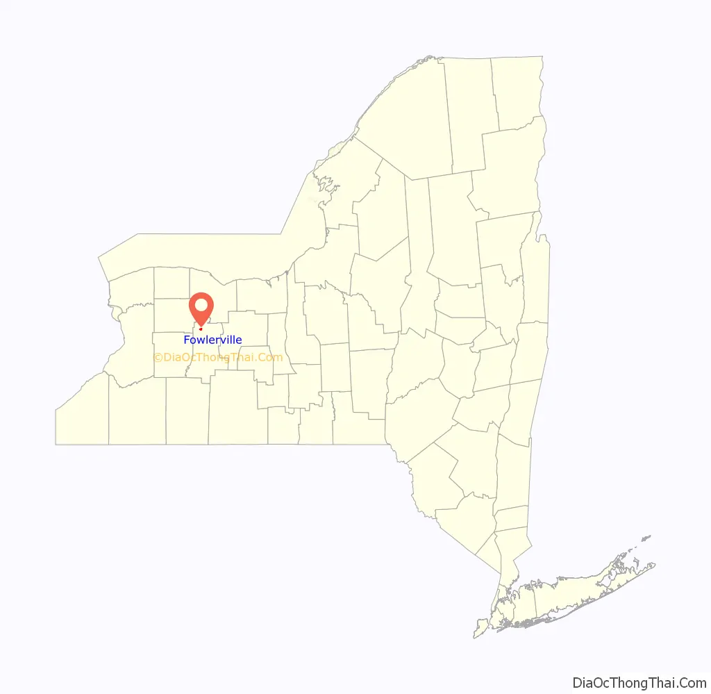
Fowlerville location map. Where is Fowlerville CDP?
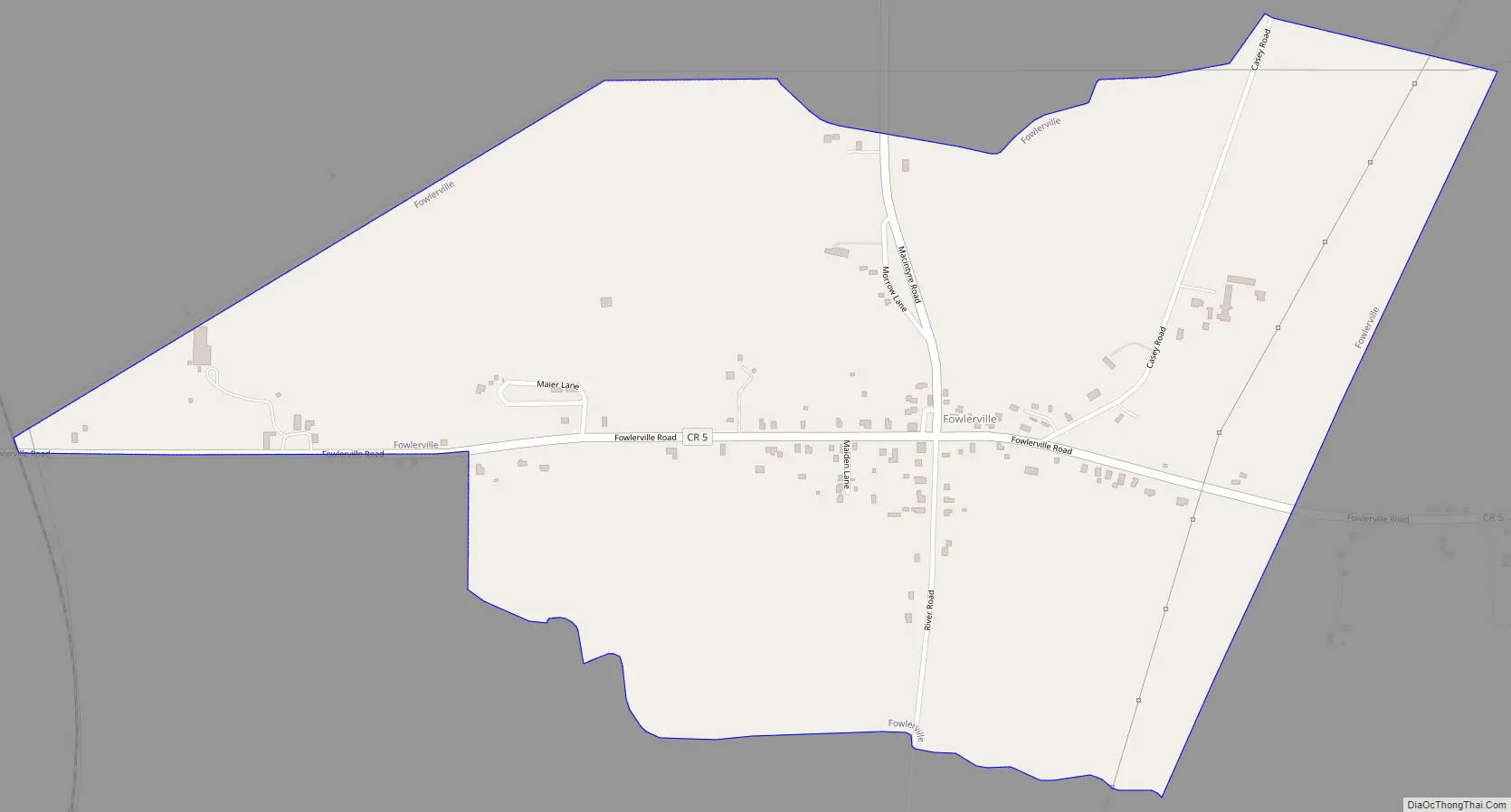
Fowlerville Road Map
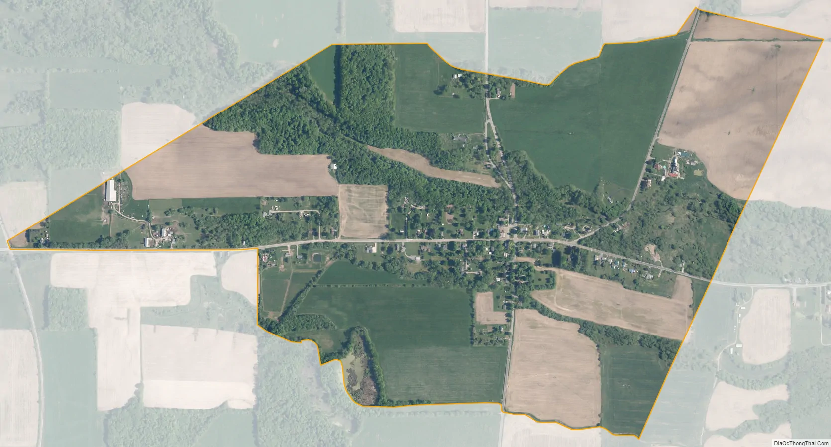
Fowlerville city Satellite Map
Geography
Fowlerville is located in northwestern Livingston County at 42°53′36″N 077°50′44″W / 42.89333°N 77.84556°W / 42.89333; -77.84556 (42.8933955, -77.8455608), in the northeastern part of the town of York, at an elevation of 636 feet (194 m). It is 3 miles (5 km) northeast of York hamlet, 8 miles (13 km) northwest of Geneseo, the Livingston county seat, 6 miles (10 km) west of Avon, and 24 miles (39 km) southwest of Rochester.
According to the 2010 United States Census, the Fowlerville CDP has a total area of 0.90 square miles (2.33 km), all land.
See also
Map of New York State and its subdivision:- Albany
- Allegany
- Bronx
- Broome
- Cattaraugus
- Cayuga
- Chautauqua
- Chemung
- Chenango
- Clinton
- Columbia
- Cortland
- Delaware
- Dutchess
- Erie
- Essex
- Franklin
- Fulton
- Genesee
- Greene
- Hamilton
- Herkimer
- Jefferson
- Kings
- Lake Ontario
- Lewis
- Livingston
- Madison
- Monroe
- Montgomery
- Nassau
- New York
- Niagara
- Oneida
- Onondaga
- Ontario
- Orange
- Orleans
- Oswego
- Otsego
- Putnam
- Queens
- Rensselaer
- Richmond
- Rockland
- Saint Lawrence
- Saratoga
- Schenectady
- Schoharie
- Schuyler
- Seneca
- Steuben
- Suffolk
- Sullivan
- Tioga
- Tompkins
- Ulster
- Warren
- Washington
- Wayne
- Westchester
- Wyoming
- Yates
- Alabama
- Alaska
- Arizona
- Arkansas
- California
- Colorado
- Connecticut
- Delaware
- District of Columbia
- Florida
- Georgia
- Hawaii
- Idaho
- Illinois
- Indiana
- Iowa
- Kansas
- Kentucky
- Louisiana
- Maine
- Maryland
- Massachusetts
- Michigan
- Minnesota
- Mississippi
- Missouri
- Montana
- Nebraska
- Nevada
- New Hampshire
- New Jersey
- New Mexico
- New York
- North Carolina
- North Dakota
- Ohio
- Oklahoma
- Oregon
- Pennsylvania
- Rhode Island
- South Carolina
- South Dakota
- Tennessee
- Texas
- Utah
- Vermont
- Virginia
- Washington
- West Virginia
- Wisconsin
- Wyoming


