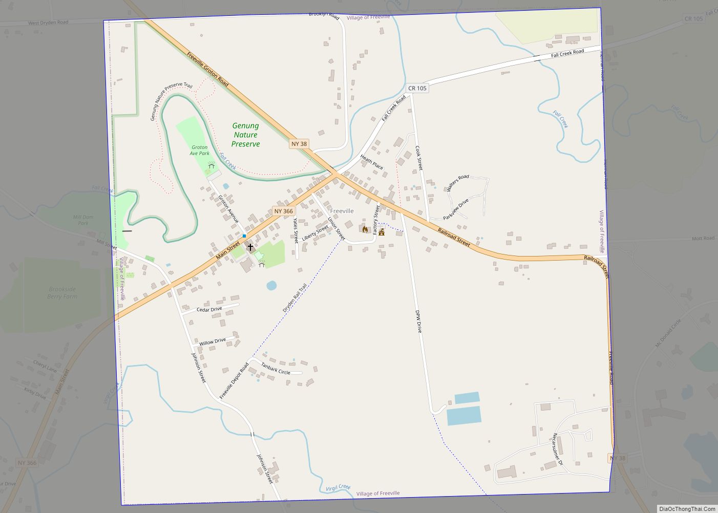
Freeville is a village in Tompkins County, New York, United States. The population was 520 at the 2010 census.
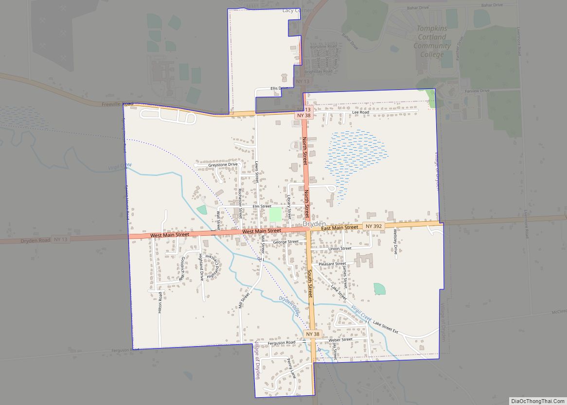
The Village of Freeville is in the Town of Dryden and is east of Ithaca. It is the only incorporated municipality in the United States named Freeville.
| Name: | Freeville village |
|---|---|
| LSAD Code: | 47 |
| LSAD Description: | village (suffix) |
| State: | New York |
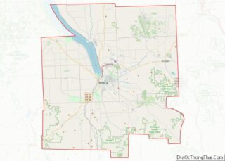
| County: | Tompkins County |
| Incorporated: | July 2, 1887 (1887-07-02) |
| Elevation: | 1,043 ft (318 m) |
| Total Area: | 1.09 sq mi (2.84 km²) |
| Land Area: | 1.06 sq mi (2.74 km²) |
| Water Area: | 0.04 sq mi (0.10 km²) |
| Total Population: | 498 |
| Population Density: | 470.70/sq mi (181.68/km²) |
| ZIP code: | 13068 |
| Area code: | 607 |
| FIPS code: | 3627529 |
| GNISfeature ID: | 0950679 |
| Website: | freevilleny.org |
Online Interactive Map
Click on ![]() to view map in "full screen" mode.
to view map in "full screen" mode.
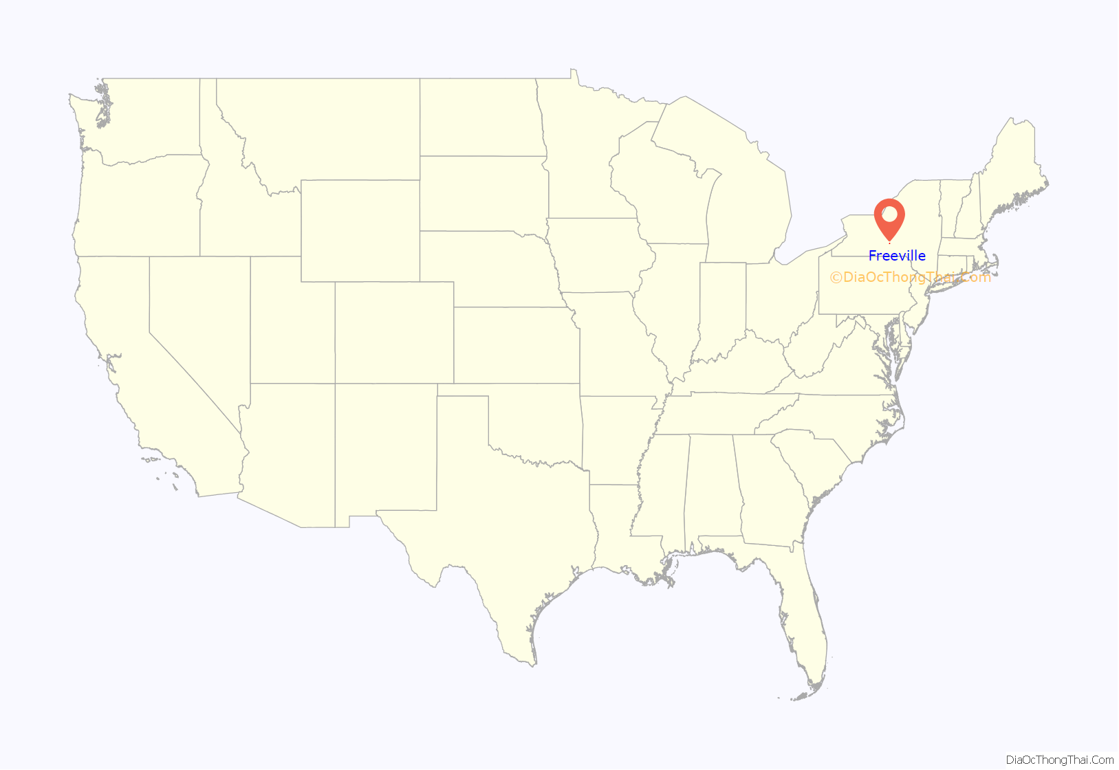
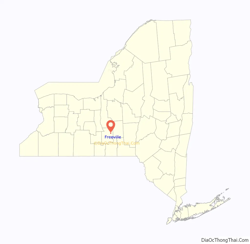
Freeville location map. Where is Freeville village?
History
Freeville was in the former Central New York Military Tract. It was first settled by Daniel White, a Revolutionary War soldier who cleared land along Fall Creek and built a cabin there around 1798; by 1802 White had established a grist mill at the site.
In the early 1870s, Freeville was transformed from a quiet mill town into an important regional railroad junction when the Southern Central Railroad and the Utica, Ithaca & Elmira Railroad (acquired in 1884 by the newly created Elmira, Cortland and Northern Railroad) extended their lines through the village. Both lines were acquired in the mid-1890s by the Lehigh Valley Railroad, which maintained passenger service at Freeville through the 1930s and freight service until the 1970s.
The Village of Freeville was incorporated in 1887.
George Junior Republic, a youth center, originally called the Freeville Junior Republic, was founded just outside of the village in 1895; the name was changed in 1909.
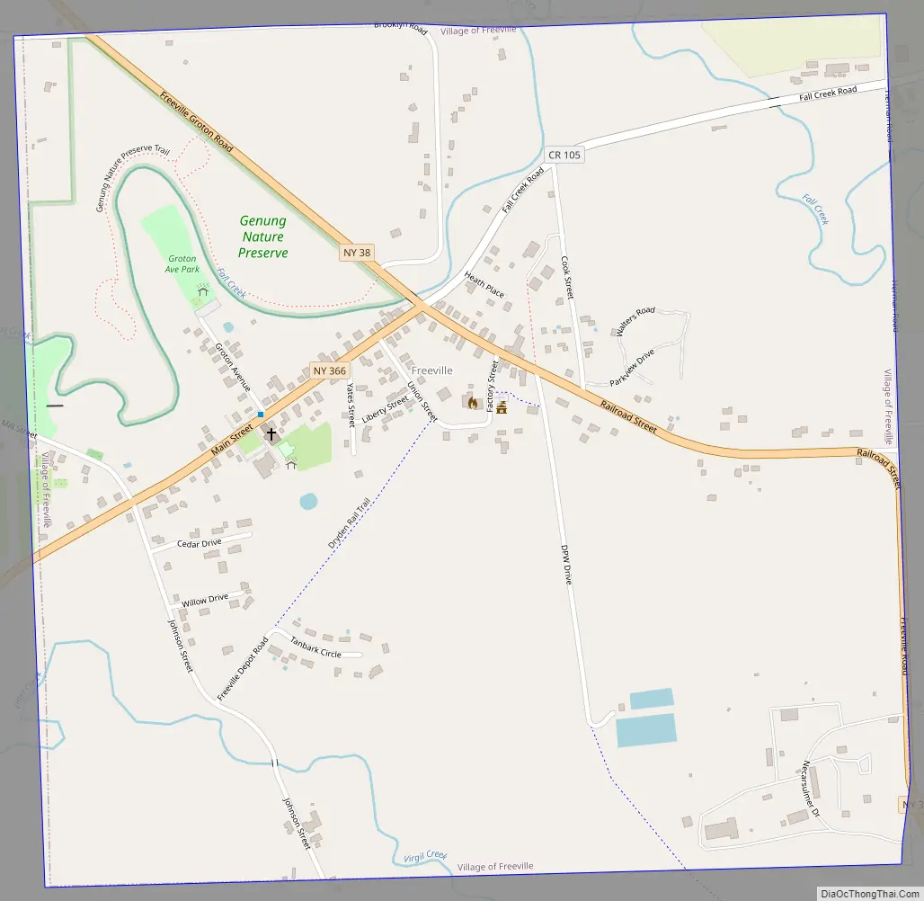
Freeville Road Map
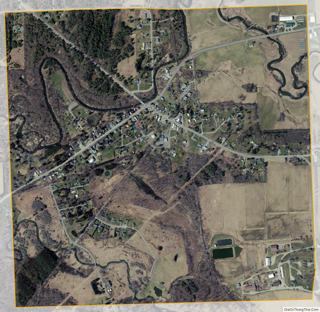
Freeville city Satellite Map
Geography
Freeville is located at 42°30′45″N 76°20′45″W / 42.51250°N 76.34583°W / 42.51250; -76.34583 (42.513, -76.346).
According to the United States Census Bureau, the village has a total area of 1.1 square miles (2.8 km), all of it land.
New York State Route 38 intersects New York State Route 366 in Freeville.
See also
Map of New York State and its subdivision:- Albany
- Allegany
- Bronx
- Broome
- Cattaraugus
- Cayuga
- Chautauqua
- Chemung
- Chenango
- Clinton
- Columbia
- Cortland
- Delaware
- Dutchess
- Erie
- Essex
- Franklin
- Fulton
- Genesee
- Greene
- Hamilton
- Herkimer
- Jefferson
- Kings
- Lake Ontario
- Lewis
- Livingston
- Madison
- Monroe
- Montgomery
- Nassau
- New York
- Niagara
- Oneida
- Onondaga
- Ontario
- Orange
- Orleans
- Oswego
- Otsego
- Putnam
- Queens
- Rensselaer
- Richmond
- Rockland
- Saint Lawrence
- Saratoga
- Schenectady
- Schoharie
- Schuyler
- Seneca
- Steuben
- Suffolk
- Sullivan
- Tioga
- Tompkins
- Ulster
- Warren
- Washington
- Wayne
- Westchester
- Wyoming
- Yates
- Alabama
- Alaska
- Arizona
- Arkansas
- California
- Colorado
- Connecticut
- Delaware
- District of Columbia
- Florida
- Georgia
- Hawaii
- Idaho
- Illinois
- Indiana
- Iowa
- Kansas
- Kentucky
- Louisiana
- Maine
- Maryland
- Massachusetts
- Michigan
- Minnesota
- Mississippi
- Missouri
- Montana
- Nebraska
- Nevada
- New Hampshire
- New Jersey
- New Mexico
- New York
- North Carolina
- North Dakota
- Ohio
- Oklahoma
- Oregon
- Pennsylvania
- Rhode Island
- South Carolina
- South Dakota
- Tennessee
- Texas
- Utah
- Vermont
- Virginia
- Washington
- West Virginia
- Wisconsin
- Wyoming