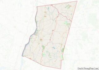
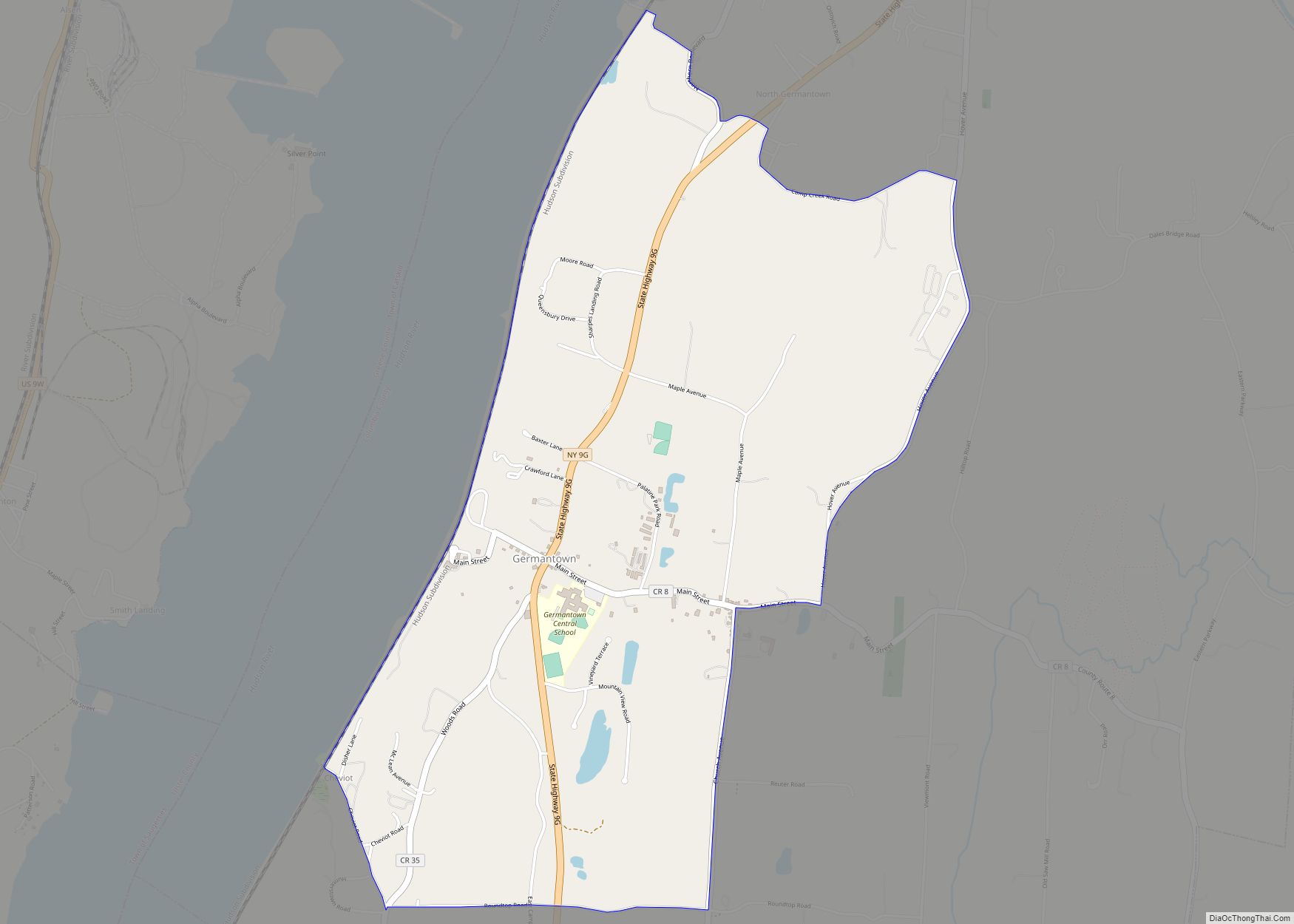
Germantown is a census-designated place (CDP) in the town of Germantown in Columbia County, New York, United States, on the east side of the Hudson River. The population of the CDP was 845 at the 2010 census, out of a total town population of 1,954.
| Name: | Germantown CDP |
|---|---|
| LSAD Code: | 57 |
| LSAD Description: | CDP (suffix) |
| State: | New York |
| County: | Columbia County |
| Elevation: | 135 ft (41 m) |
| Total Area: | 3.66 sq mi (9.48 km²) |
| Land Area: | 3.65 sq mi (9.44 km²) |
| Water Area: | 0.02 sq mi (0.04 km²) |
| Total Population: | 1,121 |
| Population Density: | 307.54/sq mi (118.75/km²) |
| ZIP code: | 12526 |
| Area code: | 518 |
| FIPS code: | 3628761 |
| GNISfeature ID: | 0951036 |
Online Interactive Map
Click on ![]() to view map in "full screen" mode.
to view map in "full screen" mode.
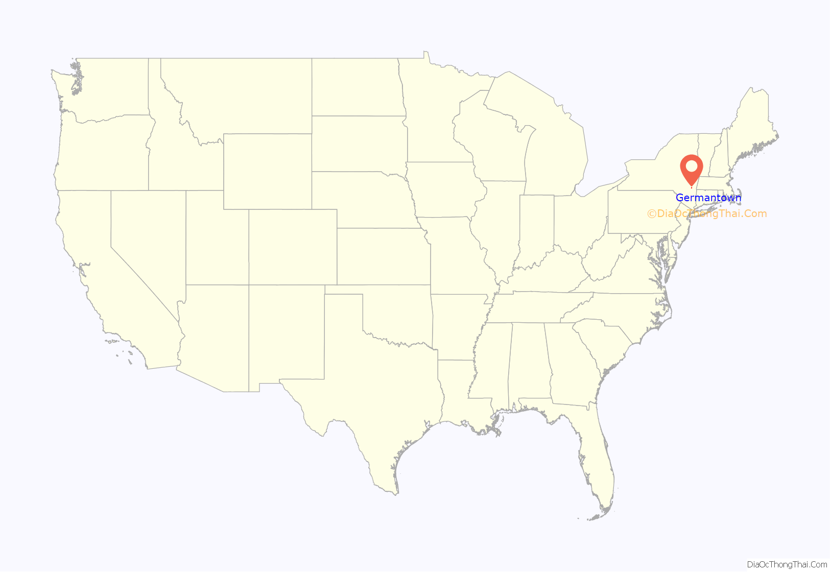
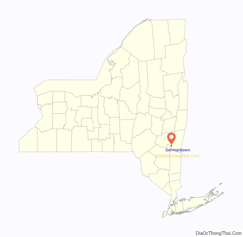
Germantown location map. Where is Germantown CDP?
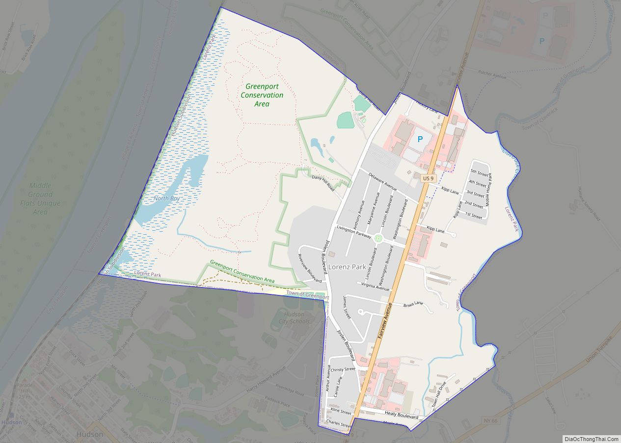
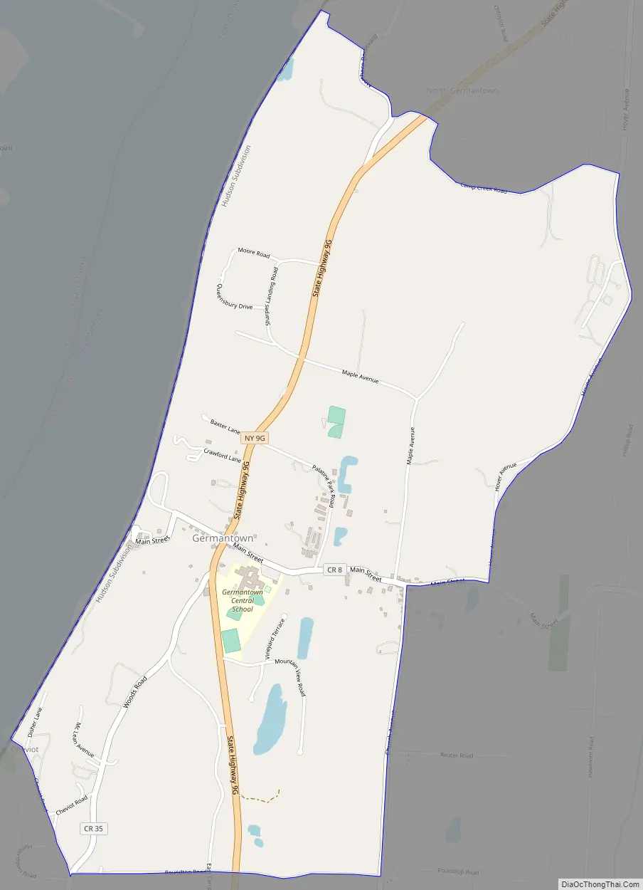
Germantown Road Map
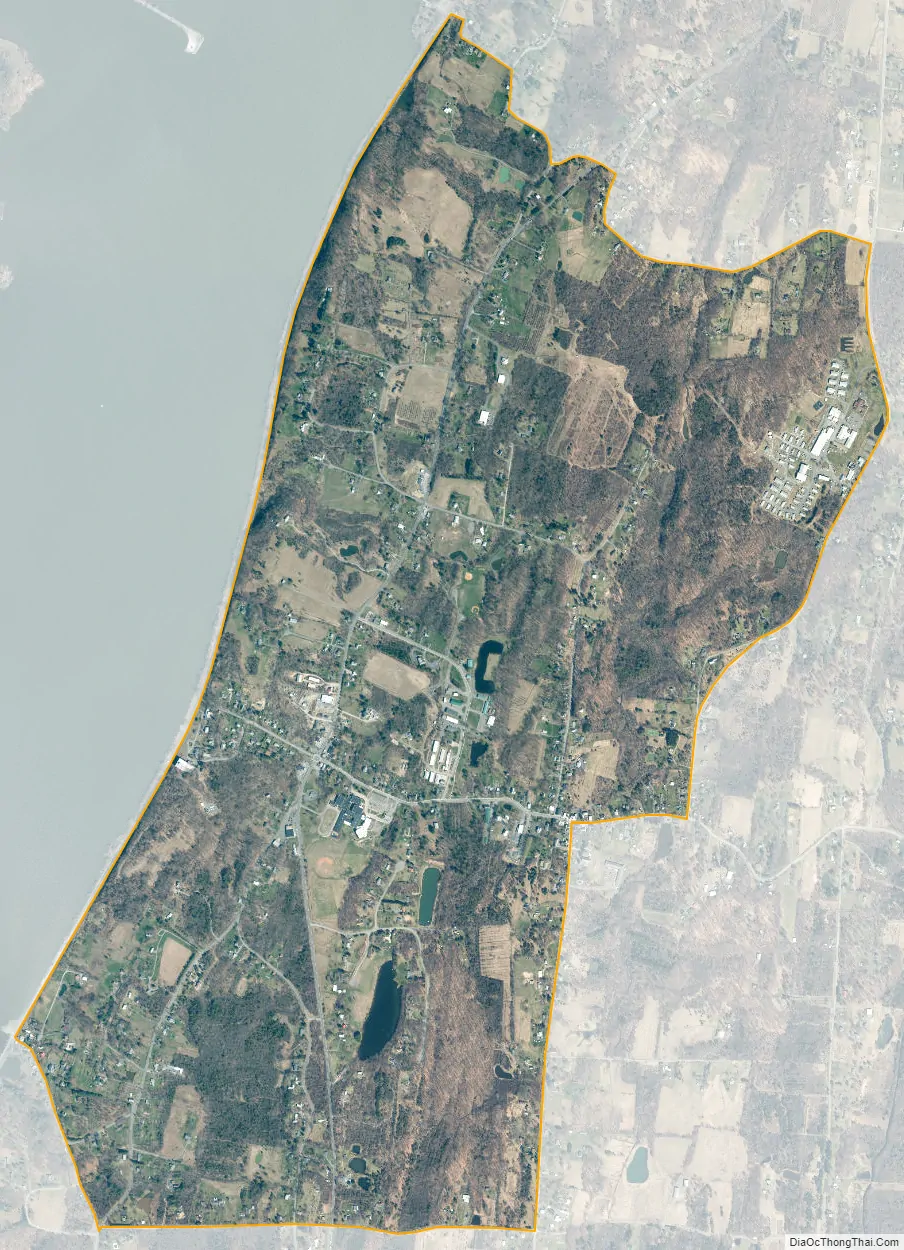
Germantown city Satellite Map
Geography
Germantown is located at 42°8′9″N 73°53′16″W / 42.13583°N 73.88778°W / 42.13583; -73.88778 (42.135865, -73.887886). The CDP includes all of the hamlet of Germantown but also extends north as far as North Germantown and south to include most of the hamlet of Cheviot. The CDP is bordered to the west by the Hudson River; to the north by Anchorage Road, Northern Boulevard, and Camp Creek Road; to the east by Hover Avenue and Church Avenue; and to the south by Roundtop Road and Cheviot Road.
New York State Route 9G passes through Germantown, leading north 10 miles (16 km) to Hudson and south 9 miles (14 km) to Annandale-on-Hudson.
According to the United States Census Bureau, the Germantown CDP has a total area of 2.7 square miles (7.0 km), of which 0.015 square miles (0.04 km), or 0.59%, is water.
See also
Map of New York State and its subdivision:- Albany
- Allegany
- Bronx
- Broome
- Cattaraugus
- Cayuga
- Chautauqua
- Chemung
- Chenango
- Clinton
- Columbia
- Cortland
- Delaware
- Dutchess
- Erie
- Essex
- Franklin
- Fulton
- Genesee
- Greene
- Hamilton
- Herkimer
- Jefferson
- Kings
- Lake Ontario
- Lewis
- Livingston
- Madison
- Monroe
- Montgomery
- Nassau
- New York
- Niagara
- Oneida
- Onondaga
- Ontario
- Orange
- Orleans
- Oswego
- Otsego
- Putnam
- Queens
- Rensselaer
- Richmond
- Rockland
- Saint Lawrence
- Saratoga
- Schenectady
- Schoharie
- Schuyler
- Seneca
- Steuben
- Suffolk
- Sullivan
- Tioga
- Tompkins
- Ulster
- Warren
- Washington
- Wayne
- Westchester
- Wyoming
- Yates
- Alabama
- Alaska
- Arizona
- Arkansas
- California
- Colorado
- Connecticut
- Delaware
- District of Columbia
- Florida
- Georgia
- Hawaii
- Idaho
- Illinois
- Indiana
- Iowa
- Kansas
- Kentucky
- Louisiana
- Maine
- Maryland
- Massachusetts
- Michigan
- Minnesota
- Mississippi
- Missouri
- Montana
- Nebraska
- Nevada
- New Hampshire
- New Jersey
- New Mexico
- New York
- North Carolina
- North Dakota
- Ohio
- Oklahoma
- Oregon
- Pennsylvania
- Rhode Island
- South Carolina
- South Dakota
- Tennessee
- Texas
- Utah
- Vermont
- Virginia
- Washington
- West Virginia
- Wisconsin
- Wyoming