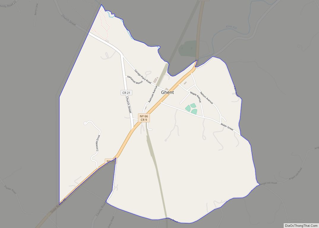
Ghent is a census-designated place (CDP) in the town of Ghent in Columbia County, New York, United States. The population of the CDP was 564 at the 2010 census, out of a total town population of 5,402.
The community is located northeast of the city of Hudson.
Ghent was originally the site of a Mahican Native American village known as Squampamock, Scom-pa-muck or Squampanoc.
| Name: | Ghent CDP |
|---|---|
| LSAD Code: | 57 |
| LSAD Description: | CDP (suffix) |
| State: | New York |
| County: | Columbia County |
| Elevation: | 407 ft (124 m) |
| Total Area: | 1.64 sq mi (4.24 km²) |
| Land Area: | 1.63 sq mi (4.21 km²) |
| Water Area: | 0.01 sq mi (0.03 km²) |
| Total Population: | 623 |
| Population Density: | 383.38/sq mi (148.06/km²) |
| ZIP code: | 12075 |
| Area code: | 518 |
| FIPS code: | 3628860 |
| GNISfeature ID: | 0951055 |
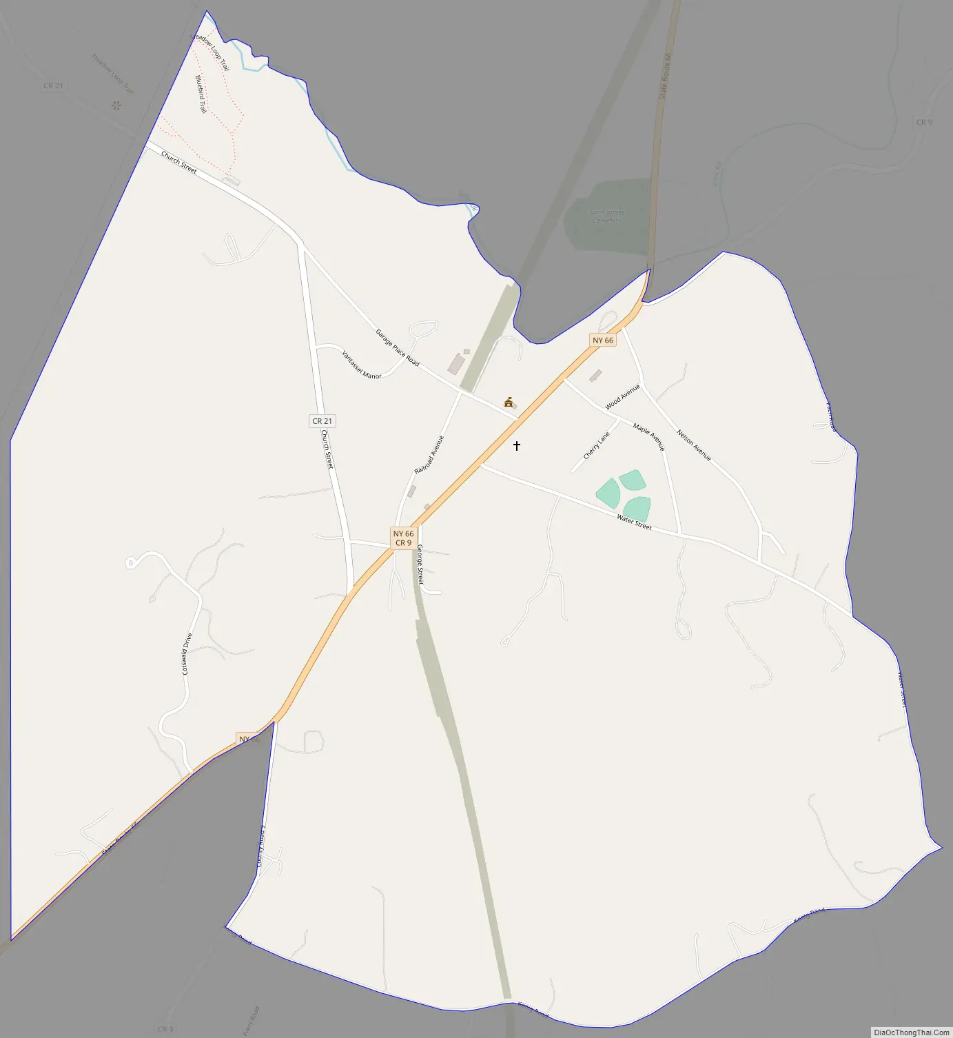
Online Interactive Map
Click on ![]() to view map in "full screen" mode.
to view map in "full screen" mode.
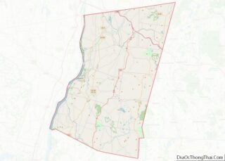
Ghent location map. Where is Ghent CDP?
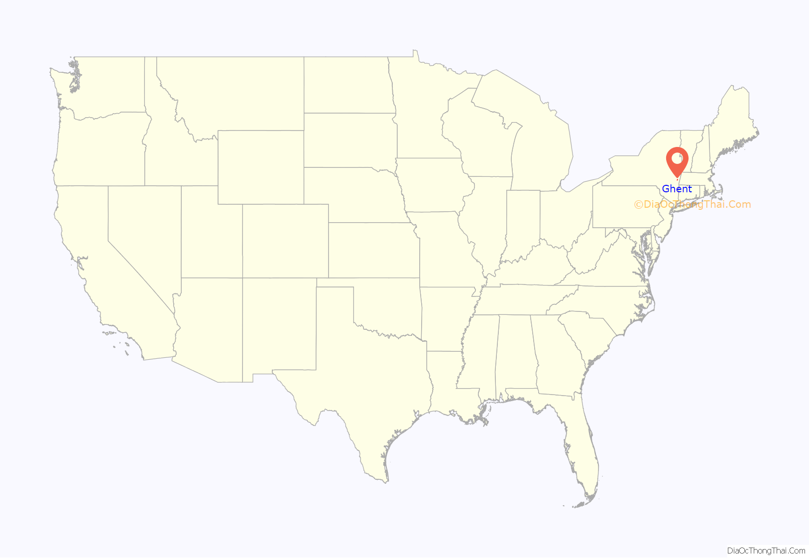
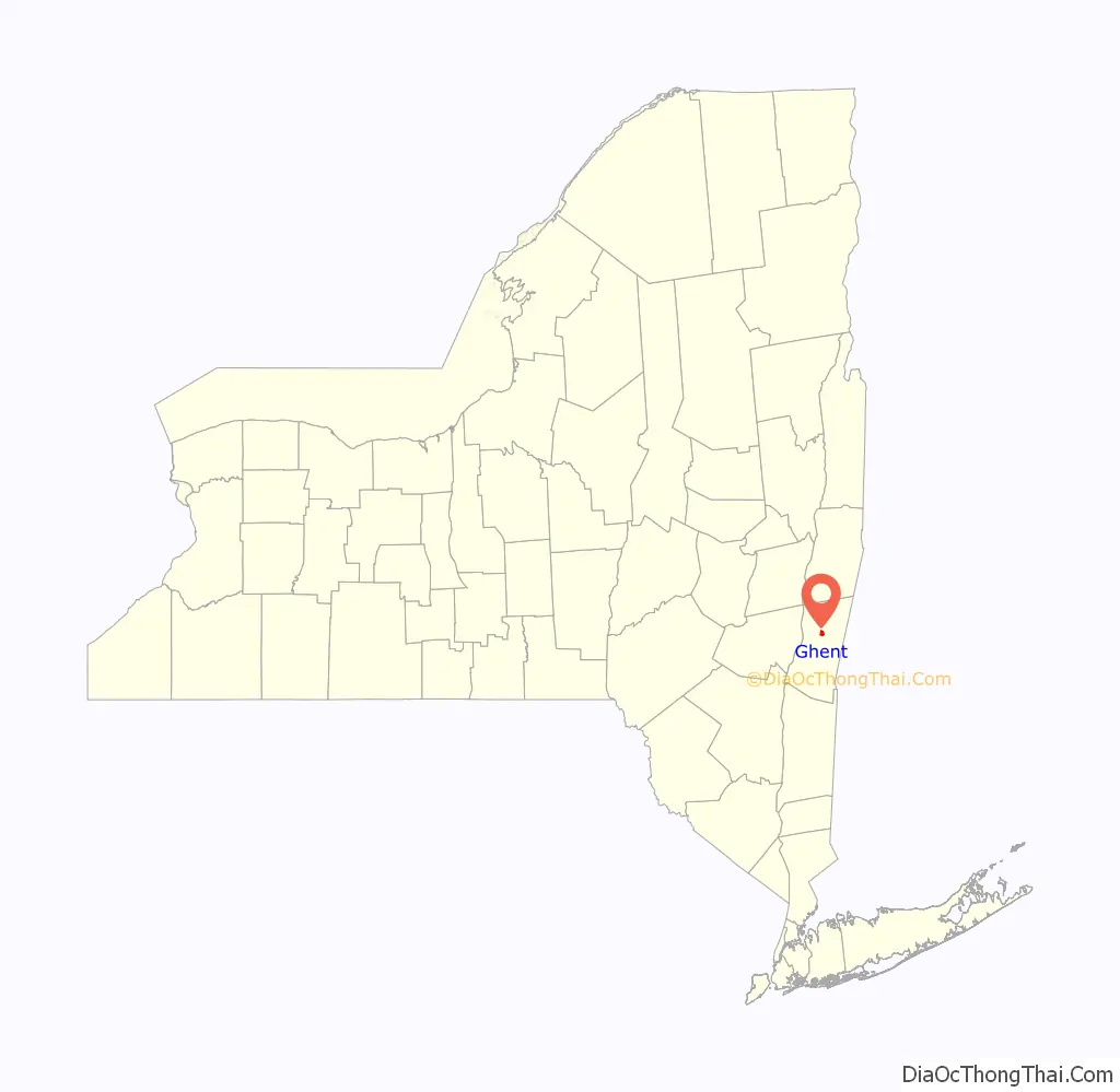
Ghent Road Map
Ghent city Satellite Map

Geography
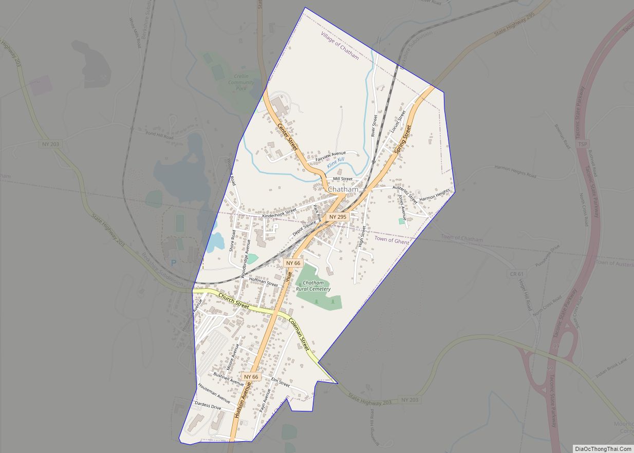
Ghent is located in the northeast part of the town of Ghent at 42°19′45″N 73°36′59″W / 42.32917°N 73.61639°W / 42.32917; -73.61639 (42.329228, -73.616596), bordered on the north by Kline Kill, a stream which flows north to Kinderhook Creek, a tributary of the Hudson River.
New York State Route 66 passes through Ghent, leading southwest 11 miles (18 km) to Hudson, the Columbia County seat, and northeast 2.5 miles (4.0 km) to Chatham.
According to the United States Census Bureau, the CDP has a total area of 1.5 square miles (4.0 km), of which 0.01 square miles (0.03 km), or 0.70%, is water.
See also
Map of New York State and its subdivision:- Albany
- Allegany
- Bronx
- Broome
- Cattaraugus
- Cayuga
- Chautauqua
- Chemung
- Chenango
- Clinton
- Columbia
- Cortland
- Delaware
- Dutchess
- Erie
- Essex
- Franklin
- Fulton
- Genesee
- Greene
- Hamilton
- Herkimer
- Jefferson
- Kings
- Lake Ontario
- Lewis
- Livingston
- Madison
- Monroe
- Montgomery
- Nassau
- New York
- Niagara
- Oneida
- Onondaga
- Ontario
- Orange
- Orleans
- Oswego
- Otsego
- Putnam
- Queens
- Rensselaer
- Richmond
- Rockland
- Saint Lawrence
- Saratoga
- Schenectady
- Schoharie
- Schuyler
- Seneca
- Steuben
- Suffolk
- Sullivan
- Tioga
- Tompkins
- Ulster
- Warren
- Washington
- Wayne
- Westchester
- Wyoming
- Yates
- Alabama
- Alaska
- Arizona
- Arkansas
- California
- Colorado
- Connecticut
- Delaware
- District of Columbia
- Florida
- Georgia
- Hawaii
- Idaho
- Illinois
- Indiana
- Iowa
- Kansas
- Kentucky
- Louisiana
- Maine
- Maryland
- Massachusetts
- Michigan
- Minnesota
- Mississippi
- Missouri
- Montana
- Nebraska
- Nevada
- New Hampshire
- New Jersey
- New Mexico
- New York
- North Carolina
- North Dakota
- Ohio
- Oklahoma
- Oregon
- Pennsylvania
- Rhode Island
- South Carolina
- South Dakota
- Tennessee
- Texas
- Utah
- Vermont
- Virginia
- Washington
- West Virginia
- Wisconsin
- Wyoming