Gilgo is a hamlet and census-designated place (CDP) in the Town of Babylon in Suffolk County, New York, United States. The population was 131 at the 2010 census.
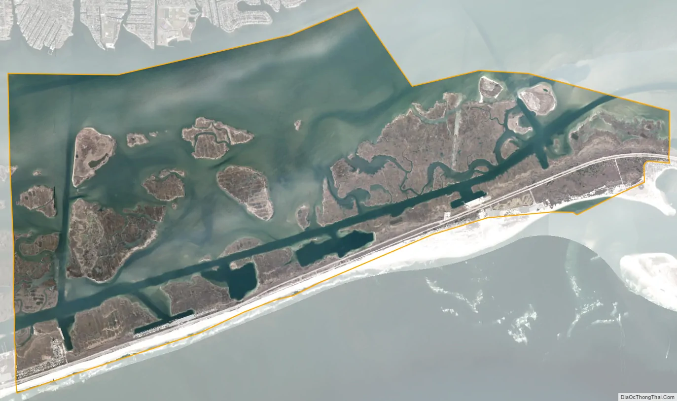
Prior to the 2010 census, the area was part of a larger CDP called Gilgo-Oak Beach-Captree. The Gilgo CDP contains several small beach communities on a barrier island along the southern edge of Long Island. In order from west to east, these include West Gilgo (on the Nassau/Suffolk county border), Gilgo Beach, and Cedar Beach (no residences). To the east along the beach is the CDP of Oak Beach.
| Name: | Gilgo CDP |
|---|---|
| LSAD Code: | 57 |
| LSAD Description: | CDP (suffix) |
| State: | New York |
| County: | Suffolk County |
| Elevation: | 10 ft (3 m) |
| Total Area: | 15.38 sq mi (39.84 km²) |
| Land Area: | 5.02 sq mi (13.00 km²) |
| Water Area: | 10.36 sq mi (26.84 km²) |
| Total Population: | 185 |
| Population Density: | 36.86/sq mi (14.23/km²) |
| FIPS code: | 3628990 |
Online Interactive Map
Click on ![]() to view map in "full screen" mode.
to view map in "full screen" mode.
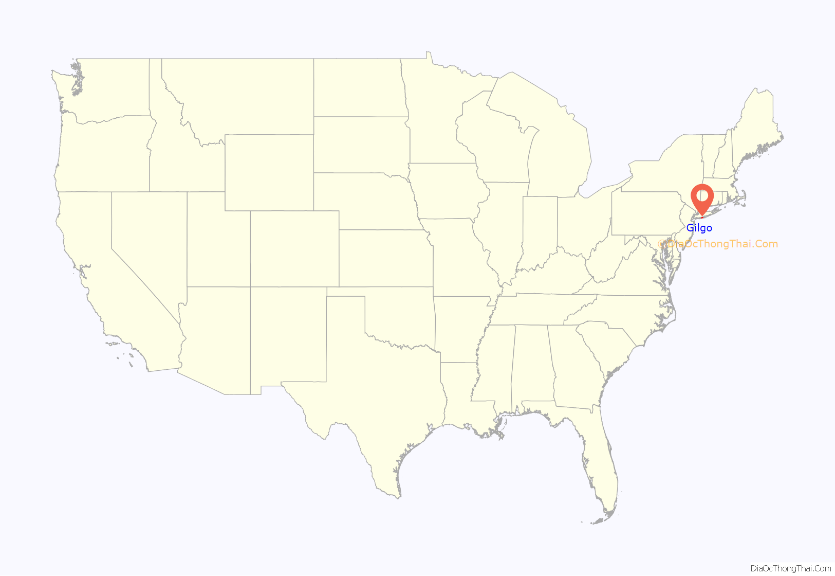
Gilgo location map. Where is Gilgo CDP?
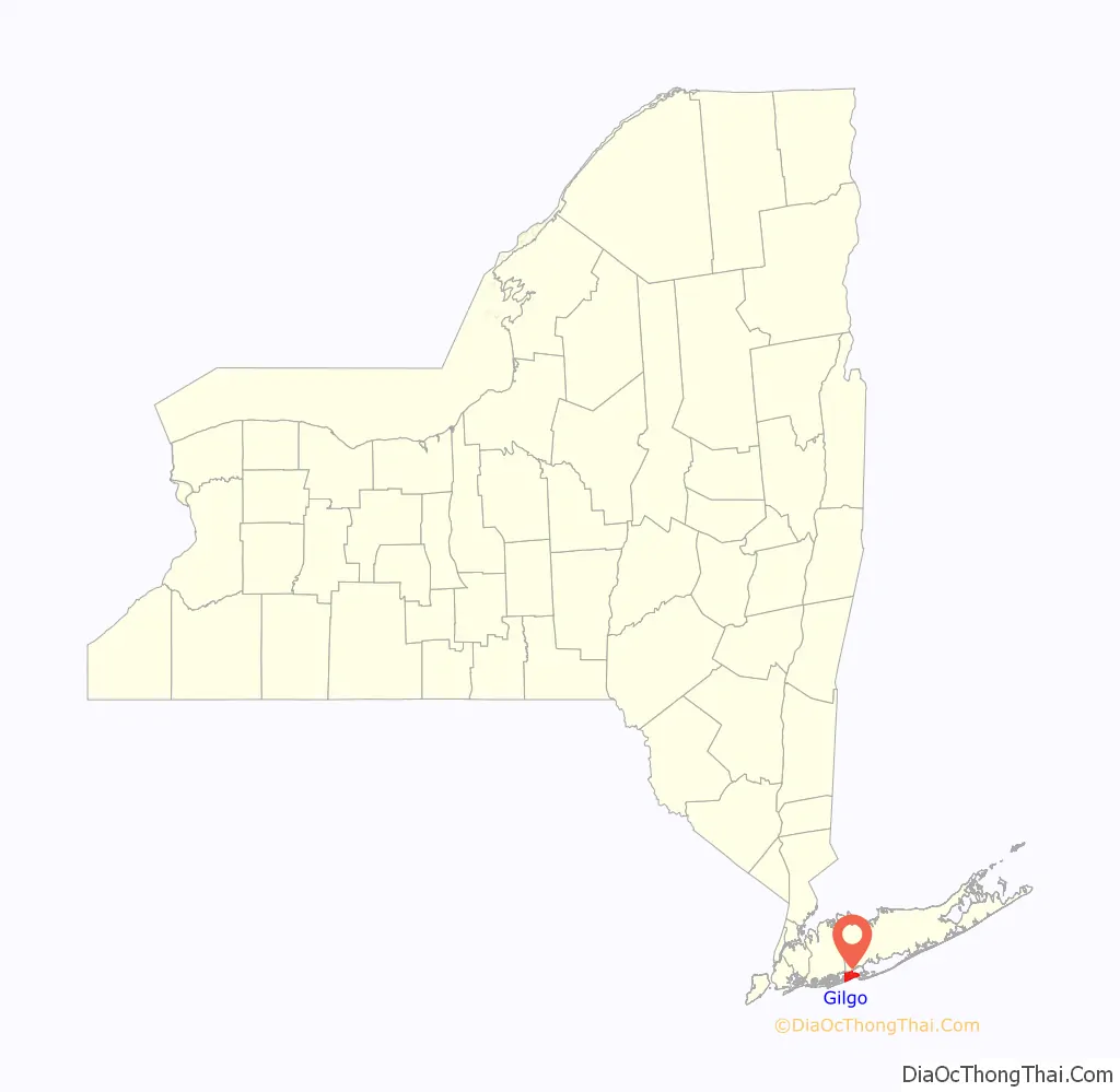
Gilgo Road Map
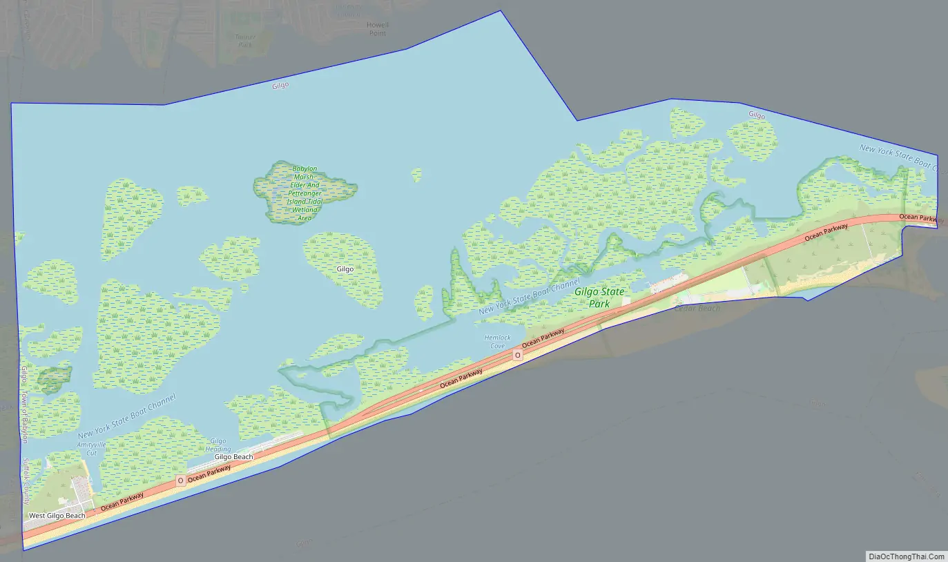
Gilgo city Satellite Map
Geography
Gilgo is located at 40°37′04″N 73°23′48″W / 40.61778°N 73.39667°W / 40.61778; -73.39667.
According to the United States Census Bureau, the CDP has a total area of 11.7 square miles (30.3 km), of which 5.0 square miles (12.9 km) is land and 6.7 square miles (17.4 km), or 57.31%, is water.
See also
Map of New York State and its subdivision:- Albany
- Allegany
- Bronx
- Broome
- Cattaraugus
- Cayuga
- Chautauqua
- Chemung
- Chenango
- Clinton
- Columbia
- Cortland
- Delaware
- Dutchess
- Erie
- Essex
- Franklin
- Fulton
- Genesee
- Greene
- Hamilton
- Herkimer
- Jefferson
- Kings
- Lake Ontario
- Lewis
- Livingston
- Madison
- Monroe
- Montgomery
- Nassau
- New York
- Niagara
- Oneida
- Onondaga
- Ontario
- Orange
- Orleans
- Oswego
- Otsego
- Putnam
- Queens
- Rensselaer
- Richmond
- Rockland
- Saint Lawrence
- Saratoga
- Schenectady
- Schoharie
- Schuyler
- Seneca
- Steuben
- Suffolk
- Sullivan
- Tioga
- Tompkins
- Ulster
- Warren
- Washington
- Wayne
- Westchester
- Wyoming
- Yates
- Alabama
- Alaska
- Arizona
- Arkansas
- California
- Colorado
- Connecticut
- Delaware
- District of Columbia
- Florida
- Georgia
- Hawaii
- Idaho
- Illinois
- Indiana
- Iowa
- Kansas
- Kentucky
- Louisiana
- Maine
- Maryland
- Massachusetts
- Michigan
- Minnesota
- Mississippi
- Missouri
- Montana
- Nebraska
- Nevada
- New Hampshire
- New Jersey
- New Mexico
- New York
- North Carolina
- North Dakota
- Ohio
- Oklahoma
- Oregon
- Pennsylvania
- Rhode Island
- South Carolina
- South Dakota
- Tennessee
- Texas
- Utah
- Vermont
- Virginia
- Washington
- West Virginia
- Wisconsin
- Wyoming


