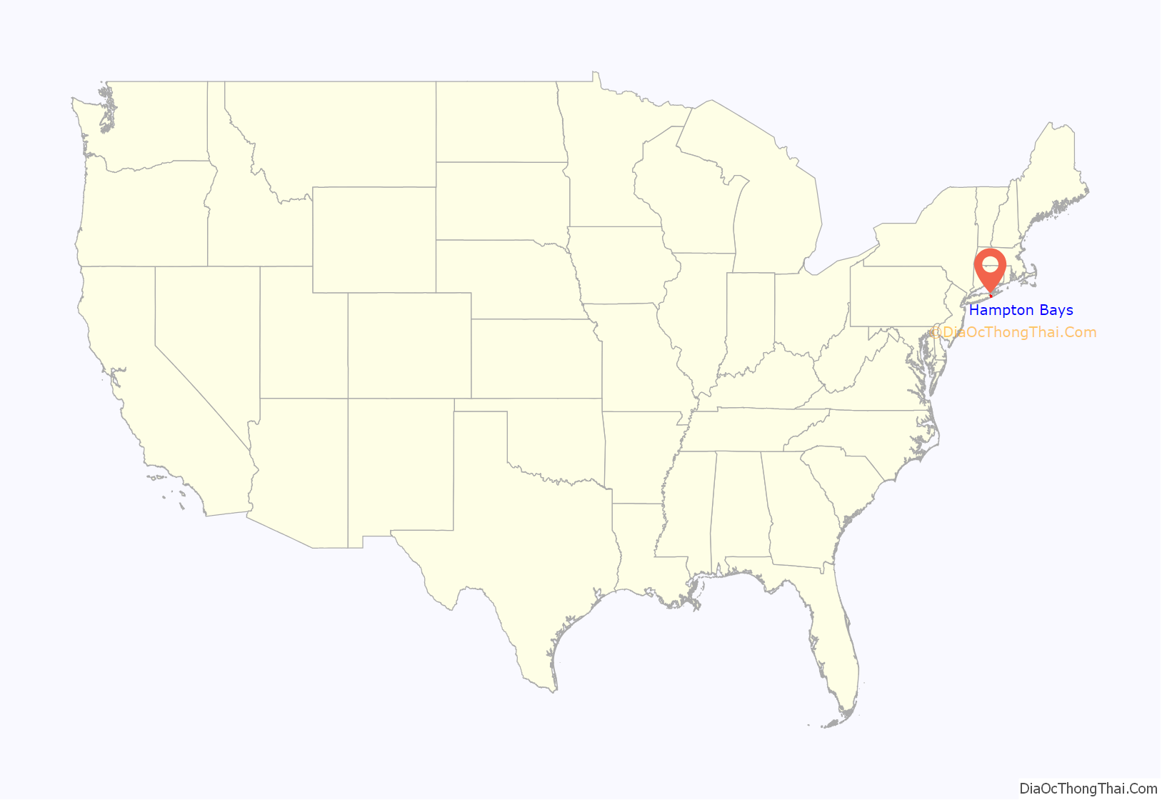
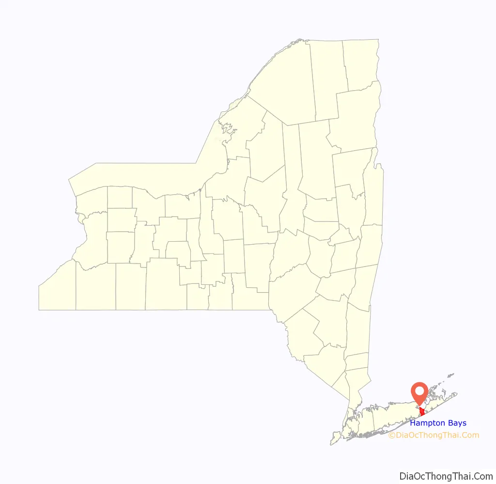
Hampton Bays is a hamlet and census-designated place (CDP) in the Town of Southampton in Suffolk County, on Long Island, in New York. It is considered as part of the region of Long Island known as The Hamptons. The population was 13,603 at the 2010 census.
| Name: | Hampton Bays CDP |
|---|---|
| LSAD Code: | 57 |
| LSAD Description: | CDP (suffix) |
| State: | New York |
| County: | Suffolk County |
| Elevation: | 33 ft (10 m) |
| Total Area: | 20.51 sq mi (53.12 km²) |
| Land Area: | 12.94 sq mi (33.50 km²) |
| Water Area: | 7.57 sq mi (19.61 km²) |
| Total Population: | 15,228 |
| Population Density: | 1,177.27/sq mi (454.54/km²) |
| ZIP code: | 11946 |
| Area code: | 631, 934 |
| FIPS code: | 3631896 |
| GNISfeature ID: | 0952135 |
Online Interactive Map
Click on ![]() to view map in "full screen" mode.
to view map in "full screen" mode.
Hampton Bays location map. Where is Hampton Bays CDP?
History
The hamlet was settled in 1740 as “Good Ground”, which became the main hamlet of eleven in the immediate area. The area where Main Street, also known as Montauk Highway, is located today, was the approximate area of the original hamlet.
There were ten other hamlets in the area. They were called Canoe Place, East Tiana, Newtown, Ponquogue, Rampasture, Red Creek, Squiretown, Southport, Springville, and West Tiana. Most of these hamlets were settled by one or two families and had their own school house. Many of the names from the former hamlets are still featured as local street names today.
As a result of the growth of the surrounding hamlets and villages in the Hamptons and increased tourism from New York City, the eleven hamlets, although generally called “Good Ground” collectively by the early part of the 20th century, amalgamated under the name “Hampton Bays” in 1922. The motive behind the name change was for the hamlet to benefit from the “Hamptons” trade that the community’s neighbors were experiencing.
In the early 1970s and the 2010s, portions of Hampton Bays unsuccessfully attempted to incorporate itself as the Incorporated Village of Hampton Bays.
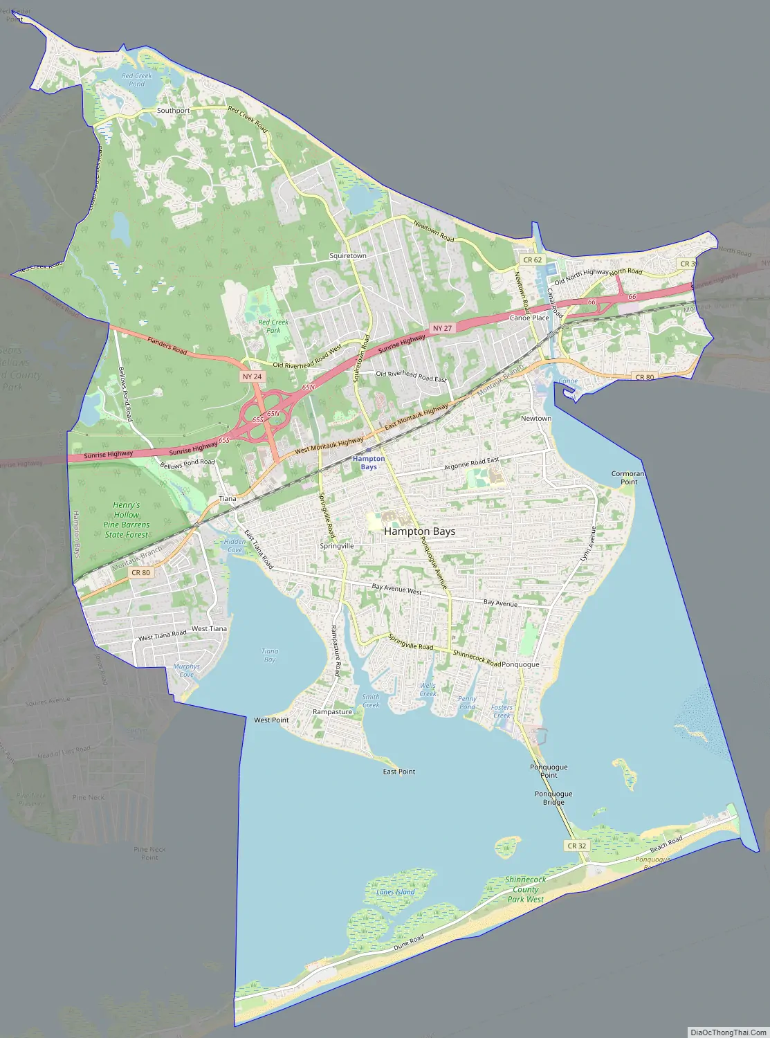
Hampton Bays Road Map
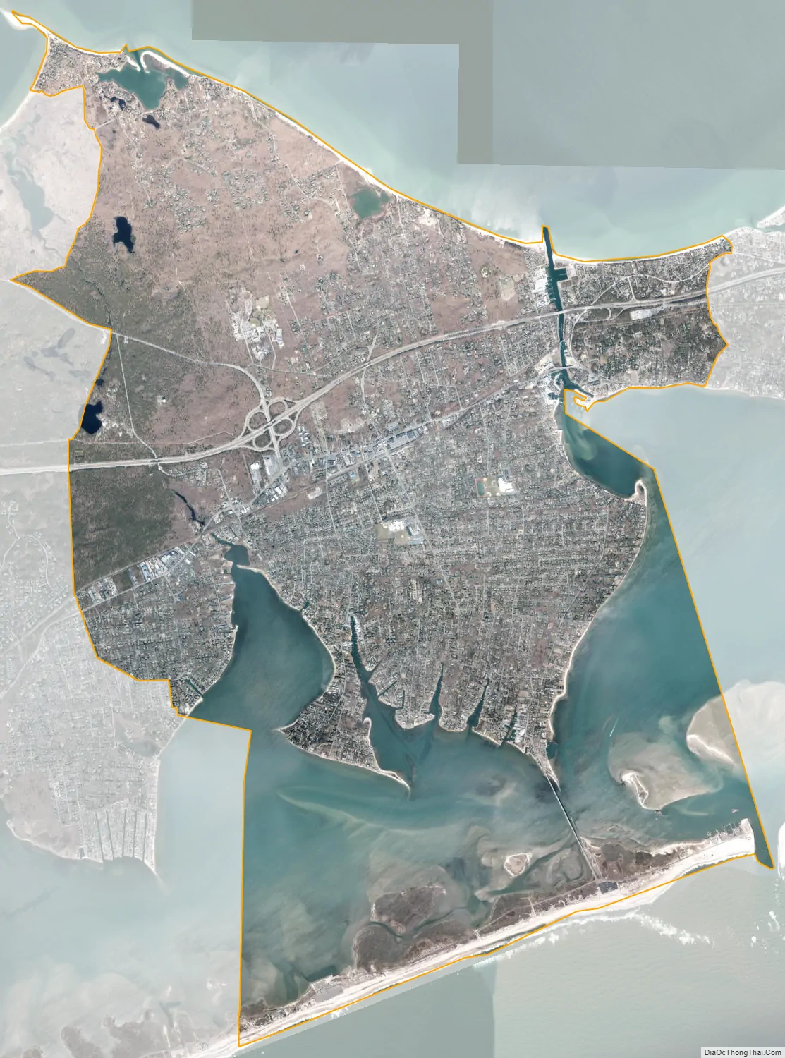
Hampton Bays city Satellite Map
Geography
According to the U.S. Census Bureau, the CDP has a total area of 18.1 square miles (47.0 km), of which 12.9 square miles (33.5 km) is land and 5.2 square miles (13.4 km), or 28.54%, is water. The hamlet is surrounded by three bays, the Peconic Bay to the north, and Shinnecock and Tiana bays to the south. The two southern bays are a part of a greater bay system, called the Great South Bay system, which stretches from approximately Southampton Village to Jamaica Bay in New York City. The Shinnecock Canal, a man-made canal located in the eastern part of the hamlet, connects the Great Peconic Bay with the Shinnecock Bay. Shinnecock Inlet, which leads from the Shinnecock Bay to the Atlantic Ocean, is the easternmost inlet, making it very popular for commercial fishing. The inlet itself, which separates the barrier beaches of Hampton Bays from those of neighboring Southampton, was created in the 1938 New England hurricane when the forces of the hurricane washed over that area of barrier beach, connecting the waters of the Atlantic with the bay.
The Hampton Bays CDP is bounded by the Atlantic Ocean to the south; by the Shinnecock Inlet and the eastern portion of Shinnecock Bay to the east, beyond which lie the village of Southampton and the CDP of Shinnecock Hills; by Peconic Bay to the north, beyond which lie the towns of Southold and Riverhead; and by the CDPs of Flanders and East Quogue (still within the town of Southampton) to the west.
Hampton Bays is located approximately 81 miles (130 km) east of Manhattan.
See also
Map of New York State and its subdivision:- Albany
- Allegany
- Bronx
- Broome
- Cattaraugus
- Cayuga
- Chautauqua
- Chemung
- Chenango
- Clinton
- Columbia
- Cortland
- Delaware
- Dutchess
- Erie
- Essex
- Franklin
- Fulton
- Genesee
- Greene
- Hamilton
- Herkimer
- Jefferson
- Kings
- Lake Ontario
- Lewis
- Livingston
- Madison
- Monroe
- Montgomery
- Nassau
- New York
- Niagara
- Oneida
- Onondaga
- Ontario
- Orange
- Orleans
- Oswego
- Otsego
- Putnam
- Queens
- Rensselaer
- Richmond
- Rockland
- Saint Lawrence
- Saratoga
- Schenectady
- Schoharie
- Schuyler
- Seneca
- Steuben
- Suffolk
- Sullivan
- Tioga
- Tompkins
- Ulster
- Warren
- Washington
- Wayne
- Westchester
- Wyoming
- Yates
- Alabama
- Alaska
- Arizona
- Arkansas
- California
- Colorado
- Connecticut
- Delaware
- District of Columbia
- Florida
- Georgia
- Hawaii
- Idaho
- Illinois
- Indiana
- Iowa
- Kansas
- Kentucky
- Louisiana
- Maine
- Maryland
- Massachusetts
- Michigan
- Minnesota
- Mississippi
- Missouri
- Montana
- Nebraska
- Nevada
- New Hampshire
- New Jersey
- New Mexico
- New York
- North Carolina
- North Dakota
- Ohio
- Oklahoma
- Oregon
- Pennsylvania
- Rhode Island
- South Carolina
- South Dakota
- Tennessee
- Texas
- Utah
- Vermont
- Virginia
- Washington
- West Virginia
- Wisconsin
- Wyoming


