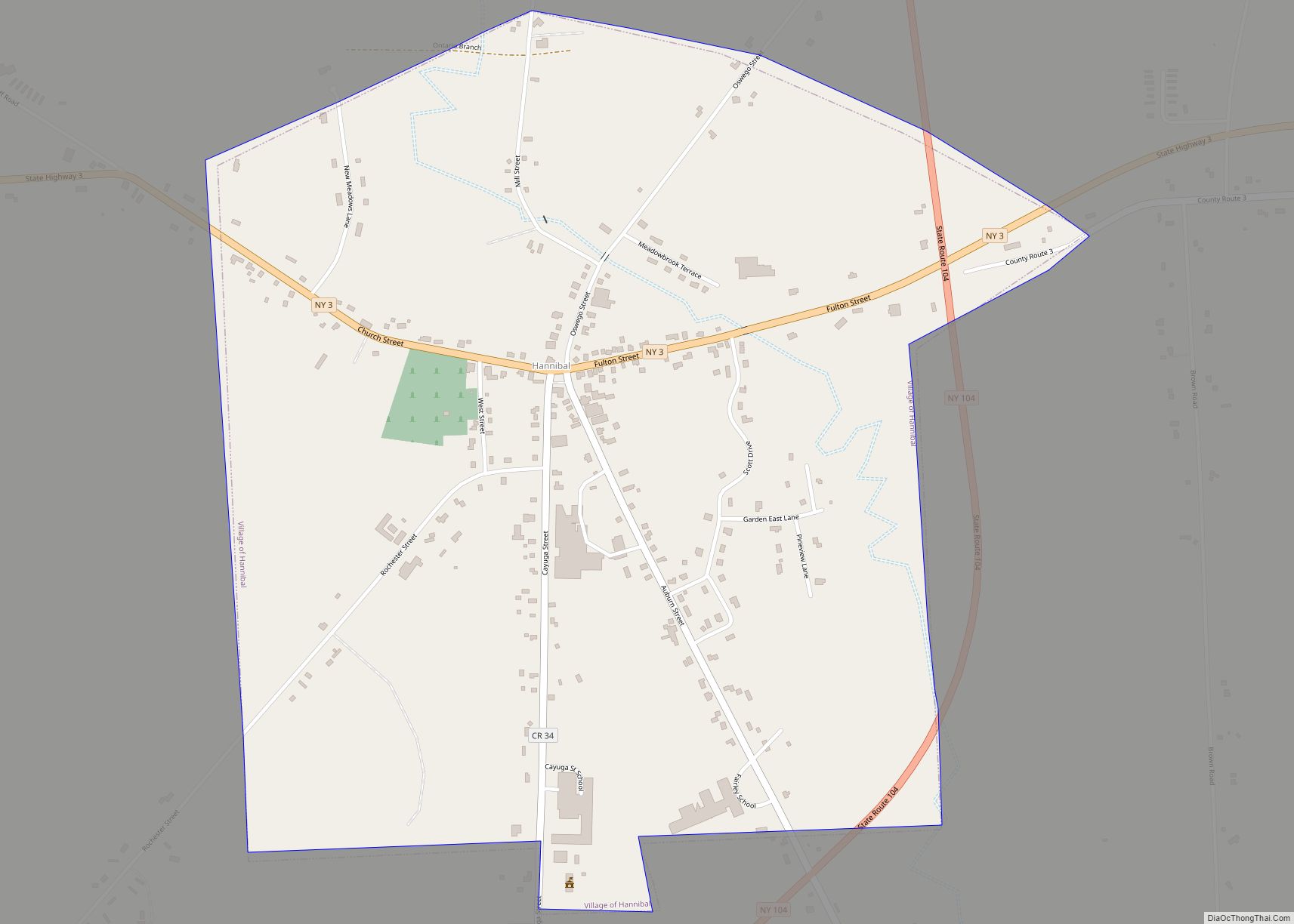
Hannibal is a village in Oswego County, New York, United States. The population was 555 at the 2010 census. The village is named after Hannibal, the hero of ancient Carthage.
The Village of Hannibal is located in the western part of the Town of Hannibal on New York State Routes 3 and 104, and Oswego County Route 34.
| Name: | Hannibal village |
|---|---|
| LSAD Code: | 47 |
| LSAD Description: | village (suffix) |
| State: | New York |
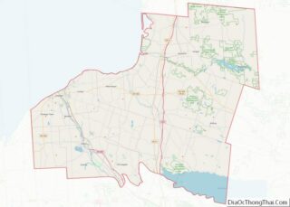
| County: | Oswego County |
| Elevation: | 328 ft (100 m) |
| Total Area: | 1.15 sq mi (2.98 km²) |
| Land Area: | 1.15 sq mi (2.98 km²) |
| Water Area: | 0.00 sq mi (0.00 km²) |
| Total Population: | 535 |
| Population Density: | 464.41/sq mi (179.25/km²) |
| ZIP code: | 13074 |
| Area code: | 315 |
| FIPS code: | 3632017 |
| GNISfeature ID: | 0952170 |
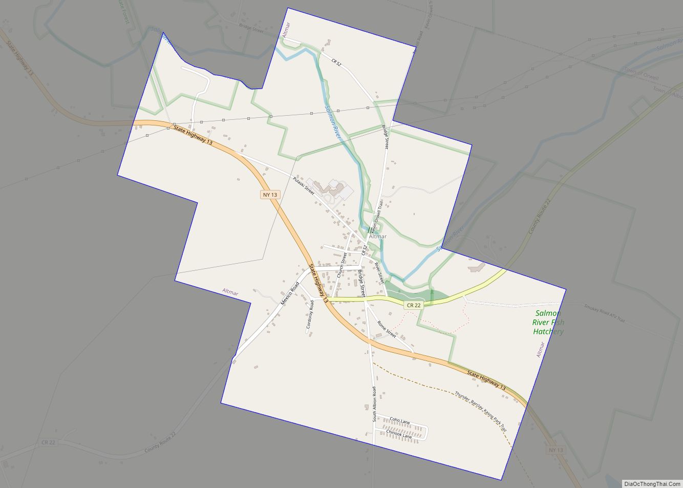
Online Interactive Map
Click on ![]() to view map in "full screen" mode.
to view map in "full screen" mode.
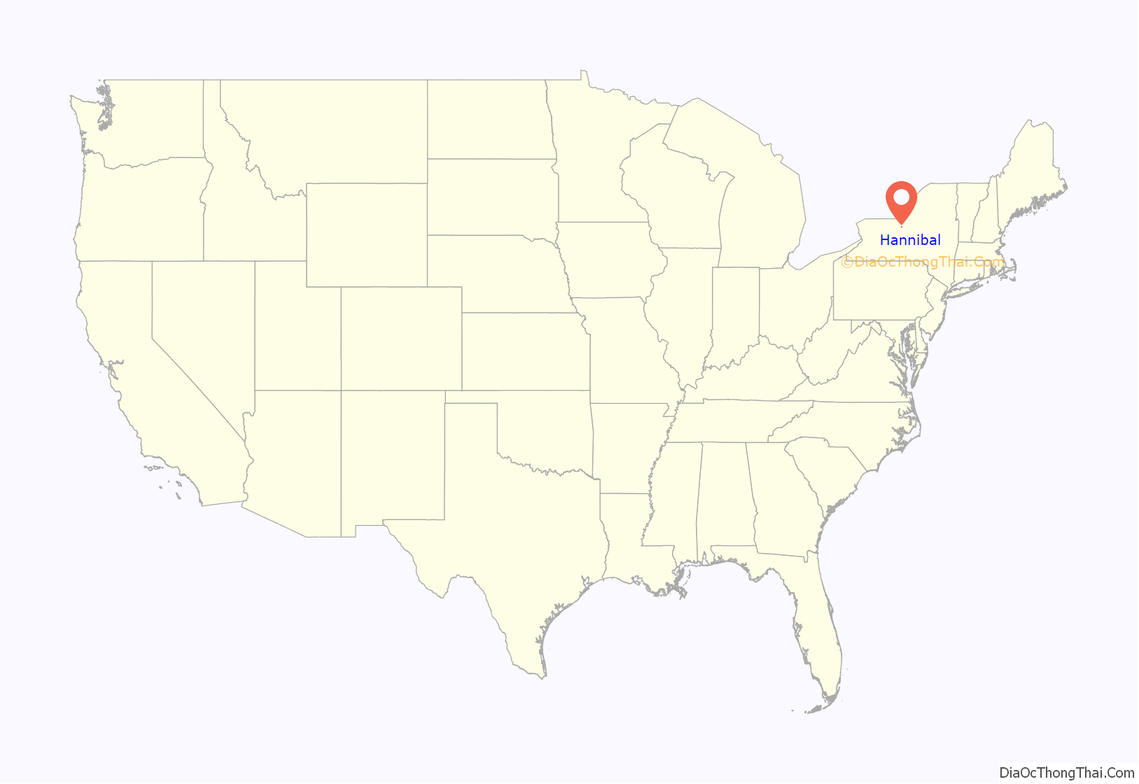
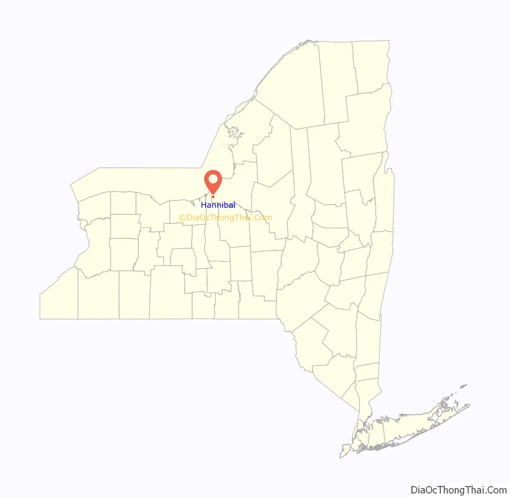
Hannibal location map. Where is Hannibal village?
History
The first settlement came circa 1808 with a structure made of logs on the site of a former Indian encampment. The village was incorporated in 1860. The population was then 416. By 1895, the population had reached 450.
Hannibal Road Map
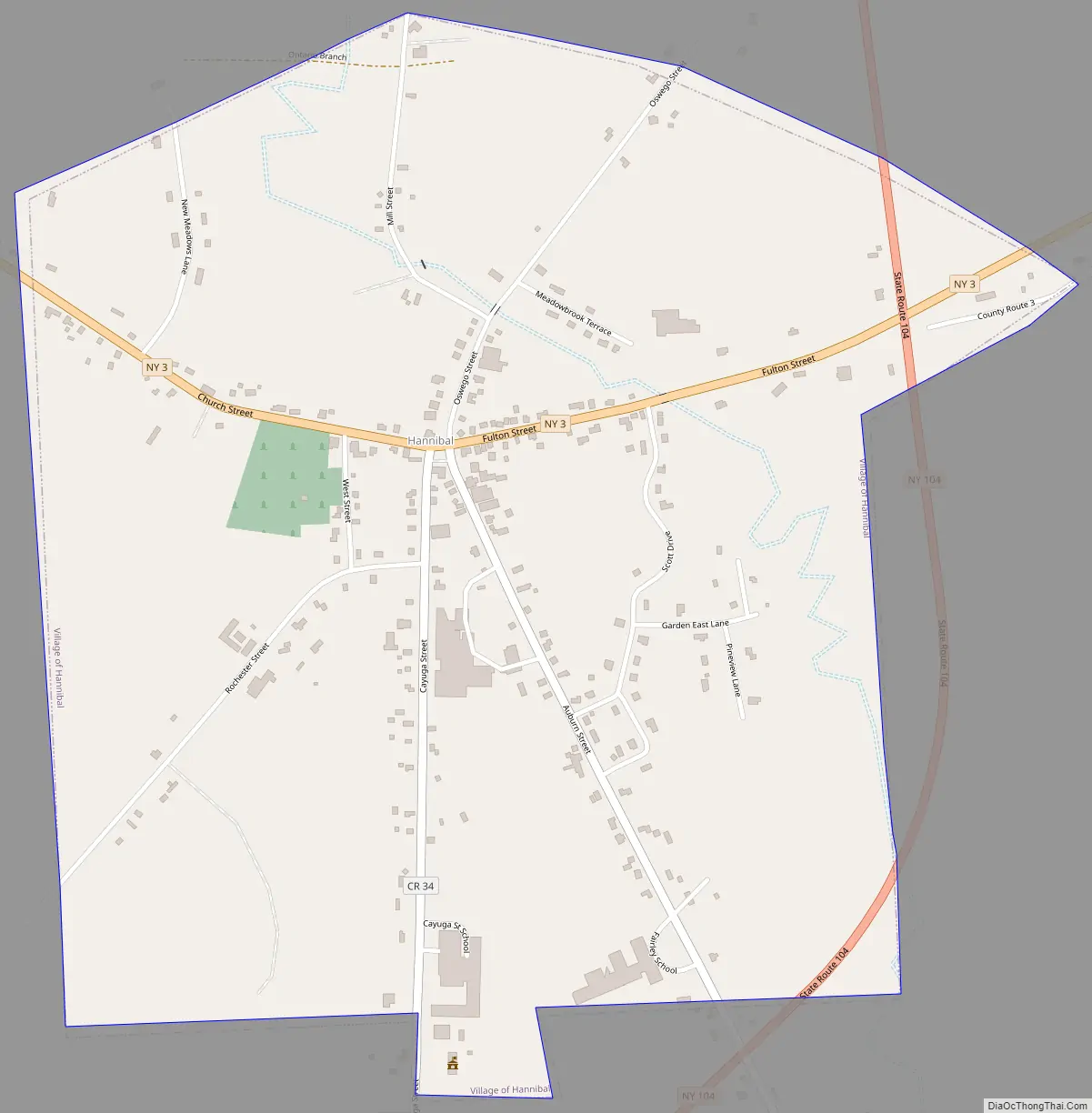
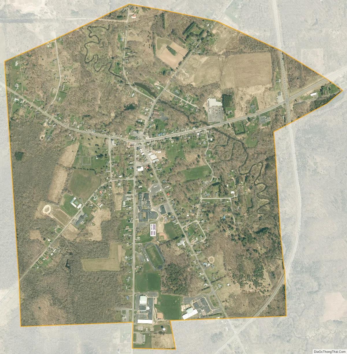
Hannibal city Satellite Map
Geography
Hannibal is located at 43°19′15″N 76°34′34″W / 43.32083°N 76.57611°W / 43.32083; -76.57611 (43.320945, -76.576193). The village is located on Nine Mile Creek.
According to the United States Census Bureau, the village has a total area of 1.1 square miles (3.0 km), all land.
See also
Map of New York State and its subdivision:- Albany
- Allegany
- Bronx
- Broome
- Cattaraugus
- Cayuga
- Chautauqua
- Chemung
- Chenango
- Clinton
- Columbia
- Cortland
- Delaware
- Dutchess
- Erie
- Essex
- Franklin
- Fulton
- Genesee
- Greene
- Hamilton
- Herkimer
- Jefferson
- Kings
- Lake Ontario
- Lewis
- Livingston
- Madison
- Monroe
- Montgomery
- Nassau
- New York
- Niagara
- Oneida
- Onondaga
- Ontario
- Orange
- Orleans
- Oswego
- Otsego
- Putnam
- Queens
- Rensselaer
- Richmond
- Rockland
- Saint Lawrence
- Saratoga
- Schenectady
- Schoharie
- Schuyler
- Seneca
- Steuben
- Suffolk
- Sullivan
- Tioga
- Tompkins
- Ulster
- Warren
- Washington
- Wayne
- Westchester
- Wyoming
- Yates
- Alabama
- Alaska
- Arizona
- Arkansas
- California
- Colorado
- Connecticut
- Delaware
- District of Columbia
- Florida
- Georgia
- Hawaii
- Idaho
- Illinois
- Indiana
- Iowa
- Kansas
- Kentucky
- Louisiana
- Maine
- Maryland
- Massachusetts
- Michigan
- Minnesota
- Mississippi
- Missouri
- Montana
- Nebraska
- Nevada
- New Hampshire
- New Jersey
- New Mexico
- New York
- North Carolina
- North Dakota
- Ohio
- Oklahoma
- Oregon
- Pennsylvania
- Rhode Island
- South Carolina
- South Dakota
- Tennessee
- Texas
- Utah
- Vermont
- Virginia
- Washington
- West Virginia
- Wisconsin
- Wyoming